Spanning 274.5 miles from Arvada to Rangely, this cross-state journey takes approximately 5 hours and 59 minutes of active driving time. Because the route is primarily a turn-heavy local drive rather than a high-speed interstate corridor, you should plan to treat this as a dedicated one-day commitment. Expect to budget roughly $42 for fuel to complete the trek across the Mountain West. Since the route avoids major highways entirely, it offers a more intimate look at the regional landscape than a typical transit corridor would. While you can technically complete this in a single day, be prepared for a focused effort behind the wheel to navigate the local roads efficiently.
Trip Pace
Same-day drive is realistic
A same-day return is possible, but it will make for a full day on the road.
Break Rhythm
1 planned break
Plan on a short reset every 3 to 4 hours to stay fresh behind the wheel.
Midpoint
137.2 miles from Arvada, CO
A natural place for your longest stop of the day
, about 2h 37m into the drive
.
Main Roads
Road
Distance
Duration
I 70
177.2 mi
3h 20m
CO 64
55 mi
1h 28m
Government Road
37.1 mi
59m
Whiteriver Avenue
1.5 mi
3m
Kipling Parkway
1 mi
1m
West 58th Avenue
0.8 mi
1m
Ralston Road
0.4 mi
1m
CO 13
0.3 mi
<1m
Longest stretch:
I 70
— 177.2 mi, about 3h 20m
Traffic on I-70
Hour-of-day weekday pattern from 16 FHWA count stations on your route.
Peak
4 PM
~1,405 veh/hr typical
· worst 1,990
Quietest
2 AM
~79 veh/hr
Peak-to-quiet ratio
17.8×
busier at peak than in the quiet hours
12a6anoon6p11p
Averaged across 52 weeks of 2023 FHWA Travel Monitoring Analysis System data. Weekday hours only (Mon–Fri).
Turn-by-Turn Driving Directions
Step-by-step road directions between Arvada, CO and Rangely, CO.
1
Start on this road
41 ft·5 sec·this road
2
Turn right onto Ammons Street
227 ft·9 sec·Ammons Street
3
Turn right onto Ralston Road
0.4 mi·1 min·Ralston Road
4
Continue on West 58th Avenue
0.8 mi·1 min·West 58th Avenue
5
Turn left onto Kipling Parkway
1.0 mi·1 min·Kipling Parkway
Use the left lane.
6
Continue on CO 391
0.2 mi·25 sec·Kipling Street
Use the left lane.
7
Take the ramp
0.3 mi·45 sec
Toward I 70 West
8
Merge onto I 70
177 mi·3 hr 20 min·I 70
Use the straight / slight right lanes.
9
Take the exit
0.2 mi·27 sec
Toward CO 13 North: Rifle, Meeker
10
Turn right onto CO 13
0.3 mi·35 sec·CO 13
11
Turn slight right onto Whiteriver Avenue
1.5 mi·3 min·Whiteriver Avenue
12
Turn right onto CO 13
0.3 mi·26 sec·Railroad Avenue
13
Continue on CO 13
37 mi·59 min·Government Road
Use the straight / right lanes.
14
Turn left onto CO 64
55 mi·1 hr 28 min·CO 64
Use the left lane.
15
Arrive at destination
CO 64
Trip Plan
To keep your 6-hour drive manageable, aim to head out early in the day to account for the slower pace of local roads. Since the route includes only one major stop, make sure your vehicle is prepared for the full stretch before you depart from Arvada. Budgeting $42 for gas is a good baseline, but keep an eye on your fuel gauge throughout the journey since local roads may offer fewer refueling opportunities than major interstates. Given the turn-heavy nature of the trip, ensure your passenger is ready to assist with navigation to keep you on track. Stay flexible with your schedule, as local traffic patterns can easily add time to your estimated arrival in Rangely.
Morning Departure
An early start around 7-8 AM gets you there with plenty of daylight left.
Evening Departure
A late afternoon start means arriving after dark. Morning is better.
You can normally do this drive in one day.
Plan roughly 1 meaningful break for fuel, food, and rest.
The halfway point lands around 137.2 miles from Arvada, CO, or about 2h 37m into the drive.
The longest continuous stretch on this route runs about 177.2 miles.
This is a comfortable same-day trip.
Departure
Before you leave
Start with fuel, water, and navigation already sorted so the first hour feels easy.
First stop
Around 60 miles or 1h 10m in
Use this first pause for coffee, a restroom break, and a quick traffic check ahead.
Halfway reset
Around 137.2 miles or 2h 37m in
This is the best place for your longest stop, a real meal, and a full fuel check.
Final approach
Final hour starts around 4h 40m
Traffic, exits, and arrival timing usually matter more near Rangely, CO than in the middle of the route.
Before You Leave
+
Open the route before leaving Arvada, CO so your first major turns are already loaded.
+
Leave with enough water and a charging cable within reach, not packed away.
+
Check your fuel range against the first long segment, especially if you are starting outside city service areas.
Day 1
Settle into the route from Arvada, CO
This is one driving day of about 274.5 miles and 5h 59m.
Your first comfortable stop window is around 60 miles from Arvada, CO.
This route can stay practical as a one-day drive if traffic stays reasonable.
Plan about 1 real break rather than only quick fuel stops.
The longest stretch is on I 70 for about 177.2 miles.
Where to Stop
Rest stops, refuel points, and overnight suggestions along this route.
Place data sourced from public business listings. Hours and availability may vary.
Heads-up: tricky spots
5 of 9
5 decision points cluster between mile 0 and 219.5 — GPS handles the exact turns, but know they're coming. Your lane choice matters more than the turn itself.
5
0 mi into trip|~0m in|Ammons Street
Turn right onto Ammons Street
Navigation decision point
4
1.3 mi into trip|~3m in|Kipling Parkway
Turn left onto Kipling Parkway
Lane positioning matters here
Use the left lane.
5
2.9 mi into trip|~5m in|I 70
Merge onto I 70
Merge point - match speed before joining. Lane positioning matters here
Use the straight / slight right lanes.
5
180.1 mi into trip|~3h 26m in
Take the exit toward CO 13 North: Rifle, Meeker
Exit ramp - move to the correct lane early. Multiple destination signs - pick the right one
Toward CO 13 North: Rifle, Meeker
5
219.5 mi into trip|~4h 31m in|CO 64
Turn left onto CO 64
Lane positioning matters here
Use the left lane.
Fuel & Cost
Regular Gas
$41.86 one way
$83.71 round trip
$3.87/gal25.4 MPG avg96 kg CO2
Fuel Type
$/gal
One Way
Round Trip
midgrade
$4.12
$44.49
$88.99
premium
$4.45
$48.12
$96.25
diesel
$4.80
$51.83
$103.66
No toll roads detected on this route.
Estimated Trip Cost (one way, 1 person)
Fuel
$42
Meals
$25–$50
Total
$67–$92
Rough estimate based on US averages. Hotel $80–$140/night, meals $25–$50/day.
Estimated CO2 emission: 96 kg one way.
Prices: EIA weekly data, 2026-07-13.
Driving Electric?
About $29 in charging
· 1 stop
· 67% less CO2
Vehicle Type
kWh
Stops
DC Fast
Home Charge
Average EV
82.4
1
$28.82
$13.18
Efficient EV
68.6
0
$24.02
$10.98
EV Truck/SUV
109.8
1
$38.43
$17.57
Gas CO2
96 kg
EV CO2
32 kg (67% less)
Plan for 1 charging stop. A 30-minute DC fast charge mid-route should be enough to complete the trip comfortably.
DC fast charging avg $0.35/kWh. Home charging avg $0.16/kWh. US grid CO2: 0.39 kg/kWh.
Travel Intel
Current conditions at both ends of the drive.
Forecast as of Jul 18, 2026
Origin
Arvada, CO
Late night
in Arvada on Sunday
Local time
2:19 AM
MDT
Current temp
65°F
Mostly Clear
WSW 6 mph2% chanceLive forecast
Heat Advisory
Heat Advisory issued July 17 at 12:00PM MDT until July 20 at 9:00PM MDT by NWS Denver CO
Destination
Rangely, CO
Late night
in Rangely on Sunday
Local time
2:19 AM
MDT
Current temp
59°F
Slight Chance Showers And Thunderstorms then Partly Cloudy
SE 0 to 5 mph13% chanceLive forecast
Heat Advisory
Heat Advisory issued July 17 at 12:00PM MDT until July 20 at 9:00PM MDT by NWS Denver CO
Seasonal Notes
Summer travel usually means heavier construction, hotter rest stops, and busier weekend traffic around major cities.
Winter travel shortens daylight, so a route that looks manageable on paper can feel much longer after dark.
Holiday weekends tend to make both departure and arrival windows slower than the raw route time suggests.
Time zone
Same local time
Origin and destination are on the same clock, so arrival timing is easier to judge at a glance.
Temperature spread
6 degrees cooler at arrival
A meaningful temperature swing is a good cue to rethink layers, water, and how soon you want to arrive.
Road read
5h 59m on the road
An early start around 7-8 AM gets you there with plenty of daylight left.
Weather data from the National Weather Service. Conditions may change; check closer to your travel date.
National Parks Near This Route
Worth a detour if your schedule allows.
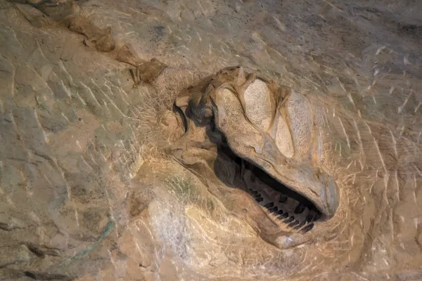
Dinosaur National Monument
National Monument
150 million years ago, dinosaurs roamed here. Their fossils are still embedded in the rocks. Today, mountains, desert, and rivers flowing in canyons support a variety of life. Petroglyphs reveal the l...
Park data from the National Park Service API. Alerts update every 2 hours.
More Details
What kind of drive is this?
Expect a hands-on experience on this route, as it consists entirely of local roads like Ammons Street, Ralston Road, and West 58th Avenue. With a highway share of 0%, this is distinctly not a monotonous interstate grind; instead, you will encounter a series of technical turns and constant adjustments. The drive demands your full attention as you navigate through the varying local terrain that defines this 274.5-mile path. Because there are no long, uninterrupted highway stretches, the pace remains steady but requires frequent gear shifts and navigation checks. You will find that the personality of the road remains consistent, favoring local connectivity over high-speed transit.
85% highway — fuel and pacing are the main things to plan.
15 navigation steps total — most of the decisions cluster near the start and finish.
Longest single stretch: 177.2 mi on I 70.
How Hard Is This Drive?
3/10
This is a straightforward highway drive that stays mostly on I 70 and CO 64. There are only a few real navigation decisions along the way. The trickiest moment comes early in the drive near Ammons Street.
Driving Effort3/10
Easy - simple navigation with a manageable amount of wheel time
Balances navigation complexity with total wheel time.
This is a straightforward 5h 59m drive. You will face about 9 decision points, but nothing that requires special attention if you follow navigation.
Where does it get tricky?
The main spots that need attention: near the start (Ammons Street): Navigation decision point; at 1.3 miles (Kipling Parkway): Lane positioning matters here; at 2.9 miles (I 70): Merge point - match speed before joining. Lane positioning matters here.
Elevation Profile
Mountain driving with significant elevation changes
10,347 ft5,231 ft
Total Climb
6,833 ft
Total Descent
6,948 ft
Highest Point
10,347 ft
~78.4 mi in
Elevation Range
5,115 ft
Notable High Points
10,347 ft at ~78.4 miles+27 ft prominence
7,219 ft at ~196.1 miles+715 ft prominence
Towns Mentioned on Route Signs
Based on OSRM destination-sign hints, not a full list of every settlement the road passes.
On the drive from Arvada, CO to Rangely, CO, road signs begin pointing toward Meeker along the way.
Arvada is a city of about 125,000 in the Denver Metropolitan Area of the U.S. state of Colorado. A former farming community in Jefferson and Adams counties, the city is now a residential suburb of Denver. Olde Town Arvada lies 7 miles (11 km) northwest of the Colorado State Capitol and 9 miles (14 km) east of the Front Range foothills.
Top landmarks
•Arvada Flour Mill — historic mill in Arvada, Colorado, USA
•Arvada Center for the Arts and Humanities — art center in Arvada, Colorado
The longest stretch is about 177.2 miles on I 70. The full list of main roads is in the Roads section above.
Yes — we found about 10 rest areas or service plazas within a short detour of the route (from OpenStreetMap). See the Rest Stops tab under Nearby Places for locations and mile markers. Plan to stretch, use the bathroom, and top off fluids every 2–3 hours on longer drives.
Only with planning. This is a long drive for kids — consider splitting it into two days rather than pushing through. Plan at least 1 meaningful breaks. There are 10 rest areas along the route for bathroom stops.
The main spots that need attention: near the start (Ammons Street): Navigation decision point; at 1.3 miles (Kipling Parkway): Lane positioning matters here; at 2.9 miles (I 70): Merge point - match speed before joining. Lane positioning matters here.
Yes — Dinosaur National Monument. See the National Parks section for detour distances and tips on detours.
Not recommended in a single day. At 6.0 hours each way, a round trip means 12.0 hours of driving — that is an unsafe level of fatigue for most drivers. Plan at least one night at Rangely, CO before the return drive.