Origin
Arapahoe, WY
Morning in Arapahoe on Tuesday
Local time
6:23 AM
MDT
Current temp
28°F
Unavailable
Live forecast
Compiled and reviewed by the US Trip Planner planning team at COD Solutions Oy · Last reviewed Apr 21, 2026 · Editorial standards
Drive Time
3h 27m
Distance
171.5 mi
276 km
Drive Score
10/10
Great drive
Same Day?
Yes, doable
Fuel Cost
$27
one way
EV Charging
Unknown
Estimated drive times based on typical traffic patterns. Actual times may vary with weather, construction, and real-time conditions.

Arapahoe, WY
Tom Fisk

Jackson, WY
Wikimedia Commons
This 171.5-mile drive from Arapahoe, WY to Jackson, WY will take you about 3 hours and 27 minutes of pure driving time. It's a solid day trip option for travelers exploring the Mountain West region, with a projected fuel cost of around $27. The route primarily follows US 26 / US 287 and North Highway 89, offering a mixed driving experience. With only one recommended stop and a longest uninterrupted stretch of 76.3 miles, you'll find this to be a manageable journey for a single day.
Trip Pace
Same-day drive is realistic
A same-day return is realistic if you keep stops short.
Break Rhythm
1 planned break
A short stop every 2 to 3 hours is enough for this drive.
Midpoint
85.7 miles from Arapahoe, WY
A natural place for your longest stop of the day , about 1h 40m into the drive .
| Road | Distance | Duration |
|---|---|---|
| West Main Street | 76.3 mi | 1h 23m |
| US 26 / US 287 | 53.2 mi | 1h |
| North Highway 89 | 29.3 mi | 40m |
| Rendezvous Road | 5.5 mi | 8m |
| East Ramshorn Street | 2.2 mi | 2m |
| WY 789 | 1.5 mi | 1m |
| East Adams Avenue | 1 mi | 2m |
| North Cache Street | 0.8 mi | 2m |
Step-by-step road directions between Arapahoe, WY and Jackson, WY.
Start on Left Hand Ditch Road
Turn left onto Rendezvous Road
At end of road, turn right onto Rendezvous Road
Turn left onto WY 789
Turn left onto East Adams Avenue
Continue on Riverview Road
Turn right onto Major Avenue
Turn left onto US 26
Turn left onto US 26; US 287
Continue on US 26; US 287
Continue on US 26; US 89; US 191
Enter roundabout onto US 26; US 89; US 191
Continue on US 26; US 89; US 191
Continue on US 26; US 89; US 191
Arrive at destination
Given the 3 hour and 27 minute duration, this route is well-suited for a single day trip. Aim to depart Arapahoe in the morning to maximize your daylight hours and allow for flexibility. With only one recommended stop and a manageable distance, you have the advantage of pacing your journey as you see fit. Keep an eye on your fuel levels, especially during the longest stretch of 76.3 miles, to ensure a smooth arrival in Jackson.
Morning Departure
An early start around 7-8 AM gets you there with plenty of daylight left.
Evening Departure
A late afternoon start means arriving after dark. Morning is better.
This is a comfortable same-day trip.
Departure
Before you leave
Start with fuel, water, and navigation already sorted so the first hour feels easy.
First stop
Around 38 miles or 48m in
Use this first pause for coffee, a restroom break, and a quick traffic check ahead.
Halfway reset
Around 85.7 miles or 1h 40m in
This is the best place for your longest stop, a real meal, and a full fuel check.
Final approach
Final hour starts around 2h 43m
Traffic, exits, and arrival timing usually matter more near Jackson, WY than in the middle of the route.
Open the route before leaving Arapahoe, WY so your first major turns are already loaded.
Leave with enough water and a charging cable within reach, not packed away.
Check your fuel range against the first long segment, especially if you are starting outside city service areas.
Day 1
Settle into the route from Arapahoe, WY
This is one driving day of about 171.5 miles and 3h 27m.
Rest stops, refuel points, and overnight suggestions along this route.

Mid-route town
Meal stop
86 mi into the route
Best for: Lunch, fuel, and a longer reset
This sits close to the middle of the route, so it works well for the longest stop of the day.
A short stop after about 38 miles helps settle the day before fatigue starts building.
The midpoint is around 85.7 miles from Arapahoe, WY, which is a good place for a longer meal and fuel stop.
Before the longest stretch
Fuel checkTop up before West Main Street if your tank is already low. That segment runs about 76.3 miles.
These stop ideas are pacing suggestions — the exact town or exit can change with traffic, hotel plans, and fuel range.
5 decision points cluster between mile 0.8 and 164.6 — GPS handles the exact turns, but know they're coming. Your lane choice matters more than the turn itself.
Turn left onto Rendezvous Road
Navigation decision point
At end of road, turn right onto Rendezvous Road
Navigation decision point
Turn left onto WY 789
Navigation decision point
Turn left onto East Adams Avenue
Navigation decision point
Enter roundabout onto US 26; US 89; US 191 / North Highway 89
Roundabout - know your exit number before entering
Regular Gas
$27.18 one way
$54.35 round trip
| Fuel Type | $/gal | One Way | Round Trip |
|---|---|---|---|
| midgrade | $4.22 | $28.49 | $56.97 |
| premium | $4.53 | $30.59 | $61.19 |
| diesel | $5.61 | $37.87 | $75.73 |
No toll roads detected on this route.
Estimated Trip Cost (one way, 1 person)
Fuel
$27
Meals
$25–$50
Total
$52–$77
Rough estimate based on US averages. Hotel $80–$140/night, meals $25–$50/day.
Estimated CO2 emission: 60 kg one way. Prices: EIA weekly data, 2026-04-13.
Driving Electric?
About $18 in charging · 0 stops · 67% less CO2
| Vehicle Type | kWh | Stops | DC Fast | Home Charge |
|---|---|---|---|---|
| Average EV | 51.4 | 0 | $18.01 | $8.23 |
| Efficient EV | 42.9 | 0 | $15.01 | $6.86 |
| EV Truck/SUV | 68.6 | 0 | $24.01 | $10.98 |
Gas CO2
60 kg
EV CO2
20 kg (67% less)
This trip is well within single-charge range for most EVs. No charging stops needed if you start fully charged.
DC fast charging avg $0.35/kWh. Home charging avg $0.16/kWh. US grid CO2: 0.39 kg/kWh.
Current conditions at both ends of the drive.
Origin
Morning in Arapahoe on Tuesday
Local time
6:23 AM
MDT
Current temp
28°F
Unavailable
Destination
Morning in Jackson on Tuesday
Local time
6:23 AM
MDT
Current temp
47°F
Unavailable
23°F
Dubois, WY
86 mi in
Seasonal Notes
Summer travel usually means heavier construction, hotter rest stops, and busier weekend traffic around major cities.
Winter travel shortens daylight, so a route that looks manageable on paper can feel much longer after dark.
Holiday weekends tend to make both departure and arrival windows slower than the raw route time suggests.
Time zone
Origin and destination are on the same clock, so arrival timing is easier to judge at a glance.
Temperature spread
A meaningful temperature swing is a good cue to rethink layers, water, and how soon you want to arrive.
Road read
Use the two city cards together: check the sky where you start, then compare it with the local time and temperature at arrival.
Weather data from the National Weather Service. Conditions may change; check closer to your travel date.
Worth a detour if your schedule allows.
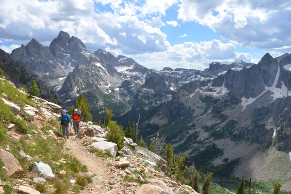
National Park
Soaring over a landscape rich with wildlife, pristine lakes, and majestic alpine vistas, the Teton Range stands as a testament to generations of stewards. For over 11,000 years, communities have thriv...
Park data from the National Park Service API. Alerts update every 2 hours.
This drive presents a mixed profile, with 49% of the journey on highways. You'll experience stretches that feel like open road cruising, interspersed with more varied driving. The longest continuous segment you'll encounter is 76.3 miles, so plan accordingly for fuel and breaks. This route is less about a monotonous interstate grind and more about a dynamic journey through varied terrain as you progress toward Jackson.
This route mixes highway mileage with some local-road sections near the start or finish. Navigation is very simple - set it and forget it for most of the drive. The trickiest moment comes around 0.8 miles in near Rendezvous Road.
Very easy - short and simple to drive
Balances navigation complexity with total wheel time.
The drive from Arapahoe, WY to Jackson, WY is easy. At 3h 27m with 49% highway, most drivers will find it relaxed and low-stress.
Where does it get tricky?
The main spots that need attention: at 0.8 miles (Rendezvous Road): Navigation decision point; at 3.5 miles (Rendezvous Road): Navigation decision point; at 6.4 miles (WY 789): Navigation decision point.
Weekend Trip
Doable as a same-day drive at 3h 27m. Total distance: 171.5 miles.
Family Friendly
Moderate complexity with 1 natural rest stops along the way.
Solo Traveler
3h 27m drive, comfortable solo distance.
First-Time Driver
Mostly highway driving (49%). Straightforward navigation.
Scenic Drive
Mixed highway & surface route profile with national parks nearby.
Compiled by the US Trip Planner planning team at COD Solutions Oy from open government datasets — OSRM over OpenStreetMap for geometry, EIA for fuel prices, and NPS for national parks. See our methodology for refresh cadence and limitations.
Was this helpful?
Thanks for your feedback!
Your tip has been submitted. Thanks!
/500
Recent Tips
·
Explore more options from Arapahoe, WY or browse trips ending in Jackson, WY.
Looking for more statewide routes? Browse WY road trips.