Connecting Saratoga to Jackson covers 325.9 miles of Wyoming’s rugged Mountain West landscape. You should plan for roughly 5 hours and 58 minutes of actual drive time, making this a long but manageable single-day commitment. Because the route relies on local roads like Highway 130 and Dwight D rather than major interstates, budget about $52 for fuel to cover the distance. This trek is best suited as a full-day adventure, allowing you to navigate the turn-heavy path comfortably. While both towns sit within the same region, the transition between them requires focused attention on local road conditions. It is a practical journey for those who prefer backroads over high-speed highway travel.
Trip Pace
Same-day drive is realistic
A same-day return is possible, but it will make for a full day on the road.
Break Rhythm
1 planned break
Plan on a short reset every 3 to 4 hours to stay fresh behind the wheel.
Midpoint
163 miles from Saratoga, WY
A natural place for your longest stop of the day
, about 2h 45m into the drive
.
Main Roads
Road
Distance
Duration
Dwight D. Eisenhower Highway
129.4 mi
2h 6m
US 191
85.9 mi
1h 35m
United States Highway 191
73 mi
1h 24m
State Highway 130
19.6 mi
21m
South Highway 89
11.8 mi
17m
South Pine Street
2.2 mi
5m
West Broadway Avenue
1 mi
2m
Elk Street
0.9 mi
1m
Longest stretch:
Dwight D. Eisenhower Highway
— 129.4 mi, about 2h 6m
Traffic on I-80
Hour-of-day weekday pattern from 8 FHWA count stations on your route.
Peak
2 PM
~480 veh/hr typical
· worst 725
Quietest
2 AM
~91 veh/hr
Peak-to-quiet ratio
5.3×
busier at peak than in the quiet hours
12a6anoon6p11p
Averaged across 49 weeks of 2023 FHWA Travel Monitoring Analysis System data. Weekday hours only (Mon–Fri).
Turn-by-Turn Driving Directions
Step-by-step road directions between Saratoga, WY and Jackson, WY.
1
Start on East Bridge Avenue
347 ft·13 sec·East Bridge Avenue
2
Turn right onto WY 130; WY 230
0.6 mi·1 min·North 1st Street
3
Continue on WY 130; WY 230
20 mi·21 min·State Highway 130
4
Continue on US 30; US 287
0.2 mi·24 sec·US 30; US 287
5
Take the ramp onto US 30; US 287
0.5 mi·40 sec·US 30; US 287
6
Merge onto I 80; US 30; US 287
129 mi·2 hr 6 min·Dwight D. Eisenhower Highway
Use the straight / slight right lanes.
7
Take the exit onto US 191
0.4 mi·50 sec·US 191
Toward US 191 North
8
Turn right onto US 191
0.9 mi·1 min·Elk Street
9
Continue on US 191
86 mi·1 hr 34 min·US 191
10
Continue on US 191
11 mi·12 min·United States Highway 191
11
Continue on US 191
0.4 mi·42 sec·US Highway 191
12
Continue on US 191
2.2 mi·5 min·South Pine Street
13
Continue on US 191
62 mi·1 hr 11 min·United States Highway 191
14
Enter roundabout onto US 26; US 89; US 189; US 191
19 ft·0 sec·South Highway 89
15
Continue on US 26; US 89; US 189; US 191
12 mi·17 min·South Highway 89
16
Continue on US 26; US 89; US 189; US 191
1.0 mi·2 min·West Broadway Avenue
17
Turn right onto West Pearl Avenue
0.4 mi·49 sec·West Pearl Avenue
18
Turn left onto South Cache Drive
519 ft·14 sec·South Cache Drive
19
Arrive at destination
US 26; US 89; US 191
Trip Plan
Given the 6-hour duration, try to depart early in the morning to maximize daylight for the more technical sections of the road. You only have one planned stop on the itinerary, so use it strategically to stretch your legs and refuel before pushing through the remaining miles. Keep a close eye on your fuel gauge, as the $52 estimate can fluctuate depending on your vehicle's efficiency on winding, non-highway roads. Since this route is quite turn-heavy, avoid rushing through the curves and pace yourself to ensure a safer arrival in Jackson. Flexibility is your greatest advantage here; don't hesitate to pull over if you need a break from the constant turning.
Morning Departure
An early start around 7-8 AM gets you there with plenty of daylight left.
Evening Departure
A late afternoon start means arriving after dark. Morning is better.
You can normally do this drive in one day.
Plan roughly 1 meaningful break for fuel, food, and rest.
The halfway point lands around 163 miles from Saratoga, WY, or about 2h 45m into the drive.
The longest continuous stretch on this route runs about 129.4 miles.
This is a comfortable same-day trip.
Departure
Before you leave
Start with fuel, water, and navigation already sorted so the first hour feels easy.
First stop
Around 72 miles or 1h 13m in
Use this first pause for coffee, a restroom break, and a quick traffic check ahead.
Halfway reset
Around 163 miles or 2h 45m in
This is the best place for your longest stop, a real meal, and a full fuel check.
Final approach
Final hour starts around 4h 45m
Traffic, exits, and arrival timing usually matter more near Jackson, WY than in the middle of the route.
Before You Leave
+
Open the route before leaving Saratoga, WY so your first major turns are already loaded.
+
Leave with enough water and a charging cable within reach, not packed away.
+
Check your fuel range against the first long segment, especially if you are starting outside city service areas.
Day 1
Settle into the route from Saratoga, WY
This is one driving day of about 325.9 miles and 5h 58m.
Your first comfortable stop window is around 72 miles from Saratoga, WY.
This route can stay practical as a one-day drive if traffic stays reasonable.
Plan about 1 real break rather than only quick fuel stops.
The longest stretch is on Dwight D. Eisenhower Highway for about 129.4 miles.
Where to Stop
Rest stops, refuel points, and overnight suggestions along this route.
Place data sourced from public business listings. Hours and availability may vary.
Heads-up: tricky spots
5 of 8
5 decision points cluster between mile 0.1 and 312.6 — GPS handles the exact turns, but know they're coming. Your lane choice matters more than the turn itself.
4
0.1 mi into trip|~0m in|WY 130; WY 230 / North 1st Street
Turn right onto WY 130; WY 230 / North 1st Street
Navigation decision point
5
20.9 mi into trip|~23m in|I 80; US 30; US 287 / Dwight D. Eisenhower Highway
Merge onto I 80; US 30; US 287 / Dwight D. Eisenhower Highway
Merge point - match speed before joining. Lane positioning matters here
Use the straight / slight right lanes.
4
150.3 mi into trip|~2h 29m in|US 191
Take the exit onto US 191 toward US 191 North
Exit ramp - move to the correct lane early
Toward US 191 North
4
150.6 mi into trip|~2h 30m in|US 191 / Elk Street
Turn right onto US 191 / Elk Street
Navigation decision point
4
312.6 mi into trip|~5h 37m in|US 26; US 89; US 189; US 191 / South Highway 89
Enter roundabout onto US 26; US 89; US 189; US 191 / South Highway 89
Roundabout - know your exit number before entering
Fuel & Cost
Regular Gas
$50.80 one way
$101.59 round trip
$3.96/gal25.4 MPG avg114 kg CO2
Fuel Type
$/gal
One Way
Round Trip
midgrade
$4.17
$53.54
$107.09
premium
$4.47
$57.40
$114.81
diesel
$4.80
$61.54
$123.07
No toll roads detected on this route.
Estimated Trip Cost (one way, 1 person)
Fuel
$51
Meals
$25–$50
Total
$76–$101
Rough estimate based on US averages. Hotel $80–$140/night, meals $25–$50/day.
Estimated CO2 emission: 114 kg one way.
Prices: EIA weekly data, 2026-07-13.
Driving Electric?
About $34 in charging
· 1 stop
· 67% less CO2
Vehicle Type
kWh
Stops
DC Fast
Home Charge
Average EV
97.8
1
$34.22
$15.64
Efficient EV
81.5
0
$28.52
$13.04
EV Truck/SUV
130.4
1
$45.63
$20.86
Gas CO2
114 kg
EV CO2
38 kg (67% less)
Plan for 1 charging stop. A 30-minute DC fast charge mid-route should be enough to complete the trip comfortably.
DC fast charging avg $0.35/kWh. Home charging avg $0.16/kWh. US grid CO2: 0.39 kg/kWh.
Travel Intel
Current conditions at both ends of the drive.
Forecast as of Jul 17, 2026
Origin
Saratoga, WY
Evening
in Saratoga on Saturday
Local time
7:33 PM
MDT
Current temp
91°F
Sunny
ENE 5 to 15 mph3% chanceLive forecast
Flood Watch
Flood Watch issued July 17 at 1:55AM MDT until July 17 at 10:00PM MDT by NWS Riverton WY
Heat Advisory
Heat Advisory issued July 17 at 1:49AM MDT until July 19 at 9:00PM MDT by NWS Rapid City SD
Destination
Jackson, WY
Evening
in Jackson on Saturday
Local time
7:33 PM
MDT
Current temp
88°F
Partly Sunny then Chance Showers And Thunderstorms
NW 3 mph59% chanceLive forecast
Flood Watch
Flood Watch issued July 17 at 1:55AM MDT until July 17 at 10:00PM MDT by NWS Riverton WY
Heat Advisory
Heat Advisory issued July 17 at 1:49AM MDT until July 19 at 9:00PM MDT by NWS Rapid City SD
Seasonal Notes
Summer travel usually means heavier construction, hotter rest stops, and busier weekend traffic around major cities.
Winter travel shortens daylight, so a route that looks manageable on paper can feel much longer after dark.
Holiday weekends tend to make both departure and arrival windows slower than the raw route time suggests.
Time zone
Same local time
Origin and destination are on the same clock, so arrival timing is easier to judge at a glance.
Temperature spread
3 degrees cooler at arrival
A meaningful temperature swing is a good cue to rethink layers, water, and how soon you want to arrive.
Road read
5h 58m on the road
An early start around 7-8 AM gets you there with plenty of daylight left.
Weather data from the National Weather Service. Conditions may change; check closer to your travel date.
National Parks Near This Route
Worth a detour if your schedule allows.
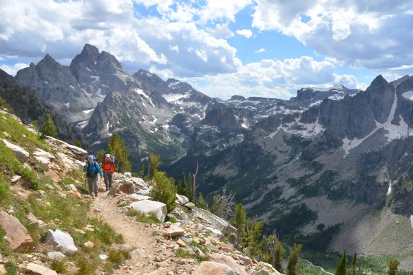
Grand Teton National Park
National Park
Soaring over a landscape rich with wildlife, pristine lakes, and majestic alpine vistas, the Teton Range stands as a testament to generations of stewards. For over 11,000 years, communities have thriv...
24 mi from route
~59 min detour
$35
near mile 325.9
Park data from the National Park Service API. Alerts update every 2 hours.
More Details
What kind of drive is this?
Expect a turn-heavy local drive that demands your full attention behind the wheel. Unlike a monotonous interstate slog, this route features a 0% highway share, meaning you will navigate surface roads for the entirety of the trip. You will find yourself constantly adjusting to the winding nature of the path as you transition between North 1st Street, Highway 130, and Dwight D. The driving experience is technical and engaging, requiring you to stay alert through every curve. It is a slow-paced, deliberate journey that prioritizes local terrain over quick, straight-line travel.
59% highway, the rest on surface roads — varied driving throughout.
19 navigation steps total — most of the decisions cluster near the start and finish.
Longest single stretch: 129.4 mi on Dwight D. Eisenhower Highway.
How Hard Is This Drive?
3/10
This route mixes highway mileage with some local-road sections near the start or finish. There are only a few real navigation decisions along the way. The trickiest moment comes around 0.1 miles in near WY 130; WY 230 / North 1st Street.
Driving Effort3/10
Easy - simple navigation with a manageable amount of wheel time
Balances navigation complexity with total wheel time.
This is a straightforward 5h 58m drive. You will face about 8 decision points, but nothing that requires special attention if you follow navigation.
Where does it get tricky?
The main spots that need attention: at 0.1 miles (WY 130; WY 230 / North 1st Street): Navigation decision point; at 20.9 miles (I 80; US 30; US 287 / Dwight D. Eisenhower Highway): Merge point - match speed before joining. Lane positioning matters here; at 150.3 miles (US 191): Exit ramp - move to the correct lane early.
Jackson is the largest town (population 11,000 in 2020) in the Jackson Hole valley in Teton County, Northwest Wyoming, close to the south end of Grand Teton National Park. It is the gateway to two of the United States' best-known national parks, Grand Teton and nearby Yellowstone. Many famous people maintain vacation homes in and around this area. The combined elements of beautiful mountain scenery, Old West heritage, tourist traps and celebrity residents give this small town a unique atmosphere both cosmopolitan and frontier.
Top landmarks
•Wort Hotel — Jackson, Wyoming, USA
•National Museum of Wildlife Art — museum in Jackson Hole, Wyoming
•George Washington Memorial Park — park in Jackson, Wyoming
Mixed highway & surface route profile with national parks nearby.
Frequently Asked Questions
The longest stretch is about 129.4 miles on Dwight D. Eisenhower Highway. The full list of main roads is in the Roads section above.
Yes — we found about 8 rest areas or service plazas within a short detour of the route (from OpenStreetMap). See the Rest Stops tab under Nearby Places for locations and mile markers. Plan to stretch, use the bathroom, and top off fluids every 2–3 hours on longer drives.
Only with planning. This is a long drive for kids — consider splitting it into two days rather than pushing through. Plan at least 1 meaningful breaks. There are 8 rest areas along the route for bathroom stops.
Mostly yes along the main roads, but rural stretches through WY can have sparse or no coverage. Before you leave, download offline Google Maps or Apple Maps for the route, and consider downloading music or podcasts instead of streaming. If you depend on data for navigation, keep a paper backup of the turn-by-turn directions.
The main spots that need attention: at 0.1 miles (WY 130; WY 230 / North 1st Street): Navigation decision point; at 20.9 miles (I 80; US 30; US 287 / Dwight D. Eisenhower Highway): Merge point - match speed before joining. Lane positioning matters here; at 150.3 miles (US 191): Exit ramp - move to the correct lane early.
Yes — Grand Teton National Park. See the National Parks section for detour distances and tips on detours.
Not recommended in a single day. At 6.0 hours each way, a round trip means 11.9 hours of driving — that is an unsafe level of fatigue for most drivers. Plan at least one night at Jackson, WY before the return drive.