Spanning 118 miles, this trek from West Lynchburg to East Highland Park takes approximately 2 hours and 38 minutes to complete. Because of the manageable duration, you can easily tackle this as a single-day trip without needing an overnight stay. You should budget about $19 for fuel, making this an affordable transit across the Southeast. Navigating via Anderson Highway, VA 24, and Richmond Highway, you will experience a diverse blend of local roads. It is a straightforward journey, though the turn-heavy nature of the route requires your full attention behind the wheel.
Trip Pace
Same-day drive is realistic
A same-day return is realistic if you keep stops short.
Break Rhythm
1 planned break
A short stop every 2 to 3 hours is enough for this drive.
Midpoint
59 miles from West Lynchburg, VA
A natural place for your longest stop of the day
, about 1h 15m into the drive
.
Main Roads
Road
Distance
Duration
Anderson Highway
36.7 mi
48m
VA 24
18.9 mi
21m
Richmond Highway
18.1 mi
24m
Powhite Parkway
12.4 mi
16m
East James Anderson Highway
8.1 mi
9m
West James Anderson Highway
7.7 mi
9m
Old Hundred Road
5.1 mi
8m
West Laburnum Avenue
3.8 mi
8m
Longest stretch:
Anderson Highway
— 36.7 mi, about 48m
Turn-by-Turn Driving Directions
Step-by-step road directions between West Lynchburg, VA and East Highland Park, VA.
1
Start on Lakeside Drive
0.7 mi·1 min·Lakeside Drive
2
Continue on Park Avenue
0.3 mi·49 sec·Park Avenue
3
Enter roundabout onto US 501 BUS
70 ft·4 sec·Langhorne Road
4
Continue on US 501 BUS
0.1 mi·19 sec·Langhorne Road
5
Continue on US 501 BUS
2.5 mi·4 min·Campbell Avenue
Use the straight / right lanes.
6
Take the exit onto US 460 BUS
0.3 mi·38 sec·US 460 BUS
Toward US 29 North, US 460 East: charlottesville, appomattox
7
Merge onto US 29; US 460
18 mi·24 min·Richmond Highway
Use the straight lane.
8
Take the exit onto VA 24
0.2 mi·21 sec·VA 24
Toward VA 24 East, VA 131 South: To Route 60, Appomattox
9
Turn slight left onto VA 24
19 mi·21 min·VA 24
10
Continue on US 60
7.7 mi·9 min·West James Anderson Highway
11
Continue on US 60
8.1 mi·9 min·East James Anderson Highway
12
Continue on US 60
37 mi·48 min·Anderson Highway
13
Continue on US 60
0.9 mi·1 min·Midlothian Turnpike
14
Turn right onto SR 652
2.5 mi·3 min·Old Hundred Road
Use the straight lane.
15
Enter roundabout onto SR 652
147 ft·5 sec·Old Hundred Road
16
Continue on SR 652
2.5 mi·4 min·Old Hundred Road
Use the straight lane.
17
Continue on VA 76
9.7 mi·12 min·Powhite Parkway
Use the left / straight lanes.
18
Keep slight right at fork onto VA 76
1.8 mi·2 min·Powhite Parkway
Use the slight right lane.
19
Keep slight left at fork onto VA 76
0.9 mi·1 min·Powhite Parkway
Use the straight lane.
20
Merge onto I 195
2.1 mi·2 min·Beltline Expressway
Use the straight lane.
21
Take the exit
0.1 mi·15 sec
Toward SR 197: Laburnum AvenueUse the slight right lane.
22
Turn right onto West Laburnum Avenue
3.8 mi·8 min·West Laburnum Avenue
Use the left lane.
23
Turn right onto Fenwick Street
56 ft·2 sec·Fenwick Street
24
Arrive at destination
Fenwick Street
Trip Plan
Given the 2 hour and 38 minute duration, you have plenty of flexibility to plan your departure time around local traffic patterns. Since there is only one recommended stop, try to time your break to coincide with the conclusion of the longest 36.7-mile stretch on Anderson Highway to keep your energy levels up. Keep a close eye on your fuel gauge, as the $19 estimate is based on standard consumption and local road conditions. Because this route relies heavily on state and local highways, stay alert for changing speed limits as you move through different municipalities. Taking these turns at a measured pace will ensure a much more comfortable trip for everyone in the vehicle.
Morning Departure
Leave by 9 AM and you'll arrive before lunch.
Evening Departure
Even a 4 PM departure gets you there before dark in summer.
You can normally do this drive in one day.
Plan roughly 1 meaningful break for fuel, food, and rest.
The halfway point lands around 59 miles from West Lynchburg, VA, or about 1h 15m into the drive.
The longest continuous stretch on this route runs about 36.7 miles.
This is a comfortable same-day trip.
Departure
Before you leave
Start with fuel, water, and navigation already sorted so the first hour feels easy.
First stop
Around 26 miles or 36m in
Use this first pause for coffee, a restroom break, and a quick traffic check ahead.
Halfway reset
Around 59 miles or 1h 15m in
This is the best place for your longest stop, a real meal, and a full fuel check.
Final approach
Final hour starts around 2h 5m
Traffic, exits, and arrival timing usually matter more near East Highland Park, VA than in the middle of the route.
Before You Leave
+
Open the route before leaving West Lynchburg, VA so your first major turns are already loaded.
+
Leave with enough water and a charging cable within reach, not packed away.
+
Check your fuel range against the first long segment, especially if you are starting outside city service areas.
Day 1
Settle into the route from West Lynchburg, VA
This is one driving day of about 118 miles and 2h 38m.
Your first comfortable stop window is around 26 miles from West Lynchburg, VA.
This route can stay practical as a one-day drive if traffic stays reasonable.
Plan about 1 real break rather than only quick fuel stops.
The longest stretch is on Anderson Highway for about 36.7 miles.
Where to Stop
Rest stops, refuel points, and overnight suggestions along this route.
Place data sourced from public business listings. Hours and availability may vary.
Heads-up: tricky spots
5 of 13
5 decision points cluster between mile 3.7 and 114.1 — GPS handles the exact turns, but know they're coming. Your lane choice matters more than the turn itself.
5
3.7 mi into trip|~7m in|US 460 BUS
Take the exit onto US 460 BUS toward US 29 North, US 460 East: charlottesville, appomattox
Exit ramp - move to the correct lane early. Multiple destination signs - pick the right one
Toward US 29 North, US 460 East: charlottesvill...
6
94.5 mi into trip|~2h 2m in|SR 652 / Old Hundred Road
Turn right onto SR 652 / Old Hundred Road
Lane positioning matters here
Use the straight lane.
6
109.3 mi into trip|~2h 22m in|VA 76 / Powhite Parkway
Keep slight right at fork onto VA 76 / Powhite Parkway
Highway fork - watch signs carefully. Lane positioning matters here
Use the slight right lane.
6
111.1 mi into trip|~2h 25m in|VA 76 / Powhite Parkway
Keep slight left at fork onto VA 76 / Powhite Parkway
Highway fork - watch signs carefully. Lane positioning matters here
Use the straight lane.
6
114.1 mi into trip|~2h 29m in
Take the exit toward SR 197: Laburnum Avenue
Exit ramp - move to the correct lane early. Lane positioning matters here
Use the slight right lane.
Toward SR 197: Laburnum Avenue
Fuel & Cost
Regular Gas
$18.45 one way
$36.91 round trip
$3.97/gal25.4 MPG avg41 kg CO2
Fuel Type
$/gal
One Way
Round Trip
midgrade
$4.34
$20.18
$40.35
premium
$4.70
$21.84
$43.68
diesel
$5.61
$26.05
$52.11
Estimated Tolls: $0.07
Midlothian Turnpike
(0.9 mi)$0.07
Toll estimates based on average 2024-2025 rates. EZ-Pass/SunPass discounts may lower the actual cost.
Estimated Trip Cost (one way, 1 person)
Fuel
$18
Tolls
$0
Meals
$25–$50
Total
$44–$69
Rough estimate based on US averages. Hotel $80–$140/night, meals $25–$50/day.
Estimated CO2 emission: 41.3 kg one way.
Prices: EIA weekly data, 2026-04-13.
Driving Electric?
About $12 in charging
· 0 stops
· 66% less CO2
Vehicle Type
kWh
Stops
DC Fast
Home Charge
Average EV
35.4
0
$12.39
$5.66
Efficient EV
29.5
0
$10.33
$4.72
EV Truck/SUV
47.2
0
$16.52
$7.55
Gas CO2
41 kg
EV CO2
14 kg (66% less)
This trip is well within single-charge range for most EVs. No charging stops needed if you start fully charged.
DC fast charging avg $0.35/kWh. Home charging avg $0.16/kWh. US grid CO2: 0.39 kg/kWh.
Travel Intel
Current conditions at both ends of the drive.
Forecast as of Apr 15, 2026
Origin
West Lynchburg, VA
Morning
in West Lynchburg on Sunday
Local time
6:36 AM
EDT
Current temp
73°F
Unavailable
Live forecast
Destination
East Highland Park, VA
Morning
in East Highland Park on Sunday
Local time
6:36 AM
EDT
Current temp
60°F
Unavailable
Live forecast
Seasonal Notes
Summer travel usually means heavier construction, hotter rest stops, and busier weekend traffic around major cities.
Winter travel shortens daylight, so a route that looks manageable on paper can feel much longer after dark.
Holiday weekends tend to make both departure and arrival windows slower than the raw route time suggests.
Time zone
Same local time
Origin and destination are on the same clock, so arrival timing is easier to judge at a glance.
Temperature spread
13 degrees cooler at arrival
A meaningful temperature swing is a good cue to rethink layers, water, and how soon you want to arrive.
Road read
2h 38m on the road
Use the two city cards together: check the sky where you start, then compare it with the local time and temperature at arrival.
Weather data from the National Weather Service. Conditions may change; check closer to your travel date.
National Parks Near This Route
Worth a detour if your schedule allows.
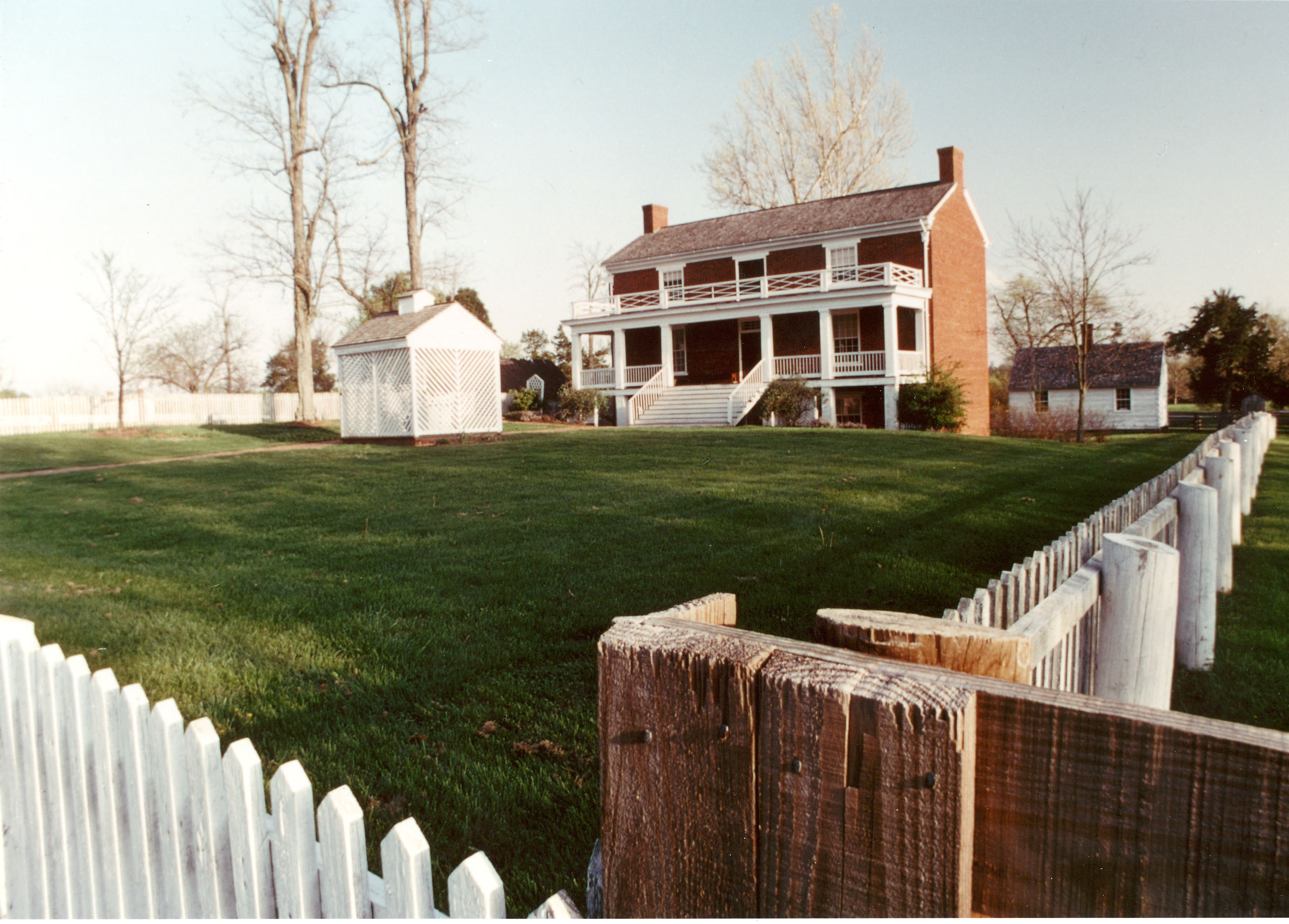
Appomattox Court House National Historical Park
National Historical Park
On April 9, 1865, the surrender of the Army of Northern Virginia in the McLean House in the village of Appomattox Court House, Virginia signaled the effective end of the nation's largest war. Question...
Two hundred ninety-two days, eight offensives, over 70,000 casualties, U. S. Colored Troops, and the decline of Gen. Lee's Army of Northern Virginia all describe the Siege of Petersburg. U.S. forces c...
20 mi from route
~51 min detour
Free
near mile 101.7
Park data from the National Park Service API. Alerts update every 2 hours.
More Details
What kind of drive is this?
Expect a hands-on driving experience rather than a monotonous interstate cruise, as only 29% of this route consists of highways. You will spend much of your time on local roads, which keeps the drive engaging and requires frequent adjustments. Your longest uninterrupted segment occurs on Anderson Highway, stretching for 36.7 miles before the road profile shifts. The character of the drive is distinctly turn-heavy, so be prepared for a winding path that demands constant focus. As you transition between these regional roads, the pace remains steady but rarely allows for long stretches of automated highway cruising.
Only 29% highway — the rest is turn-by-turn surface driving.
24 navigation steps total — most of the decisions cluster near the start and finish.
Longest single stretch: 36.7 mi on Anderson Highway.
How Hard Is This Drive?
8/10
Expect a hands-on drive with frequent turns and local roads rather than long highway stretches. This route has several spots where lane changes, forks, or exits need your full attention. The trickiest moment comes around 3.7 miles in near US 460 BUS.
Driving Effort8/10
Demanding - plan breaks and stay ahead of the key maneuvers
Balances navigation complexity with total wheel time.
This is a demanding drive. With 13 significant decision points across 118 miles, you will need to stay alert - especially through interchange areas and urban stretches. Consider splitting it into segments if you are not comfortable with fast highway navigation.
Where does it get tricky?
The main spots that need attention: at 3.7 miles (US 460 BUS): Exit ramp - move to the correct lane early. Multiple destination signs - pick the right one; at 94.5 miles (SR 652 / Old Hundred Road): Lane positioning matters here; at 109.3 miles (VA 76 / Powhite Parkway): Highway fork - watch signs carefully. Lane positioning matters here.
Towns Mentioned on Route Signs
Based on OSRM destination-sign hints, not a full list of every settlement the road passes.
On the drive from West Lynchburg, VA to East Highland Park, VA, road signs begin pointing toward Appomattox along the way.
Appomattox
22.1 mi in|~32m|via VA 24
Who Is This Route For?
Weekend Trip
Doable as a same-day drive at 2h 38m. Total distance: 118 miles.
Family Friendly
Moderate complexity with 1 natural rest stops along the way.
Solo Traveler
2h 38m drive, comfortable solo distance.
Scenic Drive
Mostly surface roads route profile with national parks nearby.
Frequently Asked Questions
The longest stretch is about 36.7 miles on Anderson Highway. The full list of main roads is in the Roads section above.
Expect about $0.07 in tolls one way, starting with Midlothian Turnpike. Most Northeast and Midwest toll agencies accept E-ZPass; in the West and Texas, transponders like TxTag or FasTrak apply. If you do not have a transponder, cashless tolling plates will mail a bill to the vehicle's registered address — usually with a surcharge, so a rental-car toll pass is often cheaper than paying by mail.
It helps. This route has a higher-than-average number of complex decision points, which get harder in the dark. If the last hour of the trip is on surface roads or mountain grades, aim to arrive at East Highland Park, VA before sunset when you can. Check the Trip Plan for departure windows that land you in daylight.
Only with planning. This is a long drive for kids — consider splitting it into two days rather than pushing through. Plan at least 1 meaningful breaks. Dedicated rest areas are limited, so plan gas or food stops as your bathroom breaks.
The main spots that need attention: at 3.7 miles (US 460 BUS): Exit ramp - move to the correct lane early. Multiple destination signs - pick the right one; at 94.5 miles (SR 652 / Old Hundred Road): Lane positioning matters here; at 109.3 miles (VA 76 / Powhite Parkway): Highway fork - watch signs carefully. Lane positioning matters here.
Yes — Appomattox Court House National Historical Park and Petersburg National Battlefield. See the National Parks section for detour distances and tips on detours.
Yes. A round trip is manageable in a single day if you plan a break at East Highland Park, VA before heading back.