Origin
Tucson, AZ
Late night in Tucson on Tuesday
Local time
3:27 AM
MST
Current temp
83°F
Unavailable
Live forecast
Compiled and reviewed by the US Trip Planner planning team at COD Solutions Oy · Last reviewed Apr 21, 2026 · Editorial standards
Drive Time
4h 17m
Distance
233 mi
375 km
Drive Score
9/10
Great drive
Same Day?
Yes, doable
Fuel Cost
$46
one way
EV Charging
Unknown
Estimated drive times based on typical traffic patterns. Actual times may vary with weather, construction, and real-time conditions.

Tucson, AZ
Wikimedia Commons

Paulden, AZ
Abhishek Navlakha
Tucson, AZ to Paulden, AZ is 233 miles and takes about 4h 17m via Casa Grande-Tucson Highway and Black Canyon Freeway, with a fuel budget near $46 and enough daylight to finish in a day. This one-day trip stays within Arizona's Desert Southwest region, transitioning from the immediate surroundings of Tucson to areas north of Phoenix. Expect a mix of highway speeds and surface roads as you make your way toward Paulden. Given the relatively short drive time, you'll have plenty of flexibility for your departure and any brief stops along the way.
Trip Pace
Same-day drive is realistic
A same-day return is possible, but it will make for a full day on the road.
Break Rhythm
1 planned break
Plan on a short reset every 3 to 4 hours to stay fresh behind the wheel.
Midpoint
116.5 miles from Tucson, AZ
A natural place for your longest stop of the day , about 2h 7m into the drive .
| Road | Distance | Duration |
|---|---|---|
| Casa Grande-Tucson Highway | 54.5 mi | 55m |
| Black Canyon Freeway | 41.3 mi | 45m |
| Phoenix-Casa Grande Highway | 38.1 mi | 38m |
| AZ 69 | 21.6 mi | 25m |
| Prescott–Ash Fork Highway | 17.8 mi | 20m |
| Maricopa Freeway | 16.2 mi | 18m |
| Arizona Veterans Highway | 13.4 mi | 13m |
| Phoenix–Cordes Junction Highway | 8.9 mi | 9m |
Step-by-step road directions between Tucson, AZ and Paulden, AZ.
Start on North Country Club Road
Turn left onto East Speedway Boulevard
Turn right onto North Freeway Road
Take the ramp
Merge onto I 10
Continue on I 10
Keep slight left at fork onto I 10
Continue on I 10
Continue on I 10
Keep slight right at fork onto US 60
Continue on I 17; US 60
Continue on I 17
Continue on I 17
Keep slight right at fork onto AZ 69
Turn right onto Fain Road
Continue on AZ 89A
Take the exit
Turn right onto AZ 89
Enter roundabout onto AZ 89
Continue on AZ 89
Enter roundabout onto AZ 89
Continue on AZ 89
Enter roundabout onto AZ 89
Continue on AZ 89
Enter roundabout onto AZ 89
Continue on AZ 89
Enter roundabout onto AZ 89
Continue on AZ 89
Arrive at destination
To make the most of this 4-hour drive, consider leaving Tucson in the morning to allow ample time for your destination. With only one recommended stop and a manageable distance, you can easily complete this trip in a single day. Keep an eye on your fuel gauge, especially as you leave the more populated areas; the fuel cost estimate is $46, so plan accordingly. The longest stretch without a significant break is over 50 miles, so ensure you're comfortable before starting that segment.
Morning Departure
An early start around 7-8 AM gets you there with plenty of daylight left.
Evening Departure
A late afternoon start means arriving after dark. Morning is better.
This is a comfortable same-day trip.
Departure
Before you leave
Start with fuel, water, and navigation already sorted so the first hour feels easy.
First stop
Around 51 miles or 58m in
Use this first pause for coffee, a restroom break, and a quick traffic check ahead.
Halfway reset
Around 116.5 miles or 2h 7m in
This is the best place for your longest stop, a real meal, and a full fuel check.
Final approach
Final hour starts around 3h 28m
Traffic, exits, and arrival timing usually matter more near Paulden, AZ than in the middle of the route.
Open the route before leaving Tucson, AZ so your first major turns are already loaded.
Leave with enough water and a charging cable within reach, not packed away.
Check your fuel range against the first long segment, especially if you are starting outside city service areas.
Day 1
Settle into the route from Tucson, AZ
This is one driving day of about 233 miles and 4h 17m.
Rest stops, refuel points, and overnight suggestions along this route.

Mid-route town
Meal stop
117 mi into the route
Best for: Lunch, fuel, and a longer reset
This sits close to the middle of the route, so it works well for the longest stop of the day.
A short stop after about 51 miles helps settle the day before fatigue starts building.
The midpoint is around 116.5 miles from Tucson, AZ, which is a good place for a longer meal and fuel stop.
These stop ideas are pacing suggestions — the exact town or exit can change with traffic, hotel plans, and fuel range.
5 decision points cluster between mile 4.8 and 214.7 — GPS handles the exact turns, but know they're coming. Your lane choice matters more than the turn itself.
Merge onto I 10 / North Freeway
Merge point - match speed before joining. Lane positioning matters here
Keep slight left at fork onto I 10 / Casa Grande-Tucson Highway
Highway fork - watch signs carefully. Lane positioning matters here
Keep slight right at fork onto US 60 / Maricopa Freeway toward I-17 North, US-60 West: Flagstaff
Highway fork - watch signs carefully. Lane positioning matters here. Multiple destination signs - pick the right one
Keep slight right at fork onto AZ 69 toward AZ 69 North: Cordes Lakes Rd, Prescott
Highway fork - watch signs carefully. Multiple destination signs - pick the right one
Take the exit toward AZ 89: Prescott, Chino Valley
Exit ramp - move to the correct lane early. Multiple destination signs - pick the right one
Regular Gas
$46.42 one way
$92.83 round trip
| Fuel Type | $/gal | One Way | Round Trip |
|---|---|---|---|
| midgrade | $5.36 | $49.12 | $98.25 |
| premium | $5.59 | $51.29 | $102.58 |
| diesel | $5.61 | $51.44 | $102.89 |
No toll roads detected on this route.
Estimated Trip Cost (one way, 1 person)
Fuel
$46
Meals
$25–$50
Total
$71–$96
Rough estimate based on US averages. Hotel $80–$140/night, meals $25–$50/day.
Estimated CO2 emission: 81.5 kg one way. Prices: EIA weekly data, 2026-04-13.
Driving Electric?
About $24 in charging · 0 stops · 67% less CO2
| Vehicle Type | kWh | Stops | DC Fast | Home Charge |
|---|---|---|---|---|
| Average EV | 69.9 | 0 | $24.46 | $11.18 |
| Efficient EV | 58.3 | 0 | $20.39 | $9.32 |
| EV Truck/SUV | 93.2 | 1 | $32.62 | $14.91 |
Gas CO2
82 kg
EV CO2
27 kg (67% less)
Plan for 0 charging stops, roughly every 270 miles. Allow 25-40 minutes per stop at a DC fast charger.
DC fast charging avg $0.35/kWh. Home charging avg $0.16/kWh. US grid CO2: 0.39 kg/kWh.
Current conditions at both ends of the drive.
Origin
Late night in Tucson on Tuesday
Local time
3:27 AM
MST
Current temp
83°F
Unavailable
Destination
Late night in Paulden on Tuesday
Local time
3:27 AM
MST
Current temp
68°F
Unavailable
Seasonal Notes
Summer travel usually means heavier construction, hotter rest stops, and busier weekend traffic around major cities.
Winter travel shortens daylight, so a route that looks manageable on paper can feel much longer after dark.
Holiday weekends tend to make both departure and arrival windows slower than the raw route time suggests.
Time zone
Origin and destination are on the same clock, so arrival timing is easier to judge at a glance.
Temperature spread
A meaningful temperature swing is a good cue to rethink layers, water, and how soon you want to arrive.
Road read
An early start around 7-8 AM gets you there with plenty of daylight left.
Weather data from the National Weather Service. Conditions may change; check closer to your travel date.
Worth a detour if your schedule allows.

National Park
Tucson, Arizona is home to the nation's largest cacti. The giant saguaro is the universal symbol of the American west. These majestic plants, found only in a small portion of the United States, are pr...

National Monument
An Ancestral Sonoran Desert People's farming community and "Great House" are preserved at Casa Grande Ruins. Whether a gathering place for people or simply a waypoint marker in an extensive system of...
National Monument
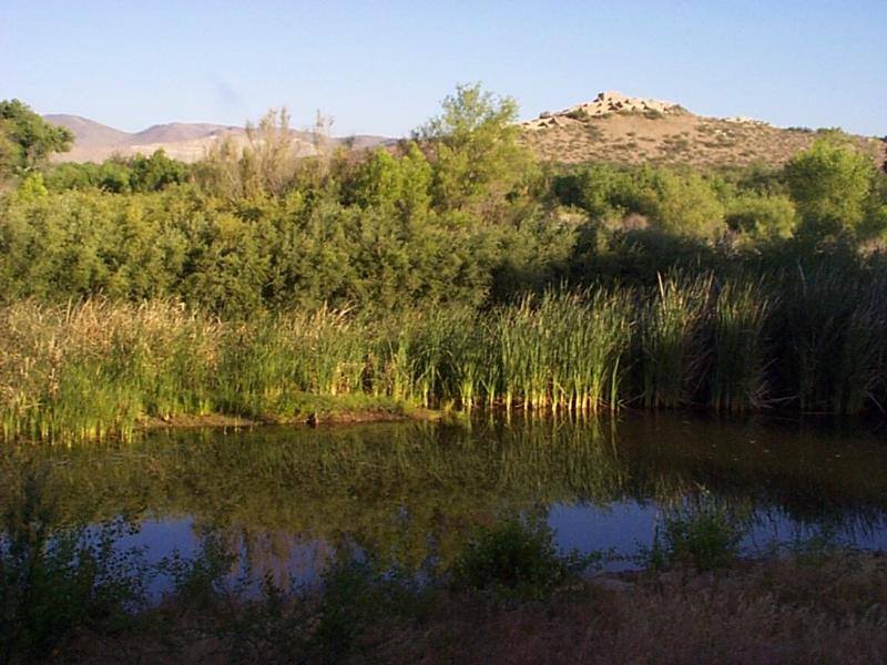
Water flows under and through this landscape, feeding the growth of people and towns. The Verde Valley is watered by snowmelt, summer monsoons, and springs that well up from the ancient sedimentary ro...
National Monument
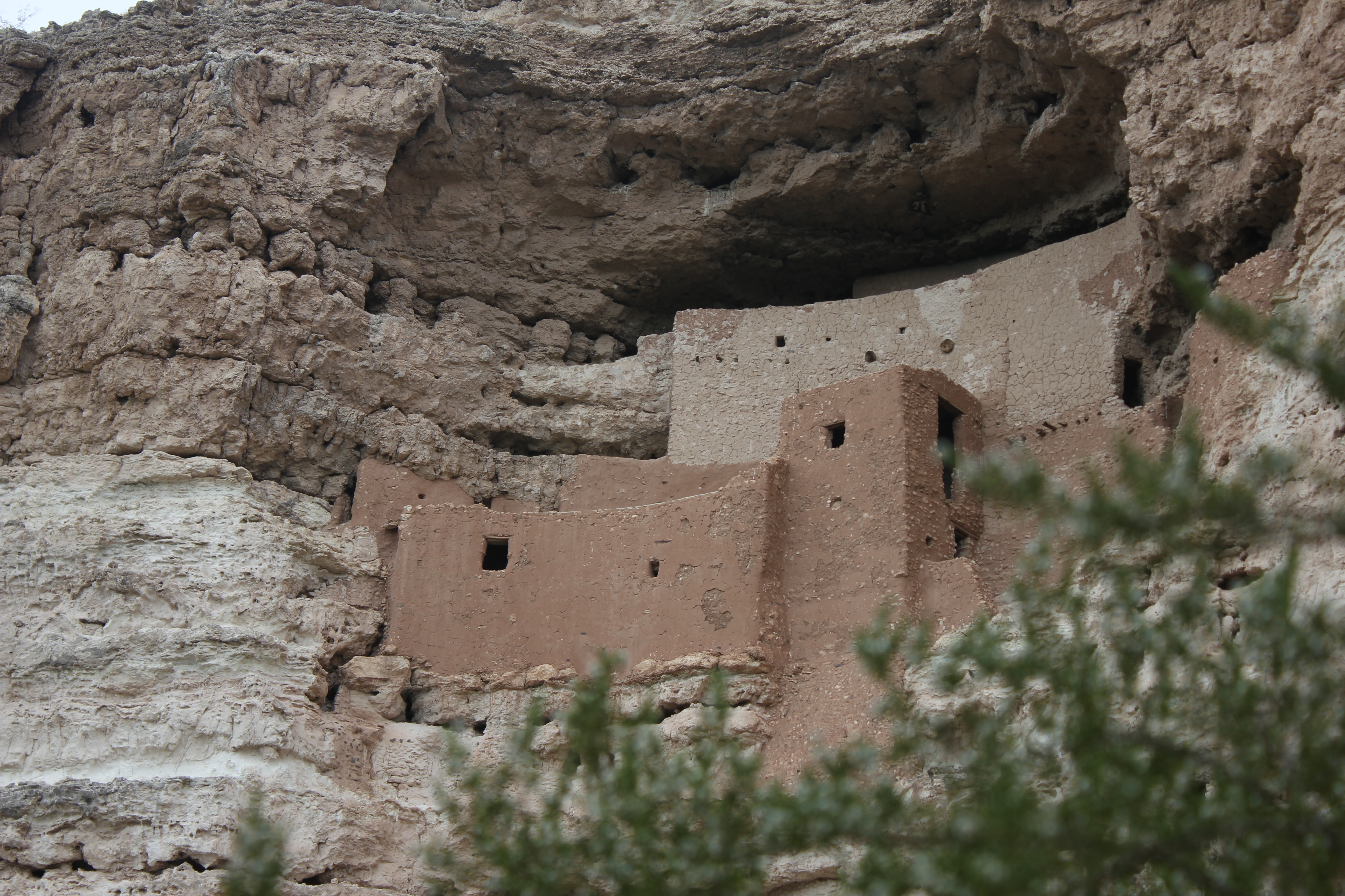
Established December 8, 1906, Montezuma Castle is the third National Monument dedicated to preserving Native American culture. This 20 room high-rise apartment, nestled into a towering limestone cliff...
Park data from the National Park Service API. Alerts update every 2 hours.
This route features a 35% highway share, meaning you'll spend a good portion of your time on surface roads. The longest continuous stretch on a single road is 54.5 miles on the Casa Grande-Tucson Highway. You'll experience the transition from more built-up areas around Phoenix to more open terrain as you head north. Be prepared for merging traffic and a higher density of exits as you pass through the greater Phoenix metropolitan area.
This route mixes highway mileage with some local-road sections near the start or finish. This route has several spots where lane changes, forks, or exits need your full attention. The trickiest moment comes around 4.8 miles in near I 10 / North Freeway.
Demanding - plan breaks and stay ahead of the key maneuvers
Balances navigation complexity with total wheel time.
This is a demanding drive. With 13 significant decision points across 233 miles, you will need to stay alert - especially through interchange areas and urban stretches. Consider splitting it into segments if you are not comfortable with fast highway navigation.
Where does it get tricky?
The main spots that need attention: at 4.8 miles (I 10 / North Freeway): Merge point - match speed before joining. Lane positioning matters here; at 11.1 miles (I 10 / Casa Grande-Tucson Highway): Highway fork - watch signs carefully. Lane positioning matters here; at 111.9 miles (US 60 / Maricopa Freeway): Highway fork - watch signs carefully. Lane positioning matters here. Multiple destination signs - pick the right one.
Based on OSRM destination-sign hints, not a full list of every settlement the road passes.
Between Tucson, AZ and Paulden, AZ, road signs point toward Prescott and Chino Valley.
Prescott
Chino Valley
Tucson (TOO-sawn), also known as the "Old Pueblo", is the second-largest city in the state of Arizona and the county seat of Pima County in the Sonoran Desert. It is at a higher elevation than nearby Phoenix and is correspondingly cooler. Although with half a million residents it is smaller than the capital city, its cultural life is just as vibrant.
City content from Wikivoyage (CC BY-SA 4.0) and Wikidata (CC0).
Weekend Trip
Doable as a same-day drive at 4h 17m. Total distance: 233 miles.
Family Friendly
Moderate complexity with 1 natural rest stops along the way.
Solo Traveler
4h 17m drive, comfortable solo distance.
Scenic Drive
Mixed highway & surface route profile with national parks nearby.
Compiled by the US Trip Planner planning team at COD Solutions Oy from open government datasets — OSRM over OpenStreetMap for geometry, EIA for fuel prices, and NPS for national parks. See our methodology for refresh cadence and limitations.
Was this helpful?
Thanks for your feedback!
Your tip has been submitted. Thanks!
/500
Recent Tips
·
Explore more options from Tucson, AZ or browse trips ending in Paulden, AZ.
Looking for more statewide routes? Browse AZ road trips.