This 176.8-mile drive from Swan Creek to Hamilton, Ohio, is a straightforward one-day trip, taking approximately 3 hours and 34 minutes. With 87% of the journey on highways, it's a focused drive best suited for covering ground efficiently. The estimated fuel cost is around $27, making it an economical option for a single-day excursion within the Midwest region. You'll primarily navigate via US 35 and I-71, with a brief section on State Route 7 South. This route is ideal if you're looking for a direct connection without many detours.
Trip Pace
Same-day drive is realistic
A same-day return is realistic if you keep stops short.
Break Rhythm
1 planned break
A short stop every 2 to 3 hours is enough for this drive.
Midpoint
88.4 miles from Swan Creek, OH
A natural place for your longest stop of the day
, about 1h 50m into the drive
.
Main Roads
Road
Distance
Duration
US 35
96.6 mi
1h 49m
I 71
39.5 mi
43m
State Route 7 South
15.4 mi
21m
Butler County Veterans Highway
9.3 mi
10m
Pine Street
2.3 mi
5m
Kings Mills Road
2 mi
3m
Mason Road
1.9 mi
3m
High Street
1.7 mi
3m
Longest stretch:
US 35
— 96.6 mi, about 1h 49m
Turn-by-Turn Driving Directions
Step-by-step road directions between Swan Creek, OH and Hamilton, OH.
1
Start on SR 7
15 mi·21 min·State Route 7 South
2
Continue on SR 7
0.8 mi·1 min·Garfield Avenue
3
Continue on SR 7
0.3 mi·31 sec·Vine Street
4
Turn left onto SR 7
1.0 mi·1 min·2nd Avenue
5
Turn left onto SR 160
2.3 mi·5 min·Pine Street
6
Turn slight left onto SR 160
0.5 mi·49 sec·SR 160
7
Take the ramp
0.4 mi·46 sec
Toward US 35 West: Rio Grande, Jackson
8
Merge onto US 35
57 mi·1 hr 6 min·US 35
9
Keep slight left at fork onto US 35
40 mi·43 min·US 35
Toward US 35 West: Dayton
10
Take the exit
0.3 mi·42 sec
Exit 72Toward SR 435: Columbus, Cincinnati
11
Turn left onto SR 435
0.9 mi·1 min·Old United States Highway 35
12
Turn left
0.3 mi·43 sec
Toward I 71 South: CincinnatiUse the left lane.
13
Merge onto I 71
39 mi·43 min·I 71
14
Take the exit
0.3 mi·40 sec
Exit 25Toward SR 741 North: Kings Mills Road, MasonUse the slight right lane.
15
Turn right onto SR 741
2.0 mi·3 min·Kings Mills Road
Use the straight lane.
16
Turn sharp left onto US 42
0.2 mi·15 sec·US 42
Use the left lane.
17
Continue on US 42
1.5 mi·2 min·US 42
Use the straight / left lanes.
18
Turn right onto West Main Street
0.3 mi·29 sec·West Main Street
19
Turn right onto Mason Road
0.4 mi·44 sec·Mason Road
Use the straight / right lanes.
20
Enter roundabout onto Mason Road
177 ft·3 sec·Mason Road
21
Continue on Mason Road
0.7 mi·1 min·Mason Road
Use the left lane.
22
Enter roundabout onto Mason Road
82 ft·1 sec·Mason Road
23
Continue on Mason Road
0.8 mi·1 min·Mason Road
24
Continue on Liberty Way
0.8 mi·1 min·Liberty Way
25
Turn right onto Cox Lane
0.3 mi·31 sec·Cox Lane
Use the right lane.
26
Enter roundabout onto Veterans Boulevard
302 ft·6 sec·Veterans Boulevard
27
Continue on Veterans Boulevard
0.2 mi·23 sec·Veterans Boulevard
28
Continue on Butler County Veterans Highway
9.3 mi·10 min·Butler County Veterans Highway
Use the straight / slight right lanes.
29
Continue on SR 129
1.7 mi·3 min·High Street
Use the straight lane.
30
Continue on SR 129; SR 177
228 ft·15 sec·High Street
Use the left lane.
31
Arrive at destination
SR 129; SR 177
Trip Plan
Given the 3-hour 34-minute duration, this route is easily manageable as a single-day trip, allowing for flexibility in your departure time. Aim to leave Swan Creek in the morning to maximize your daylight hours. With only one recommended stop implied by the data, you can plan your breaks strategically, perhaps around the 96.6-mile mark on US 35. Keep an eye on your fuel, as the estimated cost is $27, and plan your refueling accordingly before you hit the longer highway stretches.
Morning Departure
An early start around 7-8 AM gets you there with plenty of daylight left.
Evening Departure
A late afternoon start means arriving after dark. Morning is better.
You can normally do this drive in one day.
Plan roughly 1 meaningful break for fuel, food, and rest.
The halfway point lands around 88.4 miles from Swan Creek, OH, or about 1h 50m into the drive.
The longest continuous stretch on this route runs about 96.6 miles.
This is a comfortable same-day trip.
Departure
Before you leave
Start with fuel, water, and navigation already sorted so the first hour feels easy.
First stop
Around 39 miles or 53m in
Use this first pause for coffee, a restroom break, and a quick traffic check ahead.
Halfway reset
Around 88.4 miles or 1h 50m in
This is the best place for your longest stop, a real meal, and a full fuel check.
Final approach
Final hour starts around 2h 52m
Traffic, exits, and arrival timing usually matter more near Hamilton, OH than in the middle of the route.
Before You Leave
+
Open the route before leaving Swan Creek, OH so your first major turns are already loaded.
+
Leave with enough water and a charging cable within reach, not packed away.
+
Check your fuel range against the first long segment, especially if you are starting outside city service areas.
Day 1
Settle into the route from Swan Creek, OH
This is one driving day of about 176.8 miles and 3h 34m.
Your first comfortable stop window is around 39 miles from Swan Creek, OH.
This route can stay practical as a one-day drive if traffic stays reasonable.
Plan about 1 real break rather than only quick fuel stops.
The longest stretch is on US 35 for about 96.6 miles.
Where to Stop
Rest stops, refuel points, and overnight suggestions along this route.
Place data sourced from public business listings. Hours and availability may vary.
Heads-up: tricky spots
5 of 20
5 decision points cluster between mile 117.3 and 165.2 — GPS handles the exact turns, but know they're coming. Your lane choice matters more than the turn itself.
6
117.3 mi into trip|~2h 21m in
Take the exit toward SR 435: Columbus, Cincinnati
Exit ramp - move to the correct lane early. Multiple destination signs - pick the right one
Exit 72
Toward SR 435: Columbus, Cincinnati
6
118.5 mi into trip|~2h 23m in
Turn left toward I 71 South: Cincinnati
Lane positioning matters here
Use the left lane.
Toward I 71 South: Cincinnati
8
158.3 mi into trip|~3h 7m in
Take the exit toward SR 741 North: Kings Mills Road, Mason
Exit ramp - move to the correct lane early. Lane positioning matters here. Multiple destination signs - pick the right one
Use the slight right lane.
Exit 25
Toward SR 741 North: Kings Mills Road, Mason
7
160.5 mi into trip|~3h 11m in|US 42
Turn sharp left onto US 42
Sharp turn - reduce speed on approach. Lane positioning matters here
Use the left lane.
6
165.2 mi into trip|~3h 19m in|Cox Lane
Turn right onto Cox Lane
Lane positioning matters here
Use the right lane.
Fuel & Cost
Regular Gas
$27.44 one way
$54.88 round trip
$3.94/gal25.4 MPG avg62 kg CO2
Fuel Type
$/gal
One Way
Round Trip
midgrade
$4.38
$30.45
$60.91
premium
$4.91
$34.17
$68.34
diesel
$5.61
$39.04
$78.07
No toll roads detected on this route.
Estimated Trip Cost (one way, 1 person)
Fuel
$27
Meals
$25–$50
Total
$52–$77
Rough estimate based on US averages. Hotel $80–$140/night, meals $25–$50/day.
Estimated CO2 emission: 61.9 kg one way.
Prices: EIA weekly data, 2026-04-13.
Driving Electric?
About $19 in charging
· 0 stops
· 66% less CO2
Vehicle Type
kWh
Stops
DC Fast
Home Charge
Average EV
53
0
$18.56
$8.49
Efficient EV
44.2
0
$15.47
$7.07
EV Truck/SUV
70.7
0
$24.75
$11.32
Gas CO2
62 kg
EV CO2
21 kg (66% less)
This trip is well within single-charge range for most EVs. No charging stops needed if you start fully charged.
DC fast charging avg $0.35/kWh. Home charging avg $0.16/kWh. US grid CO2: 0.39 kg/kWh.
Travel Intel
Current conditions at both ends of the drive.
Forecast as of Apr 18, 2026
Origin
Swan Creek, OH
Late night
in Swan Creek on Sunday
Local time
4:00 AM
EDT
Current temp
58°F
Unavailable
Live forecast
Destination
Hamilton, OH
Late night
in Hamilton on Sunday
Local time
4:00 AM
EDT
Current temp
58°F
Unavailable
Live forecast
55°F
Waverly, OH
88 mi in
Seasonal Notes
Summer travel usually means heavier construction, hotter rest stops, and busier weekend traffic around major cities.
Winter travel shortens daylight, so a route that looks manageable on paper can feel much longer after dark.
Holiday weekends tend to make both departure and arrival windows slower than the raw route time suggests.
Time zone
Same local time
Origin and destination are on the same clock, so arrival timing is easier to judge at a glance.
Temperature spread
Very similar conditions
Both ends of the route are sitting at about the same temperature right now.
Road read
3h 34m on the road
Use the two city cards together: check the sky where you start, then compare it with the local time and temperature at arrival.
Weather data from the National Weather Service. Conditions may change; check closer to your travel date.
National Parks Near This Route
Worth a detour if your schedule allows.
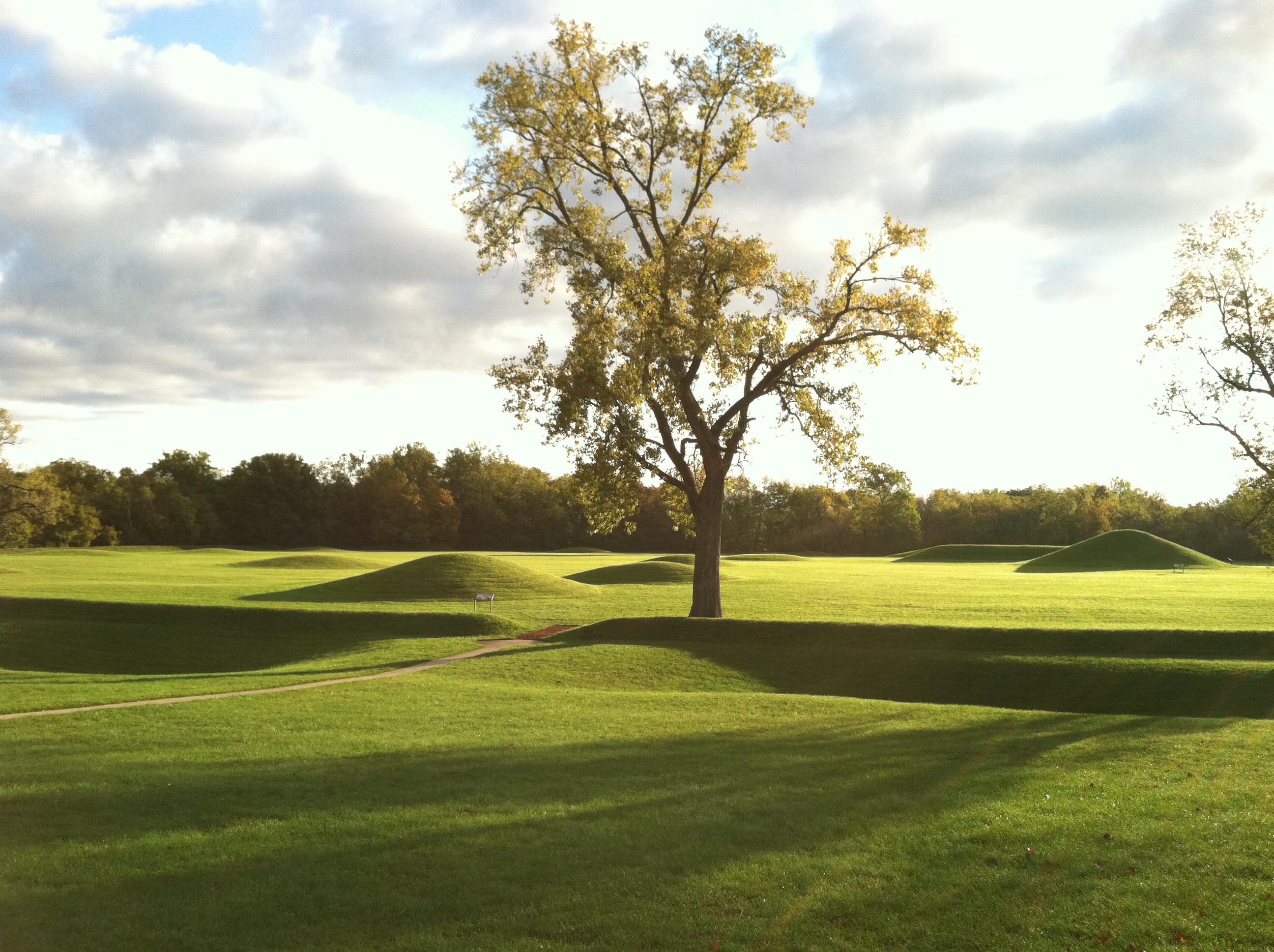
Hopewell Culture National Historical Park
National Historical Park
Nearly 2000 years ago, Native Americans built dozens of monumental mounds and earthen enclosures in southern Ohio. These earthwork complexes were ceremonial landscapes used for feasts, funerals, ritua...
5 mi from route
~13 min detour
Free
near mile 85.4
Caution: Hopeton Earthworks Closed for Construction Until May 2026
Throughout his life, Charles Young overcame countless obstacles in his ascent to prominence. In spite of overt racism and stifling inequality, Young rose through the military ranks to become one of th...
13 mi from route
~34 min detour
Free
near mile 128
Dayton Aviation Heritage National Historical Park was established to honor the lives and achievements of poet and author Paul Laurence Dunbar and aviation pioneers Wilbur and Orville Wright. Through p...
23 mi from route
~57 min detour
Free
near mile 140.2
Park data from the National Park Service API. Alerts update every 2 hours.
More Details
What kind of drive is this?
Expect a highway-focused experience for the majority of this trip, with 87% of the drive utilizing faster roads. The longest uninterrupted stretch is 96.6 miles along US 35, offering a consistent pace for a significant portion of your journey. While primarily highway, the inclusion of State Route 7 South might introduce a slightly different feel as you progress towards Hamilton. This route prioritizes forward momentum over scenic byways, making it a practical choice for reaching your destination.
87% highway — fuel and pacing are the main things to plan.
31 navigation steps total — most of the decisions cluster near the start and finish.
Longest single stretch: 96.6 mi on US 35.
How Hard Is This Drive?
6/10
This is a straightforward highway drive that stays mostly on US 35 and I 71. You will hit about 20 points where you need to pay attention to lane position or signs. The trickiest moment comes around 117.3 miles in.
Driving Effort6/10
Moderate - straightforward overall, but long enough or busy enough to require pacing
Balances navigation complexity with total wheel time.
This drive requires moderate attention. Across 176.8 miles you will encounter 20 spots where lane choice or exit timing matters. Not difficult for experienced highway drivers, but worth previewing the tricky sections before you go.
Where does it get tricky?
The main spots that need attention: at 117.3 miles: Exit ramp - move to the correct lane early. Multiple destination signs - pick the right one; at 118.5 miles: Lane positioning matters here; at 158.3 miles: Exit ramp - move to the correct lane early. Lane positioning matters here. Multiple destination signs - pick the right one.
Towns Mentioned on Route Signs
Based on OSRM destination-sign hints, not a full list of every settlement the road passes.
Between Swan Creek, OH and Hamilton, OH, road signs point toward Jackson, Cincinnati and Mason.
Jackson
20.3 mi in|~30m
Cincinnati
117.3 mi in|~2h 21m
Mason
158.3 mi in|~3h 7m
Who Is This Route For?
Weekend Trip
Doable as a same-day drive at 3h 34m. Total distance: 176.8 miles.
Family Friendly
Moderate complexity with 1 natural rest stops along the way.
Solo Traveler
3h 34m drive, comfortable solo distance.
First-Time Driver
Mostly highway driving (87%). Some complex stretches to watch for.
Frequently Asked Questions
The longest stretch is about 96.6 miles on US 35. The full list of main roads is in the Roads section above.
We did not find dedicated rest areas on this route. For a drive this long, plan bathroom and stretch breaks around gas stations, fast-food stops, or small-town downtowns — check the Nearby Places section for options.
It helps. This route has a higher-than-average number of complex decision points, which get harder in the dark. If the last hour of the trip is on surface roads or mountain grades, aim to arrive at Hamilton, OH before sunset when you can. Check the Trip Plan for departure windows that land you in daylight.
Only with planning. This is a long drive for kids — consider splitting it into two days rather than pushing through. Plan at least 1 meaningful breaks. Dedicated rest areas are limited, so plan gas or food stops as your bathroom breaks.
The main spots that need attention: at 117.3 miles: Exit ramp - move to the correct lane early. Multiple destination signs - pick the right one; at 118.5 miles: Lane positioning matters here; at 158.3 miles: Exit ramp - move to the correct lane early. Lane positioning matters here. Multiple destination signs - pick the right one.
Yes — Hopewell Culture National Historical Park, Charles Young Buffalo Soldiers National Monument and Dayton Aviation Heritage National Historical Park. See the National Parks section for detour distances and tips on detours.
Possible but tiring. At 3.6 hours each way, an in-and-out day trip would put you behind the wheel for 7.2 hours — manageable with a long break at Hamilton, OH, but most travelers stay overnight.