Traveling from Susanville to San Francisco covers 262 miles and typically takes about 5 hours and 42 minutes behind the wheel. Because this is a manageable distance, you can easily complete the trip in a single day, though you should plan for at least one stop to keep your energy up. You will navigate a mix of roads, including CA 99, CA 32, and the Dwight D. Eisenhower Highway, requiring a fuel budget of approximately $61. Both the origin and destination sit within the Pacific Coast region, keeping the general climate and landscape feel relatively consistent. Whether you are heading to the city for business or leisure, this route offers a straightforward path that avoids the need for an overnight stay.
Trip Pace
Same-day drive is realistic
A same-day return is possible, but it will make for a full day on the road.
Break Rhythm
1 planned break
Plan on a short reset every 3 to 4 hours to stay fresh behind the wheel.
Midpoint
131 miles from Susanville, CA
A natural place for your longest stop of the day
, about 2h 55m into the drive
.
Main Roads
Road
Distance
Duration
CA 99
53.2 mi
1h 8m
CA 32
52.4 mi
1h 10m
Dwight D. Eisenhower Highway
48.3 mi
58m
Hillcrest Road
28.8 mi
38m
CA 36
18.1 mi
26m
Eastshore Freeway
15.2 mi
17m
Sutter Causeway
12.7 mi
16m
Vic Fazio Highway
10.7 mi
12m
Longest stretch:
CA 99
— 53.2 mi, about 1h 8m
Turn-by-Turn Driving Directions
Step-by-step road directions between Susanville, CA and San Francisco, CA.
1
Start on Foss Street
61 ft·11 sec·Foss Street
2
Turn left onto CA 36
0.6 mi·1 min·Main Street
3
Continue on CA 36
0.1 mi·9 sec·South Pine Street
Use the straight lane.
4
Continue on CA 36
29 mi·38 min·Hillcrest Road
5
Enter roundabout onto CA 36
138 ft·9 sec·CA 36
6
Continue on CA 36
18 mi·26 min·CA 36
7
Turn left onto CA 32
52 mi·1 hr 10 min·CA 32
Use the left lane.
8
Turn left
361 ft·10 sec
Use the left lane.
9
Take the ramp
0.2 mi·12 sec
Use the straight lane.
10
Merge onto CA 99
9.9 mi·11 min·CA 99
Use the straight lane.
11
Keep slight right at fork onto CA 99
43 mi·56 min·CA 99
Toward Yuba CityUse the slight left / slight right lanes.
12
Take the exit
0.2 mi·36 sec
Toward CA 113 South: Woodland, Tudor Road
13
Turn right onto CA 113
2.1 mi·2 min·Tudor Road
Use the right lane.
14
Continue on CA 113
2.5 mi·3 min·South George Washington Boulevard
15
Continue on CA 113
13 mi·16 min·Sutter Causeway
16
Continue on E8
7.9 mi·11 min·County Road 102
17
Continue on E8
128 ft·6 sec·County Road 102
18
Turn right onto East Main Street
1.3 mi·2 min·East Main Street
Use the straight lane.
19
Take the ramp
0.4 mi·55 sec
Toward CA 113 South: Davis
20
Merge onto CA 113
11 mi·12 min·Vic Fazio Highway
Use the straight / slight right lanes.
21
Merge onto I 80; CA 113
42 mi·48 min·Dwight D. Eisenhower Highway
Use the straight / slight right lanes.
22
Continue on I 80
1.0 mi·1 min·Carquinez Bridge
Use the straight / slight right lanes.
23
Continue on I 80
0.3 mi·24 sec·Eastshore Freeway
24
Continue on I 80
3.4 mi·3 min·Linus F. Claeys Freeway
Use the straight / slight right lanes.
25
Continue on I 80
14 mi·16 min·Eastshore Freeway
Use the straight / slight right lanes.
26
Take the exit onto Eastshore Freeway
0.8 mi·1 min·Eastshore Freeway
Toward San FranciscoUse the slight left lane.
27
Merge onto I 80
0.4 mi·33 sec·Dwight D. Eisenhower Highway
Use the straight / slight right lanes.
28
Turn slight left onto I 80
0.4 mi·33 sec·Dwight D. Eisenhower Highway
29
Keep slight left at fork onto I 80
5.5 mi·8 min·Dwight D. Eisenhower Highway
Use the slight left lane.
30
Continue on I 80
0.3 mi·24 sec·Route 80
Use the straight / left / right lanes.
31
Continue on I 80
0.8 mi·1 min·Route 80
Exit 2AUse the straight / slight left lanes.
32
Continue on I 80
0.4 mi·32 sec·Route 80
Exit 1AUse the straight / slight right lanes.
33
Keep slight right at fork
0.4 mi·38 sec
Exit 1BToward US 101 North: Golden Gate BridgeUse the straight / slight right lanes.
34
Merge onto US 101
0.3 mi·25 sec·Central Freeway
35
Continue on Octavia Boulevard
0.5 mi·42 sec·Octavia Boulevard
Exit 434BToward Octavia Boulevard, Fell StreetUse the straight / slight right lanes.
36
Turn right onto Market Street
0.1 mi·31 sec·Market Street
Use the right lane.
37
Keep slight right at fork onto Market Street
0.2 mi·35 sec·Market Street
38
Arrive at destination
Market Street
Trip Plan
To make the most of your 262-mile journey, try to depart early in the morning to avoid the heaviest traffic as you near the San Francisco area. Since you only have one planned stop, use that break strategically to refuel and stretch your legs before tackling the final leg of the drive. Keep in mind that your fuel costs will hover around $61, so check your tank levels before leaving Susanville to ensure you aren't forced to stop at higher-priced stations along the way. Because this is a one-day trip, you have the flexibility to adjust your pace, but staying mindful of the 53.2-mile stretch on CA 99 will help you manage your time effectively.
Morning Departure
An early start around 7-8 AM gets you there with plenty of daylight left.
Evening Departure
A late afternoon start means arriving after dark. Morning is better.
You can normally do this drive in one day.
Plan roughly 1 meaningful break for fuel, food, and rest.
The halfway point lands around 131 miles from Susanville, CA, or about 2h 55m into the drive.
The longest continuous stretch on this route runs about 53.2 miles.
This is a comfortable same-day trip.
Departure
Before you leave
Start with fuel, water, and navigation already sorted so the first hour feels easy.
First stop
Around 58 miles or 1h 20m in
Use this first pause for coffee, a restroom break, and a quick traffic check ahead.
Halfway reset
Around 131 miles or 2h 55m in
This is the best place for your longest stop, a real meal, and a full fuel check.
Final approach
Final hour starts around 4h 43m
Traffic, exits, and arrival timing usually matter more near San Francisco, CA than in the middle of the route.
Before You Leave
+
Open the route before leaving Susanville, CA so your first major turns are already loaded.
+
Leave with enough water and a charging cable within reach, not packed away.
+
Check your fuel range against the first long segment, especially if you are starting outside city service areas.
Day 1
Settle into the route from Susanville, CA
This is one driving day of about 262 miles and 5h 42m.
Your first comfortable stop window is around 58 miles from Susanville, CA.
This route can stay practical as a one-day drive if traffic stays reasonable.
Plan about 1 real break rather than only quick fuel stops.
The longest stretch is on CA 99 for about 53.2 miles.
Where to Stop
Rest stops, refuel points, and overnight suggestions along this route.
Place data sourced from public business listings. Hours and availability may vary.
Heads-up: tricky spots
5 of 23
5 decision points cluster between mile 100 and 260.6 — GPS handles the exact turns, but know they're coming. Your lane choice matters more than the turn itself.
6
100 mi into trip|~2h 16m in
Turn left
Lane positioning matters here
Use the left lane.
7
110.2 mi into trip|~2h 28m in|CA 99
Keep slight right at fork onto CA 99 toward Yuba City
Highway fork - watch signs carefully. Lane positioning matters here
Use the slight left / slight right lanes.
Toward Yuba City
6
178.9 mi into trip|~4h in|East Main Street
Turn right onto East Main Street
Lane positioning matters here
Use the straight lane.
6
252.2 mi into trip|~5h 26m in|Eastshore Freeway
Take the exit onto Eastshore Freeway toward San Francisco
Exit ramp - move to the correct lane early. Lane positioning matters here
Use the slight left lane.
Toward San Francisco
8
260.6 mi into trip|~5h 39m in
Keep slight right at fork toward US 101 North: Golden Gate Bridge
Highway fork - watch signs carefully. Lane positioning matters here
Use the straight / slight right lanes.
Exit 1B
Toward US 101 North: Golden Gate Bridge
Fuel & Cost
Regular Gas
$60.22 one way
$120.44 round trip
$5.84/gal25.4 MPG avg92 kg CO2
Fuel Type
$/gal
One Way
Round Trip
midgrade
$6.02
$62.05
$124.11
premium
$6.18
$63.72
$127.43
diesel
$5.61
$57.85
$115.69
No toll roads detected on this route.
Estimated Trip Cost (one way, 1 person)
Fuel
$60
Meals
$25–$50
Total
$85–$110
Rough estimate based on US averages. Hotel $80–$140/night, meals $25–$50/day.
Estimated CO2 emission: 91.7 kg one way.
Prices: EIA weekly data, 2026-04-13.
Driving Electric?
About $28 in charging
· 0 stops
· 66% less CO2
Vehicle Type
kWh
Stops
DC Fast
Home Charge
Average EV
78.6
0
$27.51
$12.58
Efficient EV
65.5
0
$22.92
$10.48
EV Truck/SUV
104.8
1
$36.68
$16.77
Gas CO2
92 kg
EV CO2
31 kg (66% less)
Plan for 0 charging stops, roughly every 270 miles. Allow 25-40 minutes per stop at a DC fast charger.
DC fast charging avg $0.35/kWh. Home charging avg $0.16/kWh. US grid CO2: 0.39 kg/kWh.
Travel Intel
Current conditions at both ends of the drive.
Forecast as of Apr 15, 2026
Origin
Susanville, CA
Morning
in Susanville on Sunday
Local time
7:19 AM
PDT
Current temp
32°F
Unavailable
Live forecast
Destination
San Francisco, CA
Morning
in San Francisco on Sunday
Local time
7:19 AM
PDT
Current temp
44°F
Unavailable
Live forecast
53°F
Paradise, CA
131 mi in
Seasonal Notes
Summer travel usually means heavier construction, hotter rest stops, and busier weekend traffic around major cities.
Winter travel shortens daylight, so a route that looks manageable on paper can feel much longer after dark.
Holiday weekends tend to make both departure and arrival windows slower than the raw route time suggests.
Time zone
Same local time
Origin and destination are on the same clock, so arrival timing is easier to judge at a glance.
Temperature spread
12 degrees warmer at arrival
A meaningful temperature swing is a good cue to rethink layers, water, and how soon you want to arrive.
Road read
5h 42m on the road
An early start around 7-8 AM gets you there with plenty of daylight left.
Weather data from the National Weather Service. Conditions may change; check closer to your travel date.
National Parks Near This Route
Worth a detour if your schedule allows.
San Francisco Maritime National Historical Park
National Historical Park
Established in 1988, San Francisco Maritime National Historical Park celebrates America’s maritime heritage on the Pacific Coast. Our 50-acre park has grown around Aquatic Park Cove, a protected area...
Rosie the Riveter WWII Home Front National Historical Park
National Historical Park
Celebrate and honor the contributions and sacrifices of American civilians on the WWII home front. Discover how diverse communities lived, worked, and interacted. Many faces, many stories, many truths...
3 mi from route
~8 min detour
Free
near mile 243.9
On July 17, 1944, a massive explosion jolted the San Francisco East Bay area, shattering windows and lighting up the night sky. At Port Chicago Naval Magazine, 320 men were killed instantly when two s...
11 mi from route
~28 min detour
Free
near mile 234.9
Experience a park so rich it supports 19 distinct ecosystems with over 2,000 plant and animal species. Go for a hike, enjoy a vista, have a picnic or learn about the centuries of overlapping history f...
12 mi from route
~29 min detour
Free
near mile 262
Walk among old growth coast redwoods, cooling their roots in the fresh water of Redwood Creek and lifting their crowns to reach the sun and fog. Federally protected as a National Monument since 1908,...
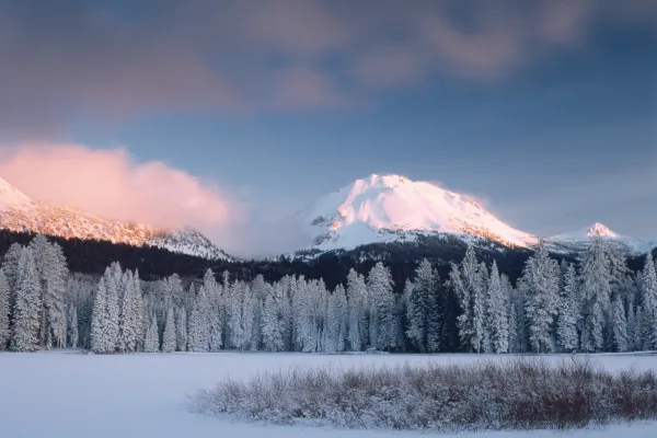
Lassen Volcanic National Park is home to steaming fumaroles, meadows freckled with wildflowers, clear mountain lakes, and numerous volcanoes. Jagged peaks tell the story of its eruptive past while hot...
16 mi from route
~41 min detour
$30
near mile 45.2
Park data from the National Park Service API. Alerts update every 2 hours.
More Details
What kind of drive is this?
Expect a mixed-drive experience that transitions between faster highway segments and slower, more localized stretches. Roughly 55% of your journey will be spent on highways, providing a nice balance between steady cruising and attentive driving. Your longest uninterrupted stretch occurs on CA 99, where you will cover 53.2 miles of road. As you move between the different routes, you will notice the character of the pavement changing, shifting from the open flow of the Eisenhower Highway to the more varied conditions found on CA 32. It is a drive that requires you to stay engaged, as the personality of the road shifts to match the changing terrain.
55% highway, the rest on surface roads — varied driving throughout.
38 navigation steps total — most of the decisions cluster near the start and finish.
Longest single stretch: 53.2 mi on CA 99.
How Hard Is This Drive?
9/10
This route mixes highway mileage with some local-road sections near the start or finish. This route has several spots where lane changes, forks, or exits need your full attention. The trickiest moment comes around 100 miles in.
Driving Effort9/10
High effort - long or complex enough to need steady focus all day
Balances navigation complexity with total wheel time.
This is a demanding drive. With 23 significant decision points across 262 miles, you will need to stay alert - especially through interchange areas and urban stretches. Consider splitting it into segments if you are not comfortable with fast highway navigation.
Where does it get tricky?
The main spots that need attention: at 100 miles: Lane positioning matters here; at 110.2 miles (CA 99): Highway fork - watch signs carefully. Lane positioning matters here; at 178.9 miles (East Main Street): Lane positioning matters here.
Towns Mentioned on Route Signs
Based on OSRM destination-sign hints, not a full list of every settlement the road passes.
On the drive from Susanville, CA to San Francisco, CA, road signs begin pointing toward Yuba City along the way.
The centerpiece of the Bay Area, San Francisco is one of the most visited cities in the world, and with good reason. The cultural center of northern California, San Francisco is renowned for its mixture of scenic beauty and unique culture that makes it one of the most vibrant and desirable cities in the nation, if not the world.
Sandwiched between the San Francisco Bay and the Pacific Ocean on a small square of land seven miles (11 km) on each side, San Francisco offers a wealth of treasures for the visitor, from the windswept and often foggy bay to the steep hills lined with Victorian homes that overlook the spectacular scenery of the city.
Top landmarks
•Golden Gate Bridge — suspension bridge on the San Francisco Bay
•Alcatraz Island — island in San Francisco, California, United States of America
•San Francisco–Oakland Bay Bridge — suspension bridge connecting San Francisco and Oakland, California, USA
Doable as a same-day drive at 5h 42m. Total distance: 262 miles.
Family Friendly
Moderate complexity with 1 natural rest stops along the way.
Solo Traveler
5h 42m drive, comfortable solo distance.
Scenic Drive
Mixed highway & surface route profile with national parks nearby.
Frequently Asked Questions
The longest stretch is about 53.2 miles on CA 99. The full list of main roads is in the Roads section above.
We did not find dedicated rest areas on this route. For a drive this long, plan bathroom and stretch breaks around gas stations, fast-food stops, or small-town downtowns — check the Nearby Places section for options.
It helps. This route has a higher-than-average number of complex decision points, which get harder in the dark. If the last hour of the trip is on surface roads or mountain grades, aim to arrive at San Francisco, CA before sunset when you can. Check the Trip Plan for departure windows that land you in daylight.
Only with planning. This is a long drive for kids — consider splitting it into two days rather than pushing through. Plan at least 1 meaningful breaks. Dedicated rest areas are limited, so plan gas or food stops as your bathroom breaks.
The main spots that need attention: at 100 miles: Lane positioning matters here; at 110.2 miles (CA 99): Highway fork - watch signs carefully. Lane positioning matters here; at 178.9 miles (East Main Street): Lane positioning matters here.
Yes — San Francisco Maritime National Historical Park, Rosie the Riveter WWII Home Front National Historical Park and Port Chicago Naval Magazine National Memorial (6 total within detour distance). See the National Parks section for detour distances and tips on detours.
Not recommended in a single day. At 5.7 hours each way, a round trip means 11.4 hours of driving — that is an unsafe level of fatigue for most drivers. Plan at least one night at San Francisco, CA before the return drive.