Embarking on the 279.3-mile journey from Susanville to Fremont typically takes about 6 hours and 2 minutes of driving time. Because this route stays within the Pacific Coast region of California, you can easily manage the trip in a single day without needing an overnight stay. Expect to budget roughly $65 for fuel to cover the distance, which primarily utilizes CA 99, CA 32, and the Donald D Doyle Highway. While this is a straightforward trek, the mixed-drive profile means you should stay alert as the road conditions shift. It is a practical route for those looking to reach the Bay Area efficiently while navigating through the heart of Northern California.
Trip Pace
Same-day drive is realistic
A same-day return is possible, but it will make for a full day on the road.
Break Rhythm
1 planned break
Plan on a short reset every 3 to 4 hours to stay fresh behind the wheel.
Midpoint
139.7 miles from Susanville, CA
A natural place for your longest stop of the day
, about 3h 7m into the drive
.
Main Roads
Road
Distance
Duration
CA 99
53.2 mi
1h 8m
CA 32
52.4 mi
1h 10m
Donald D Doyle Highway
29.6 mi
34m
Dwight D. Eisenhower Highway
29.2 mi
33m
Hillcrest Road
28.8 mi
38m
CA 36
18.1 mi
26m
Sutter Causeway
12.7 mi
16m
Luther E Gibson Freeway
12.4 mi
14m
Longest stretch:
CA 99
— 53.2 mi, about 1h 8m
Turn-by-Turn Driving Directions
Step-by-step road directions between Susanville, CA and Fremont, CA.
1
Start on Foss Street
61 ft·11 sec·Foss Street
2
Turn left onto CA 36
0.6 mi·1 min·Main Street
3
Continue on CA 36
0.1 mi·9 sec·South Pine Street
Use the straight lane.
4
Continue on CA 36
29 mi·38 min·Hillcrest Road
5
Enter roundabout onto CA 36
138 ft·9 sec·CA 36
6
Continue on CA 36
18 mi·26 min·CA 36
7
Turn left onto CA 32
52 mi·1 hr 10 min·CA 32
Use the left lane.
8
Turn left
361 ft·10 sec
Use the left lane.
9
Take the ramp
0.2 mi·12 sec
Use the straight lane.
10
Merge onto CA 99
9.9 mi·11 min·CA 99
Use the straight lane.
11
Keep slight right at fork onto CA 99
43 mi·56 min·CA 99
Toward Yuba CityUse the slight left / slight right lanes.
12
Take the exit
0.2 mi·36 sec
Toward CA 113 South: Woodland, Tudor Road
13
Turn right onto CA 113
2.1 mi·2 min·Tudor Road
Use the right lane.
14
Continue on CA 113
2.5 mi·3 min·South George Washington Boulevard
15
Continue on CA 113
13 mi·16 min·Sutter Causeway
16
Continue on E8
7.9 mi·11 min·County Road 102
17
Continue on E8
128 ft·6 sec·County Road 102
18
Turn right onto East Main Street
1.3 mi·2 min·East Main Street
Use the straight lane.
19
Take the ramp
0.4 mi·55 sec
Toward CA 113 South: Davis
20
Merge onto CA 113
11 mi·12 min·Vic Fazio Highway
Use the straight / slight right lanes.
21
Merge onto I 80; CA 113
29 mi·33 min·Dwight D. Eisenhower Highway
Use the straight / slight right lanes.
22
Take the exit
0.6 mi·1 min
Exit 40Toward I 680: Benicia, San JoseUse the straight / slight right lanes.
23
Continue on I 680
12 mi·14 min·Luther E Gibson Freeway
Use the straight / slight right lanes.
24
Continue on I 680
8.0 mi·9 min·Benicia-Martinez Bridge
Use the straight / slight right lanes.
25
Keep slight right at fork onto I 680
4.8 mi·5 min·Senator Daniel E Boatwright Highway
Use the straight / slight right lanes.
26
Continue on I 680
1.4 mi·1 min·Donald D Doyle Highway
27
Keep slight right at fork onto I 680
28 mi·32 min·Donald D Doyle Highway
Use the straight / slight right lanes.
28
Take the exit
0.3 mi·45 sec
Exit 15Toward Washington BoulevardUse the straight / slight right lanes.
29
Turn right onto Washington Boulevard
0.9 mi·2 min·Washington Boulevard
Use the right lane.
30
Continue on Fremont Boulevard
1.9 mi·4 min·Fremont Boulevard
31
Turn left onto Mowry Avenue
0.1 mi·29 sec·Mowry Avenue
Use the left lane.
32
Continue on Mowry Avenue
0.1 mi·22 sec·Mowry Avenue
Use the left lane.
33
Arrive at destination
Mowry Avenue
Trip Plan
Since this is a full-day commitment of over six hours, plan to leave early to avoid peak traffic as you approach the Fremont area. You should factor in at least one dedicated stop to stretch your legs and refuel, keeping your $65 budget in mind as you plan your stops. Because the route is a single-day trip, you have the flexibility to adjust your pace based on real-time traffic conditions. Pay close attention to your navigation when transitioning between CA 32 and CA 99, as these connections are critical to maintaining your estimated arrival time. Staying consistent with your pacing will ensure you reach your destination without unnecessary fatigue.
Morning Departure
Start early — leave by 6-7 AM to arrive at a reasonable hour.
Evening Departure
This is a long drive — plan for a morning departure or consider splitting it into two days.
You can normally do this drive in one day.
Plan roughly 1 meaningful break for fuel, food, and rest.
The halfway point lands around 139.7 miles from Susanville, CA, or about 3h 7m into the drive.
The longest continuous stretch on this route runs about 53.2 miles.
This is a comfortable same-day trip.
Departure
Before you leave
Start with fuel, water, and navigation already sorted so the first hour feels easy.
First stop
Around 61 miles or 1h 24m in
Use this first pause for coffee, a restroom break, and a quick traffic check ahead.
Halfway reset
Around 139.7 miles or 3h 7m in
This is the best place for your longest stop, a real meal, and a full fuel check.
Final approach
Final hour starts around 5h
Traffic, exits, and arrival timing usually matter more near Fremont, CA than in the middle of the route.
Before You Leave
+
Open the route before leaving Susanville, CA so your first major turns are already loaded.
+
Leave with enough water and a charging cable within reach, not packed away.
+
Check your fuel range against the first long segment, especially if you are starting outside city service areas.
Day 1
Settle into the route from Susanville, CA
This is one driving day of about 279.3 miles and 6h 2m.
Your first comfortable stop window is around 61 miles from Susanville, CA.
This route can stay practical as a one-day drive if traffic stays reasonable.
Plan about 1 real break rather than only quick fuel stops.
The longest stretch is on CA 99 for about 53.2 miles.
Where to Stop
Rest stops, refuel points, and overnight suggestions along this route.
Place data sourced from public business listings. Hours and availability may vary.
Heads-up: tricky spots
5 of 20
5 decision points cluster between mile 100 and 276 — GPS handles the exact turns, but know they're coming. Your lane choice matters more than the turn itself.
6
100 mi into trip|~2h 16m in
Turn left
Lane positioning matters here
Use the left lane.
7
110.2 mi into trip|~2h 28m in|CA 99
Keep slight right at fork onto CA 99 toward Yuba City
Highway fork - watch signs carefully. Lane positioning matters here
Use the slight left / slight right lanes.
Toward Yuba City
6
178.9 mi into trip|~4h in|East Main Street
Turn right onto East Main Street
Lane positioning matters here
Use the straight lane.
8
220.5 mi into trip|~4h 49m in
Take the exit toward I 680: Benicia, San Jose
Exit ramp - move to the correct lane early. Lane positioning matters here. Multiple destination signs - pick the right one
Use the straight / slight right lanes.
Exit 40
Toward I 680: Benicia, San Jose
7
276 mi into trip|~5h 54m in
Take the exit toward Washington Boulevard
Exit ramp - move to the correct lane early. Lane positioning matters here
Use the straight / slight right lanes.
Exit 15
Toward Washington Boulevard
Fuel & Cost
Regular Gas
$64.20 one way
$128.39 round trip
$5.84/gal25.4 MPG avg98 kg CO2
Fuel Type
$/gal
One Way
Round Trip
midgrade
$6.02
$66.15
$132.30
premium
$6.18
$67.92
$135.85
diesel
$5.61
$61.67
$123.33
No toll roads detected on this route.
Estimated Trip Cost (one way, 1 person)
Fuel
$64
Meals
$25–$50
Total
$89–$114
Rough estimate based on US averages. Hotel $80–$140/night, meals $25–$50/day.
Estimated CO2 emission: 97.7 kg one way.
Prices: EIA weekly data, 2026-04-13.
Driving Electric?
About $29 in charging
· 1 stop
· 66% less CO2
Vehicle Type
kWh
Stops
DC Fast
Home Charge
Average EV
83.8
1
$29.33
$13.41
Efficient EV
69.8
0
$24.44
$11.17
EV Truck/SUV
111.7
1
$39.10
$17.88
Gas CO2
98 kg
EV CO2
33 kg (66% less)
Plan for 1 charging stop. A 30-minute DC fast charge mid-route should be enough to complete the trip comfortably.
DC fast charging avg $0.35/kWh. Home charging avg $0.16/kWh. US grid CO2: 0.39 kg/kWh.
Travel Intel
Current conditions at both ends of the drive.
Forecast as of Apr 15, 2026
Origin
Susanville, CA
Morning
in Susanville on Sunday
Local time
7:18 AM
PDT
Current temp
32°F
Unavailable
Live forecast
Destination
Fremont, CA
Morning
in Fremont on Sunday
Local time
7:18 AM
PDT
Current temp
67°F
Unavailable
Live forecast
53°F
Paradise, CA
140 mi in
Seasonal Notes
Summer travel usually means heavier construction, hotter rest stops, and busier weekend traffic around major cities.
Winter travel shortens daylight, so a route that looks manageable on paper can feel much longer after dark.
Holiday weekends tend to make both departure and arrival windows slower than the raw route time suggests.
Time zone
Same local time
Origin and destination are on the same clock, so arrival timing is easier to judge at a glance.
Temperature spread
35 degrees warmer at arrival
A meaningful temperature swing is a good cue to rethink layers, water, and how soon you want to arrive.
Road read
6h 2m on the road
Start early — leave by 6-7 AM to arrive at a reasonable hour.
Weather data from the National Weather Service. Conditions may change; check closer to your travel date.
National Parks Near This Route
Worth a detour if your schedule allows.
Port Chicago Naval Magazine National Memorial
National Memorial
On July 17, 1944, a massive explosion jolted the San Francisco East Bay area, shattering windows and lighting up the night sky. At Port Chicago Naval Magazine, 320 men were killed instantly when two s...
5 mi from route
~13 min detour
Free
near mile 231.2
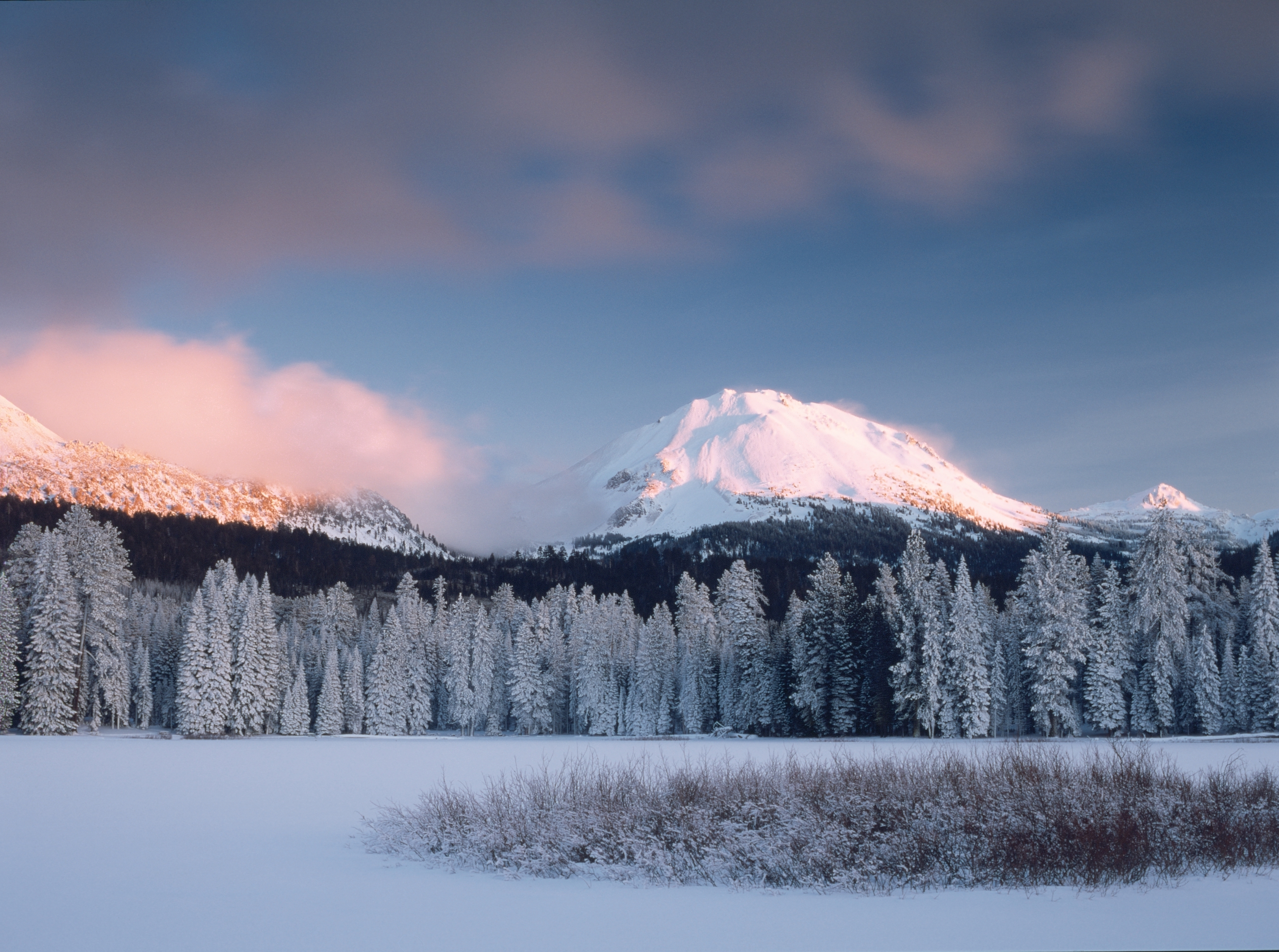
Lassen Volcanic National Park is home to steaming fumaroles, meadows freckled with wildflowers, clear mountain lakes, and numerous volcanoes. Jagged peaks tell the story of its eruptive past while hot...
15 mi from route
~38 min detour
$30
near mile 48.2
Rosie the Riveter WWII Home Front National Historical Park
National Historical Park
Celebrate and honor the contributions and sacrifices of American civilians on the WWII home front. Discover how diverse communities lived, worked, and interacted. Many faces, many stories, many truths...
17 mi from route
~43 min detour
Free
near mile 240.8
Established in 1988, San Francisco Maritime National Historical Park celebrates America’s maritime heritage on the Pacific Coast. Our 50-acre park has grown around Aquatic Park Cove, a protected area...
22 mi from route
~55 min detour
Free
near mile 250.4
Walk among old growth coast redwoods, cooling their roots in the fresh water of Redwood Creek and lifting their crowns to reach the sun and fog. Federally protected as a National Monument since 1908,...
28 mi from route
~70 min detour
$15
near mile 231.2
Park data from the National Park Service API. Alerts update every 2 hours.
More Details
What kind of drive is this?
Expect a varied experience behind the wheel, as this route is classified as a mixed drive with only 49% of the journey spent on highways. You will encounter stretches that demand your full attention, punctuated by the longest uninterrupted segment of 53.2 miles on CA 99. The road’s personality shifts significantly as you transition from local routes to the faster-paced Donald D Doyle Highway. Navigating these different road types keeps the drive engaging, moving you through diverse traffic patterns and changing landscapes. Be prepared to adapt your driving style as you move between high-speed highway sections and more technical segments.
49% highway, the rest on surface roads — varied driving throughout.
33 navigation steps total — most of the decisions cluster near the start and finish.
Longest single stretch: 53.2 mi on CA 99.
How Hard Is This Drive?
9/10
This route mixes highway mileage with some local-road sections near the start or finish. This route has several spots where lane changes, forks, or exits need your full attention. The trickiest moment comes around 100 miles in.
Driving Effort9/10
High effort - long or complex enough to need steady focus all day
Balances navigation complexity with total wheel time.
This is a demanding drive. With 20 significant decision points across 279.3 miles, you will need to stay alert - especially through interchange areas and urban stretches. Consider splitting it into segments if you are not comfortable with fast highway navigation.
Where does it get tricky?
The main spots that need attention: at 100 miles: Lane positioning matters here; at 110.2 miles (CA 99): Highway fork - watch signs carefully. Lane positioning matters here; at 178.9 miles (East Main Street): Lane positioning matters here.
Towns Mentioned on Route Signs
Based on OSRM destination-sign hints, not a full list of every settlement the road passes.
Between Susanville, CA and Fremont, CA, road signs point toward Yuba City and San Jose.
Fremont is a suburban city in the southern part of the East Bay of the San Francisco Bay Area; it is the 4th largest city in the Bay Area by population. Fremont is in the southern part of Alameda County, California, between Union City to the north, Sunol and the hills to the east, Milpitas and Santa Clara County to the south, and the San Francisco Bay to the west. The city of Newark, near the edge of the Bay, is surrounded by the city of Fremont.
Fremont industry is not particularly large relative to other parts of the Bay Area, but neither is it a bedroom community. Many people in Fremont work locally in the electronics and high-tech industry, while many others commute to Silicon Valley or San Francisco locations for work.
Top landmarks
•Mission San José — 18th-century Spanish mission in Fremont, California
•Ardenwood Historic Farm — human settlement in California, United States of America
•Niles Depot Museum — railway museum in Niles, California
Doable as a same-day drive at 6h 2m. Total distance: 279.3 miles.
Family Friendly
Moderate complexity with 1 natural rest stops along the way.
Solo Traveler
6h 2m drive, plan rest stops for pacing.
Scenic Drive
Mixed highway & surface route profile with national parks nearby.
Frequently Asked Questions
The longest stretch is about 53.2 miles on CA 99. The full list of main roads is in the Roads section above.
We did not find dedicated rest areas on this route. For a drive this long, plan bathroom and stretch breaks around gas stations, fast-food stops, or small-town downtowns — check the Nearby Places section for options.
It helps. This route has a higher-than-average number of complex decision points, which get harder in the dark. If the last hour of the trip is on surface roads or mountain grades, aim to arrive at Fremont, CA before sunset when you can. Check the Trip Plan for departure windows that land you in daylight.
Only with planning. This is a long drive for kids — consider splitting it into two days rather than pushing through. Plan at least 1 meaningful breaks. Dedicated rest areas are limited, so plan gas or food stops as your bathroom breaks.
The main spots that need attention: at 100 miles: Lane positioning matters here; at 110.2 miles (CA 99): Highway fork - watch signs carefully. Lane positioning matters here; at 178.9 miles (East Main Street): Lane positioning matters here.
Yes — Port Chicago Naval Magazine National Memorial, Lassen Volcanic National Park and Rosie the Riveter WWII Home Front National Historical Park (5 total within detour distance). See the National Parks section for detour distances and tips on detours.
Not recommended in a single day. At 6.0 hours each way, a round trip means 12.1 hours of driving — that is an unsafe level of fatigue for most drivers. Plan at least one night at Fremont, CA before the return drive.