Traveling from Santa Ana to Blythe covers 209.2 miles and typically takes about 3 hours and 55 minutes behind the wheel. You will primarily utilize the Pearl Harbor Memorial Highway, the Sonny Bono Memorial Freeway, and the Riverside Freeway to complete the journey. Since this is a manageable distance, it is perfectly suited for a single-day trip. Budgeting approximately $48 for fuel is a smart way to prepare for the expenses ahead. Both your starting point and destination are located within the Pacific Coast region, keeping the overall environment familiar as you transition from the coast toward the desert. This straightforward route offers a practical way to cross the state without needing an overnight stay.
Trip Pace
Same-day drive is realistic
A same-day return is realistic if you keep stops short.
Break Rhythm
1 planned break
A short stop every 2 to 3 hours is enough for this drive.
Midpoint
104.6 miles from Santa Ana, CA
A natural place for your longest stop of the day
, about 2h 1m into the drive
.
Main Roads
Road
Distance
Duration
Pearl Harbor Memorial Highway
110.7 mi
1h 58m
Sonny Bono Memorial Freeway
33.5 mi
35m
Riverside Freeway
30.9 mi
35m
Moreno Valley Freeway
16.2 mi
20m
Costa Mesa Freeway
6.8 mi
7m
Escondido Freeway
4.4 mi
5m
Moreno Valley Expressway
2 mi
2m
East 4th Street
1.1 mi
2m
Longest stretch:
Pearl Harbor Memorial Highway
— 110.7 mi, about 1h 58m
Turn-by-Turn Driving Directions
Step-by-step road directions between Santa Ana, CA and Blythe, CA.
1
Start on West 1st Street
260 ft·10 sec·West 1st Street
2
Continue on West 1st Street
1.0 mi·2 min·West 1st Street
Use the left lane.
3
Turn left onto Grand Avenue
0.2 mi·23 sec·Grand Avenue
4
Turn right onto East 4th Street
1.1 mi·2 min·East 4th Street
Use the right lane.
5
Continue on Irvine Boulevard
406 ft·13 sec·Irvine Boulevard
6
Turn left
0.3 mi·23 sec
Toward CA 55 NorthUse the left lane.
7
Merge onto CA 55
1.4 mi·1 min·Costa Mesa Freeway
Use the straight / slight right lanes.
8
Keep slight left at fork onto CA 55
5.3 mi·6 min·Costa Mesa Freeway
Use the straight / slight right lanes.
9
Merge onto CA 91
31 mi·35 min·Riverside Freeway
Use the straight / slight right lanes.
10
Take the exit
0.6 mi·1 min
Exit 65BToward I 215 South, CA 60 East: San Diego, IndioUse the straight / slight right lanes.
11
Merge onto CA 60
0.3 mi·22 sec·Pomona Freeway
12
Continue on I 215; CA 60
3.9 mi·4 min·Escondido Freeway
Use the straight / slight right lanes.
13
Keep slight left at fork onto I 215; CA 60
0.4 mi·30 sec·Escondido Freeway
Use the straight / slight right lanes.
14
Keep slight left at fork onto CA 60
16 mi·19 min·Moreno Valley Freeway
Exit 29Toward CA 60 East: IndioUse the straight / slight right lanes.
15
Continue on CA 60
2.0 mi·2 min·Moreno Valley Expressway
16
Continue on CA 60
0.6 mi·42 sec·Moreno Valley Freeway
Use the straight / slight right lanes.
17
Merge onto I 10
18 mi·19 min·Pearl Harbor Memorial Highway
Use the straight / slight right lanes.
18
Keep slight left at fork onto I 10
32 mi·34 min·Sonny Bono Memorial Freeway
Use the straight / slight right lanes.
19
Keep slight left at fork onto I 10
1.1 mi·1 min·Sonny Bono Memorial Freeway
20
Continue on I 10
93 mi·1 hr 39 min·Pearl Harbor Memorial Highway
21
Take the exit
0.3 mi·46 sec
Toward Lovekin Boulevard
22
Turn left onto South Lovekin Boulevard
0.3 mi·32 sec·South Lovekin Boulevard
23
Turn right onto I 10 Business
0.5 mi·1 min·West Hobsonway
24
Arrive at destination
I 10 Business
Trip Plan
To make the most of your 209.2-mile trek, consider leaving early to avoid peak traffic congestion near your starting point. You only need to plan for one major stop to keep your trip efficient and comfortable. Since you have a long 110.7-mile stretch ahead of you on the Pearl Harbor Memorial Highway, be sure to top off your tank before departing to keep your $48 fuel budget on track. Because this is a one-day drive, you have the flexibility to adjust your pace based on how you feel throughout the journey. Always check your fuel levels before starting that longest highway leg to ensure a smooth, uninterrupted ride to Blythe.
Morning Departure
An early start around 7-8 AM gets you there with plenty of daylight left.
Evening Departure
A late afternoon start means arriving after dark. Morning is better.
You can normally do this drive in one day.
Plan roughly 1 meaningful break for fuel, food, and rest.
The halfway point lands around 104.6 miles from Santa Ana, CA, or about 2h 1m into the drive.
The longest continuous stretch on this route runs about 110.7 miles.
This is a comfortable same-day trip.
Departure
Before you leave
Start with fuel, water, and navigation already sorted so the first hour feels easy.
First stop
Around 46 miles or 56m in
Use this first pause for coffee, a restroom break, and a quick traffic check ahead.
Halfway reset
Around 104.6 miles or 2h 1m in
This is the best place for your longest stop, a real meal, and a full fuel check.
Final approach
Final hour starts around 3h 13m
Traffic, exits, and arrival timing usually matter more near Blythe, CA than in the middle of the route.
Before You Leave
+
Open the route before leaving Santa Ana, CA so your first major turns are already loaded.
+
Leave with enough water and a charging cable within reach, not packed away.
+
Check your fuel range against the first long segment, especially if you are starting outside city service areas.
Day 1
Settle into the route from Santa Ana, CA
This is one driving day of about 209.2 miles and 3h 55m.
Your first comfortable stop window is around 46 miles from Santa Ana, CA.
This route can stay practical as a one-day drive if traffic stays reasonable.
Plan about 1 real break rather than only quick fuel stops.
The longest stretch is on Pearl Harbor Memorial Highway for about 110.7 miles.
Where to Stop
Rest stops, refuel points, and overnight suggestions along this route.
Place data sourced from public business listings. Hours and availability may vary.
Heads-up: tricky spots
5 of 17
5 decision points cluster between mile 2.4 and 45.6 — GPS handles the exact turns, but know they're coming. Your lane choice matters more than the turn itself.
7
2.4 mi into trip|~4m in
Turn left toward CA 55 North
Lane positioning matters here
Use the left lane.
Toward CA 55 North
6
4.1 mi into trip|~6m in|CA 55 / Costa Mesa Freeway
Keep slight left at fork onto CA 55 / Costa Mesa Freeway
Highway fork - watch signs carefully. Lane positioning matters here
Use the straight / slight right lanes.
8
40.3 mi into trip|~48m in
Take the exit toward I 215 South, CA 60 East: San Diego, Indio
Exit ramp - move to the correct lane early. Lane positioning matters here. Multiple destination signs - pick the right one
Use the straight / slight right lanes.
Exit 65B
Toward I 215 South, CA 60 East: San Diego, Indi...
6
45.2 mi into trip|~55m in|I 215; CA 60 / Escondido Freeway
Keep slight left at fork onto I 215; CA 60 / Escondido Freeway
Highway fork - watch signs carefully. Lane positioning matters here
Use the straight / slight right lanes.
8
45.6 mi into trip|~55m in|CA 60 / Moreno Valley Freeway
Keep slight left at fork onto CA 60 / Moreno Valley Freeway toward CA 60 East: Indio
Highway fork - watch signs carefully. Lane positioning matters here
Use the straight / slight right lanes.
Exit 29
Toward CA 60 East: Indio
Fuel & Cost
Regular Gas
$48.08 one way
$96.17 round trip
$5.84/gal25.4 MPG avg73 kg CO2
Fuel Type
$/gal
One Way
Round Trip
midgrade
$6.02
$49.55
$99.10
premium
$6.18
$50.88
$101.75
diesel
$5.61
$46.19
$92.38
No toll roads detected on this route.
Estimated Trip Cost (one way, 1 person)
Fuel
$48
Meals
$25–$50
Total
$73–$98
Rough estimate based on US averages. Hotel $80–$140/night, meals $25–$50/day.
Estimated CO2 emission: 73.2 kg one way.
Prices: EIA weekly data, 2026-04-13.
Driving Electric?
About $22 in charging
· 0 stops
· 67% less CO2
Vehicle Type
kWh
Stops
DC Fast
Home Charge
Average EV
62.8
0
$21.97
$10.04
Efficient EV
52.3
0
$18.30
$8.37
EV Truck/SUV
83.7
1
$29.29
$13.39
Gas CO2
73 kg
EV CO2
24 kg (67% less)
This trip is well within single-charge range for most EVs. No charging stops needed if you start fully charged.
DC fast charging avg $0.35/kWh. Home charging avg $0.16/kWh. US grid CO2: 0.39 kg/kWh.
Travel Intel
Current conditions at both ends of the drive.
Forecast as of Apr 12, 2026
Origin
Santa Ana, CA
Night
in Santa Ana on Saturday
Local time
9:38 PM
PDT
Current temp
66°F
Showers And Thunderstorms Likely
SW 5 to 15 mph72% chanceLive forecast
Winter Weather Advisory
Winter Weather Advisory issued April 12 at 8:16AM PDT until April 12 at 11:00PM PDT by NWS Eureka CA
Wind Advisory
Wind Advisory issued April 12 at 6:49AM PDT until April 12 at 11:00PM PDT by NWS Hanford CA
Destination
Blythe, CA
Night
in Blythe on Saturday
Local time
9:38 PM
PDT
Current temp
81°F
Mostly Sunny
SW 10 to 20 mph0% chanceLive forecast
Winter Weather Advisory
Winter Weather Advisory issued April 12 at 8:16AM PDT until April 12 at 11:00PM PDT by NWS Eureka CA
Wind Advisory
Wind Advisory issued April 12 at 6:49AM PDT until April 12 at 11:00PM PDT by NWS Hanford CA
67°F
Beaumont, CA
105 mi in
Seasonal Notes
Summer travel usually means heavier construction, hotter rest stops, and busier weekend traffic around major cities.
Winter travel shortens daylight, so a route that looks manageable on paper can feel much longer after dark.
Holiday weekends tend to make both departure and arrival windows slower than the raw route time suggests.
Time zone
Same local time
Origin and destination are on the same clock, so arrival timing is easier to judge at a glance.
Temperature spread
15 degrees warmer at arrival
A meaningful temperature swing is a good cue to rethink layers, water, and how soon you want to arrive.
Road read
3h 55m on the road
The weather snapshot is not static. If you are leaving later, give both cities one more quick forecast check before departure.
Weather data from the National Weather Service. Conditions may change; check closer to your travel date.
National Parks Near This Route
Worth a detour if your schedule allows.
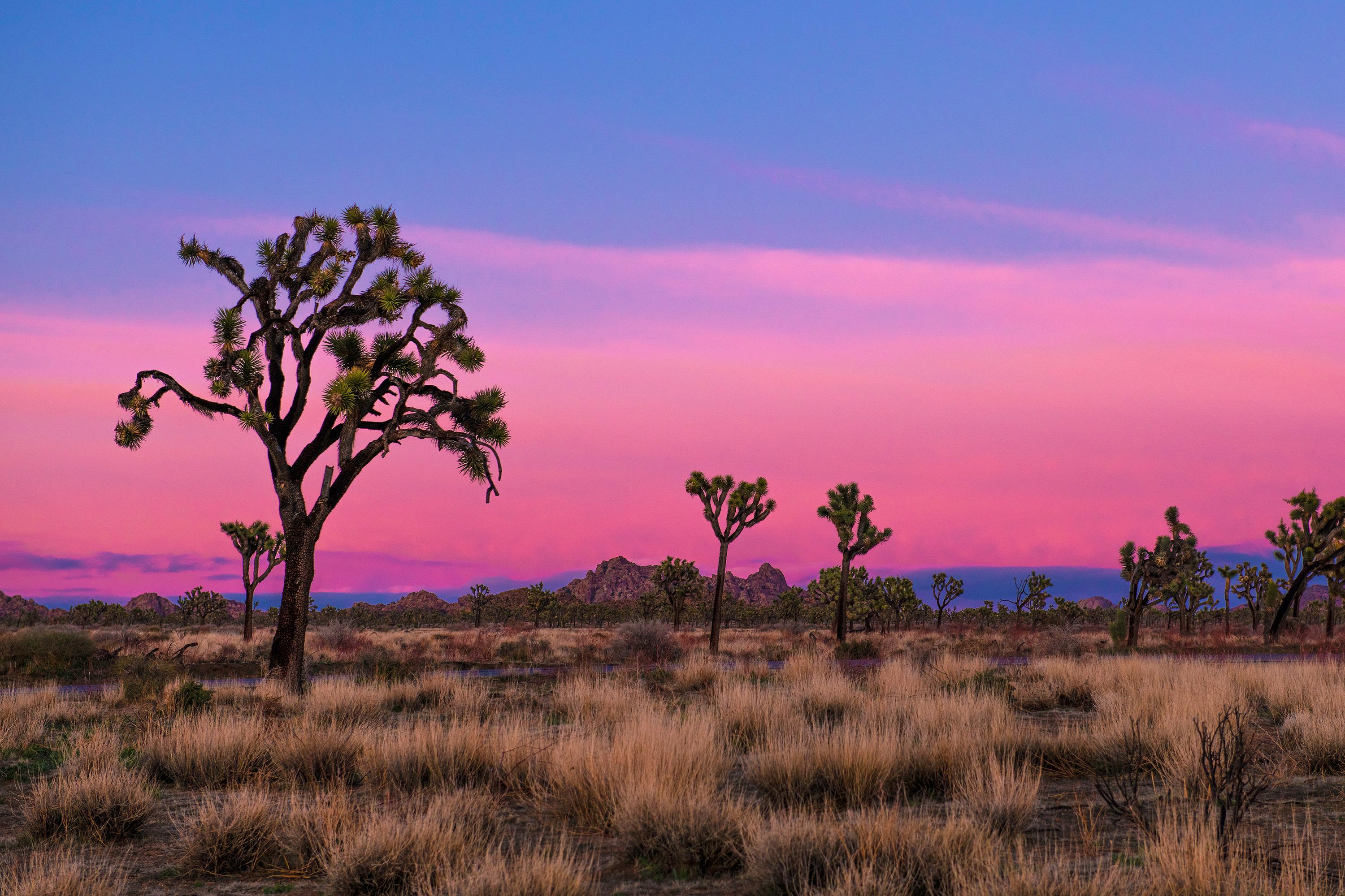
Joshua Tree National Park
National Park
Two distinct desert ecosystems, the Mojave and the Colorado, come together in Joshua Tree National Park. A fascinating variety of plants and animals make their homes in a land sculpted by strong winds...
18 mi from route
~44 min detour
$30
near mile 129.9
Park data from the National Park Service API. Alerts update every 2 hours.
More Details
What kind of drive is this?
Expect a mixed driving experience that transitions as you move inland. With 45% of your time spent on major highways, you will encounter both high-speed transit and local road segments. The most significant portion of your journey involves a 110.7-mile stretch on the Pearl Harbor Memorial Highway, which serves as the backbone of this trip. This long, uninterrupted segment requires sustained attention as the landscape shifts around you. While the road personality changes, the consistency of the highway infrastructure ensures you maintain steady momentum throughout the nearly four-hour duration.
45% highway, the rest on surface roads — varied driving throughout.
24 navigation steps total — most of the decisions cluster near the start and finish.
Longest single stretch: 110.7 mi on Pearl Harbor Memorial Highway.
How Hard Is This Drive?
9/10
This route mixes highway mileage with some local-road sections near the start or finish. This route has several spots where lane changes, forks, or exits need your full attention. The trickiest moment comes around 2.4 miles in.
Driving Effort9/10
High effort - long or complex enough to need steady focus all day
Balances navigation complexity with total wheel time.
This is a demanding drive. With 17 significant decision points across 209.2 miles, you will need to stay alert - especially through interchange areas and urban stretches. Consider splitting it into segments if you are not comfortable with fast highway navigation.
Where does it get tricky?
The main spots that need attention: at 2.4 miles: Lane positioning matters here; at 4.1 miles (CA 55 / Costa Mesa Freeway): Highway fork - watch signs carefully. Lane positioning matters here; at 40.3 miles: Exit ramp - move to the correct lane early. Lane positioning matters here. Multiple destination signs - pick the right one.
Towns Mentioned on Route Signs
Based on OSRM destination-sign hints, not a full list of every settlement the road passes.
On the drive from Santa Ana, CA to Blythe, CA, road signs begin pointing toward Indio along the way.
Doable as a same-day drive at 3h 55m. Total distance: 209.2 miles.
Family Friendly
Moderate complexity with 1 natural rest stops along the way.
Solo Traveler
3h 55m drive, comfortable solo distance.
Scenic Drive
Mixed highway & surface route profile with national parks nearby.
Frequently Asked Questions
The longest stretch is about 110.7 miles on Pearl Harbor Memorial Highway. The full list of main roads is in the Roads section above.
We did not find dedicated rest areas on this route. For a drive this long, plan bathroom and stretch breaks around gas stations, fast-food stops, or small-town downtowns — check the Nearby Places section for options.
It helps. This route has a higher-than-average number of complex decision points, which get harder in the dark. If the last hour of the trip is on surface roads or mountain grades, aim to arrive at Blythe, CA before sunset when you can. Check the Trip Plan for departure windows that land you in daylight.
Only with planning. This is a long drive for kids — consider splitting it into two days rather than pushing through. Plan at least 1 meaningful breaks. Dedicated rest areas are limited, so plan gas or food stops as your bathroom breaks.
The main spots that need attention: at 2.4 miles: Lane positioning matters here; at 4.1 miles (CA 55 / Costa Mesa Freeway): Highway fork - watch signs carefully. Lane positioning matters here; at 40.3 miles: Exit ramp - move to the correct lane early. Lane positioning matters here. Multiple destination signs - pick the right one.
Yes — Joshua Tree National Park. See the National Parks section for detour distances and tips on detours.
Possible but tiring. At 3.9 hours each way, an in-and-out day trip would put you behind the wheel for 7.8 hours — manageable with a long break at Blythe, CA, but most travelers stay overnight.