San Francisco, CA to West Bishop, CA is 291.7 miles and takes about 6h 54m via Tioga Road and US 395, with a fuel budget near $66 and enough daylight to finish in a day. This drive takes you from the Pacific Coast region into the same region, traversing California entirely. It's a trip that offers a mix of highway cruising and more surface-level driving. Given its single-day feasibility, you can decide on the fly how much time you want to spend en route.
Trip Pace
Same-day drive is realistic
A same-day return is possible, but it will make for a full day on the road.
Break Rhythm
1 planned break
Plan on a short reset every 3 to 4 hours to stay fresh behind the wheel.
Midpoint
145.9 miles from San Francisco, CA
A natural place for your longest stop of the day
, about 3h 13m into the drive
.
Main Roads
Road
Distance
Duration
Tioga Road
58.6 mi
1h 42m
US 395
58.5 mi
1h 7m
Arthur H. Breed Junior Freeway
29.3 mi
33m
East F Street
25 mi
33m
Main Street
23.5 mi
33m
CA 120
20.7 mi
25m
MacArthur Freeway
15.9 mi
18m
Robert T. Monagan Freeway
14.6 mi
16m
Longest stretch:
Tioga Road
— 58.6 mi, about 1h 42m
Turn-by-Turn Driving Directions
Step-by-step road directions between San Francisco, CA and West Bishop, CA.
1
Start on Market Street
312 ft·7 sec·Market Street
2
Turn right onto 11th Street
0.6 mi·1 min·11th Street
3
Turn left onto Bryant Street
0.3 mi·1 min·Bryant Street
4
Take the ramp
0.3 mi·25 sec
Toward I 80 East: OaklandUse the left / straight lanes.
5
Merge onto I 80
0.9 mi·1 min·Route 80
6
Continue on I 80
5.8 mi·8 min·Dwight D. Eisenhower Highway
Use the straight / slight left lanes.
7
Take the exit
1.0 mi·1 min
Exit 8BToward I 580 East: Downtown Oakland, Hayward-StocktonUse the slight right lane.
8
Merge onto I 580
16 mi·18 min·MacArthur Freeway
Use the straight / slight left lanes.
9
Merge onto I 580
12 mi·13 min·Arthur H. Breed Junior Freeway
Use the straight / slight right lanes.
10
Keep slight right at fork onto I 580
18 mi·20 min·Arthur H. Breed Junior Freeway
Use the straight / slight right lanes.
11
Keep slight left at fork onto I 205
3.9 mi·4 min·Robert T. Monagan Freeway
Toward I 205 East: Tracy, Stockton
12
Keep slight left at fork onto I 205
11 mi·11 min·Robert T. Monagan Freeway
13
Merge onto I 5
1.0 mi·1 min·Westside Freeway
14
Take the exit
469 ft·6 sec
Toward CA 120 East: Manteca, Sonora
15
Continue on CA 120
7.8 mi·8 min·CA 120
Use the straight / slight right lanes.
16
Take the exit onto CA 120
0.3 mi·36 sec·CA 120
Toward CA 120 East: Sonora, Yosemite AvenueUse the right lane.
17
Turn right onto CA 120
11 mi·15 min·East Yosemite Avenue
Use the straight / right lanes.
18
Continue on CA 120
0.2 mi·27 sec·California Street
19
Continue on CA 120
7.1 mi·10 min·Jackson Avenue
20
Continue on CA 120; J9; J14
0.9 mi·1 min·Valley Home Road
21
Continue on CA 120; J9; J14
0.9 mi·2 min·North Yosemite Avenue
22
Turn left onto CA 108; CA 120
25 mi·33 min·East F Street
23
Turn right onto CA 120
13 mi·15 min·CA 120
Use the right lane.
24
Turn right onto Old Priest Grade
1.9 mi·5 min·Old Priest Grade
25
Continue on CA 120
0.8 mi·1 min·New Priest Grade Road
26
Continue on CA 120
2.0 mi·4 min·Highway 120
27
Continue on CA 120
24 mi·33 min·Main Street
28
Continue on Big Oak Flat Road
0.7 mi·1 min·Big Oak Flat Road
29
Continue on Big Oak Flat Road
7.8 mi·16 min·Big Oak Flat Road
30
Turn left onto Tioga Road
59 mi·1 hr 42 min·Tioga Road
31
Continue on US 395; CA 120
18 mi·20 min·US 395; CA 120
Use the straight lane.
32
Continue on US 395
40 mi·46 min·US 395
Use the straight lane.
33
Take the exit
295 ft·8 sec
Use the right lane.
34
Turn straight onto Ed Powers Road
1.3 mi·3 min·Ed Powers Road
35
Turn left onto Red Hill Road
1.2 mi·3 min·Red Hill Road
36
Arrive at destination
Red Hill Road
Trip Plan
To make the most of this 6-hour, 54-minute drive, aim to depart San Francisco early in the morning. This gives you ample time to enjoy the scenery and stop without feeling rushed. With only one recommended stop and a manageable distance, you have flexibility to pull over as needed. Keep an eye on your fuel gauge, especially as you head into more rural stretches where stations might be further apart. A good tip is to fill up before you leave the San Francisco Bay Area to ensure a full tank for the initial part of the trip.
Morning Departure
Start early — leave by 6-7 AM to arrive at a reasonable hour.
Evening Departure
This is a long drive — plan for a morning departure or consider splitting it into two days.
You can normally do this drive in one day.
Plan roughly 1 meaningful break for fuel, food, and rest.
The halfway point lands around 145.9 miles from San Francisco, CA, or about 3h 13m into the drive.
The longest continuous stretch on this route runs about 58.6 miles.
This is a comfortable same-day trip.
Departure
Before you leave
Start with fuel, water, and navigation already sorted so the first hour feels easy.
First stop
Around 64 miles or 1h 17m in
Use this first pause for coffee, a restroom break, and a quick traffic check ahead.
Halfway reset
Around 145.9 miles or 3h 13m in
This is the best place for your longest stop, a real meal, and a full fuel check.
Final approach
Final hour starts around 5h 50m
Traffic, exits, and arrival timing usually matter more near West Bishop, CA than in the middle of the route.
Before You Leave
+
Open the route before leaving San Francisco, CA so your first major turns are already loaded.
+
Leave with enough water and a charging cable within reach, not packed away.
+
Check your fuel range against the first long segment, especially if you are starting outside city service areas.
Day 1
Settle into the route from San Francisco, CA
This is one driving day of about 291.7 miles and 6h 54m.
Your first comfortable stop window is around 64 miles from San Francisco, CA.
This route can stay practical as a one-day drive if traffic stays reasonable.
Plan about 1 real break rather than only quick fuel stops.
The longest stretch is on Tioga Road for about 58.6 miles.
Where to Stop
Rest stops, refuel points, and overnight suggestions along this route.
Place data sourced from public business listings. Hours and availability may vary.
Heads-up: tricky spots
5 of 20
5 decision points cluster between mile 8 and 122.8 — GPS handles the exact turns, but know they're coming. Your lane choice matters more than the turn itself.
8
8 mi into trip|~13m in
Take the exit toward I 580 East: Downtown Oakland, Hayward-Stockton
Exit ramp - move to the correct lane early. Lane positioning matters here. Multiple destination signs - pick the right one
Use the slight right lane.
Exit 8B
Toward I 580 East: Downtown Oakland, Hayward-St...
6
36.4 mi into trip|~46m in|I 580 / Arthur H. Breed Junior Freeway
Keep slight right at fork onto I 580 / Arthur H. Breed Junior Freeway
Highway fork - watch signs carefully. Lane positioning matters here
Use the straight / slight right lanes.
6
54.3 mi into trip|~1h 6m in|I 205 / Robert T. Monagan Freeway
Keep slight left at fork onto I 205 / Robert T. Monagan Freeway toward I 205 East: Tracy, Stockton
Highway fork - watch signs carefully. Multiple destination signs - pick the right one
Toward I 205 East: Tracy, Stockton
7
77.8 mi into trip|~1h 33m in|CA 120
Take the exit onto CA 120 toward CA 120 East: Sonora, Yosemite Avenue
Exit ramp - move to the correct lane early. Lane positioning matters here. Multiple destination signs - pick the right one
Use the right lane.
Toward CA 120 East: Sonora, Yosemite Avenue
6
122.8 mi into trip|~2h 38m in|CA 120
Turn right onto CA 120
Lane positioning matters here
Use the right lane.
Fuel & Cost
Regular Gas
$61.03 one way
$122.05 round trip
$5.31/gal25.4 MPG avg102 kg CO2
Fuel Type
$/gal
One Way
Round Trip
midgrade
$5.52
$63.38
$126.76
premium
$5.67
$65.06
$130.12
diesel
$4.80
$55.08
$110.16
No toll roads detected on this route.
Estimated Trip Cost (one way, 1 person)
Fuel
$61
Meals
$25–$50
Total
$86–$111
Rough estimate based on US averages. Hotel $80–$140/night, meals $25–$50/day.
Estimated CO2 emission: 102.1 kg one way.
Prices: EIA weekly data, 2026-07-13.
Driving Electric?
About $31 in charging
· 1 stop
· 67% less CO2
Vehicle Type
kWh
Stops
DC Fast
Home Charge
Average EV
87.5
1
$30.63
$14.00
Efficient EV
72.9
0
$25.52
$11.67
EV Truck/SUV
116.7
1
$40.84
$18.67
Gas CO2
102 kg
EV CO2
34 kg (67% less)
Plan for 1 charging stop. A 30-minute DC fast charge mid-route should be enough to complete the trip comfortably.
DC fast charging avg $0.35/kWh. Home charging avg $0.16/kWh. US grid CO2: 0.39 kg/kWh.
Travel Intel
Current conditions at both ends of the drive.
Forecast as of Jul 17, 2026
Origin
San Francisco, CA
Evening
in San Francisco on Monday
Local time
7:51 PM
PDT
Current temp
66°F
Sunny
W 15 mph0% chanceLive forecast
Red Flag Warning
Red Flag Warning issued July 17 at 2:01PM PDT until July 17 at 8:00PM PDT by NWS Medford OR
Beach Hazards Statement
Beach Hazards Statement issued July 17 at 12:53PM PDT until July 21 at 11:00PM PDT by NWS Los Angeles/Oxnard CA
Destination
West Bishop, CA
Evening
in West Bishop on Monday
Local time
7:51 PM
PDT
Current temp
97°F
Sunny
SE 9 mph2% chanceLive forecast
Red Flag Warning
Red Flag Warning issued July 17 at 2:01PM PDT until July 17 at 8:00PM PDT by NWS Medford OR
Beach Hazards Statement
Beach Hazards Statement issued July 17 at 12:53PM PDT until July 21 at 11:00PM PDT by NWS Los Angeles/Oxnard CA
Seasonal Notes
Summer travel usually means heavier construction, hotter rest stops, and busier weekend traffic around major cities.
Winter travel shortens daylight, so a route that looks manageable on paper can feel much longer after dark.
Holiday weekends tend to make both departure and arrival windows slower than the raw route time suggests.
Time zone
Same local time
Origin and destination are on the same clock, so arrival timing is easier to judge at a glance.
Temperature spread
31 degrees warmer at arrival
A meaningful temperature swing is a good cue to rethink layers, water, and how soon you want to arrive.
Road read
6h 54m on the road
Start early — leave by 6-7 AM to arrive at a reasonable hour.
Weather data from the National Weather Service. Conditions may change; check closer to your travel date.
National Parks Near This Route
Worth a detour if your schedule allows.
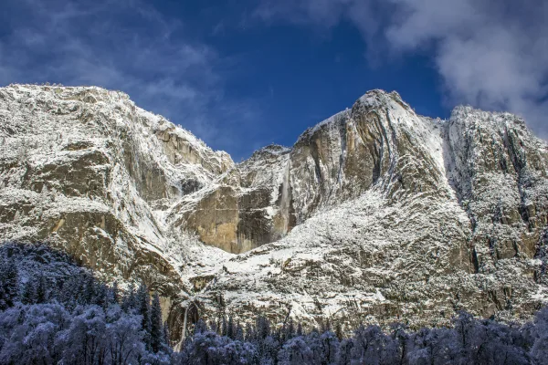
Yosemite National Park
National Park
Not just a great valley, but a shrine to human foresight, the strength of granite, the power of glaciers, the persistence of life, and the tranquility of the High Sierra. First protected in 1864, Yose...
1 mi from route
~4 min detour
$35
near mile 191.1
Park Closure: Tioga Road (Hwy 120 through the park) and Glacier Point Road are closed
Established in 1988, San Francisco Maritime National Historical Park celebrates America’s maritime heritage on the Pacific Coast. Our 50-acre park has grown around Aquatic Park Cove, a protected area...
Rosie the Riveter WWII Home Front National Historical Park
National Historical Park
Celebrate and honor the contributions and sacrifices of American civilians on the WWII home front. Discover how diverse communities lived, worked, and interacted. Many faces, many stories, many truths...
8 mi from route
~19 min detour
Free
near mile 10.1
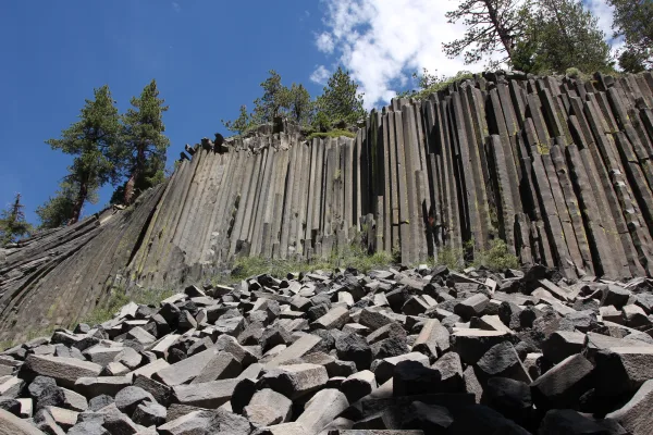
Established in 1911 by presidential proclamation, Devils Postpile National Monument protects and preserves the Devils Postpile formation, the 101-foot high Rainbow Falls, and pristine mountain scenery...
9 mi from route
~24 min detour
Free
near mile 251.5
Experience a park so rich it supports 19 distinct ecosystems with over 2,000 plant and animal species. Go for a hike, enjoy a vista, have a picnic or learn about the centuries of overlapping history f...
Walk among old growth coast redwoods, cooling their roots in the fresh water of Redwood Creek and lifting their crowns to reach the sun and fog. Federally protected as a National Monument since 1908,...
Park data from the National Park Service API. Alerts update every 2 hours.
More Details
What kind of drive is this?
Nearly half of this 291.7-mile drive, about 49%, is on highways, including parts of the Arthur H. Breed Junior Freeway. The longest continuous stretch without a major change in road type is 58.6 miles on Tioga Road. You'll transition from more developed freeway conditions to surface roads as you head east. Expect some rural cruising interspersed with potential for urban merging early on.
49% highway, the rest on surface roads — varied driving throughout.
36 navigation steps total — most of the decisions cluster near the start and finish.
Longest single stretch: 58.6 mi on Tioga Road.
How Hard Is This Drive?
10/10
This route mixes highway mileage with some local-road sections near the start or finish. This route has several spots where lane changes, forks, or exits need your full attention. The trickiest moment comes around 8 miles in.
Driving Effort10/10
High effort - long or complex enough to need steady focus all day
Balances navigation complexity with total wheel time.
This is a demanding drive. With 20 significant decision points across 291.7 miles, you will need to stay alert - especially through interchange areas and urban stretches. Consider splitting it into segments if you are not comfortable with fast highway navigation.
Where does it get tricky?
The main spots that need attention: at 8 miles: Exit ramp - move to the correct lane early. Lane positioning matters here. Multiple destination signs - pick the right one; at 36.4 miles (I 580 / Arthur H. Breed Junior Freeway): Highway fork - watch signs carefully. Lane positioning matters here; at 54.3 miles (I 205 / Robert T. Monagan Freeway): Highway fork - watch signs carefully. Multiple destination signs - pick the right one.
Elevation Profile
Mountain driving with significant elevation changes
8,502 ft27 ft
Total Climb
9,295 ft
Total Descent
4,952 ft
Highest Point
8,502 ft
~208.4 mi in
Elevation Range
8,475 ft
Notable High Points
8,502 ft at ~208.4 miles+280 ft prominence
7,637 ft at ~250 miles+435 ft prominence
Towns Mentioned on Route Signs
Based on OSRM destination-sign hints, not a full list of every settlement the road passes.
Between San Francisco, CA and West Bishop, CA, road signs point toward Stockton and Sonora.
The centerpiece of the Bay Area, San Francisco is one of the most visited cities in the world, and with good reason. The cultural center of northern California, San Francisco is renowned for its mixture of scenic beauty and unique culture that makes it one of the most vibrant and desirable cities in the nation, if not the world.
Sandwiched between the San Francisco Bay and the Pacific Ocean on a small square of land seven miles (11 km) on each side, San Francisco offers a wealth of treasures for the visitor, from the windswept and often foggy bay to the steep hills lined with Victorian homes that overlook the spectacular scenery of the city.
Top landmarks
•Golden Gate Bridge — suspension bridge on the San Francisco Bay
•Alcatraz Island — island in San Francisco, California, United States of America
•San Francisco–Oakland Bay Bridge — suspension bridge connecting San Francisco and Oakland, California, USA
Doable as a same-day drive at 6h 54m. Total distance: 291.7 miles.
Family Friendly
Moderate complexity with 1 natural rest stops along the way.
Solo Traveler
6h 54m drive, plan rest stops for pacing.
Scenic Drive
Mixed highway & surface route profile with national parks nearby.
Frequently Asked Questions
The longest stretch is about 58.6 miles on Tioga Road. The full list of main roads is in the Roads section above.
Yes — we found about 6 rest areas or service plazas within a short detour of the route (from OpenStreetMap). See the Rest Stops tab under Nearby Places for locations and mile markers. Plan to stretch, use the bathroom, and top off fluids every 2–3 hours on longer drives.
It helps. This route has a higher-than-average number of complex decision points, which get harder in the dark. If the last hour of the trip is on surface roads or mountain grades, aim to arrive at West Bishop, CA before sunset when you can. Check the Trip Plan for departure windows that land you in daylight.
Only with planning. This is a long drive for kids — consider splitting it into two days rather than pushing through. Plan at least 1 meaningful breaks. There are 6 rest areas along the route for bathroom stops.
The main spots that need attention: at 8 miles: Exit ramp - move to the correct lane early. Lane positioning matters here. Multiple destination signs - pick the right one; at 36.4 miles (I 580 / Arthur H. Breed Junior Freeway): Highway fork - watch signs carefully. Lane positioning matters here; at 54.3 miles (I 205 / Robert T. Monagan Freeway): Highway fork - watch signs carefully. Multiple destination signs - pick the right one.
Yes — Yosemite National Park, San Francisco Maritime National Historical Park and Rosie the Riveter WWII Home Front National Historical Park (6 total within detour distance). See the National Parks section for detour distances and tips on detours.
Not recommended in a single day. At 6.9 hours each way, a round trip means 13.8 hours of driving — that is an unsafe level of fatigue for most drivers. Plan at least one night at West Bishop, CA before the return drive.