Knox County Westbound Rest Area
0 mi from route
Compiled and reviewed by the US Trip Planner planning team at COD Solutions Oy · Last reviewed Jul 19, 2026 · Editorial standards
Drive Time
11h 11m
Distance
611 mi
983 km
Drive Score
8/10
Great drive
Same Day?
2-day trip
Fuel Cost
$84
one way
EV Charging
Unknown
Estimated drive times based on typical traffic patterns. Actual times may vary with weather, construction, and real-time conditions.

Saint Jo, TX
Wikimedia Commons

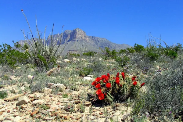
El Paso, TX
Wikimedia Commons
Embarking on a journey from Saint Jo, Texas, to El Paso, Texas, covers a substantial 611 miles and will take approximately 11 hours and 11 minutes of driving time. This long-distance adventure is best split over two recommended days, especially considering the approximately $92 estimated fuel cost. You'll primarily navigate via US 82 and US Highway 62, with these main roads accounting for about 67% of your journey. This route traverses the Great Plains region for both its origin and destination, offering a consistent, wide-open landscape. It's a drive that requires planning for overnight stays, rather than attempting it in a single day.
Trip Pace
Best split across 2 days
Treat the return leg as its own travel day rather than an afterthought.
Break Rhythm
3 planned breaks
Plan on a short reset every 3 to 4 hours to stay fresh behind the wheel.
Midpoint
305.5 miles from Saint Jo, TX
A natural place for your longest stop of the day , about 5h 33m into the drive .
| Road | Distance | Duration |
|---|---|---|
| US 82 | 108.1 mi | 2h |
| US Highway 62 | 102.3 mi | 1h 46m |
| US Highway 82 West | 93.5 mi | 1h 38m |
| Hobbs Highway | 47.9 mi | 53m |
| Seagraves Road | 40.4 mi | 42m |
| West Carlsbad Highway | 39.6 mi | 45m |
| National Parks Highway | 33.5 mi | 37m |
| US Highway 82 | 33.5 mi | 35m |
Hour-of-day weekday pattern from 4 FHWA count stations on your route.
Peak
7 AM
~6,366 veh/hr typical
Quietest
2 AM
~452 veh/hr
Peak-to-quiet ratio
14.1×
busier at peak than in the quiet hours
Averaged across 52 weeks of 2023 FHWA Travel Monitoring Analysis System data. Weekday hours only (Mon–Fri).
Step-by-step road directions between Saint Jo, TX and El Paso, TX.
Start on US 82
Turn straight onto US 82
Merge onto US 82
Take the exit onto US 82
Take the exit onto US 82
Turn right onto US 82; US 183 Business; US 277 Business; US 283 Business
Continue on US 82; US 183 Business; US 277 Business; US 283 Business
Turn right onto US 82; TX 114
Continue on US 82; TX 114
Continue on US 82; TX 114
Continue on US 82; TX 114
Continue on US 82; TX 114
Continue on US 82; TX 114
Continue on US 82; TX 114
Turn straight onto US 82
Continue on US 82
Continue on US 62; US 82
Continue on US 62; US 385
Turn right onto US 62; US 180
Continue on US 62; US 180
Continue on US 62; US 180
Continue on US 62; US 180
Continue on US 62; US 180
Continue on US 62; US 180
Continue on US 62; US 180
Continue on US 62; US 180
Turn left onto US 62; US 180; US 285
Turn slight right onto US 62; US 180
Continue on US 62; US 180
Continue on US 62; US 180
Turn slight left onto US 62; US 180
Turn right onto US 180
Take the ramp onto US 180
Merge onto I 10
Take the exit
Turn straight onto East Missouri Avenue
Turn left onto TX 20
Arrive at destination
To make the most of this 611-mile trip, plan to depart early to maximize daylight hours, especially if you're splitting it over two days. With a total duration of over 11 hours, breaking this drive into two segments is highly advisable. Aim for a midpoint stop to rest and refuel, ensuring you're comfortable for the second leg. Keep a close eye on your fuel gauge, particularly before embarking on the longest stretch of 108.1 miles on US 82, as services may be spaced out. Planning your three recommended stops in advance will help keep your journey smooth and efficient.
Morning Departure
Start early — leave by 6-7 AM to arrive at a reasonable hour.
Evening Departure
This is a long drive — plan for a morning departure or consider splitting it into two days.
Consider an overnight stop or starting very early.
Departure
Before you leave
Start with fuel, water, and navigation already sorted so the first hour feels easy.
First stop
Around 134 miles or 2h 27m in
Use this first pause for coffee, a restroom break, and a quick traffic check ahead.
Halfway reset
Around 305.5 miles or 5h 33m in
This is the best place for your longest stop, a real meal, and a full fuel check.
Overnight split
Day 1 wrap after about 305.5 miles or 5h 33m
Stop before fatigue turns the last few hours into a grind. You want day two to start fresh, not just resumed.
Final approach
Final hour starts around 10h 2m
Traffic, exits, and arrival timing usually matter more near El Paso, TX than in the middle of the route.
Open the route before leaving Saint Jo, TX so your first major turns are already loaded.
Leave with enough water and a charging cable within reach, not packed away.
Check your fuel range against the first long segment, especially if you are starting outside city service areas.
Pick one backup stop option before the midpoint in case traffic changes your pacing.
Treat this as a 2-day road trip and book the overnight stop before the busiest arrival window.
Day 1
Settle into the route from Saint Jo, TX
Aim for roughly 306 miles and 5.6 hours of wheel time on this day.
Day 2
Finish the approach into El Paso, TX
Aim for roughly 306 miles and 5.6 hours of wheel time on this day.
Rest stops, refuel points, and overnight suggestions along this route.

First major stop
Coffee and fuel
202 mi into the route
Best for: Coffee, fuel, and an easy first stretch
This is a natural early stop once the first hours of the drive are behind you.

Second major stop
Overnight candidate
403 mi into the route
Best for: Hotel check-in, dinner, and a fresh start
This lines up well with a realistic day-end stop if you are breaking the drive into stages.
Find hotels in Kermit, TXNight 1
306 mi · about 5.6h in
A practical overnight split lands near Sundown, TX after about 306 miles or 5.6 hours of driving.
Find hotelsA short stop after about 134 miles helps settle the day before fatigue starts building.
The midpoint is around 305.5 miles from Saint Jo, TX, which is a good place for a longer meal and fuel stop.
Before the longest stretch
Fuel checkTop up before US 82 if your tank is already low. That segment runs about 108.1 miles.
Overnight split
Hotel stopFor a steadier pace, wrap day one after about 306 miles or 5.6 hours on the road.
These stop ideas are pacing suggestions — the exact town or exit can change with traffic, hotel plans, and fuel range.
Picked by where they fit in your drive — first break, midpoint reset, final stretch.
Near the end, right off the route
El Paso, Texas
Hours: 10 am–6 pm
+19152123150
Visit websiteNear the end, right off the route
El Paso, Texas
Hours: 9 am–4 pm
+19155335147
Visit websiteNear the end, short detour
El Paso, Texas
Hours: 6 am–11 pm
+19152120092
Visit websiteNear the end, right off the route
El Paso, Texas
Hours: 1–5 pm
+19155436747
Visit websiteNear the end, short detour
El Paso, Texas
Hours: 9 am–5 pm
+19152120966
Visit websiteAround the midpoint, ~10 min detour
Lubbock, Texas
Hours: 10 am–5 pm
+18067478734
Visit websiteAround the midpoint, ~11 min detour
Lubbock, Texas
Hours: 7 am–8 pm
+18067752673
Visit websitePlace data sourced from public business listings. Hours and availability may vary.
5 decision points cluster between mile 59.2 and 610.2 — GPS handles the exact turns, but know they're coming. Your lane choice matters more than the turn itself.
Take the exit onto US 82 toward US 82 West, US 277 South: Lubbock, Abilene
Exit ramp - move to the correct lane early. Multiple destination signs - pick the right one
Take the exit onto US 82 toward US 82, US 183 Business: Seymour, Lubbock
Exit ramp - move to the correct lane early. Multiple destination signs - pick the right one
Turn right onto US 82; TX 114 / East California Street
Navigation decision point
Merge onto I 10
Merge point - match speed before joining. Lane positioning matters here
Take the exit toward Missouri Avenue, Downtown
Exit ramp - move to the correct lane early. Lane positioning matters here. Multiple destination signs - pick the right one
Regular Gas
$83.69 one way
$167.38 round trip
| Fuel Type | $/gal | One Way | Round Trip |
|---|---|---|---|
| midgrade | $3.89 | $93.48 | $186.96 |
| premium | $4.23 | $101.63 | $203.27 |
| diesel | $4.80 | $115.37 | $230.74 |
No toll roads detected on this route.
Estimated Trip Cost (one way, 1 person)
Fuel
$84
Hotel (1n)
$80–$140
Meals
$50–$100
Total
$214–$324
Rough estimate based on US averages. Hotel $80–$140/night, meals $25–$50/day.
Estimated CO2 emission: 213.8 kg one way. Prices: EIA weekly data, 2026-07-13.
Driving Electric?
About $64 in charging · 2 stops · 67% less CO2
| Vehicle Type | kWh | Stops | DC Fast | Home Charge |
|---|---|---|---|---|
| Average EV | 183.3 | 2 | $64.16 | $29.33 |
| Efficient EV | 152.8 | 1 | $53.46 | $24.44 |
| EV Truck/SUV | 244.4 | 3 | $85.54 | $39.10 |
Gas CO2
214 kg
EV CO2
71 kg (67% less)
Plan for 2 charging stops, roughly every 270 miles. Allow 25-40 minutes per stop at a DC fast charger.
DC fast charging avg $0.35/kWh. Home charging avg $0.16/kWh. US grid CO2: 0.39 kg/kWh.
Current conditions at both ends of the drive.
Origin
Afternoon in Saint Jo on Sunday
Local time
1:55 PM
CDT
Current temp
88°F
Chance Showers And Thunderstorms
Flash Flood Warning
Flash Flood Warning issued July 16 at 3:47PM CDT until July 16 at 6:00PM CDT by NWS Austin/San Antonio TX
Special Weather Statement
Special Weather Statement issued July 16 at 3:47PM CDT by NWS Austin/San Antonio TX
Destination
Afternoon in El Paso on Sunday
Local time
12:55 PM
MDT
Current temp
93°F
Slight Chance Showers And Thunderstorms
Flash Flood Warning
Flash Flood Warning issued July 16 at 3:47PM CDT until July 16 at 6:00PM CDT by NWS Austin/San Antonio TX
Special Weather Statement
Special Weather Statement issued July 16 at 3:47PM CDT by NWS Austin/San Antonio TX
Seasonal Notes
Summer travel usually means heavier construction, hotter rest stops, and busier weekend traffic around major cities.
Winter travel shortens daylight, so a route that looks manageable on paper can feel much longer after dark.
Holiday weekends tend to make both departure and arrival windows slower than the raw route time suggests.
For long drives, weather on day two can matter just as much as conditions at departure, so check the whole travel window rather than only the first day.
Time zone
The destination clock does not match departure time, so double-check hotel check-in windows and late arrival plans.
Temperature spread
A meaningful temperature swing is a good cue to rethink layers, water, and how soon you want to arrive.
Road read
This is long enough that the arrival forecast matters almost as much as departure conditions. Recheck both ends before you roll.
Weather data from the National Weather Service. Conditions may change; check closer to your travel date.
Worth a detour if your schedule allows.

National Memorial
Chamizal is more than just an urban park to recreate or enjoy a quiet afternoon. These grounds are a reminder of the harmonious settlement of a 100-year boundary dispute between the United States and...
National Park
Come experience mountains and canyons, desert and dunes, night skies and spectacular vistas within a place unlike any other. Guadalupe Mountains National Park protects the world's most extensive Permi...
Park data from the National Park Service API. Alerts update every 2 hours.
This road trip features a significant portion on highways, with 67% of the drive utilizing them. Expect stretches that are more about covering ground efficiently, particularly on US 82. The longest uninterrupted stretch you'll encounter is 108.1 miles on US 82, so be sure to plan your fuel stops accordingly. While not exclusively an interstate grind, the character leans towards efficient travel rather than highly technical or winding scenic byways. The landscape will likely remain consistent throughout much of this cross-state Texas drive.
At 11h 11m, this is a long-haul route where pacing matters more than any single turn. You will hit about 11 points where you need to pay attention to lane position or signs. The trickiest moment comes around 59.2 miles in near US 82.
Moderate - straightforward overall, but long enough or busy enough to require pacing
Balances navigation complexity with total wheel time.
This drive requires moderate attention. Across 611 miles you will encounter 11 spots where lane choice or exit timing matters. Not difficult for experienced highway drivers, but worth previewing the tricky sections before you go.
Where does it get tricky?
The main spots that need attention: at 59.2 miles (US 82): Exit ramp - move to the correct lane early. Multiple destination signs - pick the right one; at 107.9 miles (US 82): Exit ramp - move to the correct lane early. Multiple destination signs - pick the right one; at 110.4 miles (US 82; TX 114 / East California Street): Navigation decision point.
High-altitude sections with notable climbs
Total Climb
5,196 ft
Total Descent
2,624 ft
Highest Point
5,253 ft
~567.3 mi in
Elevation Range
4,393 ft
Notable High Points
Based on OSRM destination-sign hints, not a full list of every settlement the road passes.
Between Saint Jo, TX and El Paso, TX, road signs point toward Abilene and Lubbock.
Abilene
Lubbock
Top landmarks
“The Sun City” · Founded 1680
El Paso is the sixth largest city in Texas, with 679,000 residents (2020). It is on the United States-Mexico border. The city on the other side of the border is Ciudad Juarez, Chihuahua. El Paso is often called the Sun City. Collectively, the city of El Paso and other nearby cities, such as Juarez and Las Cruces, New Mexico are referred to as The Borderland.
Top landmarks
City content from Wikivoyage (CC BY-SA 4.0) and Wikidata (CC0).
Family Friendly
Moderate complexity with 3 natural rest stops along the way.
Solo Traveler
11h 11m drive, plan rest stops for pacing.
Compiled by the US Trip Planner planning team at COD Solutions Oy from open government datasets — OSRM over OpenStreetMap for geometry, EIA for fuel prices, USGS 3DEP for elevation, NPS for national parks, and FHWA TMAS for hourly traffic volumes. See our methodology for refresh cadence and limitations.
Was this helpful?
Thanks for your feedback!
Your tip has been submitted. Thanks!
/500
Recent Tips
·
Explore more options from Saint Jo, TX or browse trips ending in El Paso, TX.
Looking for more statewide routes? Browse TX road trips.