If you are planning to travel from Sahuarita to Phoenix, you are looking at a straightforward 133-mile trek through the heart of the Desert Southwest. Expect to spend about two hours behind the wheel, making this an ideal day trip that doesn't require an overnight stay. Your journey will take you along I-19 North, the Nogales–Tucson Highway, and finally I-10 West. With a fuel budget of approximately $26, the trip is quite economical for a quick transition between these two Arizona hubs. Since the entire route remains within the same region, you will experience a consistent high-desert landscape throughout the duration of your travel.
Trip Pace
Same-day drive is realistic
A same-day return is realistic if you keep stops short.
Midpoint
66.4 miles from Sahuarita, AZ
A natural place for your longest stop of the day
, about 1h 13m into the drive
.
Main Roads
Road
Distance
Duration
Casa Grande-Tucson Highway
54.5 mi
55m
Phoenix-Casa Grande Highway
38.1 mi
38m
Nogales–Tucson Highway
16 mi
19m
Maricopa Freeway
13.9 mi
16m
South Freeway
5.4 mi
6m
East Sahuarita Road
1.8 mi
3m
South 7th Street
1.3 mi
2m
East Washington Street
0.5 mi
1m
Longest stretch:
Casa Grande-Tucson Highway
— 54.5 mi, about 55m
Turn-by-Turn Driving Directions
Step-by-step road directions between Sahuarita, AZ and Phoenix, AZ.
1
Start on East Sahuarita Road
1.8 mi·3 min·East Sahuarita Road
2
Take the ramp
0.4 mi·48 sec
Toward I 19 North: Tucson
3
Merge onto I 19
16 mi·19 min·Nogales–Tucson Highway
Use the straight / right lanes.
4
Keep slight left at fork
0.6 mi·49 sec
Toward I 10 West: Phoenix
5
Merge onto I 10
5.4 mi·6 min·South Freeway
Use the straight / slight right lanes.
6
Continue on I 10
3.7 mi·4 min·Casa Grande-Tucson Highway
Use the straight / slight right lanes.
7
Keep slight left at fork onto I 10
51 mi·51 min·Casa Grande-Tucson Highway
Use the straight / slight right lanes.
8
Continue on I 10
38 mi·38 min·Phoenix-Casa Grande Highway
Use the straight / slight right lanes.
9
Continue on I 10
12 mi·13 min·Maricopa Freeway
Use the straight / slight right lanes.
10
Keep slight right at fork onto US 60
1.9 mi·2 min·Maricopa Freeway
Toward I-17 North, US-60 West: FlagstaffUse the slight right lane.
11
Take the exit
0.2 mi·26 sec
Exit 195BToward 7th Street, Central AvenueUse the slight right lane.
12
Turn straight onto East Maricopa Freeway
134 ft·2 sec·East Maricopa Freeway
13
Turn right onto South 7th Street
1.3 mi·2 min·South 7th Street
Use the straight lane.
14
Turn left onto East Washington Street
0.5 mi·1 min·East Washington Street
Use the left lane.
15
Arrive at destination
West Washington Street
Trip Plan
Since this is a relatively short two-hour journey, you have plenty of flexibility when it comes to your departure time. You can easily complete the 133-mile distance without needing to plan for formal stops, though keeping your fuel budget of $26 in mind is a good habit for your arrival in Phoenix. Watch the traffic patterns carefully when transitioning from the local highways onto the I-10 West corridor, as congestion can fluctuate depending on the time of day. Because there are zero planned stops on this route, make sure you are fueled up and ready to go before leaving Sahuarita to ensure a seamless experience. Aim to travel during off-peak hours to keep the drive time closer to the two-hour mark.
Morning Departure
Leave by 9 AM and you'll arrive before lunch.
Evening Departure
Even a 4 PM departure gets you there before dark in summer.
You can normally do this drive in one day.
You may only need one short stretch break if traffic stays light.
The halfway point lands around 66.4 miles from Sahuarita, AZ, or about 1h 13m into the drive.
The longest continuous stretch on this route runs about 54.5 miles.
This is a comfortable same-day trip.
Departure
Before you leave
Start with fuel, water, and navigation already sorted so the first hour feels easy.
First stop
Around 29 miles or 35m in
Use this first pause for coffee, a restroom break, and a quick traffic check ahead.
Halfway reset
Around 66.4 miles or 1h 13m in
This is the best place for your longest stop, a real meal, and a full fuel check.
Final approach
Final hour starts around 1h 56m
Traffic, exits, and arrival timing usually matter more near Phoenix, AZ than in the middle of the route.
Before You Leave
+
Open the route before leaving Sahuarita, AZ so your first major turns are already loaded.
+
Leave with enough water and a charging cable within reach, not packed away.
+
Check your fuel range against the first long segment, especially if you are starting outside city service areas.
Day 1
Settle into the route from Sahuarita, AZ
This is one driving day of about 132.7 miles and 2h 25m.
Your first comfortable stop window is around 29 miles from Sahuarita, AZ.
This route can stay practical as a one-day drive if traffic stays reasonable.
The longest stretch is on Casa Grande-Tucson Highway for about 54.5 miles.
Where to Stop
Rest stops, refuel points, and overnight suggestions along this route.
Place data sourced from public business listings. Hours and availability may vary.
Heads-up: tricky spots
5 of 9
5 decision points cluster between mile 2.1 and 132.2 — GPS handles the exact turns, but know they're coming. Your lane choice matters more than the turn itself.
5
2.1 mi into trip|~4m in|I 19 / Nogales–Tucson Highway
Merge onto I 19 / Nogales–Tucson Highway
Merge point - match speed before joining. Lane positioning matters here
Use the straight / right lanes.
6
27.9 mi into trip|~34m in|I 10 / Casa Grande-Tucson Highway
Keep slight left at fork onto I 10 / Casa Grande-Tucson Highway
Highway fork - watch signs carefully. Lane positioning matters here
Use the straight / slight right lanes.
8
128.7 mi into trip|~2h 18m in|US 60 / Maricopa Freeway
Keep slight right at fork onto US 60 / Maricopa Freeway toward I-17 North, US-60 West: Flagstaff
Highway fork - watch signs carefully. Lane positioning matters here. Multiple destination signs - pick the right one
Use the slight right lane.
Toward I-17 North, US-60 West: Flagstaff
8
130.6 mi into trip|~2h 20m in
Take the exit toward 7th Street, Central Avenue
Exit ramp - move to the correct lane early. Lane positioning matters here. Multiple destination signs - pick the right one
Use the slight right lane.
Exit 195B
Toward 7th Street, Central Avenue
6
132.2 mi into trip|~2h 23m in|East Washington Street
Turn left onto East Washington Street
Lane positioning matters here
Use the left lane.
Fuel & Cost
Regular Gas
$26.44 one way
$52.87 round trip
$5.06/gal25.4 MPG avg46 kg CO2
Fuel Type
$/gal
One Way
Round Trip
midgrade
$5.36
$27.98
$55.95
premium
$5.59
$29.21
$58.42
diesel
$5.61
$29.30
$58.60
No toll roads detected on this route.
Estimated Trip Cost (one way, 1 person)
Fuel
$26
Meals
$25–$50
Total
$51–$76
Rough estimate based on US averages. Hotel $80–$140/night, meals $25–$50/day.
Estimated CO2 emission: 46.4 kg one way.
Prices: EIA weekly data, 2026-04-13.
Driving Electric?
About $14 in charging
· 0 stops
· 65% less CO2
Vehicle Type
kWh
Stops
DC Fast
Home Charge
Average EV
39.8
0
$13.93
$6.37
Efficient EV
33.2
0
$11.61
$5.31
EV Truck/SUV
53.1
0
$18.58
$8.49
Gas CO2
46 kg
EV CO2
16 kg (65% less)
This trip is well within single-charge range for most EVs. No charging stops needed if you start fully charged.
DC fast charging avg $0.35/kWh. Home charging avg $0.16/kWh. US grid CO2: 0.39 kg/kWh.
Travel Intel
Current conditions at both ends of the drive.
Forecast as of Apr 20, 2026
Origin
Sahuarita, AZ
Late night
in Sahuarita on Tuesday
Local time
3:56 AM
MST
Current temp
82°F
Unavailable
Live forecast
Destination
Phoenix, AZ
Late night
in Phoenix on Tuesday
Local time
3:56 AM
MST
Current temp
84°F
Unavailable
Live forecast
Seasonal Notes
Summer travel usually means heavier construction, hotter rest stops, and busier weekend traffic around major cities.
Winter travel shortens daylight, so a route that looks manageable on paper can feel much longer after dark.
Holiday weekends tend to make both departure and arrival windows slower than the raw route time suggests.
Time zone
Same local time
Origin and destination are on the same clock, so arrival timing is easier to judge at a glance.
Temperature spread
2 degrees warmer at arrival
A meaningful temperature swing is a good cue to rethink layers, water, and how soon you want to arrive.
Road read
2h 25m on the road
Use the two city cards together: check the sky where you start, then compare it with the local time and temperature at arrival.
Weather data from the National Weather Service. Conditions may change; check closer to your travel date.
National Parks Near This Route
Worth a detour if your schedule allows.
Casa Grande Ruins National Monument
National Monument
An Ancestral Sonoran Desert People's farming community and "Great House" are preserved at Casa Grande Ruins. Whether a gathering place for people or simply a waypoint marker in an extensive system of...
10 mi from route
~26 min detour
Free
near mile 86.9
Tucson, Arizona is home to the nation's largest cacti. The giant saguaro is the universal symbol of the American west. These majestic plants, found only in a small portion of the United States, are pr...
13 mi from route
~32 min detour
$25
near mile 18.3
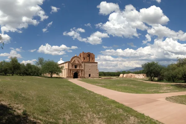
Tumacácori sits at a cultural crossroads in the Santa Cruz River valley. Here O’odham, Yaqui, and Apache people met and mingled with European Jesuit and Franciscan missionaries, settlers, and soldiers...
Park data from the National Park Service API. Alerts update every 2 hours.
More Details
What kind of drive is this?
Expect a drive that feels more like a turn-heavy local navigation than a mindless highway cruise. While you will eventually merge onto I-10 West, the initial segments involve shifting through I-19 North and local highway corridors. Because there is no significant highway-only stretch, you should remain alert for frequent transitions and road changes. The longest uninterrupted stretch on I-19 North is negligible, meaning you will need to pay close attention to your navigation as you move through the connecting segments. It is a practical, functional route that prioritizes getting you to your destination efficiently rather than providing a long-distance interstate haul.
Only 15% highway — the rest is turn-by-turn surface driving.
15 navigation steps total — most of the decisions cluster near the start and finish.
Longest single stretch: 54.5 mi on Casa Grande-Tucson Highway.
How Hard Is This Drive?
8/10
Expect a hands-on drive with frequent turns and local roads rather than long highway stretches. This route has several spots where lane changes, forks, or exits need your full attention. The trickiest moment comes around 2.1 miles in near I 19 / Nogales–Tucson Highway.
Driving Effort8/10
Demanding - plan breaks and stay ahead of the key maneuvers
Balances navigation complexity with total wheel time.
This is a demanding drive. With 9 significant decision points across 132.7 miles, you will need to stay alert - especially through interchange areas and urban stretches. Consider splitting it into segments if you are not comfortable with fast highway navigation.
Where does it get tricky?
The main spots that need attention: at 2.1 miles (I 19 / Nogales–Tucson Highway): Merge point - match speed before joining. Lane positioning matters here; at 27.9 miles (I 10 / Casa Grande-Tucson Highway): Highway fork - watch signs carefully. Lane positioning matters here; at 128.7 miles (US 60 / Maricopa Freeway): Highway fork - watch signs carefully. Lane positioning matters here. Multiple destination signs - pick the right one.
Phoenix is the capital of the state of Arizona, the most populous city in the American Southwest. Warm and sunny winter weather have ensured a thriving tourism industry, and the city has become the region's primary political, cultural, economic, and transportation center. Phoenix is extremely hot and dry in the summertime, so always have sunscreen with you! It had about 1,625,000 residents in 2021, and is the fifth largest city in the United States.
Top landmarks
•Arizona State Capitol — state capitol building of the U.S. state of Arizona
•Phoenix Art Museum — art museum in Phoenix, Arizona
•St. Mary's Basilica — Roman Catholic church in Phoenix, Arizona
Doable as a same-day drive at 2h 25m. Total distance: 132.7 miles.
Family Friendly
Moderate complexity with 0 natural rest stops along the way.
Solo Traveler
2h 25m drive, comfortable solo distance.
Scenic Drive
Mostly surface roads route profile with national parks nearby.
Frequently Asked Questions
The longest stretch is about 54.5 miles on Casa Grande-Tucson Highway. The full list of main roads is in the Roads section above.
It helps. This route has a higher-than-average number of complex decision points, which get harder in the dark. If the last hour of the trip is on surface roads or mountain grades, aim to arrive at Phoenix, AZ before sunset when you can. Check the Trip Plan for departure windows that land you in daylight.
Only with planning. This is a long drive for kids — consider splitting it into two days rather than pushing through. Dedicated rest areas are limited, so plan gas or food stops as your bathroom breaks.
The main spots that need attention: at 2.1 miles (I 19 / Nogales–Tucson Highway): Merge point - match speed before joining. Lane positioning matters here; at 27.9 miles (I 10 / Casa Grande-Tucson Highway): Highway fork - watch signs carefully. Lane positioning matters here; at 128.7 miles (US 60 / Maricopa Freeway): Highway fork - watch signs carefully. Lane positioning matters here. Multiple destination signs - pick the right one.
Yes — Casa Grande Ruins National Monument, Saguaro National Park and Tumacácori National Historical Park. See the National Parks section for detour distances and tips on detours.
Yes. A round trip is manageable in a single day if you plan a break at Phoenix, AZ before heading back.