Origin
Rowood, AZ
Night in Rowood on Saturday
Local time
9:17 PM
MST
Current temp
84°F
Unavailable
Live forecast
Compiled and reviewed by the US Trip Planner planning team at COD Solutions Oy · Last reviewed Apr 18, 2026 · Editorial standards
Drive Time
2h 40m
Distance
144.9 mi
233 km
Drive Score
8/10
Great drive
Same Day?
Yes, doable
Fuel Cost
$29
one way
EV Charging
Unknown
Estimated drive times based on typical traffic patterns. Actual times may vary with weather, construction, and real-time conditions.

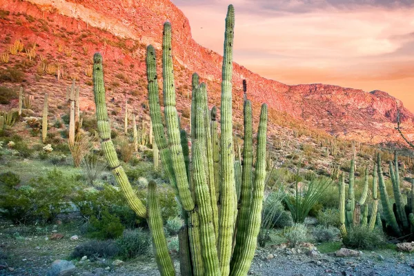
Rowood, AZ
Mark Stebnicki

Marana, AZ
Wikimedia Commons
This 144.9-mile drive from Rowood to Marana, Arizona, is a manageable 2-hour and 40-minute journey, perfect for a single day trip. You'll primarily be on the Blue Star Memorial Highway, Casa Grande-Tucson Highway, and Gila Bend-Lukeville Highway, with 100% of the route utilizing these main roads. With a fuel cost estimated at $29 and only one recommended stop, it's an efficient way to travel within the Desert Southwest region. The overall feel is that of a turn-heavy local drive, so expect a more engaged experience behind the wheel. This trip is well-suited for a single day, allowing for flexibility in your schedule.
Trip Pace
Same-day drive is realistic
A same-day return is realistic if you keep stops short.
Break Rhythm
1 planned break
A short stop every 2 to 3 hours is enough for this drive.
Midpoint
72.5 miles from Rowood, AZ
A natural place for your longest stop of the day , about 1h 24m into the drive .
| Road | Distance | Duration |
|---|---|---|
| Blue Star Memorial Highway | 62 mi | 1h 2m |
| Casa Grande-Tucson Highway | 36.3 mi | 36m |
| Gila Bend-Lukeville Highway | 31.5 mi | 36m |
| North Ajo Gila Bend Highway | 8.1 mi | 10m |
| North Sandario Road | 1.6 mi | 3m |
| Ajo Well Road No 1 | 1.2 mi | 2m |
| Rasmussen Road | 1.1 mi | 2m |
| Tucson-Ajo Highway | 0.9 mi | 1m |
Step-by-step road directions between Rowood, AZ and Marana, AZ.
Start on AZ 85
Turn right onto Ajo Well Road No 1
Turn left onto Rasmussen Road
Turn right onto AZ 85
Continue on AZ 85
Take the ramp
Merge onto I 8
Keep slight right at fork
Continue on Phoenix Bypass Route
Continue on I 10
Take the exit
Turn right onto North Sandario Road
Enter roundabout onto North Sandario Road
Continue on North Sandario Road
At end of road, turn right onto West Moore Road
Turn left onto North Whitney Lane
Turn right onto West Swanson Street
Turn left onto North Steele Drive
Arrive at destination
Given the 2-hour and 40-minute duration, this drive is easily completed in a single day. Consider an early morning departure to maximize your time in Marana or to enjoy cooler driving conditions. With only one recommended stop along the 144.9 miles, you have a lot of flexibility to decide when and where to take a break. The fuel cost is estimated at $29, so ensure your tank is full before you leave Rowood. A practical tip for this route: pay close attention to signage for the Casa Grande-Tucson Highway and Gila Bend-Lukeville Highway transitions, as the 'turn-heavy' nature of the drive means these changes can be more frequent than on a standard interstate.
Morning Departure
Leave by 9 AM and you'll arrive before lunch.
Evening Departure
Even a 4 PM departure gets you there before dark in summer.
This is a comfortable same-day trip.
Departure
Before you leave
Start with fuel, water, and navigation already sorted so the first hour feels easy.
First stop
Around 32 miles or 41m in
Use this first pause for coffee, a restroom break, and a quick traffic check ahead.
Halfway reset
Around 72.5 miles or 1h 24m in
This is the best place for your longest stop, a real meal, and a full fuel check.
Final approach
Final hour starts around 2h 10m
Traffic, exits, and arrival timing usually matter more near Marana, AZ than in the middle of the route.
Open the route before leaving Rowood, AZ so your first major turns are already loaded.
Leave with enough water and a charging cable within reach, not packed away.
Check your fuel range against the first long segment, especially if you are starting outside city service areas.
Day 1
Settle into the route from Rowood, AZ
This is one driving day of about 144.9 miles and 2h 40m.
Rest stops, refuel points, and overnight suggestions along this route.

Mid-route town
Meal stop
72 mi into the route
Best for: Lunch, fuel, and a longer reset
This sits close to the middle of the route, so it works well for the longest stop of the day.
A short stop after about 32 miles helps settle the day before fatigue starts building.
The midpoint is around 72.5 miles from Rowood, AZ, which is a good place for a longer meal and fuel stop.
Before the longest stretch
Fuel checkTop up before Blue Star Memorial Highway if your tank is already low. That segment runs about 62 miles.
These stop ideas are pacing suggestions — the exact town or exit can change with traffic, hotel plans, and fuel range.
5 decision points cluster between mile 105 and 144.9 — GPS handles the exact turns, but know they're coming. Your lane choice matters more than the turn itself.
Keep slight right at fork toward I 10 East: Tucson
Highway fork - watch signs carefully
Take the exit toward Marana Road
Exit ramp - move to the correct lane early. Lane positioning matters here
Enter roundabout onto North Sandario Road
Roundabout - know your exit number before entering
At end of road, turn right onto West Moore Road
Navigation decision point
Turn left onto North Steele Drive
Navigation decision point
Regular Gas
$28.87 one way
$57.73 round trip
| Fuel Type | $/gal | One Way | Round Trip |
|---|---|---|---|
| midgrade | $5.36 | $30.55 | $61.10 |
| premium | $5.59 | $31.90 | $63.79 |
| diesel | $5.61 | $31.99 | $63.98 |
No toll roads detected on this route.
Estimated Trip Cost (one way, 1 person)
Fuel
$29
Meals
$25–$50
Total
$54–$79
Rough estimate based on US averages. Hotel $80–$140/night, meals $25–$50/day.
Estimated CO2 emission: 50.7 kg one way. Prices: EIA weekly data, 2026-04-13.
Driving Electric?
About $15 in charging · 0 stops · 67% less CO2
| Vehicle Type | kWh | Stops | DC Fast | Home Charge |
|---|---|---|---|---|
| Average EV | 43.5 | 0 | $15.21 | $6.96 |
| Efficient EV | 36.2 | 0 | $12.68 | $5.80 |
| EV Truck/SUV | 58 | 0 | $20.29 | $9.27 |
Gas CO2
51 kg
EV CO2
17 kg (67% less)
This trip is well within single-charge range for most EVs. No charging stops needed if you start fully charged.
DC fast charging avg $0.35/kWh. Home charging avg $0.16/kWh. US grid CO2: 0.39 kg/kWh.
Current conditions at both ends of the drive.
Origin
Night in Rowood on Saturday
Local time
9:17 PM
MST
Current temp
84°F
Unavailable
Destination
Night in Marana on Saturday
Local time
9:17 PM
MST
Current temp
53°F
Unavailable
Seasonal Notes
Summer travel usually means heavier construction, hotter rest stops, and busier weekend traffic around major cities.
Winter travel shortens daylight, so a route that looks manageable on paper can feel much longer after dark.
Holiday weekends tend to make both departure and arrival windows slower than the raw route time suggests.
Time zone
Origin and destination are on the same clock, so arrival timing is easier to judge at a glance.
Temperature spread
A meaningful temperature swing is a good cue to rethink layers, water, and how soon you want to arrive.
Road read
Use the two city cards together: check the sky where you start, then compare it with the local time and temperature at arrival.
Weather data from the National Weather Service. Conditions may change; check closer to your travel date.
Worth a detour if your schedule allows.

National Monument
An Ancestral Sonoran Desert People's farming community and "Great House" are preserved at Casa Grande Ruins. Whether a gathering place for people or simply a waypoint marker in an extensive system of...
National Monument
Look closely. Look again. The sights and sounds of Organ Pipe Cactus National Monument, an International Biosphere Reserve, reveal a thriving community of plants and animals. Human stories echo throug...
Park data from the National Park Service API. Alerts update every 2 hours.
Expect a turn-heavy local drive on this 144.9-mile route, which means you'll be actively navigating rather than cruising on an interstate. While it's not a monotonous highway grind, the experience is characterized by frequent road changes and turns. The longest uninterrupted stretch you'll encounter is 62 miles on the Blue Star Memorial Highway, offering a brief period of sustained driving before more local road segments. With a 100% highway share and a profile suggesting a more involved driving experience, this route demands your attention as you transition between the Casa Grande-Tucson Highway and the Gila Bend-Lukeville Highway.
Expect a hands-on drive with frequent turns and local roads rather than long highway stretches. There are only a few real navigation decisions along the way. The trickiest moment comes around 105 miles in.
Easy - simple navigation with a manageable amount of wheel time
Balances navigation complexity with total wheel time.
This is a straightforward 2h 40m drive. You will face about 13 decision points, but nothing that requires special attention if you follow navigation.
Where does it get tricky?
The main spots that need attention: at 105 miles: Highway fork - watch signs carefully; at 142.3 miles: Exit ramp - move to the correct lane early. Lane positioning matters here; at 142.9 miles (North Sandario Road): Roundabout - know your exit number before entering.
Weekend Trip
Doable as a same-day drive at 2h 40m. Total distance: 144.9 miles.
Family Friendly
Moderate complexity with 1 natural rest stops along the way.
Solo Traveler
2h 40m drive, comfortable solo distance.
First-Time Driver
Mostly highway driving (1%). Straightforward navigation.
Scenic Drive
Mostly surface roads route profile with national parks nearby.
Compiled by the US Trip Planner planning team at COD Solutions Oy from open government datasets — OSRM over OpenStreetMap for geometry, EIA for fuel prices, and NPS for national parks. See our methodology for refresh cadence and limitations.
Was this helpful?
Thanks for your feedback!
Your tip has been submitted. Thanks!
/500
Recent Tips
·
Explore more options from Rowood, AZ or browse trips ending in Marana, AZ.
Looking for more statewide routes? Browse AZ road trips.