Planning a trip from Rosepine, LA, to Shreveport, LA? This 135.6-mile journey takes approximately 2 hours and 41 minutes, making it a perfect day trip. You'll be spending about half your time on the interstate, with the other half on local roads like Hammond Street and Natchitoches Highway. The estimated fuel cost for this drive is around $20. Since both locations are in the Southeast region of Louisiana, you won't be crossing state lines, and the drive offers a mixed experience that's manageable for a single day. You'll likely find just one stop is all you need to break up the drive.
Trip Pace
Same-day drive is realistic
A same-day return is realistic if you keep stops short.
Break Rhythm
1 planned break
A short stop every 2 to 3 hours is enough for this drive.
Midpoint
67.8 miles from Rosepine, LA
A natural place for your longest stop of the day
, about 1h 24m into the drive
.
Main Roads
Road
Distance
Duration
I 49
56.9 mi
59m
Hammond Street
20.9 mi
24m
Natchitoches Highway
14.1 mi
16m
Lake Charles Highway
12.9 mi
17m
Shreveport Highway
11.1 mi
13m
LA 485
10.4 mi
14m
South 5th Street
3.1 mi
4m
Johnny B Hall Memorial Highway
1 mi
1m
Longest stretch:
I 49
— 56.9 mi, about 59m
Turn-by-Turn Driving Directions
Step-by-step road directions between Rosepine, LA and Shreveport, LA.
1
Start on US 171
1.0 mi·1 min·Johnny B Hall Memorial Highway
2
Continue on US 171
13 mi·17 min·Lake Charles Highway
3
Continue on US 171
3.1 mi·4 min·South 5th Street
4
Keep slight left at fork onto US 171; LA 8
412 ft·5 sec·North 5th Street
5
Enter roundabout onto US 171
182 ft·2 sec·Shreveport Highway
6
Continue on US 171
11 mi·13 min·Shreveport Highway
7
Continue on US 171
21 mi·24 min·Hammond Street
8
Continue on Fisher Road
0.4 mi·45 sec·Fisher Road
9
Turn slight right onto Martin Luther King Drive
0.7 mi·1 min·Martin Luther King Drive
10
Turn right onto LA 6
0.3 mi·21 sec·San Antonio Avenue
11
Continue on LA 6
14 mi·16 min·Natchitoches Highway
12
Turn left onto LA 485
10 mi·14 min·LA 485
13
Continue on LA 485
0.3 mi·37 sec·State Route 485
14
Turn left
0.4 mi·54 sec
15
Merge onto I 49
57 mi·59 min·I 49
16
Keep slight left at fork
0.8 mi·1 min
Toward Pete Harris Drive, Murphy Street
17
Continue on Pete Harris Drive
0.8 mi·1 min·Pete Harris Drive
18
Turn right onto LA 173
0.9 mi·2 min·Caddo Street
19
At end of road, turn left onto Clyde Fant Memorial Parkway
0.5 mi·56 sec·Clyde Fant Memorial Parkway
20
Turn slight right onto River Parkway
68 ft·1 sec·River Parkway
21
Arrive at destination
River Parkway
Trip Plan
For this roughly 2 hour and 41 minute drive, leaving in the morning is a good strategy to maximize your daylight hours. With only one recommended stop and a manageable 135.6 miles, you have flexibility in pacing yourself. Keep an eye on your fuel gauge, especially during the longest stretch on I-49, as services can be spread out. The estimated fuel cost of $20 should help you budget accordingly. A practical tip for this route is to ensure you have your navigation set correctly before departing Rosepine, as the transition from highway to local roads around Natchitoches can require attention.
Morning Departure
Leave by 9 AM and you'll arrive before lunch.
Evening Departure
Even a 4 PM departure gets you there before dark in summer.
You can normally do this drive in one day.
Plan roughly 1 meaningful break for fuel, food, and rest.
The halfway point lands around 67.8 miles from Rosepine, LA, or about 1h 24m into the drive.
The longest continuous stretch on this route runs about 56.9 miles.
This is a comfortable same-day trip.
Departure
Before you leave
Start with fuel, water, and navigation already sorted so the first hour feels easy.
First stop
Around 30 miles or 39m in
Use this first pause for coffee, a restroom break, and a quick traffic check ahead.
Halfway reset
Around 67.8 miles or 1h 24m in
This is the best place for your longest stop, a real meal, and a full fuel check.
Final approach
Final hour starts around 2h 12m
Traffic, exits, and arrival timing usually matter more near Shreveport, LA than in the middle of the route.
Before You Leave
+
Open the route before leaving Rosepine, LA so your first major turns are already loaded.
+
Leave with enough water and a charging cable within reach, not packed away.
+
Check your fuel range against the first long segment, especially if you are starting outside city service areas.
Day 1
Settle into the route from Rosepine, LA
This is one driving day of about 135.6 miles and 2h 41m.
Your first comfortable stop window is around 30 miles from Rosepine, LA.
This route can stay practical as a one-day drive if traffic stays reasonable.
Plan about 1 real break rather than only quick fuel stops.
The longest stretch is on I 49 for about 56.9 miles.
Where to Stop
Rest stops, refuel points, and overnight suggestions along this route.
Place data sourced from public business listings. Hours and availability may vary.
Heads-up: tricky spots
5 of 9
5 decision points cluster between mile 17 and 134.3 — GPS handles the exact turns, but know they're coming. Your lane choice matters more than the turn itself.
4
17 mi into trip|~23m in|US 171; LA 8 / North 5th Street
Keep slight left at fork onto US 171; LA 8 / North 5th Street
Highway fork - watch signs carefully
6
17.1 mi into trip|~23m in|US 171 / Shreveport Highway
Enter roundabout onto US 171 / Shreveport Highway
Roundabout - know your exit number before entering
4
75.3 mi into trip|~1h 34m in
Turn left
Navigation decision point
6
132.7 mi into trip|~2h 35m in
Keep slight left at fork toward Pete Harris Drive, Murphy Street
Highway fork - watch signs carefully. Multiple destination signs - pick the right one
Toward Pete Harris Drive, Murphy Street
4
134.3 mi into trip|~2h 38m in|LA 173 / Caddo Street
Turn right onto LA 173 / Caddo Street
Navigation decision point
Fuel & Cost
Regular Gas
$20.48 one way
$40.96 round trip
$3.84/gal25.4 MPG avg47 kg CO2
Fuel Type
$/gal
One Way
Round Trip
midgrade
$4.21
$22.48
$44.96
premium
$4.56
$24.34
$48.68
diesel
$5.61
$29.94
$59.88
No toll roads detected on this route.
Estimated Trip Cost (one way, 1 person)
Fuel
$20
Meals
$25–$50
Total
$45–$70
Rough estimate based on US averages. Hotel $80–$140/night, meals $25–$50/day.
Estimated CO2 emission: 47.4 kg one way.
Prices: EIA weekly data, 2026-04-13.
Driving Electric?
About $14 in charging
· 0 stops
· 66% less CO2
Vehicle Type
kWh
Stops
DC Fast
Home Charge
Average EV
40.7
0
$14.24
$6.51
Efficient EV
33.9
0
$11.86
$5.42
EV Truck/SUV
54.2
0
$18.98
$8.68
Gas CO2
47 kg
EV CO2
16 kg (66% less)
This trip is well within single-charge range for most EVs. No charging stops needed if you start fully charged.
DC fast charging avg $0.35/kWh. Home charging avg $0.16/kWh. US grid CO2: 0.39 kg/kWh.
Travel Intel
Current conditions at both ends of the drive.
Forecast as of Apr 15, 2026
Origin
Rosepine, LA
Morning
in Rosepine on Sunday
Local time
9:18 AM
CDT
Current temp
57°F
Unavailable
Live forecast
Destination
Shreveport, LA
Morning
in Shreveport on Sunday
Local time
9:18 AM
CDT
Current temp
57°F
Unavailable
Live forecast
Seasonal Notes
Summer travel usually means heavier construction, hotter rest stops, and busier weekend traffic around major cities.
Winter travel shortens daylight, so a route that looks manageable on paper can feel much longer after dark.
Holiday weekends tend to make both departure and arrival windows slower than the raw route time suggests.
Time zone
Same local time
Origin and destination are on the same clock, so arrival timing is easier to judge at a glance.
Temperature spread
Very similar conditions
Both ends of the route are sitting at about the same temperature right now.
Road read
2h 41m on the road
Use the two city cards together: check the sky where you start, then compare it with the local time and temperature at arrival.
Weather data from the National Weather Service. Conditions may change; check closer to your travel date.
National Parks Near This Route
Worth a detour if your schedule allows.
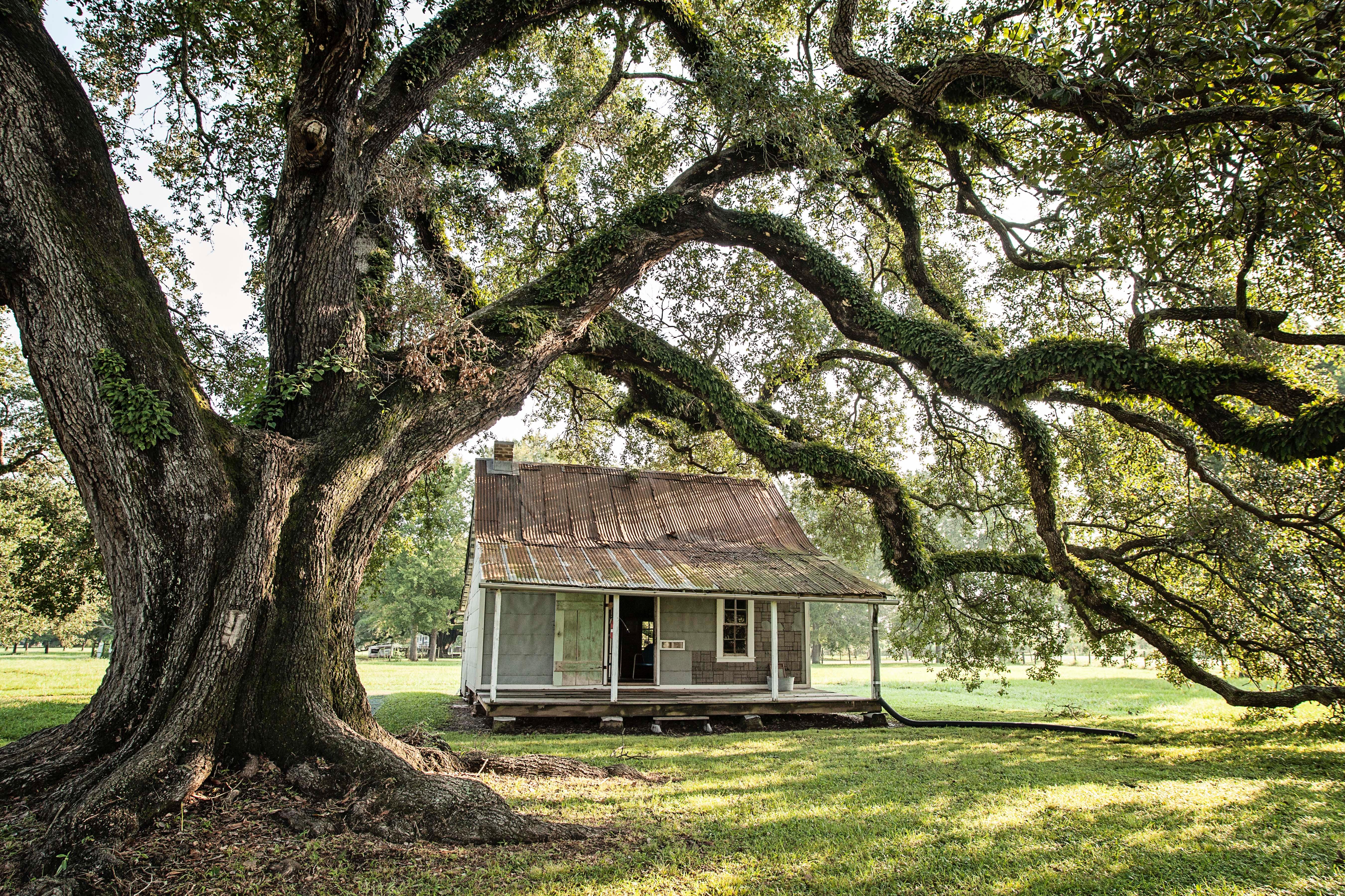
Cane River Creole National Historical Park
National Historical Park
The Cane River region is home to a unique culture; the Creoles. Generations of the same families of workers, enslaved and tenant, and owners lived on these lands for over 200 years. The park tells the...
18 mi from route
~44 min detour
Free
near mile 65.5
Park data from the National Park Service API. Alerts update every 2 hours.
More Details
What kind of drive is this?
This route offers a varied driving experience, with 50% of the journey on highways. You'll encounter stretches on I-49, including a significant 56.9-mile segment without exits, providing a chance to cover ground efficiently. The remaining portion of the drive will shift to local roads, including Hammond Street and Natchitoches Highway, which will likely present a different pace. Expect a mixed drive that transitions from quicker interstate travel to more localized routes as you approach your destination.
50% highway, the rest on surface roads — varied driving throughout.
21 navigation steps total — most of the decisions cluster near the start and finish.
Longest single stretch: 56.9 mi on I 49.
How Hard Is This Drive?
4/10
This route mixes highway mileage with some local-road sections near the start or finish. There are only a few real navigation decisions along the way. The trickiest moment comes around 17 miles in near US 171; LA 8 / North 5th Street.
Driving Effort4/10
Easy - simple navigation with a manageable amount of wheel time
Balances navigation complexity with total wheel time.
This is a straightforward 2h 41m drive. You will face about 9 decision points, but nothing that requires special attention if you follow navigation.
Where does it get tricky?
The main spots that need attention: at 17 miles (US 171; LA 8 / North 5th Street): Highway fork - watch signs carefully; at 17.1 miles (US 171 / Shreveport Highway): Roundabout - know your exit number before entering; at 75.3 miles: Navigation decision point.
Shreveport is the largest city in Northern Louisiana, part of the twin city metro of Shreveport-Bossier City, and is considered the principal city in the three-state region known as the "Ark-La-Tex." It has about 188,000 residents (2019), and is in the area of the state designated as the Sportsman's Paradise. Many lakes and rivers are in the area and offer recreational activities. The surrounding area is also a contrast from points in southern Louisiana, in that the landscape is marked by rolling hills and pine forests, being an extension of the Texas region known as the Piney Woods.
Mixed highway & surface route profile with national parks nearby.
Frequently Asked Questions
The longest stretch is about 56.9 miles on I 49. The full list of main roads is in the Roads section above.
Yes, with realistic expectations. Build in a stop roughly every 2 hours, have snacks and activities ready, and check the Nearby Places tabs for kid-friendly stops along the way.
The main spots that need attention: at 17 miles (US 171; LA 8 / North 5th Street): Highway fork - watch signs carefully; at 17.1 miles (US 171 / Shreveport Highway): Roundabout - know your exit number before entering; at 75.3 miles: Navigation decision point.
Yes — Cane River Creole National Historical Park. See the National Parks section for detour distances and tips on detours.
Yes. A round trip is manageable in a single day if you plan a break at Shreveport, LA before heading back.