Origin
Raton, NM
Evening in Raton on Saturday
Local time
8:50 PM
MDT
Current temp
76°F
Unavailable
Live forecast
Compiled and reviewed by the US Trip Planner planning team at COD Solutions Oy · Last reviewed Apr 19, 2026 · Editorial standards
Drive Time
2h 59m
Distance
173.3 mi
279 km
Drive Score
8/10
Great drive
Same Day?
Yes, doable
Fuel Cost
$26
one way
EV Charging
Unknown
Estimated drive times based on typical traffic patterns. Actual times may vary with weather, construction, and real-time conditions.

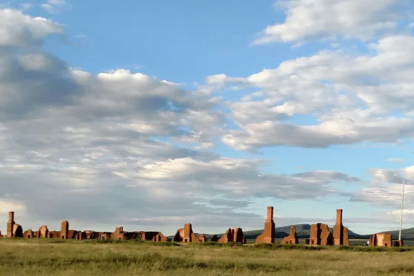
Raton, NM
Wikimedia Commons

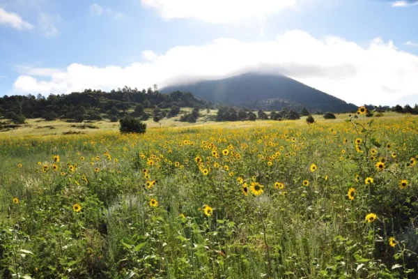
Santa Fe, NM
Wikimedia Commons
Traveling from Raton to Santa Fe covers 173.6 miles of New Mexico landscape, typically taking about 2 hours and 32 minutes to complete. Because this route avoids major highways entirely, it functions best as a focused, one-day trip rather than a multi-day journey. You should budget approximately $27 for fuel to cover the distance. Navigating through local streets like North 2nd Street, Sugarite Avenue, and Guadalupe Street keeps the drive engaging and personal. Since both cities are located within the Desert Southwest, you can expect a consistent regional feel throughout your travel.
Trip Pace
Same-day drive is realistic
A same-day return is realistic if you keep stops short.
Break Rhythm
1 planned break
A short stop every 2 to 3 hours is enough for this drive.
Midpoint
86.7 miles from Raton, NM
A natural place for your longest stop of the day , about 1h 28m into the drive .
| Road | Distance | Duration |
|---|---|---|
| I 25 | 168.2 mi | 2h 48m |
| Old Pecos Trail | 2.9 mi | 5m |
| Old Santa Fe Trail | 0.7 mi | 1m |
| Sugarite Avenue | 0.5 mi | 1m |
| East Cook Avenue | 0.3 mi | <1m |
| Guadalupe Street | 0.2 mi | <1m |
| North 2nd Street | <0.1 mi | <1m |
| East Water Street | <0.1 mi | <1m |
Step-by-step road directions between Raton, NM and Santa Fe, NM.
Start on Clark Avenue
Turn right onto I 25 Bus
Turn slight right onto Sugarite Avenue
Continue on Sugarite Avenue
Continue on Guadalupe Street
Continue on East Cook Avenue
Take the ramp
Merge onto I 25
Take the exit
Keep slight right at fork
Turn straight onto NM 466
Keep slight right at fork onto Old Pecos Trail
Continue on Old Santa Fe Trail
At end of road, turn left onto East Water Street
Turn right onto Old Santa Fe Trail
Turn right onto East San Francisco Street
Arrive at destination
Given the 2 hour and 32 minute duration, you have plenty of flexibility to plan your departure time, though starting in the morning allows you to make the most of your arrival in Santa Fe. You should plan for at least one stop during the 173.6-mile trek to stretch your legs and ensure you stay alert on the technical, turn-heavy sections. Keep your $27 fuel budget in mind as you head out, and verify your fuel levels before leaving Raton to avoid any local supply gaps. A great tip for this specific route is to stay vigilant with your navigation tools, as relying on local streets like Guadalupe Street requires more frequent turns than a standard highway drive.
Morning Departure
Leave by 9 AM and you'll arrive before lunch.
Evening Departure
Even a 4 PM departure gets you there before dark in summer.
This is a comfortable same-day trip.
Departure
Before you leave
Start with fuel, water, and navigation already sorted so the first hour feels easy.
First stop
Around 38 miles or 39m in
Use this first pause for coffee, a restroom break, and a quick traffic check ahead.
Halfway reset
Around 86.7 miles or 1h 28m in
This is the best place for your longest stop, a real meal, and a full fuel check.
Final approach
Final hour starts around 2h 23m
Traffic, exits, and arrival timing usually matter more near Santa Fe, NM than in the middle of the route.
Open the route before leaving Raton, NM so your first major turns are already loaded.
Leave with enough water and a charging cable within reach, not packed away.
Check your fuel range against the first long segment, especially if you are starting outside city service areas.
Day 1
Settle into the route from Raton, NM
This is one driving day of about 173.3 miles and 2h 59m.
Rest stops, refuel points, and overnight suggestions along this route.

Mid-route town
Meal stop
87 mi into the route
Best for: Lunch, fuel, and a longer reset
This sits close to the middle of the route, so it works well for the longest stop of the day.
A short stop after about 38 miles helps settle the day before fatigue starts building.
The midpoint is around 86.7 miles from Raton, NM, which is a good place for a longer meal and fuel stop.
Before the longest stretch
Fuel checkTop up before I 25 if your tank is already low. That segment runs about 168.2 miles.
These stop ideas are pacing suggestions — the exact town or exit can change with traffic, hotel plans, and fuel range.
5 decision points cluster between mile 0 and 173.3 — GPS handles the exact turns, but know they're coming. Your lane choice matters more than the turn itself.
Turn right onto I 25 Bus / North 2nd Street
Navigation decision point
Take the exit toward NM 466: Old Pecos Trail
Exit ramp - move to the correct lane early
Keep slight right at fork
Highway fork - watch signs carefully
Turn right onto Old Santa Fe Trail
Navigation decision point
Turn right onto East San Francisco Street
Navigation decision point
Regular Gas
$26.17 one way
$52.34 round trip
| Fuel Type | $/gal | One Way | Round Trip |
|---|---|---|---|
| midgrade | $4.21 | $28.73 | $57.46 |
| premium | $4.56 | $31.11 | $62.21 |
| diesel | $5.61 | $38.26 | $76.52 |
No toll roads detected on this route.
Estimated Trip Cost (one way, 1 person)
Fuel
$26
Meals
$25–$50
Total
$51–$76
Rough estimate based on US averages. Hotel $80–$140/night, meals $25–$50/day.
Estimated CO2 emission: 60.6 kg one way. Prices: EIA weekly data, 2026-04-13.
Driving Electric?
About $18 in charging · 0 stops · 67% less CO2
| Vehicle Type | kWh | Stops | DC Fast | Home Charge |
|---|---|---|---|---|
| Average EV | 52 | 0 | $18.20 | $8.32 |
| Efficient EV | 43.3 | 0 | $15.16 | $6.93 |
| EV Truck/SUV | 69.3 | 0 | $24.26 | $11.09 |
Gas CO2
61 kg
EV CO2
20 kg (67% less)
This trip is well within single-charge range for most EVs. No charging stops needed if you start fully charged.
DC fast charging avg $0.35/kWh. Home charging avg $0.16/kWh. US grid CO2: 0.39 kg/kWh.
Current conditions at both ends of the drive.
Origin
Evening in Raton on Saturday
Local time
8:50 PM
MDT
Current temp
76°F
Unavailable
Destination
Evening in Santa Fe on Saturday
Local time
8:50 PM
MDT
Current temp
72°F
Unavailable
73°F
Las Vegas, NM
87 mi in
Seasonal Notes
Summer travel usually means heavier construction, hotter rest stops, and busier weekend traffic around major cities.
Winter travel shortens daylight, so a route that looks manageable on paper can feel much longer after dark.
Holiday weekends tend to make both departure and arrival windows slower than the raw route time suggests.
Time zone
Origin and destination are on the same clock, so arrival timing is easier to judge at a glance.
Temperature spread
A meaningful temperature swing is a good cue to rethink layers, water, and how soon you want to arrive.
Road read
Use the two city cards together: check the sky where you start, then compare it with the local time and temperature at arrival.
Weather data from the National Weather Service. Conditions may change; check closer to your travel date.
Worth a detour if your schedule allows.

National Historical Park
Pecos is a natural and cultural crossroads through which hunters, gatherers, traders, missionaries, immigrants, soldiers, ranchers, and other travelers passed and lived. Follow in their footsteps and...
National Monument
Exposed to the wind, within a sweeping valley of short grass prairie, and along the eroded Santa Fe Trail, lie the adobe walled ruins of the largest 19th century military fort in the region. From 1851...

National Monument
Bandelier National Monument protects over 33,000 acres of ruggedly beautiful canyon and mesa country. Petroglyphs, dwellings carved into the soft rock cliffs, and standing masonry walls pay tribute to...

National Historical Park
The Manhattan Project is one of the most transformative events of the 20th century. It ushered in the nuclear age with the development of the world’s first atomic bombs. Most of this development took...
National Monument
Part of the 8,000 square mile Raton-Clayton Volcanic Field, Capulin Volcano showcases the volcanic geology of northeastern New Mexico. The views are spectacular day or night, with views of 4 different...
Park data from the National Park Service API. Alerts update every 2 hours.
This trip offers a departure from the usual interstate grind, as it is a turn-heavy, local drive with a 0% highway share. You will navigate via North 2nd Street, Sugarite Avenue, and Guadalupe Street, requiring your full attention as the road winds through the landscape. Without long, uninterrupted highway stretches, the route feels intimate and requires more active steering than a typical cross-country interstate path. Expect a technical, hands-on experience behind the wheel that prioritizes local navigation over high-speed transit. The personality of this drive is defined by its constant shifts and reliance on city-to-city surface roads.
This is a straightforward highway drive that stays mostly on I 25 and Old Pecos Trail. There are only a few real navigation decisions along the way. The trickiest moment comes early in the drive near I 25 Bus / North 2nd Street.
Easy - simple navigation with a manageable amount of wheel time
Balances navigation complexity with total wheel time.
This is a straightforward 2h 59m drive. You will face about 9 decision points, but nothing that requires special attention if you follow navigation.
Where does it get tricky?
The main spots that need attention: near the start (I 25 Bus / North 2nd Street): Navigation decision point; at 169.4 miles: Exit ramp - move to the correct lane early; at 169.6 miles: Highway fork - watch signs carefully.
Weekend Trip
Doable as a same-day drive at 2h 59m. Total distance: 173.3 miles.
Family Friendly
Moderate complexity with 1 natural rest stops along the way.
Solo Traveler
2h 59m drive, comfortable solo distance.
First-Time Driver
Mostly highway driving (97%). Straightforward navigation.
Compiled by the US Trip Planner planning team at COD Solutions Oy from open government datasets — OSRM over OpenStreetMap for geometry, EIA for fuel prices, and NPS for national parks. See our methodology for refresh cadence and limitations.
Was this helpful?
Thanks for your feedback!
Your tip has been submitted. Thanks!
/500
Recent Tips
·
Explore more options from Raton, NM or browse trips ending in Santa Fe, NM.
Looking for more statewide routes? Browse NM road trips.