Driving from the tip of Cape Cod in Provincetown to Boston covers 115.2 miles and typically takes about 2 hours and 45 minutes. Because of the manageable duration, this trip works perfectly as a straightforward day trip, meaning you won't need to worry about booking an overnight stay. You can expect to spend roughly $16 on fuel for the journey, making it a relatively budget-friendly excursion within the Northeast. Navigating the route involves a blend of local roads and major thoroughfares like US 6, the Mid Cape Highway, and the Pilgrims Highway. Whether you are heading back to the city or exploring the coast, this drive offers a practical connection between two of Massachusetts' most iconic destinations.
Trip Pace
Same-day drive is realistic
A same-day return is realistic if you keep stops short.
Break Rhythm
1 planned break
A short stop every 2 to 3 hours is enough for this drive.
Midpoint
57.6 miles from Provincetown, MA
A natural place for your longest stop of the day
, about 1h 28m into the drive
.
Main Roads
Road
Distance
Duration
Pilgrims Highway
42.3 mi
53m
Mid Cape Highway
35.8 mi
50m
US 6
25.5 mi
41m
MA 3
8.4 mi
11m
Sagamore Bridge
0.4 mi
<1m
Conwell Street
0.3 mi
1m
Lincoln Street
0.3 mi
<1m
Pilgrim Highway
0.3 mi
<1m
Longest stretch:
Pilgrims Highway
— 42.3 mi, about 53m
Turn-by-Turn Driving Directions
Step-by-step road directions between Provincetown, MA and Boston, MA.
1
Start on Standish Street
65 ft·31 sec·Standish Street
2
Continue on Standish Street
98 ft·8 sec·Standish Street
3
Turn right onto MA 6A
0.1 mi·34 sec·Bradford Street
4
Turn left onto Conwell Street
0.3 mi·1 min·Conwell Street
5
Turn right onto US 6
25 mi·41 min·US 6
6
Enter roundabout onto US 6
404 ft·13 sec·Mid Cape Highway
Toward Hyannis, Boston
7
Continue on US 6
36 mi·50 min·Mid Cape Highway
Toward Hyannis, Boston
8
Continue on US 6
0.4 mi·45 sec·Sagamore Bridge
9
Continue on US 6
0.3 mi·20 sec·Pilgrim Highway
10
Continue on MA 3
42 mi·53 min·Pilgrims Highway
Use the straight / slight right lanes.
11
Continue on MA 3
8.4 mi·11 min·MA 3
Exit 43BToward I 93 North: BostonUse the straight / slight right lanes.
12
Continue on I 93; US 1; MA 3
0.2 mi·19 sec·John F. Fitzgerald Expressway
13
Take the exit
0.5 mi·1 min
Toward South Station, AirportUse the straight / slight left lanes.
14
Keep slight right at fork
0.5 mi·1 min
Toward South StationUse the slight left / slight right lanes.
15
Continue on Lincoln Street
0.3 mi·53 sec·Lincoln Street
16
At end of road, turn left onto Summer Street
82 ft·3 sec·Summer Street
17
Turn right onto Devonshire Street
0.1 mi·31 sec·Devonshire Street
18
Turn left onto Franklin Street
173 ft·8 sec·Franklin Street
19
Turn right onto Arch Street
463 ft·20 sec·Arch Street
20
Turn left onto Milk Street
276 ft·11 sec·Milk Street
21
Continue on Washington Street
0.1 mi·32 sec·Washington Street
22
At end of road, turn left onto Court Street
473 ft·20 sec·Court Street
23
Turn left onto Tremont Street
333 ft·11 sec·Tremont Street
24
Arrive at destination
Tremont Street
Trip Plan
Planning your departure is essential for this 115.2-mile trip, as traffic volume can fluctuate significantly depending on the season and time of day. You should budget for at least one planned stop to break up the 2-hour and 45-minute drive, allowing you to stretch your legs and refresh before entering the busier Boston metropolitan area. Since the route is relatively short, you have the flexibility to adjust your schedule to avoid peak congestion hours on the main highways. Keep an eye on your fuel gauge during the initial stretch on US 6 to ensure you are comfortable before committing to the longer 42.3-mile leg on the Pilgrims Highway. By pacing yourself and staying aware of the highway-to-local road ratio, you can ensure a smooth transition from the Cape to the city.
Morning Departure
Leave by 9 AM and you'll arrive before lunch.
Evening Departure
Even a 4 PM departure gets you there before dark in summer.
You can normally do this drive in one day.
Plan roughly 1 meaningful break for fuel, food, and rest.
The halfway point lands around 57.6 miles from Provincetown, MA, or about 1h 28m into the drive.
The longest continuous stretch on this route runs about 42.3 miles.
This is a comfortable same-day trip.
Departure
Before you leave
Start with fuel, water, and navigation already sorted so the first hour feels easy.
First stop
Around 25 miles or 42m in
Use this first pause for coffee, a restroom break, and a quick traffic check ahead.
Halfway reset
Around 57.6 miles or 1h 28m in
This is the best place for your longest stop, a real meal, and a full fuel check.
Final approach
Final hour starts around 2h 15m
Traffic, exits, and arrival timing usually matter more near Boston, MA than in the middle of the route.
Before You Leave
+
Open the route before leaving Provincetown, MA so your first major turns are already loaded.
+
Leave with enough water and a charging cable within reach, not packed away.
+
Check your fuel range against the first long segment, especially if you are starting outside city service areas.
Day 1
Settle into the route from Provincetown, MA
This is one driving day of about 115.2 miles and 2h 45m.
Your first comfortable stop window is around 25 miles from Provincetown, MA.
This route can stay practical as a one-day drive if traffic stays reasonable.
Plan about 1 real break rather than only quick fuel stops.
The longest stretch is on Pilgrims Highway for about 42.3 miles.
Where to Stop
Rest stops, refuel points, and overnight suggestions along this route.
Place data sourced from public business listings. Hours and availability may vary.
Heads-up: tricky spots
5 of 15
5 decision points cluster between mile 26 and 114.8 — GPS handles the exact turns, but know they're coming. Your lane choice matters more than the turn itself.
6
26 mi into trip|~44m in|US 6 / Mid Cape Highway
Enter roundabout onto US 6 / Mid Cape Highway toward Hyannis, Boston
Roundabout - know your exit number before entering. Multiple destination signs - pick the right one
Toward Hyannis, Boston
7
113.4 mi into trip|~2h 40m in
Take the exit toward South Station, Airport
Exit ramp - move to the correct lane early. Lane positioning matters here. Multiple destination signs - pick the right one
Use the straight / slight left lanes.
Toward South Station, Airport
7
113.9 mi into trip|~2h 41m in
Keep slight right at fork toward South Station
Highway fork - watch signs carefully. Lane positioning matters here
Use the slight left / slight right lanes.
Toward South Station
5
114.6 mi into trip|~2h 43m in|Summer Street
At end of road, turn left onto Summer Street
Navigation decision point
5
114.8 mi into trip|~2h 44m in|Franklin Street
Turn left onto Franklin Street
Navigation decision point
Fuel & Cost
Regular Gas
$18.44 one way
$36.87 round trip
$4.07/gal25.4 MPG avg40 kg CO2
Fuel Type
$/gal
One Way
Round Trip
midgrade
$4.43
$20.11
$40.21
premium
$4.82
$21.87
$43.75
diesel
$5.61
$25.43
$50.87
No toll roads detected on this route.
Estimated Trip Cost (one way, 1 person)
Fuel
$18
Meals
$25–$50
Total
$43–$68
Rough estimate based on US averages. Hotel $80–$140/night, meals $25–$50/day.
Estimated CO2 emission: 40.3 kg one way.
Prices: EIA weekly data, 2026-04-13.
Driving Electric?
About $12 in charging
· 0 stops
· 68% less CO2
Vehicle Type
kWh
Stops
DC Fast
Home Charge
Average EV
34.6
0
$12.10
$5.53
Efficient EV
28.8
0
$10.08
$4.61
EV Truck/SUV
46.1
0
$16.13
$7.37
Gas CO2
40 kg
EV CO2
13 kg (68% less)
This trip is well within single-charge range for most EVs. No charging stops needed if you start fully charged.
DC fast charging avg $0.35/kWh. Home charging avg $0.16/kWh. US grid CO2: 0.39 kg/kWh.
Travel Intel
Current conditions at both ends of the drive.
Forecast as of Jun 1, 2022
Origin
Provincetown, MA
Night
in Provincetown on Saturday
Local time
9:20 PM
EDT
Current temp
68°F
Unavailable
Live forecast
Destination
Boston, MA
Night
in Boston on Saturday
Local time
9:20 PM
EDT
Current temp
62°F
Unavailable
Live forecast
42°F
Sandwich, MA
58 mi in
Seasonal Notes
Summer travel usually means heavier construction, hotter rest stops, and busier weekend traffic around major cities.
Winter travel shortens daylight, so a route that looks manageable on paper can feel much longer after dark.
Holiday weekends tend to make both departure and arrival windows slower than the raw route time suggests.
Time zone
Same local time
Origin and destination are on the same clock, so arrival timing is easier to judge at a glance.
Temperature spread
6 degrees cooler at arrival
A meaningful temperature swing is a good cue to rethink layers, water, and how soon you want to arrive.
Road read
2h 45m on the road
Use the two city cards together: check the sky where you start, then compare it with the local time and temperature at arrival.
Weather data from the National Weather Service. Conditions may change; check closer to your travel date.
National Parks Near This Route
Worth a detour if your schedule allows.
Adams National Historical Park
National Historical Park
From the sweet little farm at the foot of Penn’s Hill to the gentleman’s country estate at Peace field, Adams National Historical Park is the story of “heroes, statesmen, philosophers…and learned wome...
Discover how one city could be the Cradle of Liberty, site of the first major battle of American Revolution, and home to many who espoused that freedom can be extended to all.
1 mi from route
~2 min detour
Free
near mile 115.2
The great Outer Beach described by Thoreau in the 1800s is protected within the national seashore. Forty miles of pristine sandy beach, marshes, ponds, and uplands support diverse species. Lighthouses...
. . . where you can walk a Civil War-era fort, view historic lighthouses, explore tide pools, hike lush trails, camp under the stars, or relax while fishing, picnicking, or swimming—all within reach o...
6 mi from route
~15 min detour
Free
near mile 111.3
At Minute Man National Historical Park the opening battle of the Revolution is brought to life as visitors explore the battlefields and structures associated with April 19, 1775, and witness the Ameri...
14 mi from route
~36 min detour
Free
near mile 115.2
Originally established in 1938 as the first National Historic Site in the United States, Salem Maritime National Historical Park consists of nine acres of land and twelve historic structures along the...
14 mi from route
~36 min detour
Free
near mile 115.2
Park data from the National Park Service API. Alerts update every 2 hours.
More Details
What kind of drive is this?
This mixed drive transitions from the slower, winding pace of the outer Cape to the faster flow of major highways. With only 30% of the trip spent on highways, you will spend a significant portion of your time navigating local roads before reaching the more fluid sections. Your longest uninterrupted stretch occurs on the Pilgrims Highway, which spans 42.3 miles and provides a steady rhythm to your travel. As you move away from the coast, the character of the road shifts from regional connectors to high-capacity routes. Expect a varied experience behind the wheel that requires you to stay alert as traffic patterns change throughout the journey.
30% highway, the rest on surface roads — varied driving throughout.
24 navigation steps total — most of the decisions cluster near the start and finish.
Longest single stretch: 42.3 mi on Pilgrims Highway.
How Hard Is This Drive?
5/10
This route mixes highway mileage with some local-road sections near the start or finish. You will hit about 15 points where you need to pay attention to lane position or signs. The trickiest moment comes around 26 miles in near US 6 / Mid Cape Highway.
Driving Effort5/10
Moderate - straightforward overall, but long enough or busy enough to require pacing
Balances navigation complexity with total wheel time.
This drive requires moderate attention. Across 115.2 miles you will encounter 15 spots where lane choice or exit timing matters. Not difficult for experienced highway drivers, but worth previewing the tricky sections before you go.
Where does it get tricky?
The main spots that need attention: at 26 miles (US 6 / Mid Cape Highway): Roundabout - know your exit number before entering. Multiple destination signs - pick the right one; at 113.4 miles: Exit ramp - move to the correct lane early. Lane positioning matters here. Multiple destination signs - pick the right one; at 113.9 miles: Highway fork - watch signs carefully. Lane positioning matters here.
Towns Mentioned on Route Signs
Based on OSRM destination-sign hints, not a full list of every settlement the road passes.
On the drive from Provincetown, MA to Boston, MA, road signs begin pointing toward Hyannis along the way.
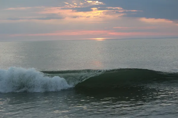
Provincetown is at the very tip of the Cape Cod peninsula region of Massachusetts. Perhaps due to being at the remote end of the Cape and because of its variety of beautiful scenes, Provincetown has attracted artists of all types over the years. One of the oldest artist colonies in America, it has produced a large number of excellent galleries, cutting edge theatre, and many unique shops. There is also the persistence of an attitude of tolerance, making Provincetown a preferred home and travel destination for many LGBTQ people.
"P-town", as it is sometimes called, also has an intriguing history as the first landing site of the Pilgrims and the place where the Mayflower Compact was signed. Fishing and whaling have also been a huge part of Provincetown's past. Its large, safe harbor and prime location made it the Cape's fishing center, with thousands of ships calling it home port.
Doable as a same-day drive at 2h 45m. Total distance: 115.2 miles.
Family Friendly
Moderate complexity with 1 natural rest stops along the way.
Solo Traveler
2h 45m drive, comfortable solo distance.
First-Time Driver
Mostly highway driving (30%). Some complex stretches to watch for.
Scenic Drive
Mixed highway & surface route profile with national parks nearby.
Frequently Asked Questions
The longest stretch is about 42.3 miles on Pilgrims Highway. The full list of main roads is in the Roads section above.
Yes, with realistic expectations. Build in a stop roughly every 2 hours, have snacks and activities ready, and check the Nearby Places tabs for kid-friendly stops along the way.
The main spots that need attention: at 26 miles (US 6 / Mid Cape Highway): Roundabout - know your exit number before entering. Multiple destination signs - pick the right one; at 113.4 miles: Exit ramp - move to the correct lane early. Lane positioning matters here. Multiple destination signs - pick the right one; at 113.9 miles: Highway fork - watch signs carefully. Lane positioning matters here.
Yes — Adams National Historical Park, Boston National Historical Park and Cape Cod National Seashore (6 total within detour distance). See the National Parks section for detour distances and tips on detours.
Yes. A round trip is manageable in a single day if you plan a break at Boston, MA before heading back.