Connecting Port Angeles to Bellingham, this 119.5-mile journey takes approximately 3 hours and 31 minutes to complete. Because the trip is well-suited for a single day, you won't need to worry about booking an overnight stay, keeping your travel plans straightforward. Budgeting around $25 for fuel covers the transit, which spans the Pacific Coast region. You will navigate via East 1st Street, State Route 20, and I-5 to reach your destination. While the route is manageable in one go, the mix of local streets and major highways means you should account for variable traffic conditions. It is a practical route for those moving between these two coastal hubs who prefer a direct, efficient path.
Trip Pace
Same-day drive is realistic
A same-day return is realistic if you keep stops short.
Break Rhythm
1 planned break
A short stop every 2 to 3 hours is enough for this drive.
Midpoint
59.8 miles from Port Angeles, WA
A natural place for your longest stop of the day
, about 2h 3m into the drive
.
Main Roads
Road
Distance
Duration
State Route 20
47.5 mi
1h 15m
East 1st Street
34.2 mi
51m
I 5
22.7 mi
26m
Port Townsend-Coupeville Ferry
5.8 mi
35m
Engle Road
3.4 mi
6m
West Sims Way
2.2 mi
5m
East Holly Street
0.6 mi
1m
South Main Street
0.6 mi
1m
Longest stretch:
State Route 20
— 47.5 mi, about 1h 15m
Turn-by-Turn Driving Directions
Step-by-step road directions between Port Angeles, WA and Bellingham, WA.
1
Start on this road
215 ft·20 sec·this road
2
At end of road, turn left onto US 101
150 ft·12 sec·North Lincoln Street
3
Turn left onto US 101
34 mi·51 min·East 1st Street
4
Turn left onto WA 20
476 ft·7 sec·State Highway 20
5
Continue on WA 20
7.7 mi·11 min·State Route 20
6
Continue on WA 20
2.1 mi·3 min·State Route 20
7
Continue on WA 20
0.4 mi·45 sec·West Sims Way
8
Enter roundabout onto WA 20
99 ft·1 sec·West Sims Way
9
Continue on WA 20
0.3 mi·40 sec·West Sims Way
10
Enter roundabout onto WA 20
102 ft·2 sec·West Sims Way
11
Continue on WA 20
1.5 mi·3 min·West Sims Way
12
Enter roundabout onto East Sims Way
88 ft·1 sec·East Sims Way
13
Continue on East Sims Way
0.2 mi·26 sec·East Sims Way
14
Continue on WA 20
0.3 mi·52 sec·Water Street
15
Turn right onto WA 20
96 ft·2 sec·Ferry Dock
Use the right lane.
16
Keep slight right at fork onto WA 20
483 ft·10 sec·Ferry Dock
17
At end of road, turn right onto WA 20
159 ft·3 sec·Port Townsend Slip 2
18
Continue on WA 20
5.8 mi·35 min·Port Townsend-Coupeville Ferry
19
Continue on WA 20
239 ft·11 sec·State Route 20
20
At end of road, turn left onto Engle Road
0.8 mi·2 min·Engle Road
21
Keep slight left at fork onto Engle Road
2.6 mi·4 min·Engle Road
22
Continue on South Main Street
0.6 mi·1 min·South Main Street
23
Turn left onto WA 20
9.5 mi·14 min·State Route 20
24
Turn left onto WA 20
3.1 mi·6 min·State Route 20
25
Enter roundabout onto WA 20
72 ft·1 sec·State Route 20
26
Continue on WA 20
4.7 mi·6 min·State Route 20
27
Enter roundabout onto WA 20
86 ft·1 sec·State Route 20
28
Continue on WA 20
7.9 mi·14 min·State Route 20
29
Enter roundabout onto WA 20
140 ft·3 sec·State Route 20
30
Continue on WA 20
0.6 mi·1 min·State Route 20
31
Keep slight left at fork onto WA 20
201 ft·4 sec·State Route 20
Toward Anacortes City Center, San Juans FerryUse the slight left / slight right lanes.
32
Enter roundabout onto WA 20
17 ft·0 sec·State Route 20
33
Continue on WA 20
12 mi·16 min·State Route 20
34
Take the exit
0.4 mi·49 sec
35
Merge onto I 5
23 mi·26 min·I 5
36
Take the exit
0.1 mi·27 sec
Exit 253Toward Lakeway Drive
37
Turn right onto King Street
471 ft·9 sec·King Street
38
Turn right onto Lakeway Drive
0.4 mi·1 min·Lakeway Drive
39
Continue on East Holly Street
0.6 mi·1 min·East Holly Street
40
Turn right onto Bay Street
77 ft·2 sec·Bay Street
41
Turn left onto Prospect Street
0.3 mi·38 sec·Prospect Street
42
Continue on Dupont Street
0.5 mi·1 min·Dupont Street
43
Arrive at destination
Dupont Street
Trip Plan
Planning for a single stop is your best strategy to keep the 3 hour and 31 minute trip comfortable. Since you are covering 119.5 miles, try to time your departure to avoid peak traffic periods on the highway portions of the route. Keep in mind that State Route 20 requires your full attention, so plan your rest break during the transition to I-5 to stay alert. Flexibility is a major advantage here; because the drive is relatively short, you can easily adjust your pace without feeling rushed. Take advantage of the $25 fuel budget to fill up before hitting the longest 47.5-mile stretch to ensure a smooth, uninterrupted ride.
Morning Departure
An early start around 7-8 AM gets you there with plenty of daylight left.
Evening Departure
A late afternoon start means arriving after dark. Morning is better.
You can normally do this drive in one day.
Plan roughly 1 meaningful break for fuel, food, and rest.
The halfway point lands around 59.8 miles from Port Angeles, WA, or about 2h 3m into the drive.
The longest continuous stretch on this route runs about 47.5 miles.
This is a comfortable same-day trip.
Departure
Before you leave
Start with fuel, water, and navigation already sorted so the first hour feels easy.
First stop
Around 26 miles or 39m in
Use this first pause for coffee, a restroom break, and a quick traffic check ahead.
Halfway reset
Around 59.8 miles or 2h 3m in
This is the best place for your longest stop, a real meal, and a full fuel check.
Final approach
Final hour starts around 3h 2m
Traffic, exits, and arrival timing usually matter more near Bellingham, WA than in the middle of the route.
Before You Leave
+
Open the route before leaving Port Angeles, WA so your first major turns are already loaded.
+
Leave with enough water and a charging cable within reach, not packed away.
+
Check your fuel range against the first long segment, especially if you are starting outside city service areas.
Day 1
Settle into the route from Port Angeles, WA
This is one driving day of about 119.5 miles and 3h 31m.
Your first comfortable stop window is around 26 miles from Port Angeles, WA.
This route can stay practical as a one-day drive if traffic stays reasonable.
Plan about 1 real break rather than only quick fuel stops.
The longest stretch is on State Route 20 for about 47.5 miles.
Where to Stop
Rest stops, refuel points, and overnight suggestions along this route.
Place data sourced from public business listings. Hours and availability may vary.
Heads-up: tricky spots
5 of 23
5 decision points cluster between mile 0 and 82.8 — GPS handles the exact turns, but know they're coming. Your lane choice matters more than the turn itself.
5
0 mi into trip|~0m in|US 101 / North Lincoln Street
At end of road, turn left onto US 101 / North Lincoln Street
Navigation decision point
5
44.8 mi into trip|~1h 9m in|WA 20 / West Sims Way
Enter roundabout onto WA 20 / West Sims Way
Roundabout - know your exit number before entering
7
46.8 mi into trip|~1h 14m in|WA 20 / Ferry Dock
Turn right onto WA 20 / Ferry Dock
Lane positioning matters here
Use the right lane.
6
46.9 mi into trip|~1h 14m in|WA 20 / Port Townsend Slip 2
At end of road, turn right onto WA 20 / Port Townsend Slip 2
Complex interchange - multiple decisions in a short stretch
8
82.8 mi into trip|~2h 41m in|WA 20 / State Route 20
Keep slight left at fork onto WA 20 / State Route 20 toward Anacortes City Center, San Juans Ferry
Highway fork - watch signs carefully. Lane positioning matters here. Multiple destination signs - pick the right one
Use the slight left / slight right lanes.
Toward Anacortes City Center, San Juans Ferry
Fuel & Cost
Regular Gas
$25.01 one way
$50.02 round trip
$5.32/gal25.4 MPG avg42 kg CO2
Fuel Type
$/gal
One Way
Round Trip
midgrade
$5.58
$26.23
$52.46
premium
$5.77
$27.14
$54.27
diesel
$5.61
$26.38
$52.77
No toll roads detected on this route.
Estimated Trip Cost (one way, 1 person)
Fuel
$25
Meals
$25–$50
Total
$50–$75
Rough estimate based on US averages. Hotel $80–$140/night, meals $25–$50/day.
Estimated CO2 emission: 41.8 kg one way.
Prices: EIA weekly data, 2026-04-13.
Driving Electric?
About $13 in charging
· 0 stops
· 67% less CO2
Vehicle Type
kWh
Stops
DC Fast
Home Charge
Average EV
35.9
0
$12.55
$5.74
Efficient EV
29.9
0
$10.46
$4.78
EV Truck/SUV
47.8
0
$16.73
$7.65
Gas CO2
42 kg
EV CO2
14 kg (67% less)
This trip is well within single-charge range for most EVs. No charging stops needed if you start fully charged.
DC fast charging avg $0.35/kWh. Home charging avg $0.16/kWh. US grid CO2: 0.39 kg/kWh.
Travel Intel
Current conditions at both ends of the drive.
Forecast as of Apr 15, 2026
Origin
Port Angeles, WA
Evening
in Port Angeles on Saturday
Local time
7:54 PM
PDT
Current temp
62°F
Unavailable
Live forecast
Destination
Bellingham, WA
Evening
in Bellingham on Saturday
Local time
7:54 PM
PDT
Current temp
59°F
Unavailable
Live forecast
Seasonal Notes
Summer travel usually means heavier construction, hotter rest stops, and busier weekend traffic around major cities.
Winter travel shortens daylight, so a route that looks manageable on paper can feel much longer after dark.
Holiday weekends tend to make both departure and arrival windows slower than the raw route time suggests.
Time zone
Same local time
Origin and destination are on the same clock, so arrival timing is easier to judge at a glance.
Temperature spread
3 degrees cooler at arrival
A meaningful temperature swing is a good cue to rethink layers, water, and how soon you want to arrive.
Road read
3h 31m on the road
Use the two city cards together: check the sky where you start, then compare it with the local time and temperature at arrival.
Weather data from the National Weather Service. Conditions may change; check closer to your travel date.
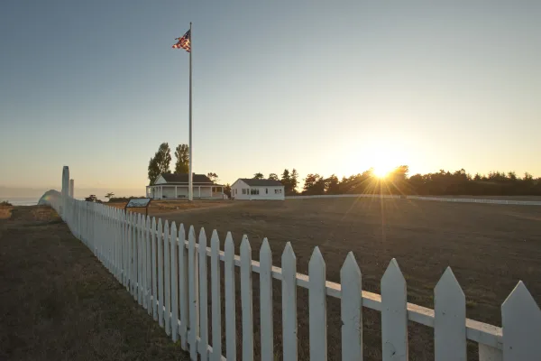
National Parks Near This Route
Worth a detour if your schedule allows.
San Juan Island National Historical Park
National Historical Park
San Juan Island is well known for its splendid vistas, saltwater shores, quiet woodlands, orca whales and one of the last remaining native prairies in the Puget Sound/Northern Straits region. But it w...
21 mi from route
~52 min detour
Free
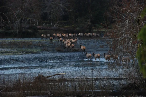
near mile 78.3
With its incredible range of precipitation and elevation, diversity is the hallmark of Olympic National Park. Encompassing nearly a million acres, the park protects a vast wilderness, thousands of yea...
Park data from the National Park Service API. Alerts update every 2 hours.
More Details
What kind of drive is this?
This trip offers a mixed driving profile that transitions from local roads to major arterials. You will spend roughly 59% of your time on highways, balancing the slower pace of local transit with the efficiency of I-5. The longest uninterrupted segment occurs on State Route 20, where you can settle in for a 47.5-mile stretch. Expect the character of the road to shift as you move from the initial local streets onto the more structured highway system. Behind the wheel, you will experience a functional blend of road types that keeps the drive from feeling like a monotonous interstate grind.
59% highway, the rest on surface roads — varied driving throughout.
43 navigation steps total — most of the decisions cluster near the start and finish.
Longest single stretch: 47.5 mi on State Route 20.
How Hard Is This Drive?
6/10
This route mixes highway mileage with some local-road sections near the start or finish. You will hit about 23 points where you need to pay attention to lane position or signs. The trickiest moment comes early in the drive near US 101 / North Lincoln Street.
Driving Effort6/10
Moderate - straightforward overall, but long enough or busy enough to require pacing
Balances navigation complexity with total wheel time.
This drive requires moderate attention. Across 119.5 miles you will encounter 23 spots where lane choice or exit timing matters. Not difficult for experienced highway drivers, but worth previewing the tricky sections before you go.
Where does it get tricky?
The main spots that need attention: near the start (US 101 / North Lincoln Street): Navigation decision point; at 44.8 miles (WA 20 / West Sims Way): Roundabout - know your exit number before entering; at 46.8 miles (WA 20 / Ferry Dock): Lane positioning matters here.
Elevation Profile
Mostly flat terrain
312 ft0 ft
Total Climb
683 ft
Total Descent
654 ft
Highest Point
312 ft
~102.4 mi in
Elevation Range
312 ft
Towns Mentioned on Route Signs
Based on OSRM destination-sign hints, not a full list of every settlement the road passes.
Between Port Angeles, WA and Bellingham, WA, road signs point toward Anacortes City Center and San Juans Ferry.
Anacortes City Center
82.8 mi in|~2h 41m|via WA 20
San Juans Ferry
82.8 mi in|~2h 41m|via WA 20
Who Is This Route For?
Weekend Trip
Doable as a same-day drive at 3h 31m. Total distance: 119.5 miles.
Family Friendly
Moderate complexity with 1 natural rest stops along the way.
Solo Traveler
3h 31m drive, comfortable solo distance.
Scenic Drive
Mixed highway & surface route profile with national parks nearby.
Frequently Asked Questions
The longest stretch is about 47.5 miles on State Route 20. The full list of main roads is in the Roads section above.
We did not find dedicated rest areas on this route. For a drive this long, plan bathroom and stretch breaks around gas stations, fast-food stops, or small-town downtowns — check the Nearby Places section for options.
It helps. This route has a higher-than-average number of complex decision points, which get harder in the dark. If the last hour of the trip is on surface roads or mountain grades, aim to arrive at Bellingham, WA before sunset when you can. Check the Trip Plan for departure windows that land you in daylight.
Only with planning. This is a long drive for kids — consider splitting it into two days rather than pushing through. Plan at least 1 meaningful breaks. Dedicated rest areas are limited, so plan gas or food stops as your bathroom breaks.
The main spots that need attention: near the start (US 101 / North Lincoln Street): Navigation decision point; at 44.8 miles (WA 20 / West Sims Way): Roundabout - know your exit number before entering; at 46.8 miles (WA 20 / Ferry Dock): Lane positioning matters here.
Yes — San Juan Island National Historical Park and Olympic National Park. See the National Parks section for detour distances and tips on detours.
Possible but tiring. At 3.5 hours each way, an in-and-out day trip would put you behind the wheel for 7.0 hours — manageable with a long break at Bellingham, WA, but most travelers stay overnight.