Phoenix to Sierra Vista is 185.8 miles and takes about 3h 24m via Casa Grande-Tucson Highway, with a fuel budget near $37 and enough daylight to finish in a day. This trip stays within Arizona's Desert Southwest region, offering a straightforward drive through varied desert landscapes. With a low highway share, expect a good portion of your travel to be on surface roads, making it a less intense driving experience. This route is well-suited for a single-day excursion, allowing you to reach your destination without needing an overnight stop.
Trip Pace
Same-day drive is realistic
A same-day return is realistic if you keep stops short.
Break Rhythm
1 planned break
A short stop every 2 to 3 hours is enough for this drive.
Midpoint
92.9 miles from Phoenix, AZ
A natural place for your longest stop of the day
, about 1h 40m into the drive
.
Main Roads
Road
Distance
Duration
Casa Grande-Tucson Highway
54.6 mi
55m
Tucson-Benson Highway
41.4 mi
43m
Phoenix-Casa Grande Highway
37.8 mi
38m
State Route 90
14.9 mi
17m
Maricopa Freeway
14 mi
16m
Huachuca Boulevard
9.1 mi
10m
North Freeway
6.1 mi
6m
North Huachuca Boulevard
2.2 mi
3m
Longest stretch:
Casa Grande-Tucson Highway
— 54.6 mi, about 55m
Turn-by-Turn Driving Directions
Step-by-step road directions between Phoenix, AZ and Sierra Vista, AZ.
1
Start on West Washington Street
322 ft·18 sec·West Washington Street
2
Turn left onto South 1st Avenue
436 ft·9 sec·South 1st Avenue
Use the left lane.
3
Keep slight left at fork onto South 1st Avenue
350 ft·14 sec·South 1st Avenue
4
Turn left onto West Madison Street
0.1 mi·31 sec·West Madison Street
5
At end of road, turn right onto South 1st Street
0.3 mi·55 sec·South 1st Street
6
Turn left onto East Lincoln Street
0.4 mi·1 min·East Lincoln Street
7
Turn right onto South 7th Street
0.9 mi·2 min·South 7th Street
Use the right lane.
8
Turn left onto East Maricopa Freeway
290 ft·8 sec·East Maricopa Freeway
Use the left lane.
9
Take the ramp
0.2 mi·27 sec
Toward I 17 South, US 60 EastUse the slight left lane.
10
Merge onto I 17; US 60
14 mi·16 min·Maricopa Freeway
Use the straight / slight right lanes.
11
Continue on I 10
38 mi·38 min·Phoenix-Casa Grande Highway
Use the straight / slight right lanes.
12
Continue on I 10
55 mi·55 min·Casa Grande-Tucson Highway
Use the straight / slight right lanes.
13
Continue on I 10
6.1 mi·6 min·North Freeway
Use the straight / slight right lanes.
14
Continue on I 10
41 mi·43 min·Tucson-Benson Highway
Use the straight / slight right lanes.
15
Take the exit
0.6 mi·1 min
Exit 302Toward AZ 90 East: Fort Huachuca, Sierra Vista
16
Turn right onto AZ 90
1.2 mi·1 min·South State Highway 90
17
Continue on AZ 90
9.1 mi·10 min·Huachuca Boulevard
18
Continue on AZ 90
12 mi·14 min·State Route 90
19
Continue on AZ 90
2.2 mi·3 min·North Huachuca Boulevard
20
Continue on AZ 90
3.0 mi·3 min·State Route 90
21
Continue on Buffalo Soldier Trail
0.4 mi·35 sec·Buffalo Soldier Trail
22
Continue on Buffalo Solder Trail
0.8 mi·1 min·Buffalo Solder Trail
23
Turn straight onto Buffalo Soldier Trail
0.3 mi·39 sec·Buffalo Soldier Trail
24
Turn left onto West Fry Boulevard
380 ft·9 sec·West Fry Boulevard
25
Continue on West Fry Boulevard
0.1 mi·19 sec·West Fry Boulevard
26
Turn left
59 ft·4 sec
27
Arrive at destination
Trip Plan
Given the 3h 24m duration, leaving Phoenix in the morning allows ample time to reach Sierra Vista before evening. With only one recommended stop and a fuel cost around $37, this is an easy day trip. Pay attention to speed limit changes as you move from highway to surface roads, especially during the 54.6-mile stretch on the Casa Grande-Tucson Highway. Since the drive is manageable in one day, you have flexibility to depart when it's most convenient for you, perhaps after the morning rush hour.
Morning Departure
An early start around 7-8 AM gets you there with plenty of daylight left.
Evening Departure
A late afternoon start means arriving after dark. Morning is better.
You can normally do this drive in one day.
Plan roughly 1 meaningful break for fuel, food, and rest.
The halfway point lands around 92.9 miles from Phoenix, AZ, or about 1h 40m into the drive.
The longest continuous stretch on this route runs about 54.6 miles.
This is a comfortable same-day trip.
Departure
Before you leave
Start with fuel, water, and navigation already sorted so the first hour feels easy.
First stop
Around 41 miles or 47m in
Use this first pause for coffee, a restroom break, and a quick traffic check ahead.
Halfway reset
Around 92.9 miles or 1h 40m in
This is the best place for your longest stop, a real meal, and a full fuel check.
Final approach
Final hour starts around 2h 42m
Traffic, exits, and arrival timing usually matter more near Sierra Vista, AZ than in the middle of the route.
Before You Leave
+
Open the route before leaving Phoenix, AZ so your first major turns are already loaded.
+
Leave with enough water and a charging cable within reach, not packed away.
+
Check your fuel range against the first long segment, especially if you are starting outside city service areas.
Day 1
Settle into the route from Phoenix, AZ
This is one driving day of about 185.8 miles and 3h 24m.
Your first comfortable stop window is around 41 miles from Phoenix, AZ.
This route can stay practical as a one-day drive if traffic stays reasonable.
Plan about 1 real break rather than only quick fuel stops.
The longest stretch is on Casa Grande-Tucson Highway for about 54.6 miles.
Where to Stop
Rest stops, refuel points, and overnight suggestions along this route.
Place data sourced from public business listings. Hours and availability may vary.
Heads-up: tricky spots
5 of 13
5 decision points cluster between mile 0.1 and 156.1 — GPS handles the exact turns, but know they're coming. Your lane choice matters more than the turn itself.
7
0.1 mi into trip|~0m in|South 1st Avenue
Turn left onto South 1st Avenue
Lane positioning matters here
Use the left lane.
5
0.1 mi into trip|~0m in|South 1st Avenue
Keep slight left at fork onto South 1st Avenue
Highway fork - watch signs carefully
6
2 mi into trip|~5m in|East Maricopa Freeway
Turn left onto East Maricopa Freeway
Lane positioning matters here
Use the left lane.
7
2 mi into trip|~5m in
Take the ramp toward I 17 South, US 60 East
Lane positioning matters here. Multiple destination signs - pick the right one
Use the slight left lane.
Toward I 17 South, US 60 East
6
156.1 mi into trip|~2h 46m in
Take the exit toward AZ 90 East: Fort Huachuca, Sierra Vista
Exit ramp - move to the correct lane early. Multiple destination signs - pick the right one
Exit 302
Toward AZ 90 East: Fort Huachuca, Sierra Vista
Fuel & Cost
Regular Gas
$37.01 one way
$74.03 round trip
$5.06/gal25.4 MPG avg65 kg CO2
Fuel Type
$/gal
One Way
Round Trip
midgrade
$5.36
$39.17
$78.34
premium
$5.59
$40.90
$81.80
diesel
$5.61
$41.02
$82.04
No toll roads detected on this route.
Estimated Trip Cost (one way, 1 person)
Fuel
$37
Meals
$25–$50
Total
$62–$87
Rough estimate based on US averages. Hotel $80–$140/night, meals $25–$50/day.
Estimated CO2 emission: 65 kg one way.
Prices: EIA weekly data, 2026-04-13.
Driving Electric?
About $20 in charging
· 0 stops
· 66% less CO2
Vehicle Type
kWh
Stops
DC Fast
Home Charge
Average EV
55.7
0
$19.51
$8.92
Efficient EV
46.5
0
$16.26
$7.43
EV Truck/SUV
74.3
0
$26.01
$11.89
Gas CO2
65 kg
EV CO2
22 kg (66% less)
This trip is well within single-charge range for most EVs. No charging stops needed if you start fully charged.
DC fast charging avg $0.35/kWh. Home charging avg $0.16/kWh. US grid CO2: 0.39 kg/kWh.
Travel Intel
Current conditions at both ends of the drive.
Forecast as of Apr 15, 2026
Origin
Phoenix, AZ
Evening
in Phoenix on Saturday
Local time
7:49 PM
MST
Current temp
93°F
Unavailable
Live forecast
Destination
Sierra Vista, AZ
Evening
in Sierra Vista on Saturday
Local time
7:49 PM
MST
Current temp
51°F
Unavailable
Live forecast
Seasonal Notes
Summer travel usually means heavier construction, hotter rest stops, and busier weekend traffic around major cities.
Winter travel shortens daylight, so a route that looks manageable on paper can feel much longer after dark.
Holiday weekends tend to make both departure and arrival windows slower than the raw route time suggests.
Time zone
Same local time
Origin and destination are on the same clock, so arrival timing is easier to judge at a glance.
Temperature spread
42 degrees cooler at arrival
A meaningful temperature swing is a good cue to rethink layers, water, and how soon you want to arrive.
Road read
3h 24m on the road
Use the two city cards together: check the sky where you start, then compare it with the local time and temperature at arrival.
Weather data from the National Weather Service. Conditions may change; check closer to your travel date.
National Parks Near This Route
Worth a detour if your schedule allows.
Saguaro National Park
National Park
Tucson, Arizona is home to the nation's largest cacti. The giant saguaro is the universal symbol of the American west. These majestic plants, found only in a small portion of the United States, are pr...
9 mi from route
~23 min detour
$25
near mile 121.7
Park Closure: Red Hills Visitor Center (TMD) theater closed for repairs
An Ancestral Sonoran Desert People's farming community and "Great House" are preserved at Casa Grande Ruins. Whether a gathering place for people or simply a waypoint marker in an extensive system of...
11 mi from route
~27 min detour
Free
near mile 44.8
It was a journey of conquest filled with exploration, wonder - and cruelty. Inspired by tales of vast cities of gold, 339 European soldiers and over a thousand Aztec allies embarked on an epic journey...
14 mi from route
~36 min detour
Free
near mile 185.8
Park data from the National Park Service API. Alerts update every 2 hours.
More Details
What kind of drive is this?
This drive is primarily on surface roads, making up 80% of the total mileage. You'll encounter a longest stretch of 54.6 miles on the Casa Grande-Tucson Highway before transitioning to surface roads. The relatively low highway share means you'll experience more local traffic and frequent changes in speed limits. Expect to navigate through more developed areas with denser exits before reaching more rural cruising.
Only 20% highway — the rest is turn-by-turn surface driving.
27 navigation steps total — most of the decisions cluster near the start and finish.
Longest single stretch: 54.6 mi on Casa Grande-Tucson Highway.
How Hard Is This Drive?
5/10
Expect a hands-on drive with frequent turns and local roads rather than long highway stretches. You will hit about 13 points where you need to pay attention to lane position or signs. The trickiest moment comes around 0.1 miles in near South 1st Avenue.
Driving Effort5/10
Moderate - straightforward overall, but long enough or busy enough to require pacing
Balances navigation complexity with total wheel time.
This drive requires moderate attention. Across 185.8 miles you will encounter 13 spots where lane choice or exit timing matters. Not difficult for experienced highway drivers, but worth previewing the tricky sections before you go.
Where does it get tricky?
The main spots that need attention: at 0.1 miles (South 1st Avenue): Lane positioning matters here; at 0.1 miles (South 1st Avenue): Highway fork - watch signs carefully; at 2 miles (East Maricopa Freeway): Lane positioning matters here.
Phoenix is the capital of the state of Arizona, the most populous city in the American Southwest. Warm and sunny winter weather have ensured a thriving tourism industry, and the city has become the region's primary political, cultural, economic, and transportation center. Phoenix is extremely hot and dry in the summertime, so always have sunscreen with you! It had about 1,625,000 residents in 2021, and is the fifth largest city in the United States.
Top landmarks
•Arizona State Capitol — state capitol building of the U.S. state of Arizona
•Phoenix Art Museum — art museum in Phoenix, Arizona
•St. Mary's Basilica — Roman Catholic church in Phoenix, Arizona
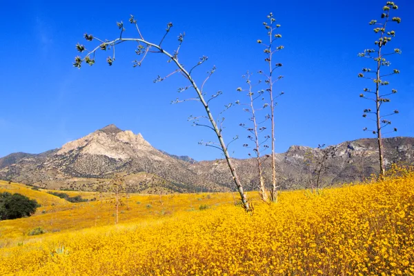
Sierra Vista (Spanish: Mountain View) is a city in Southeast Arizona and the commercial hub of the region, making it a convenient base from which to explore the area. It is perhaps best known for historic Fort Huachuca, established in 1877 during the Apache Wars. Although still an active U.S. Army military base, its two military museums and historic cemetery are open to the general public.
The landscape around the city is typical for the Southwestern United States, and the nearby mountains and canyons can be explored on foot, by bike, or on horseback. Because it is a major stopover point on avian migration routes, the area is popular with avid birdwatchers and naturalists, and is known as the "Hummingbird Capital of America".
Doable as a same-day drive at 3h 24m. Total distance: 185.8 miles.
Family Friendly
Moderate complexity with 1 natural rest stops along the way.
Solo Traveler
3h 24m drive, comfortable solo distance.
First-Time Driver
Mostly highway driving (20%). Some complex stretches to watch for.
Scenic Drive
Mostly surface roads route profile with national parks nearby.
Frequently Asked Questions
The longest stretch is about 54.6 miles on Casa Grande-Tucson Highway. The full list of main roads is in the Roads section above.
Yes — we found about 19 rest areas or service plazas within a short detour of the route (from OpenStreetMap). See the Rest Stops tab under Nearby Places for locations and mile markers. Plan to stretch, use the bathroom, and top off fluids every 2–3 hours on longer drives.
Yes, with realistic expectations. Build in a stop roughly every 2 hours, have snacks and activities ready, and check the Nearby Places tabs for kid-friendly stops along the way.
The main spots that need attention: at 0.1 miles (South 1st Avenue): Lane positioning matters here; at 0.1 miles (South 1st Avenue): Highway fork - watch signs carefully; at 2 miles (East Maricopa Freeway): Lane positioning matters here.
Yes — Saguaro National Park, Casa Grande Ruins National Monument and Coronado National Memorial. See the National Parks section for detour distances and tips on detours.
Possible but tiring. At 3.4 hours each way, an in-and-out day trip would put you behind the wheel for 6.8 hours — manageable with a long break at Sierra Vista, AZ, but most travelers stay overnight.