This 550.1-mile journey from Osceola, MI to Macomb, MI is a significant undertaking, estimated to take around 10 hours and 46 minutes of driving time. Given its length and profile as a long-distance drive, it's best planned as a two-day trip, allowing for a more relaxed pace and necessary rest. The route primarily utilizes I-75, along with Townsend Drive and M-28, with highways making up 62% of the total mileage. With an estimated fuel cost of $86 and three recommended stops, this drive through the Midwest region of Michigan is a practical option for those needing to cover ground efficiently. Consider this a straightforward travel day with plenty of opportunities to break up the journey.
Trip Pace
Best split across 2 days
Treat the return leg as its own travel day rather than an afterthought.
Break Rhythm
3 planned breaks
Plan on a short reset every 3 to 4 hours to stay fresh behind the wheel.
Midpoint
275 miles from Osceola, MI
A natural place for your longest stop of the day
, about 5h 48m into the drive
.
Main Roads
Road
Distance
Duration
I 75
262 mi
4h 31m
Townsend Drive
84 mi
1h 47m
M-28
70.9 mi
1h 24m
US 2
65.1 mi
1h 15m
M 77
17.3 mi
20m
Palms Avenue
10.2 mi
14m
US-41
8.4 mi
11m
25 Mile Road
6.9 mi
10m
Longest stretch:
I 75
— 262 mi, about 4h 31m
Turn-by-Turn Driving Directions
Step-by-step road directions between Osceola, MI and Macomb, MI.
1
Start on A Street
90 ft·7 sec·A Street
2
Turn right onto US 41
1.1 mi·1 min·County Road
3
Continue on US 41
8.4 mi·11 min·US-41
4
Continue on US 41
0.4 mi·51 sec·North Lincoln Drive
5
Turn left onto Scott Street
0.3 mi·1 min·Scott Street
6
At end of road, turn left onto US 41
0.6 mi·1 min·Hancock Street
Use the straight / right lanes.
7
Merge onto US 41
0.2 mi·26 sec·Front Street
Use the straight / slight right lanes.
8
Continue on US 41; M 26
0.3 mi·1 min·Houghton-Hancock Lift Bridge
9
Turn left onto US 41
276 ft·8 sec·US 41 South
Toward US 41 South: Marquette
10
Continue on US 41
0.6 mi·1 min·West Montezuma Avenue
Use the straight lane.
11
Merge onto US 41
0.4 mi·1 min·College Avenue
12
Continue on US 41
84 mi·1 hr 47 min·Townsend Drive
Use the left / straight lanes.
13
Enter roundabout onto US 41; M 28
92 ft·5 sec·US 41; M 28
14
Continue on US 41; M 28
0.9 mi·1 min·US 41; M 28
15
Enter roundabout onto US 41; M 28
94 ft·5 sec·Palms Avenue
16
Continue on US 41; M 28
10 mi·14 min·Palms Avenue
17
Enter roundabout onto US 41; M 28
116 ft·6 sec·US-41/M-28
18
Continue on US 41; M 28
0.5 mi·45 sec·US-41/M-28
19
Enter roundabout onto US 41; M 28
103 ft·6 sec·US-41/M-28
20
Continue on US 41; M 28
1.6 mi·2 min·US-41/M-28
21
Continue on US 41; M 28
1.0 mi·1 min·Marquette Bypass
22
Enter roundabout onto US 41; M 28
109 ft·6 sec·Marquette Bypass
23
Continue on US 41; M 28
0.2 mi·14 sec·Marquette Bypass
24
Enter roundabout onto US 41; M 28
107 ft·1 sec·Marquette Bypass
25
Continue on US 41; M 28
0.5 mi·52 sec·Marquette Bypass
26
Take the exit onto US 41; M 28
410 ft·10 sec·US 41; M 28
27
Merge onto US 41; M 28
2.6 mi·4 min·South Front Street
28
Continue on US 41; M 28
1.6 mi·2 min·US-41/M-28
29
Turn left onto M 28
36 mi·42 min·M-28
30
Continue on M 28
2.2 mi·4 min·West Munising Avenue
31
Continue on M 28
0.2 mi·22 sec·Cedar Street
32
Continue on M 28
35 mi·41 min·M-28
33
Turn sharp right onto M 77
17 mi·20 min·M 77
34
At end of road, turn left onto US 2
65 mi·1 hr 15 min·US 2
35
Take the exit
0.3 mi·44 sec
Toward I 75 South: Mackinac Bridge
36
Merge onto I 75
94 mi·1 hr 37 min·I 75
37
Keep slight left at fork onto I 75
124 mi·2 hr 7 min·I 75
Toward I 75: Saginaw, Detroit
38
Keep slight left at fork onto I 75; US 23
11 mi·11 min·I 75; US 23
39
Keep slight left at fork onto I 75
33 mi·35 min·I 75
40
Take the exit
0.6 mi·1 min
Exit 81Toward I 75 Business, M 24: Pontiac, LapeerUse the slight right lane.
41
Continue on I 75 BL
0.2 mi·27 sec·I 75 BL
42
Keep slight right at fork onto I 75 BL
0.6 mi·57 sec·I 75 BL
Toward I 75 Business South: Pontiac
43
Turn left
88 ft·3 sec
Use the left lane.
44
Turn left
154 ft·7 sec
45
Continue on Shimmons Road
0.5 mi·1 min·Shimmons Road
46
At end of road, turn left onto Shimmons Road
0.6 mi·1 min·Shimmons Road
47
At end of road, turn left onto North Squirrel Road
0.3 mi·37 sec·North Squirrel Road
48
Turn right onto Tienken Road
3.5 mi·6 min·Tienken Road
Use the right lane.
49
Enter roundabout onto West Tienken Road
128 ft·3 sec·West Tienken Road
50
Continue on West Tienken Road
1.6 mi·3 min·West Tienken Road
Use the straight / left lanes.
51
Enter roundabout onto East Tienken Road
159 ft·5 sec·East Tienken Road
52
Continue on East Tienken Road
0.6 mi·1 min·East Tienken Road
53
Enter roundabout onto Runyon Road
150 ft·3 sec·Runyon Road
54
Continue on Runyon Road
0.9 mi·1 min·Runyon Road
55
Continue on 25 Mile Road
6.0 mi·9 min·25 Mile Road
56
Enter roundabout onto 25 Mile Road
150 ft·4 sec·25 Mile Road
57
Continue on 25 Mile Road
0.9 mi·1 min·25 Mile Road
58
Enter roundabout
270 ft·7 sec
59
Arrive at destination
Trip Plan
For this 550.1-mile drive, breaking it into two days is highly recommended to avoid fatigue. Aim to depart early in the morning on your first day to maximize daylight driving and reach your overnight stop with ample time to relax. When planning your stops, remember you have three recommended breaks, which should be spaced out to coincide with your longest stretches, particularly the 262-mile segment on I-75. With a fuel cost estimate of $86, be sure to monitor your fuel levels, especially before entering longer stretches where services might be less frequent. A good target for your first day's drive would be around the halfway point to ensure a manageable second day into Macomb.
Morning Departure
Start early — leave by 6-7 AM to arrive at a reasonable hour.
Evening Departure
This is a long drive — plan for a morning departure or consider splitting it into two days.
This drive is better paced as a 2-day trip.
Plan roughly 3 meaningful breaks for fuel, food, and rest.
The halfway point lands around 275 miles from Osceola, MI, or about 5h 48m into the drive.
The longest continuous stretch on this route runs about 262 miles.
Consider an overnight stop or starting very early.
Departure
Before you leave
Start with fuel, water, and navigation already sorted so the first hour feels easy.
First stop
Around 121 miles or 2h 44m in
Use this first pause for coffee, a restroom break, and a quick traffic check ahead.
Halfway reset
Around 275 miles or 5h 48m in
This is the best place for your longest stop, a real meal, and a full fuel check.
Overnight split
Day 1 wrap after about 275 miles or 5h 48m
Stop before fatigue turns the last few hours into a grind. You want day two to start fresh, not just resumed.
Final approach
Final hour starts around 9h 29m
Traffic, exits, and arrival timing usually matter more near Macomb, MI than in the middle of the route.
Before You Leave
+
Open the route before leaving Osceola, MI so your first major turns are already loaded.
+
Leave with enough water and a charging cable within reach, not packed away.
+
Check your fuel range against the first long segment, especially if you are starting outside city service areas.
+
Pick one backup stop option before the midpoint in case traffic changes your pacing.
+
Treat this as a 2-day road trip and book the overnight stop before the busiest arrival window.
Day 1
Settle into the route from Osceola, MI
Aim for roughly 275 miles and 5.4 hours of wheel time on this day.
Day 2
Finish the approach into Macomb, MI
Aim for roughly 275 miles and 5.4 hours of wheel time on this day.
Your first comfortable stop window is around 121 miles from Osceola, MI.
This route usually feels better as a 2-day drive than as one long push.
Plan about 3 real breaks rather than only quick fuel stops.
The longest stretch is on I 75 for about 262 miles.
Where to Stop
Rest stops, refuel points, and overnight suggestions along this route.
Place data sourced from public business listings. Hours and availability may vary.
Heads-up: tricky spots
5 of 36
5 decision points cluster between mile 10.3 and 536.6 — GPS handles the exact turns, but know they're coming. Your lane choice matters more than the turn itself.
6
10.3 mi into trip|~15m in|US 41 / Hancock Street
At end of road, turn left onto US 41 / Hancock Street
Lane positioning matters here
Use the straight / right lanes.
5
10.9 mi into trip|~17m in|US 41 / Front Street
Merge onto US 41 / Front Street
Merge point - match speed before joining. Lane positioning matters here
Use the straight / slight right lanes.
6
365.9 mi into trip|~7h 22m in|I 75
Keep slight left at fork onto I 75 toward I 75: Saginaw, Detroit
Highway fork - watch signs carefully. Multiple destination signs - pick the right one
Toward I 75: Saginaw, Detroit
8
533.8 mi into trip|~10h 16m in
Take the exit toward I 75 Business, M 24: Pontiac, Lapeer
Exit ramp - move to the correct lane early. Lane positioning matters here. Multiple destination signs - pick the right one
Use the slight right lane.
Exit 81
Toward I 75 Business, M 24: Pontiac, Lapeer
6
536.6 mi into trip|~10h 23m in|Tienken Road
Turn right onto Tienken Road
Lane positioning matters here
Use the right lane.
Fuel & Cost
Regular Gas
$86.00 one way
$172.00 round trip
$3.97/gal25.4 MPG avg193 kg CO2
Fuel Type
$/gal
One Way
Round Trip
midgrade
$4.36
$94.43
$188.85
premium
$4.89
$105.86
$211.72
diesel
$5.61
$121.46
$242.91
No toll roads detected on this route.
Estimated Trip Cost (one way, 1 person)
Fuel
$86
Hotel (1n)
$80–$140
Meals
$50–$100
Total
$216–$326
Rough estimate based on US averages. Hotel $80–$140/night, meals $25–$50/day.
Estimated CO2 emission: 192.5 kg one way.
Prices: EIA weekly data, 2026-04-13.
Driving Electric?
About $58 in charging
· 2 stops
· 67% less CO2
Vehicle Type
kWh
Stops
DC Fast
Home Charge
Average EV
165
2
$57.76
$26.40
Efficient EV
137.5
1
$48.13
$22.00
EV Truck/SUV
220
2
$77.01
$35.21
Gas CO2
192 kg
EV CO2
64 kg (67% less)
Plan for 2 charging stops, roughly every 270 miles. Allow 25-40 minutes per stop at a DC fast charger.
DC fast charging avg $0.35/kWh. Home charging avg $0.16/kWh. US grid CO2: 0.39 kg/kWh.
Travel Intel
Current conditions at both ends of the drive.
Forecast as of Apr 15, 2026
Origin
Osceola, MI
Night
in Osceola on Saturday
Local time
9:07 PM
EDT
Current temp
35°F
Unavailable
Live forecast
Destination
Macomb, MI
Night
in Macomb on Saturday
Local time
9:07 PM
EDT
Current temp
47°F
Unavailable
Live forecast
56°F
Flat Rock, MI
182 mi in
Seasonal Notes
Summer travel usually means heavier construction, hotter rest stops, and busier weekend traffic around major cities.
Winter travel shortens daylight, so a route that looks manageable on paper can feel much longer after dark.
Holiday weekends tend to make both departure and arrival windows slower than the raw route time suggests.
For long drives, weather on day two can matter just as much as conditions at departure, so check the whole travel window rather than only the first day.
Time zone
Same local time
Origin and destination are on the same clock, so arrival timing is easier to judge at a glance.
Temperature spread
12 degrees warmer at arrival
A meaningful temperature swing is a good cue to rethink layers, water, and how soon you want to arrive.
Road read
10h 46m on the road
This is long enough that the arrival forecast matters almost as much as departure conditions. Recheck both ends before you roll.
Weather data from the National Weather Service. Conditions may change; check closer to your travel date.
National Parks Near This Route
Worth a detour if your schedule allows.
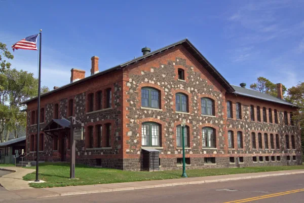
Keweenaw National Historical Park
National Historical Park
The stories of people and copper in the Keweenaw Peninsula have been intertwined for more than 7,000 years. Indigenous peoples made copper into tools and trade items. Investors and immigrants arrived...
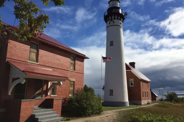
Sandstone cliffs, beaches, waterfalls, sand dunes, inland lakes, deep forest, and wild shoreline beckon you to visit Pictured Rocks National Lakeshore. The power of Lake Superior shapes the park's coa...
15 mi from route
~38 min detour
$25
near mile 170.7
Park data from the National Park Service API. Alerts update every 2 hours.
More Details
What kind of drive is this?
This route offers a driving experience that is predominantly highway-focused, with 62% of the trip on main roads. You'll encounter the longest uninterrupted stretch of 262 miles on I-75, suggesting extended periods of consistent speed. While the main roads are designed for efficiency, the inclusion of Townsend Drive and M-28 indicates some variation in road type and potentially lower speed limits in certain sections. Expect a steady pace for much of the 10-hour-plus drive, with the highway segments forming the backbone of this long-distance travel plan.
62% highway — fuel and pacing are the main things to plan.
59 navigation steps total — most of the decisions cluster near the start and finish.
Longest single stretch: 262 mi on I 75.
How Hard Is This Drive?
10/10
At 10h 46m, this is a long-haul route where pacing matters more than any single turn. This route has several spots where lane changes, forks, or exits need your full attention. The trickiest moment comes around 10.3 miles in near US 41 / Hancock Street.
Driving Effort10/10
High effort - long or complex enough to need steady focus all day
Balances navigation complexity with total wheel time.
This is a demanding drive. With 36 significant decision points across 550.1 miles, you will need to stay alert - especially through interchange areas and urban stretches. Consider splitting it into segments if you are not comfortable with fast highway navigation.
Where does it get tricky?
The main spots that need attention: at 10.3 miles (US 41 / Hancock Street): Lane positioning matters here; at 10.9 miles (US 41 / Front Street): Merge point - match speed before joining. Lane positioning matters here; at 365.9 miles (I 75): Highway fork - watch signs carefully. Multiple destination signs - pick the right one.
Towns Mentioned on Route Signs
Based on OSRM destination-sign hints, not a full list of every settlement the road passes.
On the drive from Osceola, MI to Macomb, MI, road signs begin pointing toward Detroit along the way.
Detroit
365.9 mi in|~7h 22m|via I 75
Frequently Asked Questions
The longest stretch is about 262 miles on I 75. The full list of main roads is in the Roads section above.
Yes — a 2-day pace is more comfortable than one long haul. A sensible stopping point is after roughly 275 miles on day one.
We did not find dedicated rest areas on this route. For a drive this long, plan bathroom and stretch breaks around gas stations, fast-food stops, or small-town downtowns — check the Nearby Places section for options.
It helps. This route has a higher-than-average number of complex decision points, which get harder in the dark. If the last hour of the trip is on surface roads or mountain grades, aim to arrive at Macomb, MI before sunset when you can. Check the Trip Plan for departure windows that land you in daylight.
Only with planning. This is a long drive for kids — consider splitting it into two days rather than pushing through. Plan at least 3 meaningful breaks. Dedicated rest areas are limited, so plan gas or food stops as your bathroom breaks.
The main spots that need attention: at 10.3 miles (US 41 / Hancock Street): Lane positioning matters here; at 10.9 miles (US 41 / Front Street): Merge point - match speed before joining. Lane positioning matters here; at 365.9 miles (I 75): Highway fork - watch signs carefully. Multiple destination signs - pick the right one.
Yes — Keweenaw National Historical Park and Pictured Rocks National Lakeshore. See the National Parks section for detour distances and tips on detours.
Not recommended in a single day. At 10.8 hours each way, a round trip means 21.6 hours of driving — that is an unsafe level of fatigue for most drivers. Plan at least one night at Macomb, MI before the return drive.