Embarking from Oak Grove, Louisiana, and heading to Lafayette, Louisiana, this 240.3-mile journey takes approximately 4 hours and 45 minutes. Primarily traveling on Martin Luther King Jr Drive and Martin Luther King, Jr Highway, you'll find this drive best suited for a single day trip. With a fuel cost estimated at $36, it's an economical option for exploring within the Southeast region. The route offers a modest 11% highway share, suggesting a more local driving experience. This trip is a straightforward way to connect two points in Louisiana without extensive planning.
Trip Pace
Same-day drive is realistic
A same-day return is possible, but it will make for a full day on the road.
Break Rhythm
1 planned break
Plan on a short reset every 3 to 4 hours to stay fresh behind the wheel.
Midpoint
120.1 miles from Oak Grove, LA
A natural place for your longest stop of the day
, about 2h 33m into the drive
.
Main Roads
Road
Distance
Duration
Martin Luther King Jr Drive
90.6 mi
1h 45m
Martin Luther King, Jr Highway
76 mi
1h 17m
New Monroe Road
16.8 mi
19m
State Route 2
13.3 mi
19m
Oak Grove Highway
11 mi
16m
Veterans Memorial Expressway
8.8 mi
9m
Sterlington Road
4.2 mi
5m
Pineville Expressway
4.2 mi
5m
Longest stretch:
Martin Luther King Jr Drive
— 90.6 mi, about 1h 45m
Turn-by-Turn Driving Directions
Step-by-step road directions between Oak Grove, LA and Lafayette, LA.
1
Start on LA 2
1.1 mi·1 min·East Main Street
2
Continue on LA 2
13 mi·19 min·State Route 2
3
Continue on LA 2
11 mi·16 min·Oak Grove Highway
4
Continue on LA 2
0.5 mi·51 sec·Andrews Lane
5
Turn left onto LA 138
0.7 mi·1 min·South 14th Street
6
Continue on LA 138
1.8 mi·3 min·Mer Rouge-Collinston Road
7
Turn right onto Grabault Road
3.9 mi·6 min·Grabault Road
8
At end of road, turn left onto US 165; US 425; LA 2
0.3 mi·32 sec·Mer Rouge Road
9
Continue on US 165; US 425; LA 2
3.8 mi·5 min·East Madison Avenue
10
Continue on US 165; LA 2
17 mi·19 min·New Monroe Road
11
Continue on US 165
4.2 mi·5 min·Sterlington Road
12
Continue on US 165
91 mi·1 hr 45 min·Martin Luther King Jr Drive
13
Turn left
0.3 mi·35 sec
Toward US 165 North: Monroe
14
Merge onto US 167
4.2 mi·5 min·Pineville Expressway
15
Keep slight left at fork onto US 167
0.8 mi·1 min·US 167
Toward I 49 South, US 167 South: Opelousas
16
Merge onto I 49; US 167; US 71 BYP
76 mi·1 hr 17 min·Martin Luther King, Jr Highway
17
Continue on I 49; US 167
8.8 mi·9 min·Veterans Memorial Expressway
18
Continue on I 49; LA 182
1.9 mi·3 min·Northwest Evangeline Thruway
19
Turn right onto Jefferson Boulevard
0.2 mi·33 sec·Jefferson Boulevard
20
Continue on Rue Jefferson
0.3 mi·51 sec·Rue Jefferson
21
Turn right onto Rue Vermilion Ouest
335 ft·16 sec·Rue Vermilion Ouest
22
Arrive at destination
Rue Vermilion Ouest
Trip Plan
Given the 4-hour 45-minute duration, this trip is comfortably manageable in one day. Consider departing in the morning to allow ample time for the drive and any spontaneous stops. With only one recommended stop, you have flexibility in pacing. Keep an eye on your fuel gauge, especially before embarking on the longest stretch of 90.6 miles. A practical tip for this route is to ensure your navigation is set to prioritize local roads, as the profile indicates a significant portion will not be on major highways. The estimated fuel cost of $36 is a good budget baseline.
Morning Departure
An early start around 7-8 AM gets you there with plenty of daylight left.
Evening Departure
A late afternoon start means arriving after dark. Morning is better.
You can normally do this drive in one day.
Plan roughly 1 meaningful break for fuel, food, and rest.
The halfway point lands around 120.1 miles from Oak Grove, LA, or about 2h 33m into the drive.
The longest continuous stretch on this route runs about 90.6 miles.
This is a comfortable same-day trip.
Departure
Before you leave
Start with fuel, water, and navigation already sorted so the first hour feels easy.
First stop
Around 53 miles or 1h 14m in
Use this first pause for coffee, a restroom break, and a quick traffic check ahead.
Halfway reset
Around 120.1 miles or 2h 33m in
This is the best place for your longest stop, a real meal, and a full fuel check.
Final approach
Final hour starts around 3h 58m
Traffic, exits, and arrival timing usually matter more near Lafayette, LA than in the middle of the route.
Before You Leave
+
Open the route before leaving Oak Grove, LA so your first major turns are already loaded.
+
Leave with enough water and a charging cable within reach, not packed away.
+
Check your fuel range against the first long segment, especially if you are starting outside city service areas.
Day 1
Settle into the route from Oak Grove, LA
This is one driving day of about 240.3 miles and 4h 45m.
Your first comfortable stop window is around 53 miles from Oak Grove, LA.
This route can stay practical as a one-day drive if traffic stays reasonable.
Plan about 1 real break rather than only quick fuel stops.
The longest stretch is on Martin Luther King Jr Drive for about 90.6 miles.
Where to Stop
Rest stops, refuel points, and overnight suggestions along this route.
Place data sourced from public business listings. Hours and availability may vary.
Heads-up: tricky spots
5 of 9
5 decision points cluster between mile 25.8 and 239.7 — GPS handles the exact turns, but know they're coming. Your lane choice matters more than the turn itself.
4
25.8 mi into trip|~38m in|LA 138 / South 14th Street
Turn left onto LA 138 / South 14th Street
Navigation decision point
4
32.2 mi into trip|~49m in|US 165; US 425; LA 2 / Mer Rouge Road
At end of road, turn left onto US 165; US 425; LA 2 / Mer Rouge Road
Navigation decision point
4
147.8 mi into trip|~3h 5m in
Turn left toward US 165 North: Monroe
Navigation decision point
Toward US 165 North: Monroe
6
152.3 mi into trip|~3h 12m in|US 167
Keep slight left at fork onto US 167 toward I 49 South, US 167 South: Opelousas
Highway fork - watch signs carefully. Multiple destination signs - pick the right one
Toward I 49 South, US 167 South: Opelousas
4
239.7 mi into trip|~4h 43m in|Jefferson Boulevard
Turn right onto Jefferson Boulevard
Navigation decision point
Fuel & Cost
Regular Gas
$33.36 one way
$66.72 round trip
$3.53/gal25.4 MPG avg84 kg CO2
Fuel Type
$/gal
One Way
Round Trip
midgrade
$3.95
$37.32
$74.64
premium
$4.29
$40.58
$81.15
diesel
$4.80
$45.37
$90.75
Estimated Tolls: $0.13
Northwest Evangeline Thruway
(1.9 mi)$0.13
Toll estimates based on average 2024-2025 rates. EZ-Pass/SunPass discounts may lower the actual cost.
Estimated Trip Cost (one way, 1 person)
Fuel
$33
Tolls
$0
Meals
$25–$50
Total
$58–$83
Rough estimate based on US averages. Hotel $80–$140/night, meals $25–$50/day.
Estimated CO2 emission: 84.1 kg one way.
Prices: EIA weekly data, 2026-07-13.
Driving Electric?
About $25 in charging
· 0 stops
· 67% less CO2
Vehicle Type
kWh
Stops
DC Fast
Home Charge
Average EV
72.1
0
$25.23
$11.53
Efficient EV
60.1
0
$21.03
$9.61
EV Truck/SUV
96.1
1
$33.64
$15.38
Gas CO2
84 kg
EV CO2
28 kg (67% less)
Plan for 0 charging stops, roughly every 270 miles. Allow 25-40 minutes per stop at a DC fast charger.
DC fast charging avg $0.35/kWh. Home charging avg $0.16/kWh. US grid CO2: 0.39 kg/kWh.
Travel Intel
Current conditions at both ends of the drive.
Forecast as of Jul 18, 2026
Origin
Oak Grove, LA
Late night
in Oak Grove on Sunday
Local time
5:29 AM
CDT
Current temp
94°F
Sunny
W 0 to 5 mph2% chanceLive forecast
Heat Advisory
Heat Advisory issued July 18 at 1:20AM CDT until July 18 at 6:00PM CDT by NWS New Orleans LA
Heat Advisory
Heat Advisory issued July 17 at 11:57PM CDT until July 20 at 7:00PM CDT by NWS Jackson MS
Destination
Lafayette, LA
Late night
in Lafayette on Sunday
Local time
5:29 AM
CDT
Current temp
93°F
Mostly Sunny
NW 0 to 5 mph4% chanceLive forecast
Heat Advisory
Heat Advisory issued July 18 at 1:20AM CDT until July 18 at 6:00PM CDT by NWS New Orleans LA
Heat Advisory
Heat Advisory issued July 17 at 11:57PM CDT until July 20 at 7:00PM CDT by NWS Jackson MS
Seasonal Notes
Summer travel usually means heavier construction, hotter rest stops, and busier weekend traffic around major cities.
Winter travel shortens daylight, so a route that looks manageable on paper can feel much longer after dark.
Holiday weekends tend to make both departure and arrival windows slower than the raw route time suggests.
Time zone
Same local time
Origin and destination are on the same clock, so arrival timing is easier to judge at a glance.
Temperature spread
1 degrees cooler at arrival
A meaningful temperature swing is a good cue to rethink layers, water, and how soon you want to arrive.
Road read
4h 45m on the road
An early start around 7-8 AM gets you there with plenty of daylight left.
Weather data from the National Weather Service. Conditions may change; check closer to your travel date.
National Parks Near This Route
Worth a detour if your schedule allows.
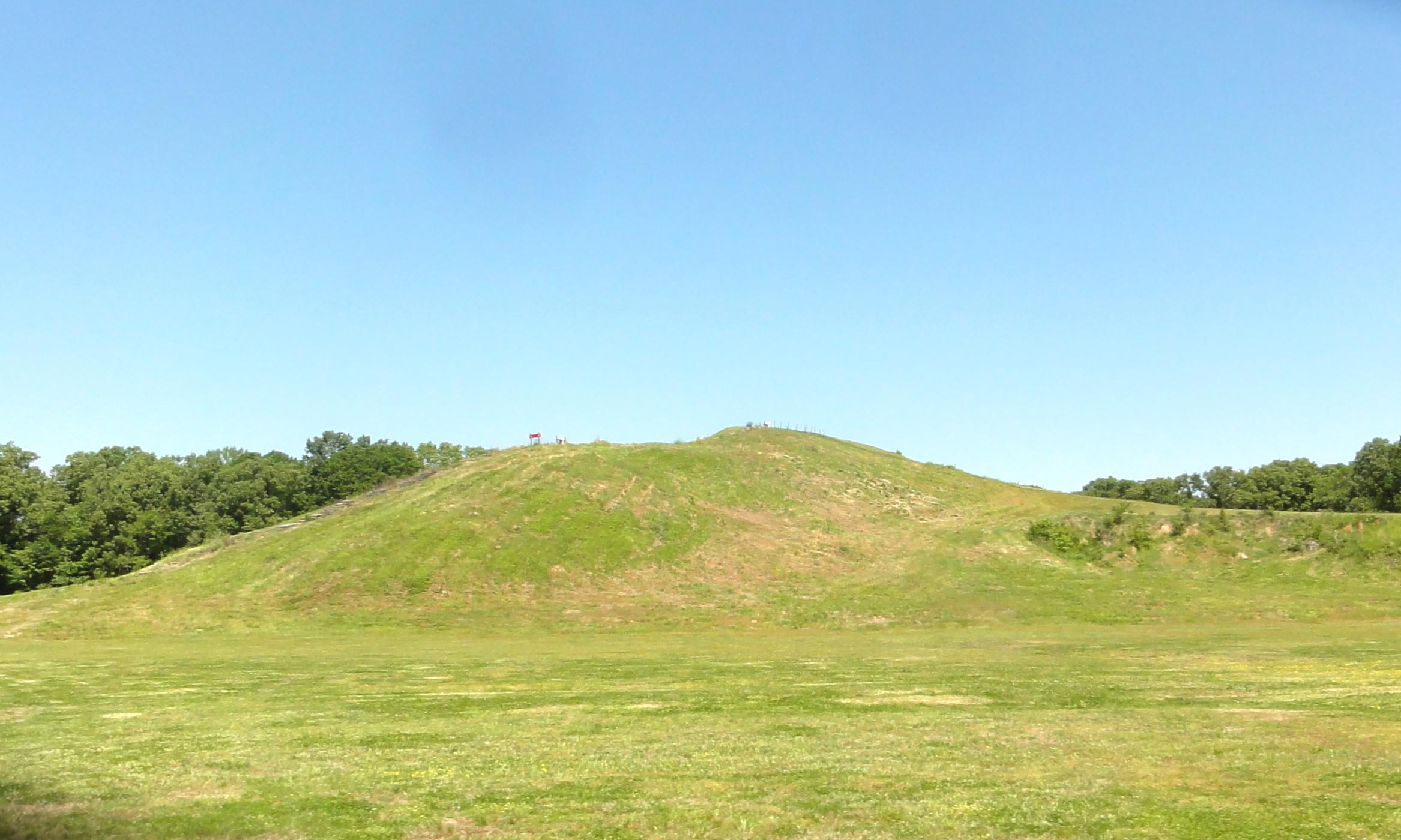
Poverty Point National Monument
National Monument
Now a nearly forgotten culture, Poverty Point at its peak 3,000 years ago was part of an enormous trading network that stretched for hundreds of miles across the continent. It was - and is - also an e...
12 mi from route
~30 min detour
Free
near mile 8.3
Park data from the National Park Service API. Alerts update every 2 hours.
More Details
What kind of drive is this?
This route is characterized by its frequent turns, offering a decidedly local driving experience rather than a highway cruise. With only 11% of the drive on highways, expect to navigate a variety of local roads. The longest continuous stretch you'll encounter is 90.6 miles along Martin Luther King Jr Drive, providing a solid segment of consistent travel before the roadscape potentially shifts. The 'turn-heavy' profile means you'll be actively engaged with the driving, making for a dynamic trip.
Only 11% highway — the rest is turn-by-turn surface driving.
22 navigation steps total — most of the decisions cluster near the start and finish.
Longest single stretch: 90.6 mi on Martin Luther King Jr Drive.
How Hard Is This Drive?
4/10
Expect a hands-on drive with frequent turns and local roads rather than long highway stretches. There are only a few real navigation decisions along the way. The trickiest moment comes around 25.8 miles in near LA 138 / South 14th Street.
Driving Effort4/10
Easy - simple navigation with a manageable amount of wheel time
Balances navigation complexity with total wheel time.
This is a straightforward 4h 45m drive. You will face about 9 decision points, but nothing that requires special attention if you follow navigation.
Where does it get tricky?
The main spots that need attention: at 25.8 miles (LA 138 / South 14th Street): Navigation decision point; at 32.2 miles (US 165; US 425; LA 2 / Mer Rouge Road): Navigation decision point; at 147.8 miles: Navigation decision point.
Lafayette is a city in Louisiana. It's the unofficial capital of Acadiana or Cajun Country. This flourishing moderate sized city is home to the University of Louisiana at Lafayette. Music and dancing is an integral part of community life. Several restaurants and dance halls thrive in the area and the city hosts several musical festivals throughout the year.
Top landmarks
•First United Methodist Church — historic church in Lafayette, Louisiana, United States
•Sterling Grove Historic District — historic district in Lafayette, Louisiana, United States
•Evangeline Hotel — historic building in Lafayette, Louisiana, United States
Mostly surface roads route profile with national parks nearby.
Frequently Asked Questions
The longest stretch is about 90.6 miles on Martin Luther King Jr Drive. The full list of main roads is in the Roads section above.
Expect about $0.13 in tolls one way, starting with Northwest Evangeline Thruway. Most Northeast and Midwest toll agencies accept E-ZPass; in the West and Texas, transponders like TxTag or FasTrak apply. If you do not have a transponder, cashless tolling plates will mail a bill to the vehicle's registered address — usually with a surcharge, so a rental-car toll pass is often cheaper than paying by mail.
Yes — we found about 7 rest areas or service plazas within a short detour of the route (from OpenStreetMap). See the Rest Stops tab under Nearby Places for locations and mile markers. Plan to stretch, use the bathroom, and top off fluids every 2–3 hours on longer drives.
Yes, with realistic expectations. Build in a stop roughly every 2 hours, have snacks and activities ready, and check the Nearby Places tabs for kid-friendly stops along the way.
The main spots that need attention: at 25.8 miles (LA 138 / South 14th Street): Navigation decision point; at 32.2 miles (US 165; US 425; LA 2 / Mer Rouge Road): Navigation decision point; at 147.8 miles: Navigation decision point.
Yes — Poverty Point National Monument. See the National Parks section for detour distances and tips on detours.
Possible but tiring. At 4.8 hours each way, an in-and-out day trip would put you behind the wheel for 9.5 hours — manageable with a long break at Lafayette, LA, but most travelers stay overnight.