Spanning 65.1 miles, this route between New Mexico, MD, and Coral Hills, MD, is a straightforward trip that typically takes about 1 hour and 37 minutes. Since the entire drive stays within the Northeast region, you can easily complete the journey in a single day without needing an overnight stay. Expect to spend approximately $11 on fuel for the trip, making it a budget-friendly option for your schedule. You will navigate a variety of corridors, including the Baltimore-Washington Parkway, Northwest Expressway, and Baltimore Boulevard. This path is ideal if you want a practical, no-fuss connection between these two Maryland points.
Trip Pace
Same-day drive is realistic
A same-day return is realistic if you keep stops short.
Midpoint
32.5 miles from New Mexico, MD
A natural place for your longest stop of the day
, about 47m into the drive
.
Main Roads
Road
Distance
Duration
Baltimore-Washington Parkway
23.2 mi
32m
Northwest Expressway
9.2 mi
11m
Baltimore Boulevard
9.1 mi
13m
Baltimore Beltway
8.7 mi
11m
Manchester Road
2.6 mi
4m
Eastern Avenue Northeast
1.8 mi
3m
Southwestern Boulevard
1.7 mi
2m
Westminster Pike
1.6 mi
2m
Longest stretch:
Baltimore-Washington Parkway
— 23.2 mi, about 32m
Traffic on I-695
Hour-of-day weekday pattern from 22 FHWA count stations on your route.
Peak
4 PM
~4,314 veh/hr typical
· worst 7,207
Quietest
2 AM
~339 veh/hr
Peak-to-quiet ratio
12.7×
busier at peak than in the quiet hours
12a6anoon6p11p
Averaged across 51 weeks of 2023 FHWA Travel Monitoring Analysis System data. Weekday hours only (Mon–Fri).
Turn-by-Turn Driving Directions
Step-by-step road directions between New Mexico, MD and Coral Hills, MD.
1
Start on Guadelupe Drive
0.2 mi·51 sec·Guadelupe Drive
2
Turn right onto MD 27
2.6 mi·4 min·Manchester Road
3
Continue on MD 27
377 ft·11 sec·Railroad Avenue
4
Take the exit
0.3 mi·37 sec
5
Merge onto MD 97; MD 140
9.1 mi·13 min·Baltimore Boulevard
Use the right lane.
6
Continue on MD 140
1.6 mi·2 min·Westminster Pike
Use the straight lane.
7
Keep slight left at fork onto I 795
9.2 mi·11 min·Northwest Expressway
Use the straight / slight right lanes.
8
Keep slight right at fork
0.7 mi·1 min
Exit 1BToward I 695 South: Glen BurnieUse the slight right lane.
9
Merge onto I 695
8.7 mi·11 min·Baltimore Beltway
Use the straight / slight right lanes.
10
Take the exit
0.2 mi·24 sec
Exit 12AToward US 1: ArbutusUse the straight / slight right lanes.
11
Keep slight left at fork
0.2 mi·25 sec
Toward US 1: Southwestern BoulevardUse the straight / slight right lanes.
12
Turn straight onto US 1
1.7 mi·2 min·Southwestern Boulevard
13
Turn straight onto US 1
0.4 mi·35 sec·Washington Boulevard
14
Continue on US 1
0.2 mi·26 sec·Washington Boulevard
15
Take the ramp
0.4 mi·47 sec
Toward I 195 East: BWI Airport
16
Merge onto I 195
1.1 mi·1 min·Metropolitan Boulevard
17
Take the exit
0.6 mi·1 min
Exit 2BToward MD 295 South: WashingtonUse the straight / slight right lanes.
18
Merge onto MD 295
23 mi·32 min·Baltimore-Washington Parkway
Use the straight / slight right lanes.
19
Keep slight left at fork
0.5 mi·35 sec
Toward US 50 East: Richmond, AnnapolisUse the slight left / slight right lanes.
20
Continue on MD 201
0.2 mi·12 sec·Kenilworth Avenue Freeway
21
Take the exit
0.1 mi·14 sec
Toward Eastern Avenue, Aquatic GardensUse the slight right lane.
22
Continue on Kenilworth Avenue
416 ft·17 sec·Kenilworth Avenue
Use the straight / left lanes.
23
Turn left onto Eastern Avenue Northeast
1.8 mi·3 min·Eastern Avenue Northeast
24
Turn right onto 63rd Street Northeast
0.2 mi·17 sec·63rd Street Northeast
25
Continue on Southern Avenue Northeast
0.2 mi·15 sec·Southern Avenue Northeast
26
Continue on Southern Avenue Southeast
427 ft·15 sec·Southern Avenue Southeast
27
Turn left onto Davey Street
285 ft·8 sec·Davey Street
28
Turn right onto Chamber Avenue
0.3 mi·42 sec·Chamber Avenue
29
Continue on Larchmont Avenue
1.0 mi·3 min·Larchmont Avenue
30
At end of road, turn left onto Marlboro Pike
0.1 mi·19 sec·Marlboro Pike
31
Turn left onto Opus Avenue
63 ft·2 sec·Opus Avenue
32
Arrive at destination
Opus Avenue
Trip Plan
Because this is a relatively short trip, you have plenty of flexibility regarding your departure time. You can comfortably manage the 1 hour and 37 minute drive without planning for formal rest stops, as the distance is short enough to cover in one go. Keep in mind that your fuel budget is roughly $11, so topping off your tank before you leave will ensure you do not have to worry about stops along the way. Since the route relies on a combination of parkways and local boulevards, stay alert for changing speed limits as you move off the highway sections. Aim to plan your departure to avoid peak local traffic, as the mix of expressway and boulevard driving can be impacted by congestion during rush hours.
Morning Departure
Leave by 9 AM and you'll arrive before lunch.
Evening Departure
Even a 4 PM departure gets you there before dark in summer.
You can normally do this drive in one day.
You may only need one short stretch break if traffic stays light.
The halfway point lands around 32.5 miles from New Mexico, MD, or about 47m into the drive.
The longest continuous stretch on this route runs about 23.2 miles.
This is a comfortable same-day trip.
Departure
Before you leave
Start with fuel, water, and navigation already sorted so the first hour feels easy.
First stop
Around 14 miles or 22m in
Use this first pause for coffee, a restroom break, and a quick traffic check ahead.
Halfway reset
Around 32.5 miles or 47m in
This is the best place for your longest stop, a real meal, and a full fuel check.
Final approach
Final hour starts around 1h 20m
Traffic, exits, and arrival timing usually matter more near Coral Hills, MD than in the middle of the route.
Before You Leave
+
Open the route before leaving New Mexico, MD so your first major turns are already loaded.
Day 1
Settle into the route from New Mexico, MD
This is one driving day of about 65.1 miles and 1h 37m.
Your first comfortable stop window is around 14 miles from New Mexico, MD.
This route can stay practical as a one-day drive if traffic stays reasonable.
The longest stretch is on Baltimore-Washington Parkway for about 23.2 miles.
Where to Stop
Rest stops, refuel points, and overnight suggestions along this route.
Place data sourced from public business listings. Hours and availability may vary.
Heads-up: tricky spots
5 of 20
5 decision points cluster between mile 23 and 61.2 — GPS handles the exact turns, but know they're coming. Your lane choice matters more than the turn itself.
8
23 mi into trip|~33m in
Keep slight right at fork toward I 695 South: Glen Burnie
Highway fork - watch signs carefully. Lane positioning matters here
Use the slight right lane.
Exit 1B
Toward I 695 South: Glen Burnie
7
32.4 mi into trip|~46m in
Take the exit toward US 1: Arbutus
Exit ramp - move to the correct lane early. Lane positioning matters here
Use the straight / slight right lanes.
Exit 12A
Toward US 1: Arbutus
8
32.6 mi into trip|~47m in
Keep slight left at fork toward US 1: Southwestern Boulevard
Highway fork - watch signs carefully. Lane positioning matters here
Use the straight / slight right lanes.
Toward US 1: Southwestern Boulevard
8
60.5 mi into trip|~1h 27m in
Keep slight left at fork toward US 50 East: Richmond, Annapolis
Highway fork - watch signs carefully. Lane positioning matters here. Multiple destination signs - pick the right one
Use the slight left / slight right lanes.
Toward US 50 East: Richmond, Annapolis
8
61.2 mi into trip|~1h 28m in
Take the exit toward Eastern Avenue, Aquatic Gardens
Exit ramp - move to the correct lane early. Lane positioning matters here. Multiple destination signs - pick the right one
Use the slight right lane.
Toward Eastern Avenue, Aquatic Gardens
Fuel & Cost
Regular Gas
$10.24 one way
$20.49 round trip
$4.00/gal25.4 MPG avg23 kg CO2
Fuel Type
$/gal
One Way
Round Trip
midgrade
$4.42
$11.33
$22.65
premium
$4.74
$12.14
$24.27
diesel
$4.58
$11.73
$23.47
No toll roads detected on this route.
Estimated Trip Cost (one way, 1 person)
Fuel
$10
Meals
$25–$50
Total
$35–$60
Rough estimate based on US averages. Hotel $80–$140/night, meals $25–$50/day.
Estimated CO2 emission: 22.8 kg one way.
Prices: EIA weekly data, 2026-07-06.
Station data from NREL Alternative Fuel Stations database.
Driving Electric?
About $7 in charging
· 0 stops
· 65% less CO2
Vehicle Type
kWh
Stops
DC Fast
Home Charge
Average EV
19.5
0
$6.84
$3.12
Efficient EV
16.3
0
$5.70
$2.60
EV Truck/SUV
26
0
$9.11
$4.17
Gas CO2
23 kg
EV CO2
8 kg (65% less)
This trip is well within single-charge range for most EVs. No charging stops needed if you start fully charged.
DC fast charging avg $0.35/kWh. Home charging avg $0.16/kWh. US grid CO2: 0.39 kg/kWh.
Travel Intel
Current conditions at both ends of the drive.
Forecast as of Jul 19, 2026
Origin
New Mexico, MD
Late night
in New Mexico on Sunday
Local time
2:44 AM
EDT
Current temp
70°F
Slight Chance Showers And Thunderstorms
W 7 mph22% chanceLive forecast
Destination
Coral Hills, MD
Late night
in Coral Hills on Sunday
Local time
2:44 AM
EDT
Current temp
75°F
Mostly Cloudy
W 7 mph12% chanceLive forecast
87°F
Lansdowne, MD
33 mi in
Seasonal Notes
Summer travel usually means heavier construction, hotter rest stops, and busier weekend traffic around major cities.
Winter travel shortens daylight, so a route that looks manageable on paper can feel much longer after dark.
Holiday weekends tend to make both departure and arrival windows slower than the raw route time suggests.
Time zone
Same local time
Origin and destination are on the same clock, so arrival timing is easier to judge at a glance.
Temperature spread
5 degrees warmer at arrival
A meaningful temperature swing is a good cue to rethink layers, water, and how soon you want to arrive.
Road read
1h 37m on the road
The weather snapshot is not static. If you are leaving later, give both cities one more quick forecast check before departure.
Weather data from the National Weather Service. Conditions may change; check closer to your travel date.
National Parks Near This Route
Worth a detour if your schedule allows.
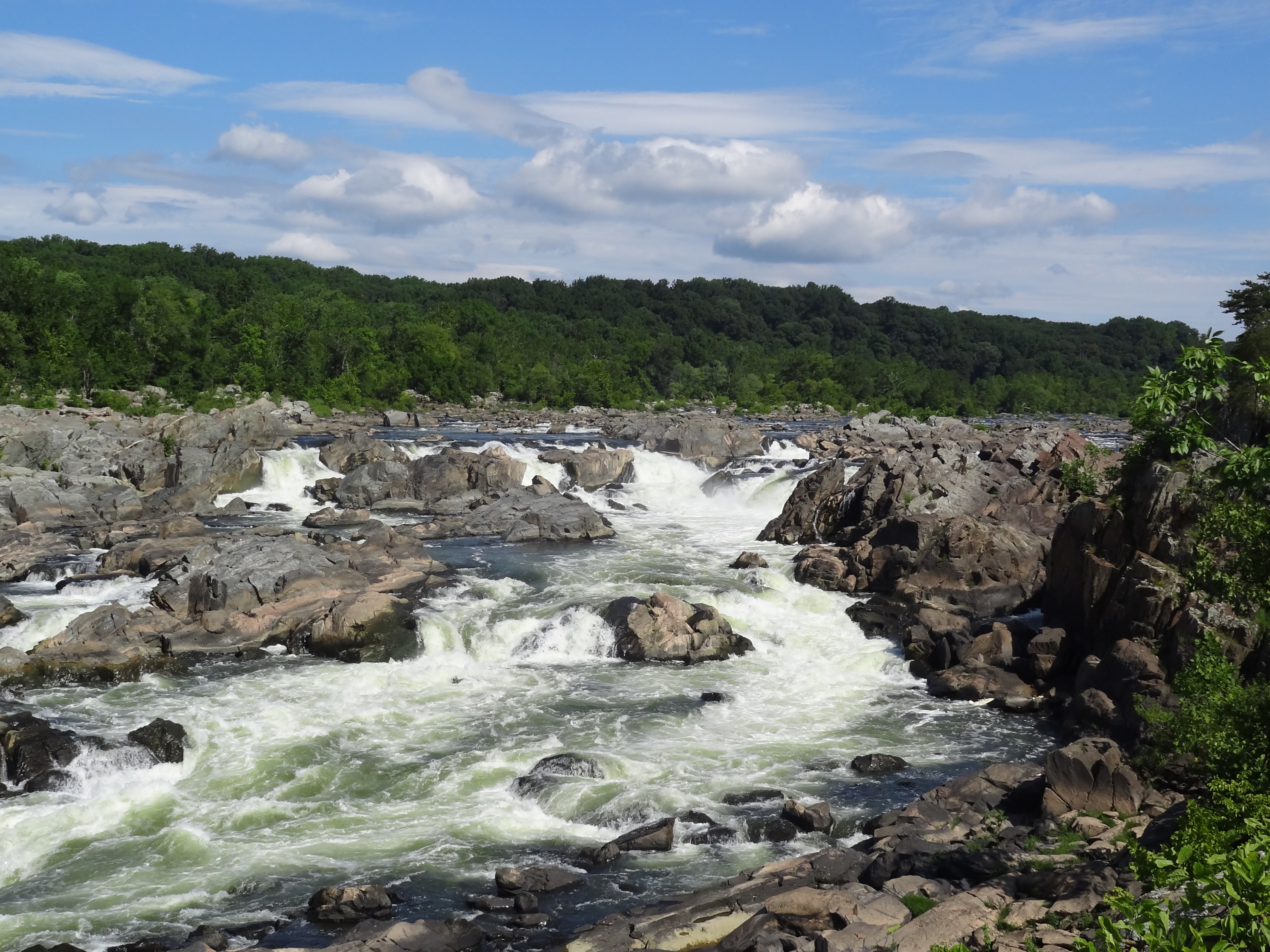
Chesapeake & Ohio Canal National Historical Park
National Historical Park
Preserving America's early transportation history, the C&O Canal began as a dream of passage to Western wealth. Operating for nearly 100 years the canal was a lifeline for communities along the Potoma...
18 mi from route
~44 min detour
$20
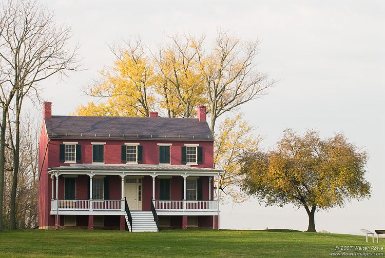
near mile 60.6
During the summer of 1864, the Confederacy carried out a bold plan to turn the tide of the Civil War in their favor. They planned to capture Washington, DC and influence the election of 1864. On July...
27 mi from route
~67 min detour
Free
near mile 4.5
Park data from the National Park Service API. Alerts update every 2 hours.
More Details
What kind of drive is this?
This 65.1-mile trek offers a mixed driving experience, with about 50 percent of your time spent on highways. You will settle into a steady rhythm during the longest stretch of the trip, which covers 23.2 miles along the Baltimore-Washington Parkway. The character of the road shifts from fast-paced highway segments to more localized driving as you transition through the different road types. While the expressway portions allow for consistent speed, the remainder of the route requires more active navigation through local corridors. By the time you reach Coral Hills, you will have navigated a balanced mix of infrastructure designed for both efficiency and local access.
50% highway, the rest on surface roads — varied driving throughout.
32 navigation steps total — most of the decisions cluster near the start and finish.
Longest single stretch: 23.2 mi on Baltimore-Washington Parkway.
How Hard Is This Drive?
10/10
This route mixes highway mileage with some local-road sections near the start or finish. This route has several spots where lane changes, forks, or exits need your full attention. The trickiest moment comes around 23 miles in.
Driving Effort10/10
Demanding - stay alert through the decision-heavy sections
Balances navigation complexity with total wheel time.
This drive requires moderate attention. Across 65.1 miles you will encounter 20 spots where lane choice or exit timing matters. Not difficult for experienced highway drivers, but worth previewing the tricky sections before you go.
Where does it get tricky?
The main spots that need attention: at 23 miles: Highway fork - watch signs carefully. Lane positioning matters here; at 32.4 miles: Exit ramp - move to the correct lane early. Lane positioning matters here; at 32.6 miles: Highway fork - watch signs carefully. Lane positioning matters here.
Elevation Profile
Mostly flat terrain
879 ft63 ft
Total Climb
524 ft
Total Descent
1,077 ft
Highest Point
879 ft
~4.6 mi in
Elevation Range
816 ft
Towns Mentioned on Route Signs
Based on OSRM destination-sign hints, not a full list of every settlement the road passes.
Between New Mexico, MD and Coral Hills, MD, road signs point toward Annapolis and Aquatic Gardens.
New Mexico (Spanish: Nuevo México), the Land of Enchantment, is a state in the American Southwest. It became a Spanish colony after conquistadors arrived in the 16th century, then a Mexican territory until the Mexican-American War of the 1840s, and then an American territory until it achieved statehood in 1912. New Mexico still has a large native Spanish-speaking population and many Native American communities, offering a unique culture that clearly stands apart from that of other states. Spanish is the official second language. A visitor to New Mexico will also discover fantastic natural scenery, a major fine arts scene centered around Santa Fe, great outdoor recreational opportunities, and a distinctive regional cuisine.
Doable as a same-day drive at 1h 37m. Total distance: 65.1 miles.
Family Friendly
Moderate complexity with 0 natural rest stops along the way.
Solo Traveler
1h 37m drive, comfortable solo distance.
First-Time Driver
Mostly highway driving (50%). Some complex stretches to watch for.
Scenic Drive
Mixed highway & surface route profile with national parks nearby.
Frequently Asked Questions
The longest stretch is about 23.2 miles on Baltimore-Washington Parkway. The full list of main roads is in the Roads section above.
Yes — we found about 1 rest area or service plaza within a short detour of the route (from OpenStreetMap). See the Rest Stops tab under Nearby Places for locations and mile markers. Plan to stretch, use the bathroom, and top off fluids every 2–3 hours on longer drives.
It helps. This route has a higher-than-average number of complex decision points, which get harder in the dark. If the last hour of the trip is on surface roads or mountain grades, aim to arrive at Coral Hills, MD before sunset when you can. Check the Trip Plan for departure windows that land you in daylight.
Yes. At under 2 hours behind the wheel, this works well for families — plan one quick stop if you have younger kids.
The main spots that need attention: at 23 miles: Highway fork - watch signs carefully. Lane positioning matters here; at 32.4 miles: Exit ramp - move to the correct lane early. Lane positioning matters here; at 32.6 miles: Highway fork - watch signs carefully. Lane positioning matters here.
Yes — Chesapeake & Ohio Canal National Historical Park and Monocacy National Battlefield. See the National Parks section for detour distances and tips on detours.
Yes. A round trip is manageable in a single day if you plan a break at Coral Hills, MD before heading back.