Mazatzal Rest Area (Closed)
0.1 mi from route
Compiled and reviewed by the US Trip Planner planning team at COD Solutions Oy · Last reviewed Jul 19, 2026 · Editorial standards
Drive Time
7h 11m
Distance
336.2 mi
541 km
Drive Score
9/10
Great drive
Same Day?
Yes, doable
Fuel Cost
$60
one way
EV Charging
Unknown
Estimated drive times based on typical traffic patterns. Actual times may vary with weather, construction, and real-time conditions.

Lukachukai, AZ
András Nyemczovszky

Tempe Junction, AZ
Abhishek Navlakha
This 368.6-mile drive from Lukachukai, AZ, to Tempe Junction, AZ, is estimated to take around 6 hours and 11 minutes, making it a feasible day trip. You'll primarily navigate on Routes 133, 13, and 12, with no significant highway driving. The estimated fuel cost for this journey is $73. This route offers a turn-heavy local drive experience through the Desert Southwest region of Arizona. With only one recommended stop, you can plan your pace accordingly, but keep in mind the duration might feel long for some as a single-day endeavor.
Trip Pace
Same-day drive is realistic
A same-day return is possible, but it will make for a full day on the road.
Break Rhythm
2 planned breaks
Plan on a short reset every 3 to 4 hours to stay fresh behind the wheel.
Midpoint
168.1 miles from Lukachukai, AZ
A natural place for your longest stop of the day , about 3h 37m into the drive .
| Road | Distance | Duration |
|---|---|---|
| Navajo Route 12 | 81.4 mi | 2h 2m |
| South Beeline Highway | 73.1 mi | 1h 26m |
| Purple Heart Trail | 69.9 mi | 1h 9m |
| Heber Road | 30.9 mi | 36m |
| Payson-Show Low Highway | 24.2 mi | 30m |
| Hwy 260 | 15.9 mi | 22m |
| Payson-Heber Highway | 12.7 mi | 17m |
| West 3rd Street North | 4.9 mi | 6m |
Step-by-step road directions between Lukachukai, AZ and Tempe Junction, AZ.
Start on this road
Turn left
Turn right onto N133
Continue on N13
At end of road, turn left onto N12
Continue on N12
Continue on N12
At end of road, turn left onto N12
Turn right onto AZ 264
Turn left onto N12
Take the ramp
Merge onto I 40
Take the exit onto AZ 77
Turn left onto I 40 Bus; AZ 77; US 66 Hist
Continue on US 180; AZ 77
Continue on AZ 77
Turn right onto AZ 377
Turn straight onto AZ 377
At end of road, turn right onto AZ 277
Continue on AZ 277
At end of road, turn right onto AZ 260
Continue on AZ 260
Continue on AZ 260
Continue on AZ 260
Turn left onto AZ 87
Continue on AZ 87
Take the exit
Merge onto AZ 202 Loop
Take the exit
Keep slight left at fork
Turn slight left onto North Scottsdale Road
Continue on South Rural Road
Turn right onto US 80 Hist
Turn left onto East 13th Street
Arrive at destination
Given the 6-hour, 11-minute duration, starting your journey from Lukachukai, AZ, early in the morning is advisable to ensure a comfortable arrival in Tempe Junction, AZ, before evening. You'll want to account for fuel, with an estimated cost of $73 for the 368.6 miles. Since this is a turn-heavy local drive with no highway share, be mindful of your navigation and keep an eye on your fuel levels, as services may be more spaced out than on major interstates. Plan for one stop to break up the drive and stretch your legs.
Morning Departure
Start early — leave by 6-7 AM to arrive at a reasonable hour.
Evening Departure
This is a long drive — plan for a morning departure or consider splitting it into two days.
This is a comfortable same-day trip.
Departure
Before you leave
Start with fuel, water, and navigation already sorted so the first hour feels easy.
First stop
Around 74 miles or 1h 53m in
Use this first pause for coffee, a restroom break, and a quick traffic check ahead.
Halfway reset
Around 168.1 miles or 3h 37m in
This is the best place for your longest stop, a real meal, and a full fuel check.
Final approach
Final hour starts around 5h 55m
Traffic, exits, and arrival timing usually matter more near Tempe Junction, AZ than in the middle of the route.
Open the route before leaving Lukachukai, AZ so your first major turns are already loaded.
Leave with enough water and a charging cable within reach, not packed away.
Check your fuel range against the first long segment, especially if you are starting outside city service areas.
Pick one backup stop option before the midpoint in case traffic changes your pacing.
Day 1
Settle into the route from Lukachukai, AZ
This is one driving day of about 336.2 miles and 7h 11m.
Rest stops, refuel points, and overnight suggestions along this route.

Mid-route town
Meal stop
168 mi into the route
Best for: Lunch, fuel, and a longer reset
This sits close to the middle of the route, so it works well for the longest stop of the day.
A short stop after about 74 miles helps settle the day before fatigue starts building.
The midpoint is around 168.1 miles from Lukachukai, AZ, which is a good place for a longer meal and fuel stop.
Before the longest stretch
Fuel checkTop up before Navajo Route 12 if your tank is already low. That segment runs about 81.4 miles.
These stop ideas are pacing suggestions — the exact town or exit can change with traffic, hotel plans, and fuel range.
Picked by where they fit in your drive — first break, midpoint reset, final stretch.
Near the end, short detour
Tempe, Arizona
+14803556060
Visit websiteNear the end, short detour
Tempe, Arizona
Near the end, short detour
Tempe, Arizona
Hours: 11 am–5 pm
+14805657081
Visit websiteNear the end, ~10 min detour
Fountain Hills, Arizona
Hours: 8 am–8 pm
+14808373966
Visit websiteNear the end, ~10 min detour
Phoenix, Arizona
Hours: Closed
+14809958653
Visit websiteNear the end, ~10 min detour
Mesa, Arizona
Hours: 6 am–10 pm
+14806442352
Visit websiteNear the end, ~12 min detour
Mesa, Arizona
Hours: 11 am–6 pm
+14805974467
Visit websitePlace data sourced from public business listings. Hours and availability may vary.
5 decision points cluster between mile 2.4 and 333.7 — GPS handles the exact turns, but know they're coming. Your lane choice matters more than the turn itself.
At end of road, turn left onto N12 / Navajo Route 12
Navigation decision point
Take the exit onto AZ 77 toward I 40 Business, AZ 77 South, AZ 377 South, US 180 East: Show Low, Heber
Exit ramp - move to the correct lane early. Multiple destination signs - pick the right one
Take the exit toward AZ 202 Loop West
Exit ramp - move to the correct lane early
Take the exit toward Scottsdale Road, Rural Road
Exit ramp - move to the correct lane early. Lane positioning matters here. Multiple destination signs - pick the right one
Keep slight left at fork toward Arizona State University-Tempe
Highway fork - watch signs carefully. Lane positioning matters here
Regular Gas
$59.58 one way
$119.15 round trip
| Fuel Type | $/gal | One Way | Round Trip |
|---|---|---|---|
| midgrade | $4.82 | $63.80 | $127.60 |
| premium | $5.04 | $66.74 | $133.47 |
| diesel | $4.80 | $63.48 | $126.96 |
No toll roads detected on this route.
Estimated Trip Cost (one way, 1 person)
Fuel
$60
Meals
$25–$50
Total
$85–$110
Rough estimate based on US averages. Hotel $80–$140/night, meals $25–$50/day.
Estimated CO2 emission: 117.6 kg one way. Prices: EIA weekly data, 2026-07-13.
Driving Electric?
About $35 in charging · 1 stop · 67% less CO2
| Vehicle Type | kWh | Stops | DC Fast | Home Charge |
|---|---|---|---|---|
| Average EV | 100.9 | 1 | $35.30 | $16.14 |
| Efficient EV | 84.1 | 0 | $29.42 | $13.45 |
| EV Truck/SUV | 134.5 | 1 | $47.07 | $21.52 |
Gas CO2
118 kg
EV CO2
39 kg (67% less)
Plan for 1 charging stop. A 30-minute DC fast charge mid-route should be enough to complete the trip comfortably.
DC fast charging avg $0.35/kWh. Home charging avg $0.16/kWh. US grid CO2: 0.39 kg/kWh.
Current conditions at both ends of the drive.
Origin
Evening in Lukachukai on Saturday
Local time
8:53 PM
MDT
Current temp
81°F
Chance Rain Showers then Showers And Thunderstorms Likely
Flash Flood Warning
Flash Flood Warning issued July 17 at 3:29AM MST until July 17 at 6:30AM MST by NWS Flagstaff AZ
Destination
Evening in Tempe Junction on Saturday
Local time
7:53 PM
MST
Current temp
93°F
Chance Showers And Thunderstorms then Slight Chance Showers And Thunderstorms
Flash Flood Warning
Flash Flood Warning issued July 17 at 3:29AM MST until July 17 at 6:30AM MST by NWS Flagstaff AZ
Seasonal Notes
Summer travel usually means heavier construction, hotter rest stops, and busier weekend traffic around major cities.
Winter travel shortens daylight, so a route that looks manageable on paper can feel much longer after dark.
Holiday weekends tend to make both departure and arrival windows slower than the raw route time suggests.
Time zone
The destination clock does not match departure time, so double-check hotel check-in windows and late arrival plans.
Temperature spread
A meaningful temperature swing is a good cue to rethink layers, water, and how soon you want to arrive.
Road read
Start early — leave by 6-7 AM to arrive at a reasonable hour.
Weather data from the National Weather Service. Conditions may change; check closer to your travel date.
Worth a detour if your schedule allows.

National Park
A landscape where deep time lies fully on display, Petrified Forest National Park blends colorful badlands, vast grasslands, and one of the world’s largest and most vivid collections of petrified wood...
National Monument
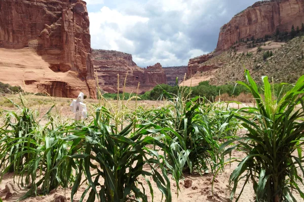
This canyon is home to Diné families who raise livestock, grow crops and live here. People have lived in these canyons for nearly 5,000 years, which is longer than anyone has lived continuously on the...

National Monument
Located within the northern range of the Sonoran Desert lie two cliff dwellings that were occupied from 1300-1450 CE (common era). They represent a vibrant culture consisting of local and immigrant gr...
Park data from the National Park Service API. Alerts update every 2 hours.
Prepare for a road with a "turn-heavy local drive" profile, meaning you'll encounter frequent changes in direction rather than long, straight stretches. The highway share is 0%, so expect a consistent local road experience throughout the entire 368.6 miles. While there isn't a specified longest uninterrupted stretch, the nature of this route suggests you'll be actively steering and navigating for much of the journey. The road character likely remains consistent, focusing on local connections rather than high-speed transit.
This route mixes highway mileage with some local-road sections near the start or finish. This route has several spots where lane changes, forks, or exits need your full attention. The trickiest moment comes around 2.4 miles in near N12 / Navajo Route 12.
Demanding - plan breaks and stay ahead of the key maneuvers
Balances navigation complexity with total wheel time.
This is a demanding drive. With 20 significant decision points across 336.2 miles, you will need to stay alert - especially through interchange areas and urban stretches. Consider splitting it into segments if you are not comfortable with fast highway navigation.
Where does it get tricky?
The main spots that need attention: at 2.4 miles (N12 / Navajo Route 12): Navigation decision point; at 157.4 miles (AZ 77): Exit ramp - move to the correct lane early. Multiple destination signs - pick the right one; at 328.2 miles: Exit ramp - move to the correct lane early.
High-altitude sections with notable climbs
Total Climb
3,268 ft
Total Descent
8,648 ft
Highest Point
7,553 ft
~216.1 mi in
Elevation Range
6,389 ft
Notable High Points
Based on OSRM destination-sign hints, not a full list of every settlement the road passes.
On the drive from Lukachukai, AZ to Tempe Junction, AZ, road signs begin pointing toward Heber along the way.
Heber
City content from Wikivoyage (CC BY-SA 4.0) and Wikidata (CC0).
Weekend Trip
Doable as a same-day drive at 7h 11m. Total distance: 336.2 miles.
Family Friendly
Moderate complexity with 2 natural rest stops along the way.
Solo Traveler
7h 11m drive, plan rest stops for pacing.
Scenic Drive
Mixed highway & surface route profile with national parks nearby.
Compiled by the US Trip Planner planning team at COD Solutions Oy from open government datasets — OSRM over OpenStreetMap for geometry, EIA for fuel prices, USGS 3DEP for elevation, and NPS for national parks. See our methodology for refresh cadence and limitations.
Was this helpful?
Thanks for your feedback!
Your tip has been submitted. Thanks!
/500
Recent Tips
·
Explore more options from Lukachukai, AZ or browse trips ending in Tempe Junction, AZ.
Looking for more statewide routes? Browse AZ road trips.