Spanning 214.4 miles across the heart of the Desert Southwest, this journey from Loving to Las Cruces typically takes about 4 hours of drive time. You can easily tackle this route in a single day, making it an efficient connection between these two New Mexico communities. With an estimated fuel cost of $33, it is a budget-friendly trip that keeps your expenses predictable. You will navigate via US Highway 62, the National Parks Highway, and the Purple Heart Memorial Freeway. Since both your start and end points are located within the same region, you will experience a consistent high-desert environment throughout your journey. It is a straightforward transit route that serves travelers looking for a reliable, no-nonsense path across the state.
Trip Pace
Same-day drive is realistic
A same-day return is possible, but it will make for a full day on the road.
Break Rhythm
1 planned break
Plan on a short reset every 3 to 4 hours to stay fresh behind the wheel.
Midpoint
107.2 miles from Loving, NM
A natural place for your longest stop of the day
, about 1h 55m into the drive
.
Main Roads
Road
Distance
Duration
US Highway 62
102.3 mi
1h 46m
National Parks Highway
33.5 mi
37m
Purple Heart Memorial Freeway
24 mi
30m
Pearl Harbor Memorial Highway
22.3 mi
22m
Montana Avenue
12.3 mi
15m
Pecos Highway
9 mi
10m
Camino Real de Tierra Adentro
5.3 mi
5m
South Main Street
1.7 mi
3m
Longest stretch:
US Highway 62
— 102.3 mi, about 1h 46m
Traffic on I-10
Hour-of-day weekday pattern from 12 FHWA count stations on your route.
Peak
5 PM
~1,773 veh/hr typical
· worst 2,185
Quietest
2 AM
~237 veh/hr
Peak-to-quiet ratio
7.5×
busier at peak than in the quiet hours
12a6anoon6p11p
Averaged across 35 weeks of 2023 FHWA Travel Monitoring Analysis System data. Weekday hours only (Mon–Fri).
Turn-by-Turn Driving Directions
Step-by-step road directions between Loving, NM and Las Cruces, NM.
1
Start on North 4th Street
105 ft·6 sec·North 4th Street
2
Turn right onto West Cedar Street
0.3 mi·45 sec·West Cedar Street
3
At end of road, turn right onto US 285
0.4 mi·26 sec·North 8th Street
4
Continue on US 285
9.0 mi·10 min·Pecos Highway
5
Continue on US 285
0.7 mi·45 sec·South Canal Street
6
Keep slight left at fork onto US 285
437 ft·13 sec·South Canal Street
7
Turn left onto US 62; US 180
34 mi·37 min·National Parks Highway
8
Continue on US 62; US 180
102 mi·1 hr 46 min·US Highway 62
9
Continue on US 62; US 180
12 mi·15 min·Montana Avenue
10
Take the exit
0.3 mi·39 sec
Toward Loop 375 North
11
Merge onto Loop 375
24 mi·30 min·Purple Heart Memorial Freeway
Use the straight / slight right lanes.
12
Turn right onto North Desert Boulevard
0.8 mi·1 min·North Desert Boulevard
13
Take the ramp
0.3 mi·33 sec
14
Merge onto I 10; US 85; US 180
5.3 mi·5 min·Camino Real de Tierra Adentro
Use the straight / slight right lanes.
15
Continue on I 10
22 mi·22 min·Pearl Harbor Memorial Highway
16
Take the exit
0.4 mi·51 sec
Toward NM 101, Valley Drive, University Avenue
17
Continue on NM 188
0.3 mi·28 sec·South Valley Drive
18
Turn slight right onto NM 478
1.7 mi·3 min·South Main Street
19
Turn right onto East Lohman Avenue
320 ft·11 sec·East Lohman Avenue
20
Turn left onto South Church Street
0.4 mi·1 min·South Church Street
21
Turn left onto East Las Cruces Avenue
157 ft·6 sec·East Las Cruces Avenue
22
Turn right
59 ft·6 sec
23
Turn right
359 ft·26 sec
24
Arrive at destination
Trip Plan
Since this is a 4-hour drive, you have the flexibility to plan your departure time to avoid the heaviest traffic periods. You should budget for at least one planned stop to stretch your legs, especially given the length of the initial 102.3-mile stretch on US Highway 62. Keep an eye on your fuel gauge before leaving Loving, as maintaining a steady flow through the desert sections is essential for a stress-free experience. Because the entire trip is designed to be completed in one day, your best strategy is to carry enough water and snacks to remain comfortable throughout the four-hour duration. Taking advantage of the single recommended stop will help you maintain focus during the transition between the National Parks Highway and the freeway segments.
Morning Departure
An early start around 7-8 AM gets you there with plenty of daylight left.
Evening Departure
A late afternoon start means arriving after dark. Morning is better.
You can normally do this drive in one day.
Plan roughly 1 meaningful break for fuel, food, and rest.
The halfway point lands around 107.2 miles from Loving, NM, or about 1h 55m into the drive.
The longest continuous stretch on this route runs about 102.3 miles.
This is a comfortable same-day trip.
Departure
Before you leave
Start with fuel, water, and navigation already sorted so the first hour feels easy.
First stop
Around 47 miles or 53m in
Use this first pause for coffee, a restroom break, and a quick traffic check ahead.
Halfway reset
Around 107.2 miles or 1h 55m in
This is the best place for your longest stop, a real meal, and a full fuel check.
Final approach
Final hour starts around 3h 13m
Traffic, exits, and arrival timing usually matter more near Las Cruces, NM than in the middle of the route.
Before You Leave
+
Open the route before leaving Loving, NM so your first major turns are already loaded.
+
Leave with enough water and a charging cable within reach, not packed away.
+
Check your fuel range against the first long segment, especially if you are starting outside city service areas.
Day 1
Settle into the route from Loving, NM
This is one driving day of about 214.4 miles and 4h.
Your first comfortable stop window is around 47 miles from Loving, NM.
This route can stay practical as a one-day drive if traffic stays reasonable.
Plan about 1 real break rather than only quick fuel stops.
The longest stretch is on US Highway 62 for about 102.3 miles.
Where to Stop
Rest stops, refuel points, and overnight suggestions along this route.
Place data sourced from public business listings. Hours and availability may vary.
Heads-up: tricky spots
5 of 14
5 decision points cluster between mile 0 and 214.3 — GPS handles the exact turns, but know they're coming. Your lane choice matters more than the turn itself.
5
0 mi into trip|~0m in|West Cedar Street
Turn right onto West Cedar Street
Navigation decision point
5
158.9 mi into trip|~2h 52m in|Loop 375 / Purple Heart Memorial Freeway
Merge onto Loop 375 / Purple Heart Memorial Freeway
Merge point - match speed before joining. Lane positioning matters here
Use the straight / slight right lanes.
5
184 mi into trip|~3h 25m in|I 10; US 85; US 180 / Camino Real de Tierra Adentro
Merge onto I 10; US 85; US 180 / Camino Real de Tierra Adentro
Merge point - match speed before joining. Lane positioning matters here
Use the straight / slight right lanes.
5
211.5 mi into trip|~3h 54m in
Take the exit toward NM 101, Valley Drive, University Avenue
Exit ramp - move to the correct lane early. Multiple destination signs - pick the right one
Toward NM 101, Valley Drive, University Avenue
5
214.3 mi into trip|~3h 59m in
Turn right
Navigation decision point
Fuel & Cost
Regular Gas
$29.76 one way
$59.53 round trip
$3.53/gal25.4 MPG avg75 kg CO2
Fuel Type
$/gal
One Way
Round Trip
midgrade
$3.95
$33.30
$66.60
premium
$4.29
$36.20
$72.41
diesel
$4.80
$40.48
$80.97
No toll roads detected on this route.
Estimated Trip Cost (one way, 1 person)
Fuel
$30
Meals
$25–$50
Total
$55–$80
Rough estimate based on US averages. Hotel $80–$140/night, meals $25–$50/day.
Estimated CO2 emission: 75 kg one way.
Prices: EIA weekly data, 2026-07-13.
Driving Electric?
About $23 in charging
· 0 stops
· 67% less CO2
Vehicle Type
kWh
Stops
DC Fast
Home Charge
Average EV
64.3
0
$22.51
$10.29
Efficient EV
53.6
0
$18.76
$8.58
EV Truck/SUV
85.8
1
$30.02
$13.72
Gas CO2
75 kg
EV CO2
25 kg (67% less)
This trip is well within single-charge range for most EVs. No charging stops needed if you start fully charged.
DC fast charging avg $0.35/kWh. Home charging avg $0.16/kWh. US grid CO2: 0.39 kg/kWh.
Travel Intel
Current conditions at both ends of the drive.
Forecast as of Jul 18, 2026
Origin
Loving, NM
Night
in Loving on Sunday
Local time
11:14 PM
MDT
Current temp
96°F
Chance Showers And Thunderstorms
S 5 mph31% chanceLive forecast
Special Weather Statement
Special Weather Statement issued July 18 at 4:58PM MDT by NWS El Paso Tx/Santa Teresa NM
Flash Flood Warning
Flash Flood Warning issued July 18 at 4:53PM MDT until July 18 at 7:00PM MDT by NWS El Paso Tx/Santa Teresa NM
Destination
Las Cruces, NM
Night
in Las Cruces on Sunday
Local time
11:14 PM
MDT
Current temp
93°F
Chance Showers And Thunderstorms
NW 5 mph31% chanceLive forecast
Special Weather Statement
Special Weather Statement issued July 18 at 4:58PM MDT by NWS El Paso Tx/Santa Teresa NM
Flash Flood Warning
Flash Flood Warning issued July 18 at 4:53PM MDT until July 18 at 7:00PM MDT by NWS El Paso Tx/Santa Teresa NM
Seasonal Notes
Summer travel usually means heavier construction, hotter rest stops, and busier weekend traffic around major cities.
Winter travel shortens daylight, so a route that looks manageable on paper can feel much longer after dark.
Holiday weekends tend to make both departure and arrival windows slower than the raw route time suggests.
Time zone
Same local time
Origin and destination are on the same clock, so arrival timing is easier to judge at a glance.
Temperature spread
3 degrees cooler at arrival
A meaningful temperature swing is a good cue to rethink layers, water, and how soon you want to arrive.
Road read
4h on the road
An early start around 7-8 AM gets you there with plenty of daylight left.
Weather data from the National Weather Service. Conditions may change; check closer to your travel date.
National Parks Near This Route
Worth a detour if your schedule allows.
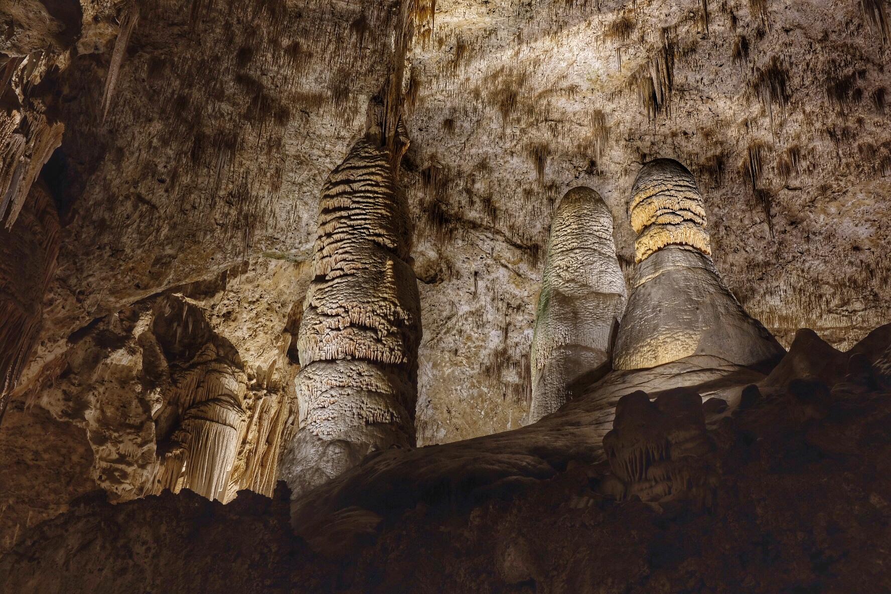
Carlsbad Caverns National Park
National Park
High ancient sea ledges, deep rocky canyons, flowering cactus, and desert wildlife—treasures above the ground in the Chihuahuan Desert. Hidden beneath the surface are more than 119 caves—formed when s...
Park data from the National Park Service API. Alerts update every 2 hours.
More Details
What kind of drive is this?
Expect a mixed driving experience that balances open stretches with varying road types, as 59% of the journey consists of highway travel. You will face your longest uninterrupted segment early on, covering 102.3 miles on US Highway 62. The character of the road shifts as you transition between major routes, requiring you to remain alert as you move from local highways onto the more sustained pace of the Purple Heart Memorial Freeway. While the terrain remains largely consistent with the Desert Southwest, the transition in road infrastructure provides enough variety to keep the drive from feeling like a monotonous interstate grind. You will find that the rhythm of the trip changes significantly once you move past that primary long stretch.
59% highway, the rest on surface roads — varied driving throughout.
24 navigation steps total — most of the decisions cluster near the start and finish.
Longest single stretch: 102.3 mi on US Highway 62.
How Hard Is This Drive?
4/10
This route mixes highway mileage with some local-road sections near the start or finish. There are only a few real navigation decisions along the way. The trickiest moment comes early in the drive near West Cedar Street.
Driving Effort4/10
Easy - simple navigation with a manageable amount of wheel time
Balances navigation complexity with total wheel time.
This is a straightforward 4h drive. You will face about 14 decision points, but nothing that requires special attention if you follow navigation.
Where does it get tricky?
The main spots that need attention: near the start (West Cedar Street): Navigation decision point; at 158.9 miles (Loop 375 / Purple Heart Memorial Freeway): Merge point - match speed before joining. Lane positioning matters here; at 184 miles (I 10; US 85; US 180 / Camino Real de Tierra Adentro): Merge point - match speed before joining. Lane positioning matters here.
Elevation Profile
High-altitude sections with notable climbs
5,354 ft3,049 ft
Total Climb
2,766 ft
Total Descent
1,925 ft
Highest Point
5,354 ft
~61.3 mi in
Elevation Range
2,305 ft
Notable High Points
5,354 ft at ~61.3 miles+1,540 ft prominence
4,275 ft at ~107.2 miles+207 ft prominence
Towns Mentioned on Route Signs
Based on OSRM destination-sign hints, not a full list of every settlement the road passes.
On the drive from Loving, NM to Las Cruces, NM, road signs begin pointing toward Loop 375 North along the way.
Las Cruces is a city in New Mexico. The name means "the crosses" in Spanish. It is the state's second largest city, with a population of over 111,000 (in 2020), and is the site of New Mexico State University.
Top landmarks
•Rio Grande Theatre — movie theater in Las Cruces, New Mexico, United States
•Mesilla Park Elementary School — school building in Las Cruces, New Mexico
•Mesilla Park Historic District — historic district in Las Cruces, New Mexico
Mixed highway & surface route profile with national parks nearby.
Frequently Asked Questions
The longest stretch is about 102.3 miles on US Highway 62. The full list of main roads is in the Roads section above.
Yes — we found about 10 rest areas or service plazas within a short detour of the route (from OpenStreetMap). See the Rest Stops tab under Nearby Places for locations and mile markers. Plan to stretch, use the bathroom, and top off fluids every 2–3 hours on longer drives.
Yes, with realistic expectations. Build in a stop roughly every 2 hours, have snacks and activities ready, and check the Nearby Places tabs for kid-friendly stops along the way.
Mostly yes along the main roads, but rural stretches through NM can have sparse or no coverage. Before you leave, download offline Google Maps or Apple Maps for the route, and consider downloading music or podcasts instead of streaming. If you depend on data for navigation, keep a paper backup of the turn-by-turn directions.
The main spots that need attention: near the start (West Cedar Street): Navigation decision point; at 158.9 miles (Loop 375 / Purple Heart Memorial Freeway): Merge point - match speed before joining. Lane positioning matters here; at 184 miles (I 10; US 85; US 180 / Camino Real de Tierra Adentro): Merge point - match speed before joining. Lane positioning matters here.
Yes — Carlsbad Caverns National Park. See the National Parks section for detour distances and tips on detours.
Possible but tiring. At 4.0 hours each way, an in-and-out day trip would put you behind the wheel for 8.0 hours — manageable with a long break at Las Cruces, NM, but most travelers stay overnight.