Origin
Lebanon, NH
Night in Lebanon on Saturday
Local time
10:49 PM
EDT
Current temp
36°F
Unavailable
Live forecast
Compiled and reviewed by the US Trip Planner planning team at COD Solutions Oy · Last reviewed Apr 19, 2026 · Editorial standards
Drive Time
2h 39m
Distance
87.7 mi
141 km
Drive Score
8/10
Great drive
Same Day?
Yes, doable
Fuel Cost
$14
one way
EV Charging
Unknown
Estimated drive times based on typical traffic patterns. Actual times may vary with weather, construction, and real-time conditions.

Lebanon, NH
Wikimedia Commons

Conway, NH
Wikimedia Commons
Planning a trip from Lebanon, NH, to Conway, NH? This 87.7-mile journey takes about 2 hours and 39 minutes, making it a perfectly manageable day trip. You'll navigate primarily on U.S. Route 4 and Whittier Highway, with a modest 28% of the drive on highways. Expect a fuel cost of around $14 for this drive within the Northeast region. The route offers a sense of local exploration rather than a high-speed transit, so budget your time accordingly and embrace the more leisurely pace. One stop is recommended along the way to break up the travel.
Trip Pace
Same-day drive is realistic
A same-day return is realistic if you keep stops short.
Break Rhythm
1 planned break
A short stop every 2 to 3 hours is enough for this drive.
Midpoint
43.9 miles from Lebanon, NH
A natural place for your longest stop of the day , about 1h 20m into the drive .
| Road | Distance | Duration |
|---|---|---|
| U.S. Route 4 | 14.1 mi | 26m |
| Whittier Highway | 12.2 mi | 22m |
| Main Street | 9.1 mi | 16m |
| Ragged Mountain Highway | 8.2 mi | 14m |
| White Mountain Highway | 7.1 mi | 10m |
| New Hampshire Highway 104 | 6 mi | 9m |
| Dartmouth College Highway | 4.7 mi | 8m |
| Summer Street | 4.4 mi | 7m |
Step-by-step road directions between Lebanon, NH and Conway, NH.
Start on US 4
At end of road, turn left onto US 4
Turn slight right onto US 4
Turn straight onto US 4
Continue on US 4
Continue on US 4
Continue on US 4
Continue on US 4
Continue on US 4
Turn left onto NH 104
Continue on NH 104
Continue on Pleasant Street
Continue on NH 104
Continue on NH 104
Continue on NH 104
Turn left onto US 3
Turn slight right
Turn right onto NH 25
Continue on NH 25
Continue on NH 25
Continue on NH 25
Continue on NH 25
Continue on NH 25; NH 113
Continue on NH 25; NH 113
Turn left onto NH 113
Turn left onto NH 113
Turn right onto NH 113
Turn slight right onto Page Hill Road
Turn left onto NH 16
Continue on NH 16
Continue on NH 16; NH 113
Arrive at destination
For this 87.7-mile drive, consider an early morning departure to make the most of your day, especially since it's a single-day trip. The 2-hour-and-39-minute duration allows for flexibility, but planning for one stop is advised to stretch your legs. Keep an eye on your fuel gauge, as the estimated cost is $14, and while there are highway segments, much of this is on local roads where services might be less frequent. A specific tip for this route: pay attention as you transition onto Whittier Highway; it's a key part of the journey and can be a bit more winding.
Morning Departure
Leave by 9 AM and you'll arrive before lunch.
Evening Departure
Even a 4 PM departure gets you there before dark in summer.
This is a comfortable same-day trip.
Departure
Before you leave
Start with fuel, water, and navigation already sorted so the first hour feels easy.
First stop
Around 19 miles or 36m in
Use this first pause for coffee, a restroom break, and a quick traffic check ahead.
Halfway reset
Around 43.9 miles or 1h 20m in
This is the best place for your longest stop, a real meal, and a full fuel check.
Final approach
Final hour starts around 2h 16m
Traffic, exits, and arrival timing usually matter more near Conway, NH than in the middle of the route.
Open the route before leaving Lebanon, NH so your first major turns are already loaded.
Leave with enough water and a charging cable within reach, not packed away.
Check your fuel range against the first long segment, especially if you are starting outside city service areas.
Day 1
Settle into the route from Lebanon, NH
This is one driving day of about 87.7 miles and 2h 39m.
Rest stops, refuel points, and overnight suggestions along this route.

Mid-route town
Meal stop
44 mi into the route
Best for: Lunch, fuel, and a longer reset
This sits close to the middle of the route, so it works well for the longest stop of the day.
A short stop after about 19 miles helps settle the day before fatigue starts building.
The midpoint is around 43.9 miles from Lebanon, NH, which is a good place for a longer meal and fuel stop.
These stop ideas are pacing suggestions — the exact town or exit can change with traffic, hotel plans, and fuel range.
5 decision points cluster between mile 0.1 and 76 — GPS handles the exact turns, but know they're coming. Your lane choice matters more than the turn itself.
At end of road, turn left onto US 4 / East Park Street
Navigation decision point
Turn straight onto US 4 / Dartmouth College Highway
Lane positioning matters here
Turn left onto US 3 / Daniel Webster Highway
Lane positioning matters here
Turn right onto NH 25 / Winnipesaukee Street
Lane positioning matters here
Turn left onto NH 16 / Chocorua Mtn Highway
Navigation decision point
Regular Gas
$14.12 one way
$28.24 round trip
| Fuel Type | $/gal | One Way | Round Trip |
|---|---|---|---|
| midgrade | $4.50 | $15.53 | $31.07 |
| premium | $4.86 | $16.79 | $33.59 |
| diesel | $5.61 | $19.36 | $38.73 |
No toll roads detected on this route.
Estimated Trip Cost (one way, 1 person)
Fuel
$14
Meals
$25–$50
Total
$39–$64
Rough estimate based on US averages. Hotel $80–$140/night, meals $25–$50/day.
Estimated CO2 emission: 30.7 kg one way. Prices: EIA weekly data, 2026-04-13.
Driving Electric?
About $9 in charging · 0 stops · 68% less CO2
| Vehicle Type | kWh | Stops | DC Fast | Home Charge |
|---|---|---|---|---|
| Average EV | 26.3 | 0 | $9.21 | $4.21 |
| Efficient EV | 21.9 | 0 | $7.67 | $3.51 |
| EV Truck/SUV | 35.1 | 0 | $12.28 | $5.61 |
Gas CO2
31 kg
EV CO2
10 kg (68% less)
This trip is well within single-charge range for most EVs. No charging stops needed if you start fully charged.
DC fast charging avg $0.35/kWh. Home charging avg $0.16/kWh. US grid CO2: 0.39 kg/kWh.
Current conditions at both ends of the drive.
Origin
Night in Lebanon on Saturday
Local time
10:49 PM
EDT
Current temp
36°F
Unavailable
Destination
Night in Conway on Saturday
Local time
10:49 PM
EDT
Current temp
35°F
Unavailable
50°F
Bristol, NH
44 mi in
Seasonal Notes
Summer travel usually means heavier construction, hotter rest stops, and busier weekend traffic around major cities.
Winter travel shortens daylight, so a route that looks manageable on paper can feel much longer after dark.
Holiday weekends tend to make both departure and arrival windows slower than the raw route time suggests.
Time zone
Origin and destination are on the same clock, so arrival timing is easier to judge at a glance.
Temperature spread
A meaningful temperature swing is a good cue to rethink layers, water, and how soon you want to arrive.
Road read
Use the two city cards together: check the sky where you start, then compare it with the local time and temperature at arrival.
Weather data from the National Weather Service. Conditions may change; check closer to your travel date.
Worth a detour if your schedule allows.
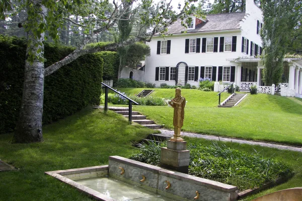
National Historical Park
Your National Park for the Arts preserves the home and studio of sculptor Augustus Saint-Gaudens (1848-1907). Here stories flow through a landscape of inspiration. Discover the history behind the capt...
Park data from the National Park Service API. Alerts update every 2 hours.
This route is characterized by its frequent turns, leaning more towards a local, scenic drive than an interstate cruise. With only 28% of the mileage on highways, you'll experience a more intimate connection with the landscape. The longest uninterrupted stretch you'll encounter is 14.1 miles on U.S. Route 4, offering a brief period of consistent travel before the road winds again. As you progress, you'll notice the transition from more open stretches to the character of Main Street as you approach your destination.
Expect a hands-on drive with frequent turns and local roads rather than long highway stretches. You will hit about 9 points where you need to pay attention to lane position or signs. The trickiest moment comes around 0.1 miles in near US 4 / East Park Street.
Moderate - straightforward overall, but long enough or busy enough to require pacing
Balances navigation complexity with total wheel time.
This drive requires moderate attention. Across 87.7 miles you will encounter 9 spots where lane choice or exit timing matters. Not difficult for experienced highway drivers, but worth previewing the tricky sections before you go.
Where does it get tricky?
The main spots that need attention: at 0.1 miles (US 4 / East Park Street): Navigation decision point; at 0.7 miles (US 4 / Dartmouth College Highway): Lane positioning matters here; at 51.1 miles (US 3 / Daniel Webster Highway): Lane positioning matters here.
Mostly flat terrain
Total Climb
816 ft
Total Descent
943 ft
Highest Point
896 ft
~12.5 mi in
Elevation Range
433 ft
Lebanon is a city in New Hampshire.
City content from Wikivoyage (CC BY-SA 4.0) and Wikidata (CC0).
Weekend Trip
Doable as a same-day drive at 2h 39m. Total distance: 87.7 miles.
Family Friendly
Moderate complexity with 1 natural rest stops along the way.
Solo Traveler
2h 39m drive, comfortable solo distance.
First-Time Driver
Mostly highway driving (28%). Some complex stretches to watch for.
Scenic Drive
Mostly surface roads route profile with national parks nearby.
Compiled by the US Trip Planner planning team at COD Solutions Oy from open government datasets — OSRM over OpenStreetMap for geometry, EIA for fuel prices, USGS 3DEP for elevation, and NPS for national parks. See our methodology for refresh cadence and limitations.
Was this helpful?
Thanks for your feedback!
Your tip has been submitted. Thanks!
/500
Recent Tips
·
Explore more options from Lebanon, NH or browse trips ending in Conway, NH.
Looking for more statewide routes? Browse NH road trips.