L'Anse to Lansing is 463.1 miles and takes about 8h 47m via US 127, I-75, and M-28, with a fuel budget near $72 and enough daylight to finish in a day, though an overnight is recommended. This drive takes you through the heart of Michigan's Midwest region, transitioning from the Upper Peninsula to the Lower Peninsula. While you'll encounter plenty of highway driving, the route offers a practical way to cover significant ground between these two points. Consider this trip if you need an efficient journey with a clear path, keeping in mind the recommended two days to comfortably enjoy the drive.
Trip Pace
Best split across 2 days
Treat the return leg as its own travel day rather than an afterthought.
Break Rhythm
2 planned breaks
Plan on a short reset every 3 to 4 hours to stay fresh behind the wheel.
Midpoint
231.6 miles from L'Anse, MI
A natural place for your longest stop of the day
, about 4h 48m into the drive
.
Main Roads
Road
Distance
Duration
US 127
137.3 mi
2h 20m
I 75
94.1 mi
1h 37m
M-28
70.9 mi
1h 24m
US 2
65.1 mi
1h 15m
US 41
53.4 mi
1h 10m
M 77
17.3 mi
20m
Palms Avenue
10.2 mi
14m
US-41/M-28
3.8 mi
5m
Longest stretch:
US 127
— 137.3 mi, about 2h 20m
Traffic on I-75
Hour-of-day weekday pattern from 6 FHWA count stations on your route.
Peak
1 PM
~672 veh/hr typical
· worst 1,490
Quietest
2 AM
~18 veh/hr
Peak-to-quiet ratio
37.3×
busier at peak than in the quiet hours
12a6anoon6p11p
Averaged across 52 weeks of 2023 FHWA Travel Monitoring Analysis System data. Weekday hours only (Mon–Fri).
Turn-by-Turn Driving Directions
Step-by-step road directions between L'Anse, MI and Lansing, MI.
1
Start on East Broad Street
0.6 mi·1 min·East Broad Street
2
At end of road, turn left onto US 41
52 mi·1 hr 8 min·US 41
3
Enter roundabout onto US 41; M 28
92 ft·5 sec·US 41; M 28
4
Continue on US 41; M 28
0.9 mi·1 min·US 41; M 28
5
Enter roundabout onto US 41; M 28
94 ft·5 sec·Palms Avenue
6
Continue on US 41; M 28
10 mi·14 min·Palms Avenue
7
Enter roundabout onto US 41; M 28
116 ft·6 sec·US-41/M-28
8
Continue on US 41; M 28
0.5 mi·45 sec·US-41/M-28
9
Enter roundabout onto US 41; M 28
103 ft·6 sec·US-41/M-28
10
Continue on US 41; M 28
1.6 mi·2 min·US-41/M-28
11
Continue on US 41; M 28
1.0 mi·1 min·Marquette Bypass
12
Enter roundabout onto US 41; M 28
109 ft·6 sec·Marquette Bypass
13
Continue on US 41; M 28
0.2 mi·14 sec·Marquette Bypass
14
Enter roundabout onto US 41; M 28
107 ft·1 sec·Marquette Bypass
15
Continue on US 41; M 28
0.5 mi·52 sec·Marquette Bypass
16
Take the exit onto US 41; M 28
410 ft·10 sec·US 41; M 28
17
Merge onto US 41; M 28
2.6 mi·4 min·South Front Street
18
Continue on US 41; M 28
1.6 mi·2 min·US-41/M-28
19
Turn left onto M 28
36 mi·42 min·M-28
20
Continue on M 28
2.2 mi·4 min·West Munising Avenue
21
Continue on M 28
0.2 mi·22 sec·Cedar Street
22
Continue on M 28
35 mi·41 min·M-28
23
Turn sharp right onto M 77
17 mi·20 min·M 77
24
At end of road, turn left onto US 2
65 mi·1 hr 15 min·US 2
25
Take the exit
0.3 mi·44 sec
Toward I 75 South: Mackinac Bridge
26
Merge onto I 75
94 mi·1 hr 37 min·I 75
27
Keep slight right at fork onto US 127
137 mi·2 hr 20 min·US 127
Exit 249Toward US 127: Clare, Lansing
28
Take the exit
0.6 mi·1 min
Exit 77Toward I 496 West: Downtown LansingUse the slight right lane.
29
Merge onto I 496
1.9 mi·1 min·Ransom E Olds Freeway
30
Take the exit
0.3 mi·38 sec
Exit 6Toward Downtown
31
Turn right onto South Walnut Street
0.4 mi·1 min·South Walnut Street
32
Turn right onto West Allegan Street
412 ft·12 sec·West Allegan Street
33
Turn right onto Townsend Street
22 ft·1 sec·Townsend Street
34
Arrive at destination
Townsend Street
Trip Plan
With a total duration of nearly 9 hours, splitting this drive over two days is highly recommended to avoid fatigue. Aim to depart in the morning to maximize daylight, and plan your overnight stop around the halfway point. You'll be making two primary stops along the way, so use these opportunities to refuel and stretch your legs. Keep an eye on your fuel levels, especially during the longer stretches on US 127, as services can sometimes be spread out.
Morning Departure
Start early — leave by 6-7 AM to arrive at a reasonable hour.
Evening Departure
This is a long drive — plan for a morning departure or consider splitting it into two days.
This drive is better paced as a 2-day trip.
Plan roughly 2 meaningful breaks for fuel, food, and rest.
The halfway point lands around 231.6 miles from L'Anse, MI, or about 4h 48m into the drive.
The longest continuous stretch on this route runs about 137.3 miles.
Consider an overnight stop or starting very early.
Departure
Before you leave
Start with fuel, water, and navigation already sorted so the first hour feels easy.
First stop
Around 102 miles or 2h 13m in
Use this first pause for coffee, a restroom break, and a quick traffic check ahead.
Halfway reset
Around 231.6 miles or 4h 48m in
This is the best place for your longest stop, a real meal, and a full fuel check.
Overnight split
Day 1 wrap after about 231.6 miles or 4h 48m
Stop before fatigue turns the last few hours into a grind. You want day two to start fresh, not just resumed.
Final approach
Final hour starts around 7h 44m
Traffic, exits, and arrival timing usually matter more near Lansing, MI than in the middle of the route.
Before You Leave
+
Open the route before leaving L'Anse, MI so your first major turns are already loaded.
+
Leave with enough water and a charging cable within reach, not packed away.
+
Check your fuel range against the first long segment, especially if you are starting outside city service areas.
+
Pick one backup stop option before the midpoint in case traffic changes your pacing.
+
Treat this as a 2-day road trip and book the overnight stop before the busiest arrival window.
Day 1
Settle into the route from L'Anse, MI
Aim for roughly 232 miles and 4.4 hours of wheel time on this day.
Day 2
Finish the approach into Lansing, MI
Aim for roughly 232 miles and 4.4 hours of wheel time on this day.
Your first comfortable stop window is around 102 miles from L'Anse, MI.
This route usually feels better as a 2-day drive than as one long push.
Plan about 2 real breaks rather than only quick fuel stops.
The longest stretch is on US 127 for about 137.3 miles.
Where to Stop
Rest stops, refuel points, and overnight suggestions along this route.
Place data sourced from public business listings. Hours and availability may vary.
Heads-up: tricky spots
5 of 21
5 decision points cluster between mile 67.5 and 459.9 — GPS handles the exact turns, but know they're coming. Your lane choice matters more than the turn itself.
5
67.5 mi into trip|~1h 30m in|US 41; M 28 / Marquette Bypass
Enter roundabout onto US 41; M 28 / Marquette Bypass
Roundabout - know your exit number before entering
5
145.7 mi into trip|~3h 7m in|M 77
Turn sharp right onto M 77
Sharp turn - reduce speed on approach
5
163 mi into trip|~3h 28m in|US 2
At end of road, turn left onto US 2
Navigation decision point
7
322.5 mi into trip|~6h 22m in|US 127
Keep slight right at fork onto US 127 toward US 127: Clare, Lansing
Highway fork - watch signs carefully. Multiple destination signs - pick the right one
Exit 249
Toward US 127: Clare, Lansing
7
459.9 mi into trip|~8h 42m in
Take the exit toward I 496 West: Downtown Lansing
Exit ramp - move to the correct lane early. Lane positioning matters here
Use the slight right lane.
Exit 77
Toward I 496 West: Downtown Lansing
Fuel & Cost
Regular Gas
$68.39 one way
$136.78 round trip
$3.75/gal25.4 MPG avg162 kg CO2
Fuel Type
$/gal
One Way
Round Trip
midgrade
$4.14
$75.50
$151.00
premium
$4.72
$85.98
$171.97
diesel
$4.80
$87.44
$174.88
No toll roads detected on this route.
Estimated Trip Cost (one way, 1 person)
Fuel
$68
Hotel (1n)
$80–$140
Meals
$50–$100
Total
$198–$308
Rough estimate based on US averages. Hotel $80–$140/night, meals $25–$50/day.
Estimated CO2 emission: 162 kg one way.
Prices: EIA weekly data, 2026-07-13.
Driving Electric?
About $49 in charging
· 1 stop
· 67% less CO2
Vehicle Type
kWh
Stops
DC Fast
Home Charge
Average EV
138.9
1
$48.63
$22.23
Efficient EV
115.8
1
$40.52
$18.52
EV Truck/SUV
185.2
2
$64.83
$29.64
Gas CO2
162 kg
EV CO2
54 kg (67% less)
Plan for 1 charging stop. A 30-minute DC fast charge mid-route should be enough to complete the trip comfortably.
DC fast charging avg $0.35/kWh. Home charging avg $0.16/kWh. US grid CO2: 0.39 kg/kWh.
Travel Intel
Current conditions at both ends of the drive.
Forecast as of Jul 16, 2026
Origin
L'Anse, MI
Late night
in L'Anse on Sunday
Local time
4:19 AM
EDT
Current temp
60°F
Smoke
SE 5 mph18% chanceLive forecast
Destination
Lansing, MI
Late night
in Lansing on Sunday
Local time
4:19 AM
EDT
Current temp
66°F
Smoke
ENE 3 mph0% chanceLive forecast
79°F
McMillan, MI
232 mi in
Seasonal Notes
Summer travel usually means heavier construction, hotter rest stops, and busier weekend traffic around major cities.
Winter travel shortens daylight, so a route that looks manageable on paper can feel much longer after dark.
Holiday weekends tend to make both departure and arrival windows slower than the raw route time suggests.
For long drives, weather on day two can matter just as much as conditions at departure, so check the whole travel window rather than only the first day.
Time zone
Same local time
Origin and destination are on the same clock, so arrival timing is easier to judge at a glance.
Temperature spread
6 degrees warmer at arrival
A meaningful temperature swing is a good cue to rethink layers, water, and how soon you want to arrive.
Road read
8h 47m on the road
This is long enough that the arrival forecast matters almost as much as departure conditions. Recheck both ends before you roll.
Weather data from the National Weather Service. Conditions may change; check closer to your travel date.
National Parks Near This Route
Worth a detour if your schedule allows.
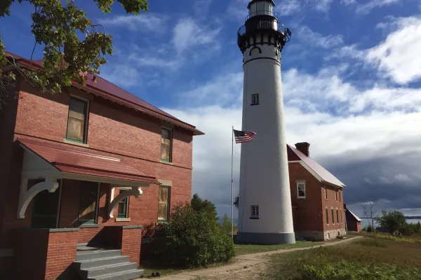
Pictured Rocks National Lakeshore
National Lakeshore
Sandstone cliffs, beaches, waterfalls, sand dunes, inland lakes, deep forest, and wild shoreline beckon you to visit Pictured Rocks National Lakeshore. The power of Lake Superior shapes the park's coa...
15 mi from route
~38 min detour
$25
near mile 127.8
Park Closure: Munising Falls Trail Closed Until Further Notice
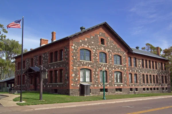
The stories of people and copper in the Keweenaw Peninsula have been intertwined for more than 7,000 years. Indigenous peoples made copper into tools and trade items. Investors and immigrants arrived...
Park data from the National Park Service API. Alerts update every 2 hours.
More Details
What kind of drive is this?
This is predominantly a highway-focused drive, with 77% of the route utilizing major roadways. You'll experience stretches of consistent speed, particularly on US 127, which features the longest uninterrupted segment at 137.3 miles. The journey offers a mix of efficient highway travel, allowing you to make good time, while also incorporating other main roads like I-75 and M-28. Expect a driving experience that prioritizes covering distance over winding scenic byways.
77% highway — fuel and pacing are the main things to plan.
34 navigation steps total — most of the decisions cluster near the start and finish.
Longest single stretch: 137.3 mi on US 127.
How Hard Is This Drive?
5/10
This is a straightforward highway drive that stays mostly on US 127 and I 75. You will hit about 21 points where you need to pay attention to lane position or signs. The trickiest moment comes around 67.5 miles in near US 41; M 28 / Marquette Bypass.
Driving Effort5/10
Moderate - straightforward overall, but long enough or busy enough to require pacing
Balances navigation complexity with total wheel time.
This drive requires moderate attention. Across 463.1 miles you will encounter 21 spots where lane choice or exit timing matters. Not difficult for experienced highway drivers, but worth previewing the tricky sections before you go.
Where does it get tricky?
The main spots that need attention: at 67.5 miles (US 41; M 28 / Marquette Bypass): Roundabout - know your exit number before entering; at 145.7 miles (M 77): Sharp turn - reduce speed on approach; at 163 miles (US 2): Navigation decision point.
Lansing is a pleasant city, and as Michigan's state capital, it is home to many government offices. Downtown Lansing has a historic shopping district amidst the campus of Thomas M. Cooley Law School.
Top landmarks
•Michigan State Capitol — state capitol building of the U.S. state of Michigan
•Boji Tower — building in Lansing, Michigan, United States completed in 1931
•Accident Fund Building — office building and former power plant in Lansing, Michigan, US
Moderate complexity with 2 natural rest stops along the way.
Solo Traveler
8h 47m drive, plan rest stops for pacing.
First-Time Driver
Mostly highway driving (77%). Some complex stretches to watch for.
Frequently Asked Questions
The longest stretch is about 137.3 miles on US 127. The full list of main roads is in the Roads section above.
Yes — a 2-day pace is more comfortable than one long haul. A sensible stopping point is after roughly 232 miles on day one.
Yes — we found about 22 rest areas or service plazas within a short detour of the route (from OpenStreetMap). See the Rest Stops tab under Nearby Places for locations and mile markers. Plan to stretch, use the bathroom, and top off fluids every 2–3 hours on longer drives.
It helps. This is a long drive, so arriving tired and in the dark compounds. If the last hour of the trip is on surface roads or mountain grades, aim to arrive at Lansing, MI before sunset when you can. Check the Trip Plan for departure windows that land you in daylight.
Only with planning. This is a long drive for kids — consider splitting it into two days rather than pushing through. Plan at least 2 meaningful breaks. There are 22 rest areas along the route for bathroom stops.
The main spots that need attention: at 67.5 miles (US 41; M 28 / Marquette Bypass): Roundabout - know your exit number before entering; at 145.7 miles (M 77): Sharp turn - reduce speed on approach; at 163 miles (US 2): Navigation decision point.
Yes — Pictured Rocks National Lakeshore and Keweenaw National Historical Park. See the National Parks section for detour distances and tips on detours.
Not recommended in a single day. At 8.8 hours each way, a round trip means 17.6 hours of driving — that is an unsafe level of fatigue for most drivers. Plan at least one night at Lansing, MI before the return drive.