Spanning 148 miles, this trek from Laguna to San Juan Bautista is a straightforward journey that typically takes about 2 hours and 55 minutes. Given the manageable duration, this route is perfectly suited for a single-day excursion, allowing you to reach your destination without needing an overnight stay. You should budget approximately $34 for fuel to cover the distance. The path connects two points within the Pacific Coast region, keeping you within a familiar coastal state climate for the duration of the trip. It is a practical, no-nonsense drive that prioritizes efficiency over meandering detours.
Trip Pace
Same-day drive is realistic
A same-day return is realistic if you keep stops short.
Break Rhythm
1 planned break
A short stop every 2 to 3 hours is enough for this drive.
Midpoint
74 miles from Laguna, CA
A natural place for your longest stop of the day
, about 1h 26m into the drive
.
Main Roads
Road
Distance
Duration
Westside Freeway
96.8 mi
1h 44m
Pacheco Pass Highway
32.5 mi
38m
CA 156
8.4 mi
10m
Santa Nella Road
3.2 mi
5m
Franklin Boulevard
2.3 mi
4m
Hood Franklin Road
1.2 mi
2m
Elk Grove Boulevard
1 mi
1m
Foulks Ranch Drive
0.7 mi
1m
Longest stretch:
Westside Freeway
— 96.8 mi, about 1h 44m
Turn-by-Turn Driving Directions
Step-by-step road directions between Laguna, CA and San Juan Bautista, CA.
1
Start on Fall Breeze Court
183 ft·10 sec·Fall Breeze Court
2
Turn right onto Mapleview Way
155 ft·10 sec·Mapleview Way
3
Turn right onto November Drive
0.1 mi·28 sec·November Drive
4
Turn right onto Seasons Drive
0.2 mi·36 sec·Seasons Drive
5
Turn left onto Laguna Park Drive
0.2 mi·33 sec·Laguna Park Drive
6
Turn left onto Foulks Ranch Drive
0.7 mi·1 min·Foulks Ranch Drive
7
Turn right onto E12
1.0 mi·1 min·Elk Grove Boulevard
8
Turn left onto J8
1.1 mi·1 min·Franklin Boulevard
Use the left / uturn lanes.
9
Keep slight right at fork onto J8
1.2 mi·2 min·Franklin Boulevard
Use the straight / slight right lanes.
10
Turn right onto Hood Franklin Road
1.2 mi·2 min·Hood Franklin Road
11
Take the ramp
0.2 mi·24 sec
12
Merge onto I 5
45 mi·49 min·Westside Freeway
Use the straight / slight right lanes.
13
Keep slight left at fork onto I 5
0.8 mi·48 sec·Westside Freeway
14
Keep slight left at fork onto I 5
51 mi·54 min·Westside Freeway
15
Take the exit
0.4 mi·36 sec
Exit 407Toward CA 33: Santa Nella, Gilroy
16
Turn right onto CA 33
3.2 mi·5 min·Santa Nella Road
17
Take the ramp
0.3 mi·45 sec
18
Merge onto CA 152
26 mi·29 min·Pacheco Pass Highway
Use the straight lane.
19
Keep slight left at fork onto CA 156
6.6 mi·9 min·Pacheco Pass Highway
Use the straight / left / right lanes.
20
Turn straight onto CA 156
6.0 mi·7 min·CA 156
21
Enter roundabout onto CA 156
159 ft·5 sec·CA 156
22
Continue on CA 156
2.4 mi·2 min·CA 156
Use the straight / right lanes.
23
Turn right onto The Alameda
0.2 mi·27 sec·The Alameda
Use the right lane.
24
Turn right onto Franklin Street
305 ft·11 sec·Franklin Street
25
Turn left onto Second Street
0.2 mi·35 sec·Second Street
26
Turn left onto Polk Street
260 ft·15 sec·Polk Street
27
Turn right onto Third Street
135 ft·23 sec·Third Street
28
Arrive at destination
Third Street
Trip Plan
Since this is a relatively short trip, you have the flexibility to plan your departure around your own schedule rather than rushing to beat the clock. With one recommended stop included in the itinerary, try to time your break for the transition between the Westside Freeway and the regional highways to stretch your legs before the final leg. Keep a close eye on your fuel gauge before starting the 96.8-mile freeway stretch, as services can be spaced out along that specific segment. Taking a moment to verify traffic conditions on the Pacheco Pass Highway before you leave can help ensure your 2-hour and 55-minute estimate remains accurate.
Morning Departure
Leave by 9 AM and you'll arrive before lunch.
Evening Departure
Even a 4 PM departure gets you there before dark in summer.
You can normally do this drive in one day.
Plan roughly 1 meaningful break for fuel, food, and rest.
The halfway point lands around 74 miles from Laguna, CA, or about 1h 26m into the drive.
The longest continuous stretch on this route runs about 96.8 miles.
This is a comfortable same-day trip.
Departure
Before you leave
Start with fuel, water, and navigation already sorted so the first hour feels easy.
First stop
Around 33 miles or 41m in
Use this first pause for coffee, a restroom break, and a quick traffic check ahead.
Halfway reset
Around 74 miles or 1h 26m in
This is the best place for your longest stop, a real meal, and a full fuel check.
Final approach
Final hour starts around 2h 20m
Traffic, exits, and arrival timing usually matter more near San Juan Bautista, CA than in the middle of the route.
Before You Leave
+
Open the route before leaving Laguna, CA so your first major turns are already loaded.
+
Leave with enough water and a charging cable within reach, not packed away.
+
Check your fuel range against the first long segment, especially if you are starting outside city service areas.
Day 1
Settle into the route from Laguna, CA
This is one driving day of about 148 miles and 2h 55m.
Your first comfortable stop window is around 33 miles from Laguna, CA.
This route can stay practical as a one-day drive if traffic stays reasonable.
Plan about 1 real break rather than only quick fuel stops.
The longest stretch is on Westside Freeway for about 96.8 miles.
Where to Stop
Rest stops, refuel points, and overnight suggestions along this route.
The midpoint is around 74 miles from Laguna, CA, which is a good place for a longer meal and fuel stop.
Before the longest stretch
Fuel check
Top up before Westside Freeway if your tank is already low. That segment runs about 96.8 miles.
These stop ideas are pacing suggestions — the exact town or exit can change with traffic, hotel plans, and fuel range.
Heads-up: tricky spots
5 of 23
5 decision points cluster between mile 0 and 132.5 — GPS handles the exact turns, but know they're coming. Your lane choice matters more than the turn itself.
5
0 mi into trip|~0m in|Mapleview Way
Turn right onto Mapleview Way
Navigation decision point
5
0.2 mi into trip|~0m in|Seasons Drive
Turn right onto Seasons Drive
Navigation decision point
6
3.4 mi into trip|~7m in|J8 / Franklin Boulevard
Keep slight right at fork onto J8 / Franklin Boulevard
Highway fork - watch signs carefully. Lane positioning matters here
Use the straight / slight right lanes.
6
102.8 mi into trip|~1h 56m in
Take the exit toward CA 33: Santa Nella, Gilroy
Exit ramp - move to the correct lane early. Multiple destination signs - pick the right one
Exit 407
Toward CA 33: Santa Nella, Gilroy
6
132.5 mi into trip|~2h 33m in|CA 156 / Pacheco Pass Highway
Keep slight left at fork onto CA 156 / Pacheco Pass Highway
Highway fork - watch signs carefully. Lane positioning matters here
Use the straight / left / right lanes.
Fuel & Cost
Regular Gas
$34.02 one way
$68.03 round trip
$5.84/gal25.4 MPG avg52 kg CO2
Fuel Type
$/gal
One Way
Round Trip
midgrade
$6.02
$35.05
$70.11
premium
$6.18
$35.99
$71.98
diesel
$5.61
$32.68
$65.35
No toll roads detected on this route.
Estimated Trip Cost (one way, 1 person)
Fuel
$34
Meals
$25–$50
Total
$59–$84
Rough estimate based on US averages. Hotel $80–$140/night, meals $25–$50/day.
Estimated CO2 emission: 51.8 kg one way.
Prices: EIA weekly data, 2026-04-13.
Driving Electric?
About $16 in charging
· 0 stops
· 67% less CO2
Vehicle Type
kWh
Stops
DC Fast
Home Charge
Average EV
44.4
0
$15.54
$7.10
Efficient EV
37
0
$12.95
$5.92
EV Truck/SUV
59.2
0
$20.72
$9.47
Gas CO2
52 kg
EV CO2
17 kg (67% less)
This trip is well within single-charge range for most EVs. No charging stops needed if you start fully charged.
DC fast charging avg $0.35/kWh. Home charging avg $0.16/kWh. US grid CO2: 0.39 kg/kWh.
Travel Intel
Current conditions at both ends of the drive.
Forecast as of Apr 17, 2026
Origin
Laguna, CA
Late night
in Laguna on Sunday
Local time
4:56 AM
PDT
Current temp
74°F
Sunny
NNW 2 to 9 mph0% chanceLive forecast
Destination
San Juan Bautista, CA
Late night
in San Juan Bautista on Sunday
Local time
4:56 AM
PDT
Current temp
58°F
Unavailable
Live forecast
50°F
Los Banos, CA
74 mi in
Seasonal Notes
Summer travel usually means heavier construction, hotter rest stops, and busier weekend traffic around major cities.
Winter travel shortens daylight, so a route that looks manageable on paper can feel much longer after dark.
Holiday weekends tend to make both departure and arrival windows slower than the raw route time suggests.
Time zone
Same local time
Origin and destination are on the same clock, so arrival timing is easier to judge at a glance.
Temperature spread
16 degrees cooler at arrival
A meaningful temperature swing is a good cue to rethink layers, water, and how soon you want to arrive.
Road read
2h 55m on the road
The weather snapshot is not static. If you are leaving later, give both cities one more quick forecast check before departure.
Weather data from the National Weather Service. Conditions may change; check closer to your travel date.
National Parks Near This Route
Worth a detour if your schedule allows.
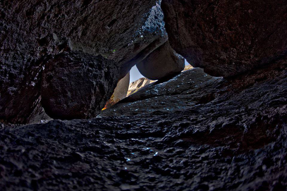
Pinnacles National Park
National Park
Around 23 million years ago, a series of volcanic eruptions shaped the landscape that is now Pinnacles National Park. The remnants of these ancient eruptions have formed a striking terrain of rocky sp...
29 mi from route
~72 min detour
$30
near mile 142.9
Park data from the National Park Service API. Alerts update every 2 hours.
More Details
What kind of drive is this?
Expect a highway-focused experience, as 71% of your journey is spent on major thoroughfares. You will spend the bulk of your time on the Westside Freeway, which accounts for the longest uninterrupted stretch of 96.8 miles. The route shifts in character as you transition from the freeway onto the Pacheco Pass Highway and eventually CA 156. While the vast majority of the mileage is dominated by high-speed transit, the final segments offer a change of pace from the long, open stretches of the main freeway. It is the type of drive where you can settle into a consistent rhythm behind the wheel.
71% highway — fuel and pacing are the main things to plan.
28 navigation steps total — most of the decisions cluster near the start and finish.
Longest single stretch: 96.8 mi on Westside Freeway.
How Hard Is This Drive?
9/10
This is a straightforward highway drive that stays mostly on Westside Freeway and Pacheco Pass Highway. This route has several spots where lane changes, forks, or exits need your full attention. The trickiest moment comes early in the drive near Mapleview Way.
Driving Effort9/10
High effort - long or complex enough to need steady focus all day
Balances navigation complexity with total wheel time.
This is a demanding drive. With 23 significant decision points across 148 miles, you will need to stay alert - especially through interchange areas and urban stretches. Consider splitting it into segments if you are not comfortable with fast highway navigation.
Where does it get tricky?
The main spots that need attention: near the start (Mapleview Way): Navigation decision point; at 0.2 miles (Seasons Drive): Navigation decision point; at 3.4 miles (J8 / Franklin Boulevard): Highway fork - watch signs carefully. Lane positioning matters here.
Towns Mentioned on Route Signs
Based on OSRM destination-sign hints, not a full list of every settlement the road passes.
On the drive from Laguna, CA to San Juan Bautista, CA, road signs begin pointing toward Gilroy along the way.
Gilroy
102.8 mi in|~1h 56m
Who Is This Route For?
Weekend Trip
Doable as a same-day drive at 2h 55m. Total distance: 148 miles.
Family Friendly
Moderate complexity with 1 natural rest stops along the way.
Solo Traveler
2h 55m drive, comfortable solo distance.
First-Time Driver
Mostly highway driving (71%). Some complex stretches to watch for.
Frequently Asked Questions
The longest stretch is about 96.8 miles on Westside Freeway. The full list of main roads is in the Roads section above.
It helps. This route has a higher-than-average number of complex decision points, which get harder in the dark. If the last hour of the trip is on surface roads or mountain grades, aim to arrive at San Juan Bautista, CA before sunset when you can. Check the Trip Plan for departure windows that land you in daylight.
Only with planning. This is a long drive for kids — consider splitting it into two days rather than pushing through. Plan at least 1 meaningful breaks. Dedicated rest areas are limited, so plan gas or food stops as your bathroom breaks.
The main spots that need attention: near the start (Mapleview Way): Navigation decision point; at 0.2 miles (Seasons Drive): Navigation decision point; at 3.4 miles (J8 / Franklin Boulevard): Highway fork - watch signs carefully. Lane positioning matters here.
Yes — Pinnacles National Park. See the National Parks section for detour distances and tips on detours.
Yes. A round trip is manageable in a single day if you plan a break at San Juan Bautista, CA before heading back.