Origin
Jackson, WY
Night in Jackson on Saturday
Local time
10:23 PM
MDT
Current temp
62°F
Unavailable
Live forecast
Compiled and reviewed by the US Trip Planner planning team at COD Solutions Oy · Last reviewed Apr 19, 2026 · Editorial standards
Drive Time
3h 34m
Distance
178.3 mi
287 km
Drive Score
8/10
Great drive
Same Day?
Yes, doable
Fuel Cost
$28
one way
EV Charging
Unknown
Estimated drive times based on typical traffic patterns. Actual times may vary with weather, construction, and real-time conditions.

Jackson, WY
Wikimedia Commons

Rock Springs, WY
Wikimedia Commons
Jackson, WY to Rock Springs, WY is 178.3 miles and takes about 3h 34m via US 26, with a fuel budget near $28 and enough daylight to finish in a day. This trip stays within the Mountain West region, traversing the state of Wyoming. It’s a straightforward drive that primarily uses major highways. Given its manageable distance and duration, this route is ideal for a single-day excursion. You'll find it to be a practical option for connecting these two Wyoming locales without extensive planning.
Trip Pace
Same-day drive is realistic
A same-day return is realistic if you keep stops short.
Break Rhythm
1 planned break
A short stop every 2 to 3 hours is enough for this drive.
Midpoint
89.1 miles from Jackson, WY
A natural place for your longest stop of the day , about 1h 49m into the drive .
| Road | Distance | Duration |
|---|---|---|
| US 26 | 163.4 mi | 3h 10m |
| South Highway 89 | 11.8 mi | 17m |
| West Broadway Avenue | 1 mi | 2m |
| Edgar Street | 0.6 mi | 1m |
| West Pearl Avenue | 0.4 mi | <1m |
| Bridger Avenue | 0.3 mi | <1m |
| M Street | 0.2 mi | <1m |
| 2nd Street | 0.2 mi | <1m |
Step-by-step road directions between Jackson, WY and Rock Springs, WY.
Start on US 26; US 89; US 191
Continue on South Cache Drive
Turn right onto West Pearl Avenue
At end of road, turn left onto US 26; US 89; US 189; US 191
Continue on US 26; US 89; US 189; US 191
Enter roundabout onto US 26; US 89; US 189; US 191
Continue on US 26; US 89; US 189; US 191
Turn left onto I 80 Business; US 30 Business
Turn right onto M Street
Continue on Broadway Street
Turn left onto F Street
Turn left onto 2nd Street
Turn right onto Edgar Street
At end of road, turn right onto Agate Street
Turn left onto Collins Street
Arrive at destination
For this 178.3-mile drive, departing Jackson, WY anytime in the morning will give you ample daylight to reach Rock Springs, WY. With a total duration of just over 3.5 hours, you can easily complete this in one day. There's only one suggested stop, so consider fueling up before you leave Jackson to ensure you have enough gas for the 163.4-mile stretch on US 26. Keep an eye on your fuel gauge, as services might be spread out during that long segment.
Morning Departure
An early start around 7-8 AM gets you there with plenty of daylight left.
Evening Departure
A late afternoon start means arriving after dark. Morning is better.
This is a comfortable same-day trip.
Departure
Before you leave
Start with fuel, water, and navigation already sorted so the first hour feels easy.
First stop
Around 39 miles or 50m in
Use this first pause for coffee, a restroom break, and a quick traffic check ahead.
Halfway reset
Around 89.1 miles or 1h 49m in
This is the best place for your longest stop, a real meal, and a full fuel check.
Final approach
Final hour starts around 2h 55m
Traffic, exits, and arrival timing usually matter more near Rock Springs, WY than in the middle of the route.
Open the route before leaving Jackson, WY so your first major turns are already loaded.
Leave with enough water and a charging cable within reach, not packed away.
Check your fuel range against the first long segment, especially if you are starting outside city service areas.
Day 1
Settle into the route from Jackson, WY
This is one driving day of about 178.3 miles and 3h 34m.
Rest stops, refuel points, and overnight suggestions along this route.

Mid-route town
Meal stop
89 mi into the route
Best for: Lunch, fuel, and a longer reset
This sits close to the middle of the route, so it works well for the longest stop of the day.
A short stop after about 39 miles helps settle the day before fatigue starts building.
The midpoint is around 89.1 miles from Jackson, WY, which is a good place for a longer meal and fuel stop.
Before the longest stretch
Fuel checkTop up before US 26 if your tank is already low. That segment runs about 163.4 miles.
These stop ideas are pacing suggestions — the exact town or exit can change with traffic, hotel plans, and fuel range.
5 decision points cluster between mile 0.1 and 178.3 — GPS handles the exact turns, but know they're coming. Your lane choice matters more than the turn itself.
Turn right onto West Pearl Avenue
Navigation decision point
At end of road, turn left onto US 26; US 89; US 189; US 191 / West Broadway Avenue
Navigation decision point
Turn right onto M Street
Navigation decision point
Turn left onto 2nd Street
Navigation decision point
Turn left onto Collins Street
Navigation decision point
Regular Gas
$28.25 one way
$56.51 round trip
| Fuel Type | $/gal | One Way | Round Trip |
|---|---|---|---|
| midgrade | $4.22 | $29.62 | $59.23 |
| premium | $4.53 | $31.81 | $63.61 |
| diesel | $5.61 | $39.37 | $78.73 |
No toll roads detected on this route.
Estimated Trip Cost (one way, 1 person)
Fuel
$28
Meals
$25–$50
Total
$53–$78
Rough estimate based on US averages. Hotel $80–$140/night, meals $25–$50/day.
Estimated CO2 emission: 62.4 kg one way. Prices: EIA weekly data, 2026-04-13.
Driving Electric?
About $19 in charging · 0 stops · 66% less CO2
| Vehicle Type | kWh | Stops | DC Fast | Home Charge |
|---|---|---|---|---|
| Average EV | 53.5 | 0 | $18.72 | $8.56 |
| Efficient EV | 44.6 | 0 | $15.60 | $7.13 |
| EV Truck/SUV | 71.3 | 0 | $24.96 | $11.41 |
Gas CO2
62 kg
EV CO2
21 kg (66% less)
This trip is well within single-charge range for most EVs. No charging stops needed if you start fully charged.
DC fast charging avg $0.35/kWh. Home charging avg $0.16/kWh. US grid CO2: 0.39 kg/kWh.
Current conditions at both ends of the drive.
Origin
Night in Jackson on Saturday
Local time
10:23 PM
MDT
Current temp
62°F
Unavailable
Destination
Night in Rock Springs on Saturday
Local time
10:23 PM
MDT
Current temp
63°F
Unavailable
Seasonal Notes
Summer travel usually means heavier construction, hotter rest stops, and busier weekend traffic around major cities.
Winter travel shortens daylight, so a route that looks manageable on paper can feel much longer after dark.
Holiday weekends tend to make both departure and arrival windows slower than the raw route time suggests.
Time zone
Origin and destination are on the same clock, so arrival timing is easier to judge at a glance.
Temperature spread
A meaningful temperature swing is a good cue to rethink layers, water, and how soon you want to arrive.
Road read
Use the two city cards together: check the sky where you start, then compare it with the local time and temperature at arrival.
Weather data from the National Weather Service. Conditions may change; check closer to your travel date.
Worth a detour if your schedule allows.
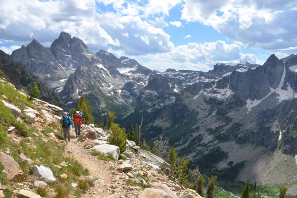
National Park
Soaring over a landscape rich with wildlife, pristine lakes, and majestic alpine vistas, the Teton Range stands as a testament to generations of stewards. For over 11,000 years, communities have thriv...
Park data from the National Park Service API. Alerts update every 2 hours.
Expect a highway-focused drive for this journey, with 98% of the route utilizing established highways. The majority of your time will be spent on US 26, which forms the longest uninterrupted stretch of 163.4 miles. This means you'll experience a consistent pace for most of the trip. The road is predominantly a well-maintained highway, offering a smooth and efficient driving experience as you transition from the Jackson area towards Rock Springs.
This is a straightforward highway drive that stays mostly on US 26 and South Highway 89. Navigation is very simple - set it and forget it for most of the drive. The trickiest moment comes around 0.1 miles in near West Pearl Avenue.
Very easy - short and simple to drive
Balances navigation complexity with total wheel time.
The drive from Jackson, WY to Rock Springs, WY is easy. At 3h 34m with 98% highway, most drivers will find it relaxed and low-stress.
Where does it get tricky?
The main spots that need attention: at 0.1 miles (West Pearl Avenue): Navigation decision point; at 0.5 miles (US 26; US 89; US 189; US 191 / West Broadway Avenue): Navigation decision point; at 177 miles (M Street): Navigation decision point.
Rock Springs is the biggest city in Sweetwater County in Southwest Wyoming. It had a population of 23,000 in 2019. Rock Springs' nickname is: "Home of 56 Nationalities". The town has a rich western and coal mining history.
City content from Wikivoyage (CC BY-SA 4.0) and Wikidata (CC0).
Weekend Trip
Doable as a same-day drive at 3h 34m. Total distance: 178.3 miles.
Family Friendly
Moderate complexity with 1 natural rest stops along the way.
Solo Traveler
3h 34m drive, comfortable solo distance.
First-Time Driver
Mostly highway driving (98%). Straightforward navigation.
Compiled by the US Trip Planner planning team at COD Solutions Oy from open government datasets — OSRM over OpenStreetMap for geometry, EIA for fuel prices, and NPS for national parks. See our methodology for refresh cadence and limitations.
Was this helpful?
Thanks for your feedback!
Your tip has been submitted. Thanks!
/500
Recent Tips
·
Explore more options from Jackson, WY or browse trips ending in Rock Springs, WY.
Looking for more statewide routes? Browse WY road trips.