Haverhill, MA to Orleans, MA is 124.6 miles and takes about 2h 44m via MA 3 and I-93, with a fuel budget near $22 and enough daylight to finish in a day. This trip stays within Massachusetts, moving from the Northeast region to the Southeast. Expect a mix of highway driving and surface roads as you make your way toward Cape Cod. It's a manageable drive, ideal for a single-day excursion.
Trip Pace
Same-day drive is realistic
A same-day return is realistic if you keep stops short.
Break Rhythm
1 planned break
A short stop every 2 to 3 hours is enough for this drive.
Midpoint
62.3 miles from Haverhill, MA
A natural place for your longest stop of the day
, about 1h 20m into the drive
.
Main Roads
Road
Distance
Duration
Mid Cape Highway
33.6 mi
46m
MA 3
30.9 mi
39m
I 93
19.6 mi
23m
Pilgrims Highway
12 mi
15m
I 495
9.7 mi
11m
Southeast Expressway
8 mi
10m
John F. Fitzgerald Expressway
3 mi
4m
Interstate 93 HOV lane
2.5 mi
3m
Longest stretch:
Mid Cape Highway
— 33.6 mi, about 46m
Traffic on I-93
Hour-of-day weekday pattern from 378 FHWA count stations on your route.
Peak
5 PM
~5,600 veh/hr typical
· worst 6,451
Quietest
2 AM
~442 veh/hr
Peak-to-quiet ratio
12.7×
busier at peak than in the quiet hours
12a6anoon6p11p
Averaged across 52 weeks of 2023 FHWA Travel Monitoring Analysis System data. Weekday hours only (Mon–Fri).
Turn-by-Turn Driving Directions
Step-by-step road directions between Haverhill, MA and Orleans, MA.
1
Start on MA 125
442 ft·14 sec·Main Street
2
Turn right onto MA 113
0.3 mi·33 sec·Merrimack Street
3
Continue on MA 110; MA 113
0.2 mi·19 sec·Washington Street
4
Continue on MA 110; MA 113
218 ft·5 sec·Washington Street
5
Continue on MA 110; MA 113
2.1 mi·3 min·River Street
6
Take the ramp
0.3 mi·42 sec
Toward I 495 South: Lawrence
7
Merge onto I 495
9.7 mi·11 min·I 495
Use the straight / slight right lanes.
8
Take the exit
0.4 mi·1 min
Exit 97AToward I 93 South: BostonUse the right lane.
9
Merge onto I 93
20 mi·23 min·I 93
Use the straight / slight right lanes.
10
Keep slight left at fork onto I 93
1.7 mi·1 min·Interstate 93 HOV lane
Use the slight left lane.
11
Keep slight left at fork onto I 93
0.8 mi·1 min·Interstate 93 HOV lane
12
Merge onto I 93; US 1
3.0 mi·4 min·John F. Fitzgerald Expressway
Use the straight / slight right lanes.
13
Continue on I 93; US 1; MA 3
8.0 mi·10 min·Southeast Expressway
Use the straight / slight right lanes.
14
Keep slight left at fork onto MA 3
31 mi·39 min·MA 3
Exit 7Toward MA 3 South: Cape CodUse the slight left lane.
15
Keep slight right at fork onto MA 3
12 mi·15 min·Pilgrims Highway
16
Continue on MA 3
0.2 mi·19 sec·Pilgrim Highway
17
Continue on US 6
0.4 mi·45 sec·Sagamore Bridge
18
Continue on US 6
34 mi·46 min·Mid Cape Highway
Use the slight right lane.
19
Take the exit
0.3 mi·47 sec
Exit 89Toward MA 6A: Orleans, East Brewster
20
Keep slight right at fork
150 ft·5 sec
Toward MA 6A East: Orleans
21
Turn right onto MA 6A
1.0 mi·1 min·Route 6A
Use the right lane.
22
Arrive at destination
MA 6A
Trip Plan
Given the 2h 44m estimated drive time, leaving Haverhill in the morning should allow you to reach Orleans with plenty of daylight. With only one recommended stop and a manageable distance, you have flexibility to depart when convenient. Keep an eye on your fuel gauge, as the estimated cost is $22, and plan your refueling accordingly before hitting longer highway stretches. You’ll want to be mindful of exits and local traffic patterns as you get closer to the Cape.
Morning Departure
Leave by 9 AM and you'll arrive before lunch.
Evening Departure
Even a 4 PM departure gets you there before dark in summer.
You can normally do this drive in one day.
Plan roughly 1 meaningful break for fuel, food, and rest.
The halfway point lands around 62.3 miles from Haverhill, MA, or about 1h 20m into the drive.
The longest continuous stretch on this route runs about 33.6 miles.
This is a comfortable same-day trip.
Departure
Before you leave
Start with fuel, water, and navigation already sorted so the first hour feels easy.
First stop
Around 27 miles or 34m in
Use this first pause for coffee, a restroom break, and a quick traffic check ahead.
Halfway reset
Around 62.3 miles or 1h 20m in
This is the best place for your longest stop, a real meal, and a full fuel check.
Final approach
Final hour starts around 2h 12m
Traffic, exits, and arrival timing usually matter more near Orleans, MA than in the middle of the route.
Before You Leave
+
Open the route before leaving Haverhill, MA so your first major turns are already loaded.
+
Leave with enough water and a charging cable within reach, not packed away.
+
Check your fuel range against the first long segment, especially if you are starting outside city service areas.
Day 1
Settle into the route from Haverhill, MA
This is one driving day of about 124.6 miles and 2h 44m.
Your first comfortable stop window is around 27 miles from Haverhill, MA.
This route can stay practical as a one-day drive if traffic stays reasonable.
Plan about 1 real break rather than only quick fuel stops.
The longest stretch is on Mid Cape Highway for about 33.6 miles.
Where to Stop
Rest stops, refuel points, and overnight suggestions along this route.
Place data sourced from public business listings. Hours and availability may vary.
Heads-up: tricky spots
5 of 13
5 decision points cluster between mile 3.1 and 123.3 — GPS handles the exact turns, but know they're coming. Your lane choice matters more than the turn itself.
5
3.1 mi into trip|~5m in|I 495
Merge onto I 495
Merge point - match speed before joining. Lane positioning matters here
Use the straight / slight right lanes.
7
12.7 mi into trip|~16m in
Take the exit toward I 93 South: Boston
Exit ramp - move to the correct lane early. Lane positioning matters here
Use the right lane.
Exit 97A
Toward I 93 South: Boston
6
32.7 mi into trip|~41m in|I 93 / Interstate 93 HOV lane
Keep slight left at fork onto I 93 / Interstate 93 HOV lane
Highway fork - watch signs carefully. Lane positioning matters here
Use the slight left lane.
8
46.2 mi into trip|~59m in|MA 3
Keep slight left at fork onto MA 3 toward MA 3 South: Cape Cod
Highway fork - watch signs carefully. Lane positioning matters here
Use the slight left lane.
Exit 7
Toward MA 3 South: Cape Cod
6
123.3 mi into trip|~2h 41m in
Take the exit toward MA 6A: Orleans, East Brewster
Exit ramp - move to the correct lane early. Multiple destination signs - pick the right one
Exit 89
Toward MA 6A: Orleans, East Brewster
Fuel & Cost
Regular Gas
$19.51 one way
$39.02 round trip
$3.98/gal25.4 MPG avg44 kg CO2
Fuel Type
$/gal
One Way
Round Trip
midgrade
$4.43
$21.74
$43.48
premium
$4.79
$23.49
$46.98
diesel
$4.80
$23.53
$47.05
No toll roads detected on this route.
Estimated Trip Cost (one way, 1 person)
Fuel
$20
Meals
$25–$50
Total
$45–$70
Rough estimate based on US averages. Hotel $80–$140/night, meals $25–$50/day.
Estimated CO2 emission: 43.6 kg one way.
Prices: EIA weekly data, 2026-07-13.
Driving Electric?
About $13 in charging
· 0 stops
· 66% less CO2
Vehicle Type
kWh
Stops
DC Fast
Home Charge
Average EV
37.4
0
$13.08
$5.98
Efficient EV
31.2
0
$10.90
$4.98
EV Truck/SUV
49.8
0
$17.44
$7.97
Gas CO2
44 kg
EV CO2
15 kg (66% less)
This trip is well within single-charge range for most EVs. No charging stops needed if you start fully charged.
DC fast charging avg $0.35/kWh. Home charging avg $0.16/kWh. US grid CO2: 0.39 kg/kWh.
Travel Intel
Current conditions at both ends of the drive.
Forecast as of Jul 16, 2026
Origin
Haverhill, MA
Night
in Haverhill on Saturday
Local time
9:33 PM
EDT
Current temp
85°F
Areas Of Smoke
W 5 to 16 mph11% chanceLive forecast
Destination
Orleans, MA
Night
in Orleans on Saturday
Local time
9:33 PM
EDT
Current temp
81°F
Areas Of Smoke
SW 6 to 10 mph4% chanceLive forecast
Seasonal Notes
Summer travel usually means heavier construction, hotter rest stops, and busier weekend traffic around major cities.
Winter travel shortens daylight, so a route that looks manageable on paper can feel much longer after dark.
Holiday weekends tend to make both departure and arrival windows slower than the raw route time suggests.
Time zone
Same local time
Origin and destination are on the same clock, so arrival timing is easier to judge at a glance.
Temperature spread
4 degrees cooler at arrival
A meaningful temperature swing is a good cue to rethink layers, water, and how soon you want to arrive.
Road read
2h 44m on the road
The weather snapshot is not static. If you are leaving later, give both cities one more quick forecast check before departure.
Weather data from the National Weather Service. Conditions may change; check closer to your travel date.
National Parks Near This Route
Worth a detour if your schedule allows.
Boston National Historical Park
National Historical Park
Discover how one city could be the Cradle of Liberty, site of the first major battle of American Revolution, and home to many who espoused that freedom can be extended to all.
From the sweet little farm at the foot of Penn’s Hill to the gentleman’s country estate at Peace field, Adams National Historical Park is the story of “heroes, statesmen, philosophers…and learned wome...
. . . where you can walk a Civil War-era fort, view historic lighthouses, explore tide pools, hike lush trails, camp under the stars, or relax while fishing, picnicking, or swimming—all within reach o...
Lowell’s water-powered textile mills catapulted the nation – including immigrant families and early female factory workers – into an uncertain new industrial era. Nearly 200 years later, the changes t...
6 mi from route
~15 min detour
Free
near mile 12.9
The great Outer Beach described by Thoreau in the 1800s is protected within the national seashore. Forty miles of pristine sandy beach, marshes, ponds, and uplands support diverse species. Lighthouses...
10 mi from route
~24 min detour
$25
near mile 124.6
At Minute Man National Historical Park the opening battle of the Revolution is brought to life as visitors explore the battlefields and structures associated with April 19, 1775, and witness the Ameri...
10 mi from route
~25 min detour
Free
near mile 25.8
Park data from the National Park Service API. Alerts update every 2 hours.
More Details
What kind of drive is this?
About 60% of this 124.6-mile route is on highways like I-93 and MA 3. You'll experience a stretch of 33.6 miles on the Mid Cape Highway without needing to exit. The transition from highway to surface roads will occur gradually as you approach your destination, leading to more local traffic and intersections.
60% highway — fuel and pacing are the main things to plan.
22 navigation steps total — most of the decisions cluster near the start and finish.
Longest single stretch: 33.6 mi on Mid Cape Highway.
How Hard Is This Drive?
8/10
This route mixes highway mileage with some local-road sections near the start or finish. This route has several spots where lane changes, forks, or exits need your full attention. The trickiest moment comes around 3.1 miles in near I 495.
Driving Effort8/10
Demanding - plan breaks and stay ahead of the key maneuvers
Balances navigation complexity with total wheel time.
This is a demanding drive. With 13 significant decision points across 124.6 miles, you will need to stay alert - especially through interchange areas and urban stretches. Consider splitting it into segments if you are not comfortable with fast highway navigation.
Where does it get tricky?
The main spots that need attention: at 3.1 miles (I 495): Merge point - match speed before joining. Lane positioning matters here; at 12.7 miles: Exit ramp - move to the correct lane early. Lane positioning matters here; at 32.7 miles (I 93 / Interstate 93 HOV lane): Highway fork - watch signs carefully. Lane positioning matters here.
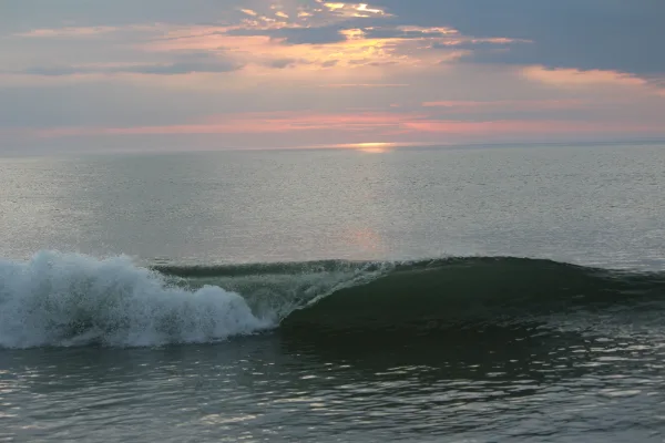
Orleans is in Massachusetts on Cape Cod, and includes the villages of East Orleans and South Orleans. With the Rock Harbor sunsets and the Nauset surf, Orleans has the best of both Cape Cod waters.
Top landmarks
•CG 36500 — Coast Guard motor lifeboat
•French Cable Station — historic telegraph station in Orleans, Massachusetts, United States
Doable as a same-day drive at 2h 44m. Total distance: 124.6 miles.
Family Friendly
Moderate complexity with 1 natural rest stops along the way.
Solo Traveler
2h 44m drive, comfortable solo distance.
First-Time Driver
Mostly highway driving (60%). Some complex stretches to watch for.
Frequently Asked Questions
The longest stretch is about 33.6 miles on Mid Cape Highway. The full list of main roads is in the Roads section above.
Yes — we found about 19 rest areas or service plazas within a short detour of the route (from OpenStreetMap). See the Rest Stops tab under Nearby Places for locations and mile markers. Plan to stretch, use the bathroom, and top off fluids every 2–3 hours on longer drives.
It helps. This route has a higher-than-average number of complex decision points, which get harder in the dark. If the last hour of the trip is on surface roads or mountain grades, aim to arrive at Orleans, MA before sunset when you can. Check the Trip Plan for departure windows that land you in daylight.
Only with planning. This is a long drive for kids — consider splitting it into two days rather than pushing through. Plan at least 1 meaningful breaks. There are 19 rest areas along the route for bathroom stops.
The main spots that need attention: at 3.1 miles (I 495): Merge point - match speed before joining. Lane positioning matters here; at 12.7 miles: Exit ramp - move to the correct lane early. Lane positioning matters here; at 32.7 miles (I 93 / Interstate 93 HOV lane): Highway fork - watch signs carefully. Lane positioning matters here.
Yes — Boston National Historical Park, Adams National Historical Park and Boston Harbor Islands National Recreation Area (6 total within detour distance). See the National Parks section for detour distances and tips on detours.
Yes. A round trip is manageable in a single day if you plan a break at Orleans, MA before heading back.