Fredonia, AZ to Munds Park, AZ is 214.8 miles and takes about 4h 35m via Bitter Springs–Fredonia Highway, with a fuel budget near $43 and enough daylight to finish in a day. This trip stays within the Desert Southwest, offering a single-day journey through Arizona. Expect a route with frequent turns, making it a more engaging local drive than a straightforward interstate cruise. With only one recommended stop and a manageable distance, this route is well-suited for a single-day excursion if you're looking for an efficient way to travel between these two points.
Trip Pace
Same-day drive is realistic
A same-day return is possible, but it will make for a full day on the road.
Break Rhythm
1 planned break
Plan on a short reset every 3 to 4 hours to stay fresh behind the wheel.
Midpoint
107.4 miles from Fredonia, AZ
A natural place for your longest stop of the day
, about 2h 22m into the drive
.
Step-by-step road directions between Fredonia, AZ and Munds Park, AZ.
1
Start on AZ 389
47 ft·3 sec·West Pratt Street
2
Turn right onto US 89A
1.6 mi·2 min·South Main Street
3
Continue on US 89A
84 mi·1 hr 53 min·Bitter Springs–Fredonia Highway
4
At end of road, turn right onto US 89
57 mi·1 hr 6 min·Cameron-Bitter Springs Highway
5
Continue on US 89
0.3 mi·26 sec·US 89
6
Continue on US 89
1.4 mi·2 min·Cameron-Bitter Springs Highway
7
Enter roundabout onto US 89
154 ft·2 sec·Flagstaff-Cameron Highway
8
Continue on US 89
38 mi·44 min·Flagstaff-Cameron Highway
9
Continue on US 89
6.4 mi·8 min·US Highway 89
10
Continue on US 89
2.3 mi·4 min·Flagstaff-Cameron Highway
11
Turn left onto Country Club Drive
0.3 mi·51 sec·Country Club Drive
Use the left lane.
12
Take the exit
0.4 mi·47 sec
Use the right lane.
13
Merge onto I 40
4.7 mi·5 min·Purple Heart Trail
14
Take the exit
0.2 mi·17 sec
Toward I 17 South, AZ 89A North: Phoenix, Flagstaff
15
Keep slight left at fork
1.0 mi·2 min
Toward I 17, AZ 89A South: Sedona, Phoenix
16
Merge onto I 17; AZ 89A
16 mi·16 min·Arizona Veterans Highway
17
Take the exit
0.2 mi·34 sec
Toward Munds Park
18
Turn left onto Pinewood Boulevard
0.3 mi·44 sec·Pinewood Boulevard
19
Turn left onto Fairway Drive
0.2 mi·43 sec·Fairway Drive
20
Turn right onto Oak Drive
448 ft·20 sec·Oak Drive
21
Continue on West Oak Drive
0.3 mi·1 min·West Oak Drive
22
Turn right onto Hillside Drive
0.6 mi·2 min·Hillside Drive
23
Turn left onto Pine Trail Drive
7 ft·0 sec·Pine Trail Drive
24
Arrive at destination
Pine Trail Drive
Trip Plan
Given the 4h 35m estimated drive time, departing in the morning will give you ample daylight to complete this trip comfortably within a single day. Plan for your one recommended stop strategically, perhaps around the halfway point, to break up the drive. Keep an eye on your fuel gauge, as the longest stretch without a major change in direction is over 83 miles. While the fuel cost is estimated at $43, it's always wise to start with a full tank in Fredonia, AZ, especially when driving through more remote sections of the Desert Southwest.
Morning Departure
An early start around 7-8 AM gets you there with plenty of daylight left.
Evening Departure
A late afternoon start means arriving after dark. Morning is better.
You can normally do this drive in one day.
Plan roughly 1 meaningful break for fuel, food, and rest.
The halfway point lands around 107.4 miles from Fredonia, AZ, or about 2h 22m into the drive.
The longest continuous stretch on this route runs about 83.6 miles.
This is a comfortable same-day trip.
Departure
Before you leave
Start with fuel, water, and navigation already sorted so the first hour feels easy.
First stop
Around 47 miles or 1h 4m in
Use this first pause for coffee, a restroom break, and a quick traffic check ahead.
Halfway reset
Around 107.4 miles or 2h 22m in
This is the best place for your longest stop, a real meal, and a full fuel check.
Final approach
Final hour starts around 3h 43m
Traffic, exits, and arrival timing usually matter more near Munds Park, AZ than in the middle of the route.
Before You Leave
+
Open the route before leaving Fredonia, AZ so your first major turns are already loaded.
+
Leave with enough water and a charging cable within reach, not packed away.
+
Check your fuel range against the first long segment, especially if you are starting outside city service areas.
Day 1
Settle into the route from Fredonia, AZ
This is one driving day of about 214.8 miles and 4h 35m.
Your first comfortable stop window is around 47 miles from Fredonia, AZ.
This route can stay practical as a one-day drive if traffic stays reasonable.
Plan about 1 real break rather than only quick fuel stops.
The longest stretch is on Bitter Springs–Fredonia Highway for about 83.6 miles.
Where to Stop
Rest stops, refuel points, and overnight suggestions along this route.
Place data sourced from public business listings. Hours and availability may vary.
Heads-up: tricky spots
5 of 15
5 decision points cluster between mile 0 and 213.8 — GPS handles the exact turns, but know they're coming. Your lane choice matters more than the turn itself.
4
0 mi into trip|~0m in|US 89A / South Main Street
Turn right onto US 89A / South Main Street
Navigation decision point
6
190.4 mi into trip|~4h 3m in
Take the exit
Exit ramp - move to the correct lane early. Lane positioning matters here
Use the right lane.
5
195.5 mi into trip|~4h 10m in
Take the exit toward I 17 South, AZ 89A North: Phoenix, Flagstaff
Exit ramp - move to the correct lane early. Multiple destination signs - pick the right one
Toward I 17 South, AZ 89A North: Phoenix, Flags...
6
195.7 mi into trip|~4h 10m in
Keep slight left at fork toward I 17, AZ 89A South: Sedona, Phoenix
Highway fork - watch signs carefully. Multiple destination signs - pick the right one
Toward I 17, AZ 89A South: Sedona, Phoenix
5
213.8 mi into trip|~4h 31m in|Oak Drive
Turn right onto Oak Drive
Navigation decision point
Fuel & Cost
Regular Gas
$38.06 one way
$76.13 round trip
$4.50/gal25.4 MPG avg75 kg CO2
Fuel Type
$/gal
One Way
Round Trip
midgrade
$4.82
$40.76
$81.52
premium
$5.04
$42.64
$85.28
diesel
$4.80
$40.56
$81.12
No toll roads detected on this route.
Estimated Trip Cost (one way, 1 person)
Fuel
$38
Meals
$25–$50
Total
$63–$88
Rough estimate based on US averages. Hotel $80–$140/night, meals $25–$50/day.
Estimated CO2 emission: 75.2 kg one way.
Prices: EIA weekly data, 2026-07-13.
Driving Electric?
About $23 in charging
· 0 stops
· 67% less CO2
Vehicle Type
kWh
Stops
DC Fast
Home Charge
Average EV
64.4
0
$22.55
$10.31
Efficient EV
53.7
0
$18.80
$8.59
EV Truck/SUV
85.9
1
$30.07
$13.75
Gas CO2
75 kg
EV CO2
25 kg (67% less)
This trip is well within single-charge range for most EVs. No charging stops needed if you start fully charged.
DC fast charging avg $0.35/kWh. Home charging avg $0.16/kWh. US grid CO2: 0.39 kg/kWh.
Travel Intel
Current conditions at both ends of the drive.
Forecast as of Jul 18, 2026
Origin
Fredonia, AZ
Late night
in Fredonia on Sunday
Local time
2:12 AM
MST
Current temp
92°F
Chance Showers And Thunderstorms
W 6 mph42% chanceLive forecast
Flash Flood Warning
Flash Flood Warning issued July 18 at 3:46PM MST until July 18 at 5:15PM MST by NWS Flagstaff AZ
Flash Flood Warning
Flash Flood Warning issued July 18 at 2:42PM MST until July 18 at 5:45PM MST by NWS Flagstaff AZ
Destination
Munds Park, AZ
Late night
in Munds Park on Sunday
Local time
2:12 AM
MST
Current temp
76°F
Showers And Thunderstorms Likely
W 5 mph67% chanceLive forecast
Flash Flood Warning
Flash Flood Warning issued July 18 at 3:46PM MST until July 18 at 5:15PM MST by NWS Flagstaff AZ
Flash Flood Warning
Flash Flood Warning issued July 18 at 2:42PM MST until July 18 at 5:45PM MST by NWS Flagstaff AZ
Seasonal Notes
Summer travel usually means heavier construction, hotter rest stops, and busier weekend traffic around major cities.
Winter travel shortens daylight, so a route that looks manageable on paper can feel much longer after dark.
Holiday weekends tend to make both departure and arrival windows slower than the raw route time suggests.
Time zone
Same local time
Origin and destination are on the same clock, so arrival timing is easier to judge at a glance.
Temperature spread
16 degrees cooler at arrival
A meaningful temperature swing is a good cue to rethink layers, water, and how soon you want to arrive.
Road read
4h 35m on the road
An early start around 7-8 AM gets you there with plenty of daylight left.
Weather data from the National Weather Service. Conditions may change; check closer to your travel date.
National Parks Near This Route
Worth a detour if your schedule allows.
Sunset Crater Volcano National Monument
National Monument
The lava flow lies on the land like a dream, a wonderland of rock. A thousand years ago the ground was torn open and lava erupted into the sky, forever changing the landscape and the lives of the peop...
4 mi from route
~10 min detour
$25
near mile 177.7
Caution: 2-hour delayed opening 20, February 2026 due to inclement weather.
Caution: 2-hour delayed opening 20, February 2026 due to inclement weather.
Since time immemorial, Indigenous Peoples have lived and traveled throughout Walnut Canyon’s dynamic landscape. Vibrant communities built their homes in the cliffs and farmed along the canyon’s rim. T...
7 mi from route
~17 min detour
$25
near mile 192.6
Nestled between the Painted Desert and ponderosa highlands of northern Arizona, Wupatki National Monument is an unlikely landscape for a thriving community. The early 1100's marked a time of cooler an...
8 mi from route
~19 min detour
$25
near mile 162.9
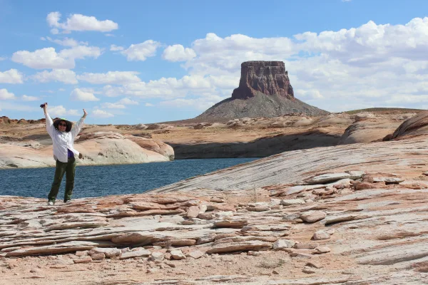
Encompassing over 1.25 million acres, Glen Canyon National Recreation Area offers unparalleled opportunities for water-based & backcountry recreation. The recreation area stretches for hundreds of mil...
13 mi from route
~32 min detour
$30
near mile 74.1
The rich history of Pipe Spring and its flowing water comes alive as you explore the traditions of the Kaibab Paiute and the Mormon settlers through the museum, historic fort, cabins, and garden. Hike...
Established December 8, 1906, Montezuma Castle is the third National Monument dedicated to preserving Native American culture. This 20 room high-rise apartment, nestled into a towering limestone cliff...
24 mi from route
~61 min detour
$10
near mile 214.8
Park data from the National Park Service API. Alerts update every 2 hours.
More Details
What kind of drive is this?
This drive is characterized as a 'turn-heavy local drive,' with 67% of the journey on main roads like the Bitter Springs–Fredonia Highway and the Flagstaff-Cameron Highway. You'll experience a longest uninterrupted stretch of 83.6 miles on the Bitter Springs–Fredonia Highway, which offers a substantial segment of consistent driving before you need to navigate further changes. The profile suggests a route that is less about high-speed cruising and more about attentive navigation through local roadways. Be prepared for a driving experience that requires more frequent adjustments compared to an interstate.
Only 3% highway — the rest is turn-by-turn surface driving.
24 navigation steps total — most of the decisions cluster near the start and finish.
Longest single stretch: 83.6 mi on Bitter Springs–Fredonia Highway.
How Hard Is This Drive?
5/10
Expect a hands-on drive with frequent turns and local roads rather than long highway stretches. You will hit about 15 points where you need to pay attention to lane position or signs. The trickiest moment comes early in the drive near US 89A / South Main Street.
Driving Effort5/10
Moderate - straightforward overall, but long enough or busy enough to require pacing
Balances navigation complexity with total wheel time.
This drive requires moderate attention. Across 214.8 miles you will encounter 15 spots where lane choice or exit timing matters. Not difficult for experienced highway drivers, but worth previewing the tricky sections before you go.
Where does it get tricky?
The main spots that need attention: near the start (US 89A / South Main Street): Navigation decision point; at 190.4 miles: Exit ramp - move to the correct lane early. Lane positioning matters here; at 195.5 miles: Exit ramp - move to the correct lane early. Multiple destination signs - pick the right one.
Elevation Profile
High-altitude sections with notable climbs
7,776 ft3,915 ft
Total Climb
7,505 ft
Total Descent
5,575 ft
Highest Point
7,776 ft
~30.7 mi in
Elevation Range
3,861 ft
Notable High Points
7,776 ft at ~30.7 miles+1,849 ft prominence
5,614 ft at ~107.4 miles+252 ft prominence
6,942 ft at ~199.4 miles+204 ft prominence
Towns Mentioned on Route Signs
Based on OSRM destination-sign hints, not a full list of every settlement the road passes.
Between Fredonia, AZ and Munds Park, AZ, road signs point toward Flagstaff and Phoenix.
Doable as a same-day drive at 4h 35m. Total distance: 214.8 miles.
Family Friendly
Moderate complexity with 1 natural rest stops along the way.
Solo Traveler
4h 35m drive, comfortable solo distance.
First-Time Driver
Mostly highway driving (3%). Some complex stretches to watch for.
Scenic Drive
Mostly surface roads route profile with national parks nearby.
Frequently Asked Questions
The longest stretch is about 83.6 miles on Bitter Springs–Fredonia Highway. The full list of main roads is in the Roads section above.
Yes — we found about 3 rest areas or service plazas within a short detour of the route (from OpenStreetMap). See the Rest Stops tab under Nearby Places for locations and mile markers. Plan to stretch, use the bathroom, and top off fluids every 2–3 hours on longer drives.
Yes, with realistic expectations. Build in a stop roughly every 2 hours, have snacks and activities ready, and check the Nearby Places tabs for kid-friendly stops along the way.
The main spots that need attention: near the start (US 89A / South Main Street): Navigation decision point; at 190.4 miles: Exit ramp - move to the correct lane early. Lane positioning matters here; at 195.5 miles: Exit ramp - move to the correct lane early. Multiple destination signs - pick the right one.
Yes — Sunset Crater Volcano National Monument, Walnut Canyon National Monument and Wupatki National Monument (6 total within detour distance). See the National Parks section for detour distances and tips on detours.
Possible but tiring. At 4.6 hours each way, an in-and-out day trip would put you behind the wheel for 9.2 hours — manageable with a long break at Munds Park, AZ, but most travelers stay overnight.