Fort Collins to Granby is 103.4 miles and takes about 3 hours 9 minutes via Trail Ridge Road, with a fuel budget near $18 and enough daylight to finish in a day. This drive stays within Colorado, connecting two points in the Mountain West region. Expect a trip primarily on surface roads, offering a more relaxed pace than a pure highway experience. It's a manageable, single-day excursion perfect for those wanting to experience Colorado's landscapes without an extended commitment.
Trip Pace
Same-day drive is realistic
A same-day return is realistic if you keep stops short.
Break Rhythm
1 planned break
A short stop every 2 to 3 hours is enough for this drive.
Midpoint
51.7 miles from Fort Collins, CO
A natural place for your longest stop of the day
, about 1h 29m into the drive
.
Step-by-step road directions between Fort Collins, CO and Granby, CO.
1
Start on South Sherwood Street
0.2 mi·43 sec·South Sherwood Street
2
Turn right onto Canyon Avenue
0.1 mi·34 sec·Canyon Avenue
3
Turn right onto West Mulberry Street
1.5 mi·3 min·West Mulberry Street
Use the straight lane.
4
Turn left onto South Taft Hill Road
8.0 mi·13 min·South Taft Hill Road
Use the left lane.
5
Continue on North Wilson Avenue
4.1 mi·6 min·North Wilson Avenue
6
Turn right onto US 34
2.2 mi·3 min·West Eisenhower Boulevard
Use the straight lane.
7
Continue on US 34
23 mi·39 min·West Highway 34
Use the straight lane.
8
Continue on US 34
1.1 mi·2 min·Big Thompson Road
Use the straight lane.
9
Continue on US 34
0.7 mi·1 min·Big Thompson Avenue
10
Continue on US 34
0.3 mi·34 sec·Big Thompson Road
Use the left / straight lanes.
11
Turn right onto US 34
0.4 mi·43 sec·East Wonderview Avenue
Use the straight lane.
12
Enter roundabout onto US 34
114 ft·6 sec·West Wonderview Avenue
13
Continue on US 34
1.2 mi·1 min·West Wonderview Avenue
Use the straight lane.
14
Continue on US 34
3.1 mi·4 min·Fall River Road
Use the straight lane.
15
Continue on US 34
4.1 mi·6 min·Trail Ridge Road
16
Continue on US 34
39 mi·1 hr 19 min·Trail Ridge Road
Use the straight lane.
17
Continue on US 34
13 mi·19 min·Colorado River Headwaters Scenic Byway
18
Turn left onto CR 61
1.1 mi·2 min·North 2nd Street
19
At end of road, turn right onto East Diamond Avenue
332 ft·16 sec·East Diamond Avenue
20
Turn left onto 1st Street
0.1 mi·24 sec·1st Street
21
Turn left onto East Topaz Avenue
477 ft·15 sec·East Topaz Avenue
22
Turn right onto North 2nd Street
503 ft·24 sec·North 2nd Street
23
Turn right
140 ft·10 sec
24
Arrive at destination
Trip Plan
Given the 3-hour drive time, starting your trip in Fort Collins in the morning is ideal, allowing ample daylight. With only one recommended stop, you have the flexibility to depart when convenient. Pay attention to the longest stretch of 43.1 miles on Trail Ridge Road; ensure you're comfortable with the duration of driving before needing a break. The $18 fuel cost is an estimate, so topping off your tank before you leave Fort Collins is a good idea, as services might be less frequent on the surface roads.
Morning Departure
An early start around 7-8 AM gets you there with plenty of daylight left.
Evening Departure
A late afternoon start means arriving after dark. Morning is better.
You can normally do this drive in one day.
Plan roughly 1 meaningful break for fuel, food, and rest.
The halfway point lands around 51.7 miles from Fort Collins, CO, or about 1h 29m into the drive.
The longest continuous stretch on this route runs about 43.1 miles.
This is a comfortable same-day trip.
Departure
Before you leave
Start with fuel, water, and navigation already sorted so the first hour feels easy.
First stop
Around 23 miles or 41m in
Use this first pause for coffee, a restroom break, and a quick traffic check ahead.
Halfway reset
Around 51.7 miles or 1h 29m in
This is the best place for your longest stop, a real meal, and a full fuel check.
Final approach
Final hour starts around 2h 37m
Traffic, exits, and arrival timing usually matter more near Granby, CO than in the middle of the route.
Before You Leave
+
Open the route before leaving Fort Collins, CO so your first major turns are already loaded.
+
Leave with enough water and a charging cable within reach, not packed away.
+
Check your fuel range against the first long segment, especially if you are starting outside city service areas.
Day 1
Settle into the route from Fort Collins, CO
This is one driving day of about 103.4 miles and 3h 9m.
Your first comfortable stop window is around 23 miles from Fort Collins, CO.
This route can stay practical as a one-day drive if traffic stays reasonable.
Plan about 1 real break rather than only quick fuel stops.
The longest stretch is on Trail Ridge Road for about 43.1 miles.
Where to Stop
Rest stops, refuel points, and overnight suggestions along this route.
Place data sourced from public business listings. Hours and availability may vary.
Heads-up: tricky spots
5 of 14
5 decision points cluster between mile 0.3 and 103.1 — GPS handles the exact turns, but know they're coming. Your lane choice matters more than the turn itself.
5
0.3 mi into trip|~1m in|West Mulberry Street
Turn right onto West Mulberry Street
Lane positioning matters here
Use the straight lane.
6
1.8 mi into trip|~4m in|South Taft Hill Road
Turn left onto South Taft Hill Road
Lane positioning matters here
Use the left lane.
6
14 mi into trip|~25m in|US 34 / West Eisenhower Boulevard
Turn right onto US 34 / West Eisenhower Boulevard
Lane positioning matters here
Use the straight lane.
5
103 mi into trip|~3h 7m in|East Diamond Avenue
At end of road, turn right onto East Diamond Avenue
Navigation decision point
5
103.1 mi into trip|~3h 7m in|1st Street
Turn left onto 1st Street
Navigation decision point
Fuel & Cost
Regular Gas
$15.77 one way
$31.53 round trip
$3.87/gal25.4 MPG avg36 kg CO2
Fuel Type
$/gal
One Way
Round Trip
midgrade
$4.12
$16.76
$33.52
premium
$4.45
$18.13
$36.26
diesel
$4.80
$19.52
$39.05
No toll roads detected on this route.
Estimated Trip Cost (one way, 1 person)
Fuel
$16
Meals
$25–$50
Total
$41–$66
Rough estimate based on US averages. Hotel $80–$140/night, meals $25–$50/day.
Estimated CO2 emission: 36.2 kg one way.
Prices: EIA weekly data, 2026-07-13.
Driving Electric?
About $11 in charging
· 0 stops
· 67% less CO2
Vehicle Type
kWh
Stops
DC Fast
Home Charge
Average EV
31
0
$10.86
$4.96
Efficient EV
25.9
0
$9.05
$4.14
EV Truck/SUV
41.4
0
$14.48
$6.62
Gas CO2
36 kg
EV CO2
12 kg (67% less)
This trip is well within single-charge range for most EVs. No charging stops needed if you start fully charged.
DC fast charging avg $0.35/kWh. Home charging avg $0.16/kWh. US grid CO2: 0.39 kg/kWh.
Travel Intel
Current conditions at both ends of the drive.
Forecast as of Jul 17, 2026
Origin
Fort Collins, CO
Afternoon
in Fort Collins on Saturday
Local time
4:14 PM
MDT
Current temp
95°F
Sunny
ESE 13 mph1% chanceLive forecast
Heat Advisory
Heat Advisory issued July 17 at 12:00PM MDT until July 20 at 9:00PM MDT by NWS Denver CO
Destination
Granby, CO
Afternoon
in Granby on Saturday
Local time
4:14 PM
MDT
Current temp
84°F
Chance Showers And Thunderstorms
E 7 to 10 mph41% chanceLive forecast
Heat Advisory
Heat Advisory issued July 17 at 12:00PM MDT until July 20 at 9:00PM MDT by NWS Denver CO
Seasonal Notes
Summer travel usually means heavier construction, hotter rest stops, and busier weekend traffic around major cities.
Winter travel shortens daylight, so a route that looks manageable on paper can feel much longer after dark.
Holiday weekends tend to make both departure and arrival windows slower than the raw route time suggests.
Time zone
Same local time
Origin and destination are on the same clock, so arrival timing is easier to judge at a glance.
Temperature spread
11 degrees cooler at arrival
A meaningful temperature swing is a good cue to rethink layers, water, and how soon you want to arrive.
Road read
3h 9m on the road
The weather snapshot is not static. If you are leaving later, give both cities one more quick forecast check before departure.
Weather data from the National Weather Service. Conditions may change; check closer to your travel date.
National Parks Near This Route
Worth a detour if your schedule allows.
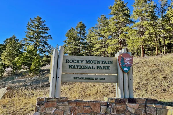
Rocky Mountain National Park
National Park
Rocky Mountain National Park's 415 square miles (265,807 acres) encompasses a spectacular range of mountain environments. From meadows found in the montane life zone to glistening alpine lakes and up...
3 mi from route
~7 min detour
$30
near mile 60.6
Park Closure: Be Weather Aware - A Winter Storm Warning is in effect beginning tonight
Park data from the National Park Service API. Alerts update every 2 hours.
More Details
What kind of drive is this?
This route features a low highway share of only 22%, meaning most of your time will be spent on surface roads. The longest continuous stretch without a major highway transition is 43.1 miles on Trail Ridge Road. You'll notice the transition from highway to surface roads as you move away from more developed areas. The majority of the drive consists of cruising on well-maintained, non-highway routes.
Only 22% highway — the rest is turn-by-turn surface driving.
24 navigation steps total — most of the decisions cluster near the start and finish.
Longest single stretch: 43.1 mi on Trail Ridge Road.
How Hard Is This Drive?
5/10
Expect a hands-on drive with frequent turns and local roads rather than long highway stretches. You will hit about 14 points where you need to pay attention to lane position or signs. The trickiest moment comes around 0.3 miles in near West Mulberry Street.
Driving Effort5/10
Moderate - straightforward overall, but long enough or busy enough to require pacing
Balances navigation complexity with total wheel time.
This drive requires moderate attention. Across 103.4 miles you will encounter 14 spots where lane choice or exit timing matters. Not difficult for experienced highway drivers, but worth previewing the tricky sections before you go.
Where does it get tricky?
The main spots that need attention: at 0.3 miles (West Mulberry Street): Lane positioning matters here; at 1.8 miles (South Taft Hill Road): Lane positioning matters here; at 14 miles (US 34 / West Eisenhower Boulevard): Lane positioning matters here.
Elevation Profile
Mountain driving with significant elevation changes
Fort Collins is a city of about 170,000 in north central region of the western U.S. state of Colorado. The seat of Larimer County, the city lies 59 miles (95 km) north of Denver on the Cache La Poudre River at the eastern edge of the Front Range foothills. Fort Collins is the home of Colorado State University and is a major research center.
Doable as a same-day drive at 3h 9m. Total distance: 103.4 miles.
Family Friendly
Moderate complexity with 1 natural rest stops along the way.
Solo Traveler
3h 9m drive, comfortable solo distance.
First-Time Driver
Mostly highway driving (22%). Some complex stretches to watch for.
Scenic Drive
Mostly surface roads route profile with national parks nearby.
Frequently Asked Questions
The longest stretch is about 43.1 miles on Trail Ridge Road. The full list of main roads is in the Roads section above.
We did not find dedicated rest areas on this route. For a drive this long, plan bathroom and stretch breaks around gas stations, fast-food stops, or small-town downtowns — check the Nearby Places section for options.
Yes, with realistic expectations. Build in a stop roughly every 2 hours, have snacks and activities ready, and check the Nearby Places tabs for kid-friendly stops along the way.
The main spots that need attention: at 0.3 miles (West Mulberry Street): Lane positioning matters here; at 1.8 miles (South Taft Hill Road): Lane positioning matters here; at 14 miles (US 34 / West Eisenhower Boulevard): Lane positioning matters here.
Yes — Rocky Mountain National Park. See the National Parks section for detour distances and tips on detours.
Possible but tiring. At 3.2 hours each way, an in-and-out day trip would put you behind the wheel for 6.3 hours — manageable with a long break at Granby, CO, but most travelers stay overnight.