Naubinway Rest Area
0 mi from route
Compiled and reviewed by the US Trip Planner planning team at COD Solutions Oy · Last reviewed Jul 19, 2026 · Editorial standards
Drive Time
10h 34m
Distance
548.9 mi
883 km
Drive Score
8/10
Great drive
Same Day?
2-day trip
Fuel Cost
$81
one way
EV Charging
Unknown
Estimated drive times based on typical traffic patterns. Actual times may vary with weather, construction, and real-time conditions.

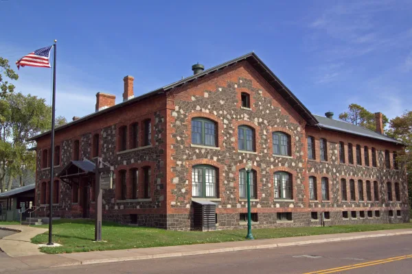
Farmington Hills, MI
Wikimedia Commons

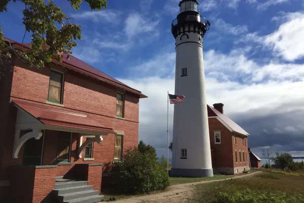
Boston, MI
Wikimedia Commons
Farmington Hills to Boston is 548.9 miles and takes about 10h 34m via I 75 and US 23, with a fuel budget near $86 and enough daylight to finish in a day. This route stays within the Midwest, primarily traversing Michigan. Given its length and the recommended 2-day pace, it's best suited for those who prefer a more relaxed approach to covering ground. You'll spend most of your time on major highways, making it a straightforward trip for anyone familiar with interstate driving. Consider this an efficient way to connect two points in the region with minimal complexity.
Trip Pace
Best split across 2 days
Treat the return leg as its own travel day rather than an afterthought.
Break Rhythm
3 planned breaks
Plan on a short reset every 3 to 4 hours to stay fresh behind the wheel.
Midpoint
274.4 miles from Farmington Hills, MI
A natural place for your longest stop of the day , about 4h 47m into the drive .
| Road | Distance | Duration |
|---|---|---|
| I 75 | 180.5 mi | 3h 4m |
| US 41 | 86.1 mi | 1h 52m |
| US 23 | 79.3 mi | 1h 25m |
| M-28 | 70.9 mi | 1h 23m |
| US-2 West | 62.1 mi | 1h 12m |
| M 77 | 17.3 mi | 20m |
| I 96 | 15.3 mi | 16m |
| County Road 480 | 12.5 mi | 18m |
Hour-of-day weekday pattern from 36 FHWA count stations on your route.
Peak
3 PM
~1,617 veh/hr typical · worst 2,601
Quietest
2 AM
~82 veh/hr
Peak-to-quiet ratio
19.7×
busier at peak than in the quiet hours
Averaged across 52 weeks of 2023 FHWA Travel Monitoring Analysis System data. Weekday hours only (Mon–Fri).
Step-by-step road directions between Farmington Hills, MI and Boston, MI.
Start on Farmington Road
Turn right onto West 12 Mile Road
Turn right onto Orchard Lake Road
Take the ramp
Merge onto I 696
Merge onto I 96
Take the exit
Keep slight right at fork
Merge onto US 23
Keep slight left at fork onto I 75; US 23
Keep slight left at fork onto I 75
Take the exit
Merge onto US 2; I 75 BL
Continue on US 2
Continue on US 2
Turn right onto M 77
Turn sharp left onto M 28
Continue on M 28
Enter roundabout onto M 28
Continue on M 28
Continue on M 28
Continue on CR 551
Turn right onto CR 480
Continue on Rail Street
Turn right onto Division Street
Turn right onto M 28 BUS
Turn left onto M 28 BUS
Turn left onto US 41; M 28
Enter roundabout onto US 41; M 28
Continue on US 41; M 28
Enter roundabout onto US 41; M 28
Continue on US 41; M 28
Turn left onto US 41
Continue on US 41
Turn left onto East White Street
At end of road, turn right onto US 41
Continue on US 41
Turn left onto Highway Road
Continue on Boston Road
Arrive at destination
Given the nearly 11-hour drive time, splitting this trip over two days is highly recommended. Aim to leave early on your first day to cover a significant portion, perhaps around 5-6 hours of driving. Utilize the 3 recommended stops to break up the longer stretches, especially the 180.5-mile segment on I 75. Keep an eye on your fuel, as the $86 budget is an estimate and prices can vary. A good midpoint for an overnight stay would be around the central Michigan area, allowing for a similar drive on day two.
Morning Departure
Start early — leave by 6-7 AM to arrive at a reasonable hour.
Evening Departure
This is a long drive — plan for a morning departure or consider splitting it into two days.
Consider an overnight stop or starting very early.
Departure
Before you leave
Start with fuel, water, and navigation already sorted so the first hour feels easy.
First stop
Around 121 miles or 2h 10m in
Use this first pause for coffee, a restroom break, and a quick traffic check ahead.
Halfway reset
Around 274.4 miles or 4h 47m in
This is the best place for your longest stop, a real meal, and a full fuel check.
Overnight split
Day 1 wrap after about 274.4 miles or 4h 47m
Stop before fatigue turns the last few hours into a grind. You want day two to start fresh, not just resumed.
Final approach
Final hour starts around 9h 12m
Traffic, exits, and arrival timing usually matter more near Boston, MI than in the middle of the route.
Open the route before leaving Farmington Hills, MI so your first major turns are already loaded.
Leave with enough water and a charging cable within reach, not packed away.
Check your fuel range against the first long segment, especially if you are starting outside city service areas.
Pick one backup stop option before the midpoint in case traffic changes your pacing.
Treat this as a 2-day road trip and book the overnight stop before the busiest arrival window.
Day 1
Settle into the route from Farmington Hills, MI
Aim for roughly 274 miles and 5.3 hours of wheel time on this day.
Day 2
Finish the approach into Boston, MI
Aim for roughly 274 miles and 5.3 hours of wheel time on this day.
Rest stops, refuel points, and overnight suggestions along this route.

First major stop
Coffee and fuel
181 mi into the route
Best for: Coffee, fuel, and an easy first stretch
This is a natural early stop once the first hours of the drive are behind you.

Second major stop
Overnight candidate
362 mi into the route
Best for: Hotel check-in, dinner, and a fresh start
This lines up well with a realistic day-end stop if you are breaking the drive into stages.
Find hotels in Au Train, MINight 1
274 mi · about 5.3h in
A practical overnight split lands near McMillan, MI after about 274 miles or 5.3 hours of driving.
Find hotelsA short stop after about 121 miles helps settle the day before fatigue starts building.
The midpoint is around 274.4 miles from Farmington Hills, MI, which is a good place for a longer meal and fuel stop.
Before the longest stretch
Fuel checkTop up before I 75 if your tank is already low. That segment runs about 180.5 miles.
Overnight split
Hotel stopFor a steadier pace, wrap day one after about 274 miles or 5.3 hours on the road.
These stop ideas are pacing suggestions — the exact town or exit can change with traffic, hotel plans, and fuel range.
Picked by where they fit in your drive — first break, midpoint reset, final stretch.
Place data sourced from public business listings. Hours and availability may vary.
5 decision points cluster between mile 2.5 and 283 — GPS handles the exact turns, but know they're coming. Your lane choice matters more than the turn itself.
Merge onto I 696 / Walter P Reuther Freeway
Merge point - match speed before joining. Lane positioning matters here
Merge onto I 96
Merge point - match speed before joining. Lane positioning matters here
Take the exit toward US 23 South, US 23 North: Ann Arbor, Spencer Road, Flint
Exit ramp - move to the correct lane early. Lane positioning matters here. Multiple destination signs - pick the right one
Keep slight right at fork toward US 23 North: Flint
Highway fork - watch signs carefully. Lane positioning matters here
Take the exit toward US 2: Manistique, Escanaba
Exit ramp - move to the correct lane early. Multiple destination signs - pick the right one
Regular Gas
$81.06 one way
$162.12 round trip
| Fuel Type | $/gal | One Way | Round Trip |
|---|---|---|---|
| midgrade | $4.14 | $89.49 | $178.98 |
| premium | $4.72 | $101.91 | $203.83 |
| diesel | $4.80 | $103.64 | $207.29 |
No toll roads detected on this route.
Estimated Trip Cost (one way, 1 person)
Fuel
$81
Hotel (1n)
$80–$140
Meals
$50–$100
Total
$211–$321
Rough estimate based on US averages. Hotel $80–$140/night, meals $25–$50/day.
Estimated CO2 emission: 192.1 kg one way. Prices: EIA weekly data, 2026-07-13.
Driving Electric?
About $58 in charging · 2 stops · 67% less CO2
| Vehicle Type | kWh | Stops | DC Fast | Home Charge |
|---|---|---|---|---|
| Average EV | 164.7 | 2 | $57.63 | $26.35 |
| Efficient EV | 137.2 | 1 | $48.03 | $21.96 |
| EV Truck/SUV | 219.6 | 2 | $76.85 | $35.13 |
Gas CO2
192 kg
EV CO2
64 kg (67% less)
Plan for 2 charging stops, roughly every 270 miles. Allow 25-40 minutes per stop at a DC fast charger.
DC fast charging avg $0.35/kWh. Home charging avg $0.16/kWh. US grid CO2: 0.39 kg/kWh.
Current conditions at both ends of the drive.
Origin
Night in Farmington Hills on Saturday
Local time
9:33 PM
EDT
Current temp
91°F
Smoke
Destination
Night in Boston on Saturday
Local time
9:33 PM
EDT
Current temp
77°F
Smoke
Seasonal Notes
Summer travel usually means heavier construction, hotter rest stops, and busier weekend traffic around major cities.
Winter travel shortens daylight, so a route that looks manageable on paper can feel much longer after dark.
Holiday weekends tend to make both departure and arrival windows slower than the raw route time suggests.
For long drives, weather on day two can matter just as much as conditions at departure, so check the whole travel window rather than only the first day.
Time zone
Origin and destination are on the same clock, so arrival timing is easier to judge at a glance.
Temperature spread
A meaningful temperature swing is a good cue to rethink layers, water, and how soon you want to arrive.
Road read
This is long enough that the arrival forecast matters almost as much as departure conditions. Recheck both ends before you roll.
Weather data from the National Weather Service. Conditions may change; check closer to your travel date.
Worth a detour if your schedule allows.
National Historical Park
The stories of people and copper in the Keweenaw Peninsula have been intertwined for more than 7,000 years. Indigenous peoples made copper into tools and trade items. Investors and immigrants arrived...
National Lakeshore
Sandstone cliffs, beaches, waterfalls, sand dunes, inland lakes, deep forest, and wild shoreline beckon you to visit Pictured Rocks National Lakeshore. The power of Lake Superior shapes the park's coa...
Park data from the National Park Service API. Alerts update every 2 hours.
With 79% of the drive on highways, expect extended periods of cruising. The longest continuous stretch without a major change in road type is 180.5 miles on I 75. You'll transition to US 23, which will feel more like a divided highway for much of its length, before eventually encountering more varied surface roads as you approach your destination. Pay attention to the exit density on I 75, as it can be quite high in more populated areas.
This is a straightforward highway drive that stays mostly on I 75 and US 41. This route has several spots where lane changes, forks, or exits need your full attention. The trickiest moment comes around 2.5 miles in near I 696 / Walter P Reuther Freeway.
High effort - long or complex enough to need steady focus all day
Balances navigation complexity with total wheel time.
This is a demanding drive. With 26 significant decision points across 548.9 miles, you will need to stay alert - especially through interchange areas and urban stretches. Consider splitting it into segments if you are not comfortable with fast highway navigation.
Where does it get tricky?
The main spots that need attention: at 2.5 miles (I 696 / Walter P Reuther Freeway): Merge point - match speed before joining. Lane positioning matters here; at 7 miles (I 96): Merge point - match speed before joining. Lane positioning matters here; at 22.3 miles: Exit ramp - move to the correct lane early. Lane positioning matters here. Multiple destination signs - pick the right one.
Gently rolling terrain
Total Climb
2,114 ft
Total Descent
1,865 ft
Highest Point
1,567 ft
~470.5 mi in
Elevation Range
961 ft
Notable High Points
Based on OSRM destination-sign hints, not a full list of every settlement the road passes.
On the drive from Farmington Hills, MI to Boston, MI, road signs begin pointing toward Escanaba along the way.
Escanaba
Farmington Hills is a city in Oakland County in Michigan. It almost completely surrounds the smaller city of Farmington.
Top landmarks
“The Hub” · Founded 1630
Top landmarks
City content from Wikivoyage (CC BY-SA 4.0) and Wikidata (CC0).
Compiled by the US Trip Planner planning team at COD Solutions Oy from open government datasets — OSRM over OpenStreetMap for geometry, EIA for fuel prices, USGS 3DEP for elevation, NPS for national parks, and FHWA TMAS for hourly traffic volumes. See our methodology for refresh cadence and limitations.
Was this helpful?
Thanks for your feedback!
Your tip has been submitted. Thanks!
/500
Recent Tips
·
Explore more options from Farmington Hills, MI or browse trips ending in Boston, MI.
Looking for more statewide routes? Browse MI road trips.