This 89.6-mile drive from Fall River, MA, to Wellfleet, MA, is a manageable one-day trip, taking an estimated 2 hours and 7 minutes. You'll primarily navigate via I-195 and MA 25 before merging onto the Mid Cape Highway. With a fuel cost estimated at $14, this route offers a straightforward journey within the Northeast region. The mixed drive profile suggests a varied experience, making it suitable for a single-day adventure without the need for an overnight stop. Plan for a relatively quick transit to your Cape Cod destination.
Trip Pace
Same-day drive is realistic
A same-day return is realistic if you keep stops short.
Midpoint
44.8 miles from Fall River, MA
A natural place for your longest stop of the day
, about 58m into the drive
.
Main Roads
Road
Distance
Duration
Mid Cape Highway
35.3 mi
49m
I 195
26.7 mi
32m
MA 25
9.6 mi
11m
Grand Army of the Republic Highway
4.5 mi
8m
Route 6
3.8 mi
6m
Sandwich Road Connector
3.2 mi
5m
State Highway
2.9 mi
5m
MA 28
0.8 mi
1m
Longest stretch:
Mid Cape Highway
— 35.3 mi, about 49m
Turn-by-Turn Driving Directions
Step-by-step road directions between Fall River, MA and Wellfleet, MA.
1
Start on Purchase Street
46 ft·5 sec·Purchase Street
2
Turn right onto South Main Street
179 ft·31 sec·South Main Street
3
Continue on South Main Street
333 ft·12 sec·South Main Street
4
Turn left onto Sullivan Drive
0.2 mi·23 sec·Sullivan Drive
5
Turn left onto Borden Street
252 ft·5 sec·Borden Street
6
Turn slight right onto Hartwell Street
0.2 mi·25 sec·Hartwell Street
7
Turn left onto Rodman Street
438 ft·9 sec·Rodman Street
8
Turn left onto MA 81
0.1 mi·15 sec·Plymouth Avenue
Use the left lane.
9
Take the ramp
0.2 mi·27 sec
Toward I 195 East: New Bedford, Cape Cod
10
Merge onto I 195
1.5 mi·2 min·I 195
Use the straight / slight right lanes.
11
Keep slight right at fork onto I 195
25 mi·30 min·I 195
Use the straight / slight left lanes.
12
Keep slight right at fork
0.5 mi·51 sec
Exit 40AToward MA 25 East: Cape Cod
13
Merge onto MA 25
9.6 mi·11 min·MA 25
14
Continue on MA 28
0.8 mi·1 min·MA 28
15
Enter roundabout onto Sandwich Road Connector
0.1 mi·22 sec·Sandwich Road Connector
16
Continue on Sandwich Road Connector
3.0 mi·5 min·Sandwich Road Connector
17
Turn right onto Mid-Cape Connector
0.3 mi·26 sec·Mid-Cape Connector
Use the left / straight lanes.
18
Take the exit
0.3 mi·45 sec
19
Merge onto US 6
35 mi·49 min·Mid Cape Highway
Use the slight right lane.
20
Enter roundabout onto US 6
487 ft·16 sec·Grand Army of the Republic Highway
Toward Eastham, Provincetown
21
Continue on US 6
3.1 mi·6 min·Grand Army of the Republic Highway
Toward Eastham, Provincetown
22
Continue on US 6
2.9 mi·5 min·State Highway
23
Continue on US 6
0.8 mi·1 min·Route 6
24
Continue on US 6
1.3 mi·2 min·Grand Army of the Republic Highway
25
Continue on US 6
3.0 mi·5 min·Route 6
26
Turn left onto Main Street
0.7 mi·1 min·Main Street
27
Turn left onto Holbrook Avenue
0.1 mi·18 sec·Holbrook Avenue
28
Arrive at destination
Holbrook Avenue
Trip Plan
Given its 2-hour duration, this trip is best tackled in a single day, offering flexibility for when you depart. Aiming for an early start can help you avoid potential traffic, especially as you get closer to the Cape Cod area. Since there are no specified stops in the data, plan your own breaks as needed, keeping in mind the longest stretch is over 35 miles. The estimated fuel cost of $14 is quite reasonable, so ensure your tank is topped up before you leave Fall River to maximize your time on the road. Watch for the transition onto the Mid Cape Highway for the longest continuous driving segment.
Morning Departure
Leave by 9 AM and you'll arrive before lunch.
Evening Departure
Even a 4 PM departure gets you there before dark in summer.
You can normally do this drive in one day.
You may only need one short stretch break if traffic stays light.
The halfway point lands around 44.8 miles from Fall River, MA, or about 58m into the drive.
The longest continuous stretch on this route runs about 35.3 miles.
This is a comfortable same-day trip.
Departure
Before you leave
Start with fuel, water, and navigation already sorted so the first hour feels easy.
First stop
Around 20 miles or 25m in
Use this first pause for coffee, a restroom break, and a quick traffic check ahead.
Halfway reset
Around 44.8 miles or 58m in
This is the best place for your longest stop, a real meal, and a full fuel check.
Final approach
Final hour starts around 1h 42m
Traffic, exits, and arrival timing usually matter more near Wellfleet, MA than in the middle of the route.
Before You Leave
+
Open the route before leaving Fall River, MA so your first major turns are already loaded.
+
Leave with enough water and a charging cable within reach, not packed away.
+
Check your fuel range against the first long segment, especially if you are starting outside city service areas.
Day 1
Settle into the route from Fall River, MA
This is one driving day of about 89.6 miles and 2h 7m.
Your first comfortable stop window is around 20 miles from Fall River, MA.
This route can stay practical as a one-day drive if traffic stays reasonable.
The longest stretch is on Mid Cape Highway for about 35.3 miles.
Where to Stop
Rest stops, refuel points, and overnight suggestions along this route.
Place data sourced from public business listings. Hours and availability may vary.
Heads-up: tricky spots
5 of 19
5 decision points cluster between mile 0 and 77.6 — GPS handles the exact turns, but know they're coming. Your lane choice matters more than the turn itself.
5
0 mi into trip|~0m in|South Main Street
Turn right onto South Main Street
Navigation decision point
5
0.1 mi into trip|~0m in|Sullivan Drive
Turn left onto Sullivan Drive
Navigation decision point
6
2.4 mi into trip|~4m in|I 195
Keep slight right at fork onto I 195
Highway fork - watch signs carefully. Lane positioning matters here
Use the straight / slight left lanes.
6
27.7 mi into trip|~34m in
Keep slight right at fork toward MA 25 East: Cape Cod
Highway fork - watch signs carefully
Exit 40A
Toward MA 25 East: Cape Cod
6
77.6 mi into trip|~1h 44m in|US 6 / Grand Army of the Republic Highway
Enter roundabout onto US 6 / Grand Army of the Republic Highway toward Eastham, Provincetown
Roundabout - know your exit number before entering. Multiple destination signs - pick the right one
Toward Eastham, Provincetown
Fuel & Cost
Regular Gas
$14.34 one way
$28.68 round trip
$4.07/gal25.4 MPG avg31 kg CO2
Fuel Type
$/gal
One Way
Round Trip
midgrade
$4.43
$15.64
$31.28
premium
$4.82
$17.01
$34.03
diesel
$5.61
$19.78
$39.57
No toll roads detected on this route.
Estimated Trip Cost (one way, 1 person)
Fuel
$14
Meals
$25–$50
Total
$39–$64
Rough estimate based on US averages. Hotel $80–$140/night, meals $25–$50/day.
Estimated CO2 emission: 31.3 kg one way.
Prices: EIA weekly data, 2026-04-13.
Driving Electric?
About $9 in charging
· 0 stops
· 68% less CO2
Vehicle Type
kWh
Stops
DC Fast
Home Charge
Average EV
26.9
0
$9.41
$4.30
Efficient EV
22.4
0
$7.84
$3.58
EV Truck/SUV
35.8
0
$12.54
$5.73
Gas CO2
31 kg
EV CO2
10 kg (68% less)
This trip is well within single-charge range for most EVs. No charging stops needed if you start fully charged.
DC fast charging avg $0.35/kWh. Home charging avg $0.16/kWh. US grid CO2: 0.39 kg/kWh.
Travel Intel
Current conditions at both ends of the drive.
Forecast as of Apr 16, 2026
Origin
Fall River, MA
Late night
in Fall River on Sunday
Local time
12:14 AM
EDT
Current temp
72°F
Mostly Sunny
S 12 mph3% chanceLive forecast
Destination
Wellfleet, MA
Late night
in Wellfleet on Sunday
Local time
12:14 AM
EDT
Current temp
52°F
Unavailable
Live forecast
42°F
Sandwich, MA
45 mi in
Seasonal Notes
Summer travel usually means heavier construction, hotter rest stops, and busier weekend traffic around major cities.
Winter travel shortens daylight, so a route that looks manageable on paper can feel much longer after dark.
Holiday weekends tend to make both departure and arrival windows slower than the raw route time suggests.
Time zone
Same local time
Origin and destination are on the same clock, so arrival timing is easier to judge at a glance.
Temperature spread
20 degrees cooler at arrival
A meaningful temperature swing is a good cue to rethink layers, water, and how soon you want to arrive.
Road read
2h 7m on the road
The weather snapshot is not static. If you are leaving later, give both cities one more quick forecast check before departure.
Weather data from the National Weather Service. Conditions may change; check closer to your travel date.
National Parks Near This Route
Worth a detour if your schedule allows.
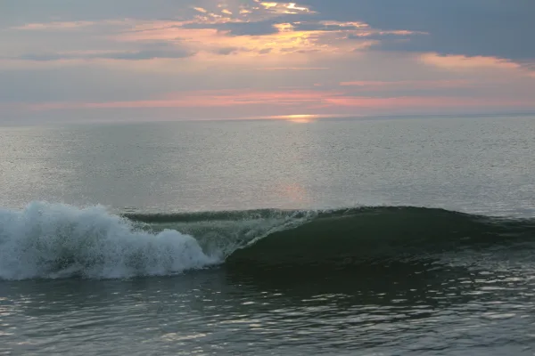
Cape Cod National Seashore
National Seashore
The great Outer Beach described by Thoreau in the 1800s is protected within the national seashore. Forty miles of pristine sandy beach, marshes, ponds, and uplands support diverse species. Lighthouses...
"The town itself is perhaps the dearest place to live in, in all New England..nowhere in all America will you find more patrician-like houses, parks and gardens more opulent, than in New Bedford…all t...
The Blackstone River powered America's entry into the Age of Industry. The success of Samuel Slater's cotton spinning mill in Pawtucket, RI touched off a chain reaction that changed how people worked...
Park data from the National Park Service API. Alerts update every 2 hours.
More Details
What kind of drive is this?
This journey presents a mixed driving profile, with 46% of the route being highway driving. Expect stretches of faster travel interspersed with other road types. The longest uninterrupted segment you'll encounter is 35.3 miles on the Mid Cape Highway, providing a good opportunity to settle in. As you progress, the character of the drive will likely shift, moving from initial highway segments to potentially more varied road conditions as you approach the Cape. It's not a monotonous grind but a blend that keeps things interesting.
46% highway, the rest on surface roads — varied driving throughout.
28 navigation steps total — most of the decisions cluster near the start and finish.
Longest single stretch: 35.3 mi on Mid Cape Highway.
How Hard Is This Drive?
7/10
This route mixes highway mileage with some local-road sections near the start or finish. This route has several spots where lane changes, forks, or exits need your full attention. The trickiest moment comes early in the drive near South Main Street.
Driving Effort7/10
Demanding - plan breaks and stay ahead of the key maneuvers
Balances navigation complexity with total wheel time.
This is a demanding drive. With 19 significant decision points across 89.6 miles, you will need to stay alert - especially through interchange areas and urban stretches. Consider splitting it into segments if you are not comfortable with fast highway navigation.
Where does it get tricky?
The main spots that need attention: near the start (South Main Street): Navigation decision point; at 0.1 miles (Sullivan Drive): Navigation decision point; at 2.4 miles (I 195): Highway fork - watch signs carefully. Lane positioning matters here.
Towns Mentioned on Route Signs
Based on OSRM destination-sign hints, not a full list of every settlement the road passes.
Between Fall River, MA and Wellfleet, MA, road signs point toward Eastham and Provincetown.
In the SouthCoast region of Massachusetts, where the Taunton River empties into Mount Hope Bay, stands Fall River- the "Spindle City". Not to be overshadowed by nearby Boston and Providence, Fall River offers visitors unique attractions that are absent from its two larger neighbors. Fall River is famous for Battleship Cove, the largest museum of its kind in the world; a rich Portuguese-American culture, featuring authentic food; and the accused axe murderess Lizzie Borden.
Doable as a same-day drive at 2h 7m. Total distance: 89.6 miles.
Family Friendly
Moderate complexity with 0 natural rest stops along the way.
Solo Traveler
2h 7m drive, comfortable solo distance.
First-Time Driver
Mostly highway driving (46%). Some complex stretches to watch for.
Scenic Drive
Mixed highway & surface route profile with national parks nearby.
Frequently Asked Questions
The longest stretch is about 35.3 miles on Mid Cape Highway. The full list of main roads is in the Roads section above.
It helps. This route has a higher-than-average number of complex decision points, which get harder in the dark. If the last hour of the trip is on surface roads or mountain grades, aim to arrive at Wellfleet, MA before sunset when you can. Check the Trip Plan for departure windows that land you in daylight.
Only with planning. This is a long drive for kids — consider splitting it into two days rather than pushing through. Dedicated rest areas are limited, so plan gas or food stops as your bathroom breaks.
The main spots that need attention: near the start (South Main Street): Navigation decision point; at 0.1 miles (Sullivan Drive): Navigation decision point; at 2.4 miles (I 195): Highway fork - watch signs carefully. Lane positioning matters here.
Yes — Cape Cod National Seashore, New Bedford Whaling National Historical Park and Blackstone River Valley National Historical Park. See the National Parks section for detour distances and tips on detours.
Yes. A round trip is manageable in a single day if you plan a break at Wellfleet, MA before heading back.