This 319.4-mile journey from Elko, NV to Caliente, NV is a solid day trip, estimated to take around 6 hours and 3 minutes. You'll navigate primarily local roads, with a short stint on I-80 East, making it a turn-heavy experience. With a fuel cost estimated at $64, this drive stays within the Mountain West region, traversing the wide-open spaces of Nevada. Plan for a single stop along the way to break up the drive. The profile suggests a route that demands attention, so be prepared for frequent turns and a more engaging driving experience than a simple highway cruise.
Trip Pace
Same-day drive is realistic
A same-day return is possible, but it will make for a full day on the road.
Break Rhythm
1 planned break
Plan on a short reset every 3 to 4 hours to stay fresh behind the wheel.
Midpoint
159.7 miles from Elko, NV
A natural place for your longest stop of the day
, about 2h 48m into the drive
.
Main Roads
Road
Distance
Duration
Great Basin Highway
264.3 mi
5h 1m
Dwight D. Eisenhower Highway
47.7 mi
44m
North 4th Street
1.6 mi
4m
East Idaho Street
1.6 mi
4m
Aultman Street
1.6 mi
3m
Great Basin Boulevard
1.1 mi
2m
North Spring Street
0.8 mi
1m
I 80 BUS
0.4 mi
<1m
Longest stretch:
Great Basin Highway
— 264.3 mi, about 5h 1m
Traffic on I-80
Hour-of-day weekday pattern from 4 FHWA count stations on your route.
Peak
1 PM
~302 veh/hr typical
· worst 457
Quietest
2 AM
~48 veh/hr
Peak-to-quiet ratio
6.3×
busier at peak than in the quiet hours
12a6anoon6p11p
Averaged across 52 weeks of 2023 FHWA Travel Monitoring Analysis System data. Weekday hours only (Mon–Fri).
Turn-by-Turn Driving Directions
Step-by-step road directions between Elko, NV and Caliente, NV.
1
Start on NV 227
62 ft·6 sec·5th Street
2
Turn right onto I 80 BUS
1.6 mi·4 min·East Idaho Street
3
Turn left onto I 80 BUS
0.1 mi·17 sec·East Jennings Way
4
Take the ramp onto I 80 BUS
0.4 mi·24 sec·I 80 BUS
Toward I 80 East: Salt Lake City
5
Merge onto I 80
48 mi·44 min·Dwight D. Eisenhower Highway
6
Take the exit
0.2 mi·32 sec
Exit 352Toward US 93: East Wells
7
Turn right onto US 93
78 mi·1 hr 23 min·Great Basin Highway
8
At end of road, turn right onto US 93
46 mi·49 min·Great Basin Highway
9
Continue on US 93
1.6 mi·4 min·North 4th Street
10
Continue on US 93
9.6 mi·15 min·Great Basin Highway
11
Continue on US 93
1.6 mi·3 min·Aultman Street
12
Turn left onto US 50; US 93
1.1 mi·2 min·Great Basin Boulevard
13
Continue on US 6; US 50; US 93
26 mi·33 min·Great Basin Highway
14
Continue on US 93
105 mi·1 hr 58 min·Great Basin Highway
15
Continue on US 93
0.8 mi·1 min·North Spring Street
16
Turn right onto Market Street
119 ft·5 sec·Market Street
17
Arrive at destination
Market Street
Trip Plan
Starting your 6-hour, 319.4-mile drive from Elko, NV early in the morning will give you ample daylight to complete the journey to Caliente, NV. Given the 'turn-heavy' nature of this route, it's wise to stay alert and keep your navigation handy. With an estimated fuel cost of $64, ensure your tank is full before departing Elko, as services might be spaced out. While there's only one recommended stop, you have the flexibility to pull over as needed due to the manageable single-day duration. Pay close attention to road signs as you transition between local roads and the short I-80 East segment.
Morning Departure
Start early — leave by 6-7 AM to arrive at a reasonable hour.
Evening Departure
This is a long drive — plan for a morning departure or consider splitting it into two days.
You can normally do this drive in one day.
Plan roughly 1 meaningful break for fuel, food, and rest.
The halfway point lands around 159.7 miles from Elko, NV, or about 2h 48m into the drive.
The longest continuous stretch on this route runs about 264.3 miles.
This is a comfortable same-day trip.
Departure
Before you leave
Start with fuel, water, and navigation already sorted so the first hour feels easy.
First stop
Around 70 miles or 1h 11m in
Use this first pause for coffee, a restroom break, and a quick traffic check ahead.
Halfway reset
Around 159.7 miles or 2h 48m in
This is the best place for your longest stop, a real meal, and a full fuel check.
Final approach
Final hour starts around 4h 57m
Traffic, exits, and arrival timing usually matter more near Caliente, NV than in the middle of the route.
Before You Leave
+
Open the route before leaving Elko, NV so your first major turns are already loaded.
+
Leave with enough water and a charging cable within reach, not packed away.
+
Check your fuel range against the first long segment, especially if you are starting outside city service areas.
Day 1
Settle into the route from Elko, NV
This is one driving day of about 319.4 miles and 6h 3m.
Your first comfortable stop window is around 70 miles from Elko, NV.
This route can stay practical as a one-day drive if traffic stays reasonable.
Plan about 1 real break rather than only quick fuel stops.
The longest stretch is on Great Basin Highway for about 264.3 miles.
Where to Stop
Rest stops, refuel points, and overnight suggestions along this route.
Place data sourced from public business listings. Hours and availability may vary.
Heads-up: tricky spots
5 of 9
5 decision points cluster between mile 1.6 and 187.1 — GPS handles the exact turns, but know they're coming. Your lane choice matters more than the turn itself.
4
1.6 mi into trip|~4m in|I 80 BUS / East Jennings Way
Turn left onto I 80 BUS / East Jennings Way
Navigation decision point
4
1.7 mi into trip|~4m in|I 80 BUS
Take the ramp onto I 80 BUS toward I 80 East: Salt Lake City
Navigation decision point
Toward I 80 East: Salt Lake City
5
49.7 mi into trip|~49m in
Take the exit toward US 93: East Wells
Exit ramp - move to the correct lane early
Exit 352
Toward US 93: East Wells
4
127.8 mi into trip|~2h 14m in|US 93 / Great Basin Highway
At end of road, turn right onto US 93 / Great Basin Highway
Navigation decision point
4
187.1 mi into trip|~3h 27m in|US 50; US 93 / Great Basin Boulevard
Turn left onto US 50; US 93 / Great Basin Boulevard
Navigation decision point
Fuel & Cost
Regular Gas
$56.60 one way
$113.20 round trip
$4.50/gal25.4 MPG avg112 kg CO2
Fuel Type
$/gal
One Way
Round Trip
midgrade
$4.82
$60.61
$121.22
premium
$5.04
$63.40
$126.80
diesel
$4.80
$60.31
$120.62
No toll roads detected on this route.
Estimated Trip Cost (one way, 1 person)
Fuel
$57
Meals
$25–$50
Total
$82–$107
Rough estimate based on US averages. Hotel $80–$140/night, meals $25–$50/day.
Estimated CO2 emission: 111.8 kg one way.
Prices: EIA weekly data, 2026-07-13.
Driving Electric?
About $34 in charging
· 1 stop
· 67% less CO2
Vehicle Type
kWh
Stops
DC Fast
Home Charge
Average EV
95.8
1
$33.54
$15.33
Efficient EV
79.9
0
$27.95
$12.78
EV Truck/SUV
127.8
1
$44.72
$20.44
Gas CO2
112 kg
EV CO2
37 kg (67% less)
Plan for 1 charging stop. A 30-minute DC fast charge mid-route should be enough to complete the trip comfortably.
DC fast charging avg $0.35/kWh. Home charging avg $0.16/kWh. US grid CO2: 0.39 kg/kWh.
Travel Intel
Current conditions at both ends of the drive.
Forecast as of Jul 16, 2026
Origin
Elko, NV
Morning
in Elko on Sunday
Local time
8:27 AM
PDT
Current temp
97°F
Isolated Showers And Thunderstorms
WSW 0 to 5 mph26% chanceLive forecast
Special Weather Statement
Special Weather Statement issued July 16 at 12:32PM PDT by NWS Elko NV
Special Weather Statement
Special Weather Statement issued July 16 at 12:27PM PDT by NWS Elko NV
Destination
Caliente, NV
Morning
in Caliente on Sunday
Local time
8:27 AM
PDT
Current temp
96°F
Chance Showers And Thunderstorms
SSW 7 mph42% chanceLive forecast
Special Weather Statement
Special Weather Statement issued July 16 at 12:32PM PDT by NWS Elko NV
Special Weather Statement
Special Weather Statement issued July 16 at 12:27PM PDT by NWS Elko NV
Seasonal Notes
Summer travel usually means heavier construction, hotter rest stops, and busier weekend traffic around major cities.
Winter travel shortens daylight, so a route that looks manageable on paper can feel much longer after dark.
Holiday weekends tend to make both departure and arrival windows slower than the raw route time suggests.
Time zone
Same local time
Origin and destination are on the same clock, so arrival timing is easier to judge at a glance.
Temperature spread
1 degrees cooler at arrival
A meaningful temperature swing is a good cue to rethink layers, water, and how soon you want to arrive.
Road read
6h 3m on the road
Start early — leave by 6-7 AM to arrive at a reasonable hour.
Weather data from the National Weather Service. Conditions may change; check closer to your travel date.
National Parks Near This Route
Worth a detour if your schedule allows.
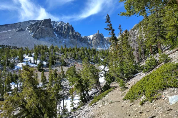
Great Basin National Park
National Park
From the 13,063-foot summit of Wheeler Peak to the sagebrush-covered foothills, Great Basin National Park hosts a sample of the incredible diversity of the larger Great Basin region. Come and partake...
14 mi from route
~35 min detour
Free
near mile 220.3
Park data from the National Park Service API. Alerts update every 2 hours.
More Details
What kind of drive is this?
Expect a turn-heavy local drive for most of this 319.4-mile route. While a small portion involves I-80 East, the majority of your time will be spent on less direct, more engaging roads. There's no significant highway share to speak of, meaning you won't be settling into a long, monotonous interstate pace. The longest uninterrupted stretch isn't noted, but the 'turn-heavy' profile implies a dynamic route where you'll be adjusting your course frequently. This drive is less about high-speed cruising and more about navigating a series of connections between points.
Only 0% highway — the rest is turn-by-turn surface driving.
17 navigation steps total — most of the decisions cluster near the start and finish.
Longest single stretch: 264.3 mi on Great Basin Highway.
How Hard Is This Drive?
3/10
Expect a hands-on drive with frequent turns and local roads rather than long highway stretches. There are only a few real navigation decisions along the way. The trickiest moment comes around 1.6 miles in near I 80 BUS / East Jennings Way.
Driving Effort3/10
Easy - simple navigation with a manageable amount of wheel time
Balances navigation complexity with total wheel time.
The route itself is not hard, but at 6h 3m, endurance matters. Plan breaks every 2-3 hours. The 9 decision points are all manageable with basic attention.
Where does it get tricky?
The main spots that need attention: at 1.6 miles (I 80 BUS / East Jennings Way): Navigation decision point; at 1.7 miles (I 80 BUS): Navigation decision point; at 49.7 miles: Exit ramp - move to the correct lane early.
Mostly surface roads route profile with national parks nearby.
Frequently Asked Questions
The longest stretch is about 264.3 miles on Great Basin Highway. The full list of main roads is in the Roads section above.
Yes — we found about 9 rest areas or service plazas within a short detour of the route (from OpenStreetMap). See the Rest Stops tab under Nearby Places for locations and mile markers. Plan to stretch, use the bathroom, and top off fluids every 2–3 hours on longer drives.
It helps. This is a long drive, so arriving tired and in the dark compounds. If the last hour of the trip is on surface roads or mountain grades, aim to arrive at Caliente, NV before sunset when you can. Check the Trip Plan for departure windows that land you in daylight.
Only with planning. This is a long drive for kids — consider splitting it into two days rather than pushing through. Plan at least 1 meaningful breaks. There are 9 rest areas along the route for bathroom stops.
Mostly yes along the main roads, but rural stretches through NV can have sparse or no coverage. Before you leave, download offline Google Maps or Apple Maps for the route, and consider downloading music or podcasts instead of streaming. If you depend on data for navigation, keep a paper backup of the turn-by-turn directions.
The main spots that need attention: at 1.6 miles (I 80 BUS / East Jennings Way): Navigation decision point; at 1.7 miles (I 80 BUS): Navigation decision point; at 49.7 miles: Exit ramp - move to the correct lane early.
Yes — Great Basin National Park. See the National Parks section for detour distances and tips on detours.
Not recommended in a single day. At 6.1 hours each way, a round trip means 12.1 hours of driving — that is an unsafe level of fatigue for most drivers. Plan at least one night at Caliente, NV before the return drive.