Connecting Elizabethtown to Greenville, this 113.5-mile journey is a straightforward trek through the Southeast region of North Carolina. You can expect a total drive time of approximately 2 hours and 38 minutes, making it an ideal candidate for a single-day trip. With a fuel budget of about $18, this route is quite economical for solo drivers or small groups. Because the trip is relatively short, there is no need to plan for an overnight stay unless you have business or personal commitments in Greenville. Expect a mix of local roads and highway driving that keeps the journey engaging from start to finish.
Trip Pace
Same-day drive is realistic
A same-day return is realistic if you keep stops short.
Break Rhythm
1 planned break
A short stop every 2 to 3 hours is enough for this drive.
Midpoint
56.8 miles from Elizabethtown, NC
A natural place for your longest stop of the day
, about 1h 19m into the drive
.
Main Roads
Road
Distance
Duration
Faison Highway
28.7 mi
38m
US 13
23.6 mi
31m
North Poplar Street
17.7 mi
24m
Garland Highway
13.3 mi
18m
Dickinson Avenue
10.8 mi
17m
US 117 Connector
5.8 mi
6m
Goldsboro Bypass
4.9 mi
5m
Southeast Boulevard
2.4 mi
4m
Longest stretch:
Faison Highway
— 28.7 mi, about 38m
Turn-by-Turn Driving Directions
Step-by-step road directions between Elizabethtown, NC and Greenville, NC.
1
Start on US 701; NC 41
18 mi·24 min·North Poplar Street
2
Continue on US 701
1.2 mi·2 min·South Ingold Avenue
3
Continue on US 701
13 mi·18 min·Garland Highway
4
Continue on US 701 Business
2.4 mi·4 min·Southeast Boulevard
5
Turn right onto Pugh Road
0.8 mi·1 min·Pugh Road
6
Turn right onto NC 403
29 mi·38 min·Faison Highway
7
Continue on US 117 Connector
5.8 mi·6 min·US 117 Connector
Use the straight / right lanes.
8
Continue on I 795
1.4 mi·1 min·I 795
9
Take the exit
0.2 mi·28 sec
10
Keep slight right at fork
0.5 mi·1 min
11
Merge onto I 42
4.9 mi·5 min·Goldsboro Bypass
12
Take the exit
0.3 mi·44 sec
13
Keep slight left at fork
127 ft·5 sec
14
Turn left onto US 13
13 mi·19 min·US 13
Use the straight lane.
15
Turn left onto US 13; NC 903
1.2 mi·1 min·Martin Luther King Jr Parkway
16
Continue on US 13; US 258; NC 903
6.5 mi·7 min·US 13; US 258; NC 903
17
Turn right onto US 13
3.7 mi·5 min·US 13
18
Take the exit onto US 13
197 ft·3 sec·US 13
19
Merge onto US 13; US 264
11 mi·17 min·Dickinson Avenue
Use the straight / right lanes.
20
Turn right onto Reade Circle
0.3 mi·40 sec·Reade Circle
21
Turn right onto East 5th Street
0.2 mi·38 sec·East 5th Street
22
Turn left onto South Summit Street
0.2 mi·51 sec·South Summit Street
23
Arrive at destination
South Summit Street
Trip Plan
Given the local nature of these roads, it is wise to leave during daylight hours to maintain better visibility through the turns. While the 2 hour and 38 minute duration is manageable, planning for at least one stop is recommended to break up the drive and stretch your legs. Keep a close eye on your fuel gauge before starting, as local routes can sometimes have fewer service stations than major interstates. Since you only have one recommended stop, use that time effectively to refuel or grab a snack. Because this route is flexible, feel free to adjust your departure time to avoid local traffic bottlenecks often found on secondary thoroughfares.
Morning Departure
Leave by 9 AM and you'll arrive before lunch.
Evening Departure
Even a 4 PM departure gets you there before dark in summer.
You can normally do this drive in one day.
Plan roughly 1 meaningful break for fuel, food, and rest.
The halfway point lands around 56.8 miles from Elizabethtown, NC, or about 1h 19m into the drive.
The longest continuous stretch on this route runs about 28.7 miles.
This is a comfortable same-day trip.
Departure
Before you leave
Start with fuel, water, and navigation already sorted so the first hour feels easy.
First stop
Around 25 miles or 35m in
Use this first pause for coffee, a restroom break, and a quick traffic check ahead.
Halfway reset
Around 56.8 miles or 1h 19m in
This is the best place for your longest stop, a real meal, and a full fuel check.
Final approach
Final hour starts around 2h 7m
Traffic, exits, and arrival timing usually matter more near Greenville, NC than in the middle of the route.
Before You Leave
+
Open the route before leaving Elizabethtown, NC so your first major turns are already loaded.
+
Leave with enough water and a charging cable within reach, not packed away.
+
Check your fuel range against the first long segment, especially if you are starting outside city service areas.
Day 1
Settle into the route from Elizabethtown, NC
This is one driving day of about 113.5 miles and 2h 38m.
Your first comfortable stop window is around 25 miles from Elizabethtown, NC.
This route can stay practical as a one-day drive if traffic stays reasonable.
Plan about 1 real break rather than only quick fuel stops.
The longest stretch is on Faison Highway for about 28.7 miles.
Where to Stop
Rest stops, refuel points, and overnight suggestions along this route.
Place data sourced from public business listings. Hours and availability may vary.
Heads-up: tricky spots
5 of 15
5 decision points cluster between mile 71.5 and 113.3 — GPS handles the exact turns, but know they're coming. Your lane choice matters more than the turn itself.
4
71.5 mi into trip|~1h 38m in
Keep slight right at fork
Highway fork - watch signs carefully
4
77.2 mi into trip|~1h 45m in
Keep slight left at fork
Highway fork - watch signs carefully
4
77.3 mi into trip|~1h 45m in|US 13
Turn left onto US 13
Lane positioning matters here
Use the straight lane.
5
102.1 mi into trip|~2h 18m in|US 13; US 264 / Dickinson Avenue
Merge onto US 13; US 264 / Dickinson Avenue
Merge point - match speed before joining. Lane positioning matters here
Use the straight / right lanes.
4
113.3 mi into trip|~2h 37m in|South Summit Street
Turn left onto South Summit Street
Navigation decision point
Fuel & Cost
Regular Gas
$17.75 one way
$35.50 round trip
$3.97/gal25.4 MPG avg40 kg CO2
Fuel Type
$/gal
One Way
Round Trip
midgrade
$4.34
$19.41
$38.81
premium
$4.70
$21.01
$42.01
diesel
$5.61
$25.06
$50.12
No toll roads detected on this route.
Estimated Trip Cost (one way, 1 person)
Fuel
$18
Meals
$25–$50
Total
$43–$68
Rough estimate based on US averages. Hotel $80–$140/night, meals $25–$50/day.
Estimated CO2 emission: 39.7 kg one way.
Prices: EIA weekly data, 2026-04-13.
Driving Electric?
About $12 in charging
· 0 stops
· 68% less CO2
Vehicle Type
kWh
Stops
DC Fast
Home Charge
Average EV
34.1
0
$11.92
$5.45
Efficient EV
28.4
0
$9.93
$4.54
EV Truck/SUV
45.4
0
$15.89
$7.26
Gas CO2
40 kg
EV CO2
13 kg (68% less)
This trip is well within single-charge range for most EVs. No charging stops needed if you start fully charged.
DC fast charging avg $0.35/kWh. Home charging avg $0.16/kWh. US grid CO2: 0.39 kg/kWh.
Travel Intel
Current conditions at both ends of the drive.
Forecast as of Apr 17, 2026
Origin
Elizabethtown, NC
Morning
in Elizabethtown on Sunday
Local time
6:14 AM
EDT
Current temp
58°F
Unavailable
Live forecast
Destination
Greenville, NC
Morning
in Greenville on Sunday
Local time
6:14 AM
EDT
Current temp
57°F
Unavailable
Live forecast
Seasonal Notes
Summer travel usually means heavier construction, hotter rest stops, and busier weekend traffic around major cities.
Winter travel shortens daylight, so a route that looks manageable on paper can feel much longer after dark.
Holiday weekends tend to make both departure and arrival windows slower than the raw route time suggests.
Time zone
Same local time
Origin and destination are on the same clock, so arrival timing is easier to judge at a glance.
Temperature spread
1 degrees cooler at arrival
A meaningful temperature swing is a good cue to rethink layers, water, and how soon you want to arrive.
Road read
2h 38m on the road
Use the two city cards together: check the sky where you start, then compare it with the local time and temperature at arrival.
Weather data from the National Weather Service. Conditions may change; check closer to your travel date.
National Parks Near This Route
Worth a detour if your schedule allows.
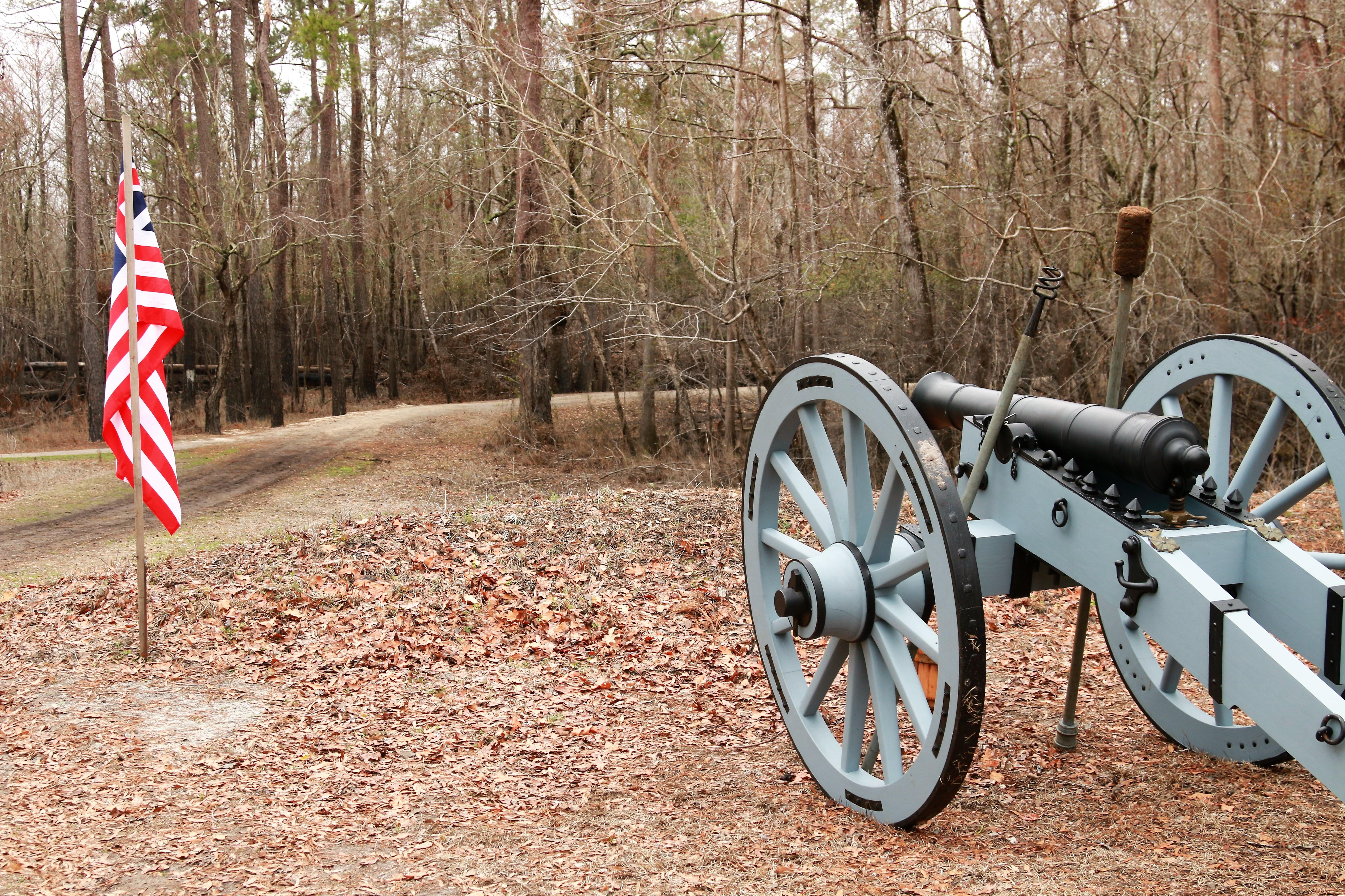
Moores Creek National Battlefield
National Battlefield
In the early morning hours of February 27, 1776, Loyalist forces charged across a partially dismantled Moores Creek Bridge. Beyond the bridge, nearly 1,000 North Carolina Patriots waited quietly with...
26 mi from route
~65 min detour
Free
near mile 7.8
Park data from the National Park Service API. Alerts update every 2 hours.
More Details
What kind of drive is this?
Prepare for a turn-heavy local drive that demands your full attention behind the wheel. Only about 28% of this route consists of highway travel, meaning you will spend the majority of your time navigating smaller, secondary roads. The longest uninterrupted section you will encounter is a 28.7-mile stretch along Faison Highway, which offers a brief respite from constant turns. As you transition between Faison Highway, US 13, and North Poplar Street, the road's character shifts frequently. This isn't a mindless interstate cruise; it is a route that requires you to stay alert and adjust to changing road conditions.
Only 28% highway — the rest is turn-by-turn surface driving.
23 navigation steps total — most of the decisions cluster near the start and finish.
Longest single stretch: 28.7 mi on Faison Highway.
How Hard Is This Drive?
8/10
Expect a hands-on drive with frequent turns and local roads rather than long highway stretches. This route has several spots where lane changes, forks, or exits need your full attention. The trickiest moment comes around 71.5 miles in.
Driving Effort8/10
Demanding - plan breaks and stay ahead of the key maneuvers
Balances navigation complexity with total wheel time.
This is a demanding drive. With 15 significant decision points across 113.5 miles, you will need to stay alert - especially through interchange areas and urban stretches. Consider splitting it into segments if you are not comfortable with fast highway navigation.
Where does it get tricky?
The main spots that need attention: at 71.5 miles: Highway fork - watch signs carefully; at 77.2 miles: Highway fork - watch signs carefully; at 77.3 miles (US 13): Lane positioning matters here.
Greenville, one of the fastest growing cities in North Carolina, is the county seat of Pitt County, and is
the principal city of the Greenville, North Carolina metropolitan area. Greenville is known as the cultural, economical, and educational hub of North Carolina's Inner Banks, the geographical area east of Raleigh and west of the North Carolina coast.
Doable as a same-day drive at 2h 38m. Total distance: 113.5 miles.
Family Friendly
Moderate complexity with 1 natural rest stops along the way.
Solo Traveler
2h 38m drive, comfortable solo distance.
Scenic Drive
Mostly surface roads route profile with national parks nearby.
Frequently Asked Questions
The longest stretch is about 28.7 miles on Faison Highway. The full list of main roads is in the Roads section above.
It helps. This route has a higher-than-average number of complex decision points, which get harder in the dark. If the last hour of the trip is on surface roads or mountain grades, aim to arrive at Greenville, NC before sunset when you can. Check the Trip Plan for departure windows that land you in daylight.
Only with planning. This is a long drive for kids — consider splitting it into two days rather than pushing through. Plan at least 1 meaningful breaks. Dedicated rest areas are limited, so plan gas or food stops as your bathroom breaks.
The main spots that need attention: at 71.5 miles: Highway fork - watch signs carefully; at 77.2 miles: Highway fork - watch signs carefully; at 77.3 miles (US 13): Lane positioning matters here.
Yes — Moores Creek National Battlefield. See the National Parks section for detour distances and tips on detours.
Yes. A round trip is manageable in a single day if you plan a break at Greenville, NC before heading back.