El Paso, TX to Lubbock, TX is 344.3 miles and takes about 6h 23m via US Highway 62, with a fuel budget near $52 and enough daylight to finish in a day. This drive stays within Texas, beginning in the Great Plains region and ending in the same area. Expect a mixed landscape of highway cruising and surface roads as you travel northeast. With a recommended one-day drive time, this route is a solid option if you want to cover ground efficiently between these two Texas cities.
Trip Pace
Same-day drive is realistic
A same-day return is possible, but it will make for a full day on the road.
Break Rhythm
1 planned break
Plan on a short reset every 3 to 4 hours to stay fresh behind the wheel.
Midpoint
172.1 miles from El Paso, TX
A natural place for your longest stop of the day
, about 3h 11m into the drive
.
Main Roads
Road
Distance
Duration
US Highway 62
102.3 mi
1h 46m
North Main Street
40.4 mi
43m
West Carlsbad Highway
39.6 mi
45m
National Parks Highway
33.6 mi
37m
East Seminole Highway
27.5 mi
31m
US 62
24.1 mi
27m
Hobbs Highway
20.4 mi
21m
Montana Avenue
18.9 mi
24m
Longest stretch:
US Highway 62
— 102.3 mi, about 1h 46m
Traffic on I-10
Hour-of-day weekday pattern from 4 FHWA count stations on your route.
Peak
7 AM
~6,366 veh/hr typical
Quietest
2 AM
~452 veh/hr
Peak-to-quiet ratio
14.1×
busier at peak than in the quiet hours
12a6anoon6p11p
Averaged across 52 weeks of 2023 FHWA Travel Monitoring Analysis System data. Weekday hours only (Mon–Fri).
Turn-by-Turn Driving Directions
Step-by-step road directions between El Paso, TX and Lubbock, TX.
1
Start on North Mesa Street
0.2 mi·24 sec·North Mesa Street
2
Turn right onto East Franklin Avenue
0.2 mi·26 sec·East Franklin Avenue
3
Take the ramp
0.4 mi·50 sec
Toward I 10 East
4
Merge onto I 10; US 180
3.2 mi·4 min·I 10; US 180
Use the straight / slight right lanes.
5
Take the exit onto US 180
0.6 mi·1 min·US 180
Exit 23BToward US 62, US 180: Paisano Drive, Chelsea StreetUse the slight right lane.
6
Turn left onto US 62; US 180
0.5 mi·43 sec·East Paisano Drive
7
Continue on US 62; US 180
5.2 mi·7 min·Montana Avenue
Use the straight / right lanes.
8
Continue on US 62; US 180
2.5 mi·3 min·Arturo Benavides Memorial Freeway
9
Continue on US 62; US 180
14 mi·17 min·Montana Avenue
10
Continue on US 62; US 180
102 mi·1 hr 46 min·US Highway 62
11
Continue on US 62; US 180
34 mi·37 min·National Parks Highway
12
Merge onto US 62; US 180; US 285
1.9 mi·2 min·South Canal Street
13
Turn right onto US 62; US 180
6.5 mi·7 min·West Greene Street
14
Continue on US 62; US 180
20 mi·21 min·Hobbs Highway
15
Continue on US 62; US 180
40 mi·45 min·West Carlsbad Highway
16
Continue on US 62; US 180
2.5 mi·2 min·West Marland Boulevard
17
Continue on US 62; US 180
0.6 mi·43 sec·East Marland Street
18
Continue on US 62; US 180
1.3 mi·1 min·South Marland Boulevard
19
Continue on US 62; US 180
27 mi·31 min·East Seminole Highway
20
Continue on US 62; US 180
0.3 mi·25 sec·West Avenue A
21
Turn left onto US 62; US 385
40 mi·43 min·North Main Street
22
Continue on US 62; US 385
0.5 mi·1 min·South 1st Street
23
Continue on US 62; US 82; US 385
15 mi·15 min·Lubbock Road
24
Continue on US 62; US 82
24 mi·27 min·US 62; US 82
25
Take the exit
0.3 mi·33 sec
Toward US 84: Avenue Q
26
Turn straight onto Marsha Sharp Freeway
0.5 mi·54 sec·Marsha Sharp Freeway
27
Turn right onto US 84
1.0 mi·1 min·Avenue Q
28
Turn left onto US 62; TX 114
33 ft·0 sec·19th Street
29
Arrive at destination
US 62; TX 114
Trip Plan
Starting your drive from El Paso in the morning will give you plenty of daylight to reach Lubbock, as the total travel time is just under 6.5 hours. Because this is a single-day trip, you have the flexibility to stop as needed, though the data suggests only one primary stop is factored in. Keep an eye on your fuel levels, especially during the 102.3-mile stretch on US Highway 62, and plan for your $52 fuel budget. The transition between highway and surface roads will require you to adjust your speed and awareness as you pass through populated areas.
Morning Departure
Start early — leave by 6-7 AM to arrive at a reasonable hour.
Evening Departure
This is a long drive — plan for a morning departure or consider splitting it into two days.
You can normally do this drive in one day.
Plan roughly 1 meaningful break for fuel, food, and rest.
The halfway point lands around 172.1 miles from El Paso, TX, or about 3h 11m into the drive.
The longest continuous stretch on this route runs about 102.3 miles.
This is a comfortable same-day trip.
Departure
Before you leave
Start with fuel, water, and navigation already sorted so the first hour feels easy.
First stop
Around 76 miles or 1h 27m in
Use this first pause for coffee, a restroom break, and a quick traffic check ahead.
Halfway reset
Around 172.1 miles or 3h 11m in
This is the best place for your longest stop, a real meal, and a full fuel check.
Final approach
Final hour starts around 5h 16m
Traffic, exits, and arrival timing usually matter more near Lubbock, TX than in the middle of the route.
Before You Leave
+
Open the route before leaving El Paso, TX so your first major turns are already loaded.
+
Leave with enough water and a charging cable within reach, not packed away.
+
Check your fuel range against the first long segment, especially if you are starting outside city service areas.
Day 1
Settle into the route from El Paso, TX
This is one driving day of about 344.3 miles and 6h 23m.
Your first comfortable stop window is around 76 miles from El Paso, TX.
This route can stay practical as a one-day drive if traffic stays reasonable.
Plan about 1 real break rather than only quick fuel stops.
The longest stretch is on US Highway 62 for about 102.3 miles.
Where to Stop
Rest stops, refuel points, and overnight suggestions along this route.
Place data sourced from public business listings. Hours and availability may vary.
Heads-up: tricky spots
5 of 10
5 decision points cluster between mile 0.2 and 263 — GPS handles the exact turns, but know they're coming. Your lane choice matters more than the turn itself.
5
0.2 mi into trip|~0m in|East Franklin Avenue
Turn right onto East Franklin Avenue
Navigation decision point
5
0.8 mi into trip|~1m in|I 10; US 180
Merge onto I 10; US 180
Merge point - match speed before joining. Lane positioning matters here
Use the straight / slight right lanes.
8
4 mi into trip|~5m in|US 180
Take the exit onto US 180 toward US 62, US 180: Paisano Drive, Chelsea Street
Exit ramp - move to the correct lane early. Lane positioning matters here. Multiple destination signs - pick the right one
Use the slight right lane.
Exit 23B
Toward US 62, US 180: Paisano Drive, Chelsea St...
4
164.3 mi into trip|~3h 1m in|US 62; US 180 / West Greene Street
Turn right onto US 62; US 180 / West Greene Street
Navigation decision point
4
263 mi into trip|~4h 53m in|US 62; US 385 / North Main Street
Turn left onto US 62; US 385 / North Main Street
Navigation decision point
Fuel & Cost
Regular Gas
$47.16 one way
$94.32 round trip
$3.48/gal25.4 MPG avg121 kg CO2
Fuel Type
$/gal
One Way
Round Trip
midgrade
$3.89
$52.68
$105.35
premium
$4.23
$57.27
$114.54
diesel
$4.80
$65.01
$130.02
No toll roads detected on this route.
Estimated Trip Cost (one way, 1 person)
Fuel
$47
Meals
$25–$50
Total
$72–$97
Rough estimate based on US averages. Hotel $80–$140/night, meals $25–$50/day.
Estimated CO2 emission: 120.5 kg one way.
Prices: EIA weekly data, 2026-07-13.
Driving Electric?
About $36 in charging
· 1 stop
· 67% less CO2
Vehicle Type
kWh
Stops
DC Fast
Home Charge
Average EV
103.3
1
$36.15
$16.53
Efficient EV
86.1
0
$30.13
$13.77
EV Truck/SUV
137.7
1
$48.20
$22.04
Gas CO2
120 kg
EV CO2
40 kg (67% less)
Plan for 1 charging stop. A 30-minute DC fast charge mid-route should be enough to complete the trip comfortably.
DC fast charging avg $0.35/kWh. Home charging avg $0.16/kWh. US grid CO2: 0.39 kg/kWh.
Travel Intel
Current conditions at both ends of the drive.
Forecast as of Jul 17, 2026
Origin
El Paso, TX
Morning
in El Paso on Sunday
Local time
8:45 AM
MDT
Current temp
74°F
Mostly Clear
E 5 mph4% chanceLive forecast
Flash Flood Warning
Flash Flood Warning issued July 17 at 7:00AM CDT until July 17 at 10:00AM CDT by NWS San Angelo TX
Flood Warning
Flood Warning issued July 17 at 6:45AM CDT by NWS Austin/San Antonio TX
Destination
Lubbock, TX
Morning
in Lubbock on Sunday
Local time
9:45 AM
CDT
Current temp
85°F
Chance Showers And Thunderstorms
S 10 to 15 mph34% chanceLive forecast
Flash Flood Warning
Flash Flood Warning issued July 17 at 7:00AM CDT until July 17 at 10:00AM CDT by NWS San Angelo TX
Flood Warning
Flood Warning issued July 17 at 6:45AM CDT by NWS Austin/San Antonio TX
100°F
Carlsbad, NM
172 mi in
Seasonal Notes
Summer travel usually means heavier construction, hotter rest stops, and busier weekend traffic around major cities.
Winter travel shortens daylight, so a route that looks manageable on paper can feel much longer after dark.
Holiday weekends tend to make both departure and arrival windows slower than the raw route time suggests.
Time zone
1 hour later
The destination clock does not match departure time, so double-check hotel check-in windows and late arrival plans.
Temperature spread
11 degrees warmer at arrival
A meaningful temperature swing is a good cue to rethink layers, water, and how soon you want to arrive.
Road read
6h 23m on the road
Start early — leave by 6-7 AM to arrive at a reasonable hour.
Weather data from the National Weather Service. Conditions may change; check closer to your travel date.
National Parks Near This Route
Worth a detour if your schedule allows.
Chamizal National Memorial
National Memorial
Chamizal is more than just an urban park to recreate or enjoy a quiet afternoon. These grounds are a reminder of the harmonious settlement of a 100-year boundary dispute between the United States and...
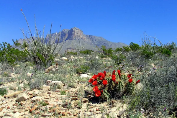
Come experience mountains and canyons, desert and dunes, night skies and spectacular vistas within a place unlike any other. Guadalupe Mountains National Park protects the world's most extensive Permi...
6 mi from route
~14 min detour
$10
near mile 106.8
Park data from the National Park Service API. Alerts update every 2 hours.
More Details
What kind of drive is this?
This route is 39% highway, meaning you'll spend a good portion of your time on surface roads, particularly as you enter and exit towns. The longest stretch without a significant change in road type is 102.3 miles on US Highway 62. You'll notice the transition from more open highway driving to navigating through towns like Carlsbad, where you'll be on North Main Street and West Carlsbad Highway.
39% highway, the rest on surface roads — varied driving throughout.
29 navigation steps total — most of the decisions cluster near the start and finish.
Longest single stretch: 102.3 mi on US Highway 62.
How Hard Is This Drive?
4/10
This route mixes highway mileage with some local-road sections near the start or finish. There are only a few real navigation decisions along the way. The trickiest moment comes around 0.2 miles in near East Franklin Avenue.
Driving Effort4/10
Easy - simple navigation with a manageable amount of wheel time
Balances navigation complexity with total wheel time.
The route itself is not hard, but at 6h 23m, endurance matters. Plan breaks every 2-3 hours. The 10 decision points are all manageable with basic attention.
Where does it get tricky?
The main spots that need attention: at 0.2 miles (East Franklin Avenue): Navigation decision point; at 0.8 miles (I 10; US 180): Merge point - match speed before joining. Lane positioning matters here; at 4 miles (US 180): Exit ramp - move to the correct lane early. Lane positioning matters here. Multiple destination signs - pick the right one.
El Paso is the sixth largest city in Texas, with 679,000 residents (2020). It is on the United States-Mexico border. The city on the other side of the border is Ciudad Juarez, Chihuahua. El Paso is often called the Sun City. Collectively, the city of El Paso and other nearby cities, such as Juarez and Las Cruces, New Mexico are referred to as The Borderland.
Top landmarks
•El Paso Museum of Art — art museum in El Paso, Texas
•Union Depot — historic place in El Paso, El Paso County, Texas
•Plaza Theatre — building in El Paso, El Paso County, Texas
Lubbock is the largest city in the Panhandle of Texas and serves as the area's agricultural and economic hub. Lubbock, commonly known as the Hub City, is in the center of the South Plains, an expansive cotton-growing region.
Top landmarks
•Buddy Holly Center — music museum and art gallery in Lubbock, Texas
•Holden Properties Historic District — historic district in Lubbock, Lubbock County, Texas
•Cactus Theater — building in Lubbock, Lubbock County, Texas
Mixed highway & surface route profile with national parks nearby.
Frequently Asked Questions
The longest stretch is about 102.3 miles on US Highway 62. The full list of main roads is in the Roads section above.
Yes — we found about 5 rest areas or service plazas within a short detour of the route (from OpenStreetMap). See the Rest Stops tab under Nearby Places for locations and mile markers. Plan to stretch, use the bathroom, and top off fluids every 2–3 hours on longer drives.
It helps. This is a long drive, so arriving tired and in the dark compounds. If the last hour of the trip is on surface roads or mountain grades, aim to arrive at Lubbock, TX before sunset when you can. Check the Trip Plan for departure windows that land you in daylight.
Only with planning. This is a long drive for kids — consider splitting it into two days rather than pushing through. Plan at least 1 meaningful breaks. There are 5 rest areas along the route for bathroom stops.
The main spots that need attention: at 0.2 miles (East Franklin Avenue): Navigation decision point; at 0.8 miles (I 10; US 180): Merge point - match speed before joining. Lane positioning matters here; at 4 miles (US 180): Exit ramp - move to the correct lane early. Lane positioning matters here. Multiple destination signs - pick the right one.
Yes — Chamizal National Memorial and Guadalupe Mountains National Park. See the National Parks section for detour distances and tips on detours.
Not recommended in a single day. At 6.4 hours each way, a round trip means 12.8 hours of driving — that is an unsafe level of fatigue for most drivers. Plan at least one night at Lubbock, TX before the return drive.