El Paso, TX to Freer, TX is 625.8 miles and takes about 11 hours 7 minutes via I 10 and US Highway 90 East, with a fuel budget near $95 and an overnight drive recommended. This long-distance journey spans across Texas, beginning in the Great Plains region and concluding in the same vast landscape. Expect a drive that is primarily on major highways, making it a practical option for covering significant ground efficiently. Given the 11-hour duration, planning for an overnight stop is essential to avoid driving while fatigued.
Trip Pace
Best split across 2 days
Treat the return leg as its own travel day rather than an afterthought.
Break Rhythm
3 planned breaks
Plan on a short reset every 3 to 4 hours to stay fresh behind the wheel.
Midpoint
312.9 miles from El Paso, TX
A natural place for your longest stop of the day
, about 5h 17m into the drive
.
Main Roads
Road
Distance
Duration
I 10
237.1 mi
3h 49m
US Highway 90 East
113.2 mi
2h 8m
Sanderson Highway
63.5 mi
1h 12m
West State Highway 44
59.3 mi
1h 4m
US 277
47.5 mi
54m
South US Highway 83
42.3 mi
43m
East Main Street
41.9 mi
48m
Loop 79
12 mi
13m
Longest stretch:
I 10
— 237.1 mi, about 3h 49m
Traffic on I-10
Hour-of-day weekday pattern from 32 FHWA count stations on your route.
Peak
4 PM
~2,133 veh/hr typical
· worst 2,521
Quietest
2 AM
~215 veh/hr
Peak-to-quiet ratio
9.9×
busier at peak than in the quiet hours
12a6anoon6p11p
Averaged across 52 weeks of 2023 FHWA Travel Monitoring Analysis System data. Weekday hours only (Mon–Fri).
Turn-by-Turn Driving Directions
Step-by-step road directions between El Paso, TX and Freer, TX.
1
Start on North Mesa Street
0.2 mi·24 sec·North Mesa Street
2
Turn right onto East Franklin Avenue
0.2 mi·26 sec·East Franklin Avenue
3
Take the ramp
0.4 mi·50 sec
Toward I 10 East
4
Merge onto I 10; US 180
167 mi·2 hr 43 min·I 10; US 180
Use the straight / slight right lanes.
5
Keep slight right at fork onto I 10
70 mi·1 hr 5 min·I 10
6
Take the exit
0.3 mi·33 sec
Exit 257Toward US 285: Pecos, Sanderson
7
Continue on Interstate 10 West
0.1 mi·21 sec·Interstate 10 West
8
Take the ramp
156 ft·4 sec
9
Merge onto US 285
2.1 mi·2 min·North US Highway 285
10
Turn right onto US 285
0.3 mi·29 sec·North Alamo Street
11
Continue on US 285
63 mi·1 hr 12 min·Sanderson Highway
12
At end of road, turn left onto US 90
2.1 mi·2 min·West Oak Street
13
Continue on US 90
113 mi·2 hr 8 min·US Highway 90 East
14
Take the exit onto Loop 79
12 mi·13 min·Loop 79
15
At end of road, turn left onto US 277
48 mi·54 min·US 277
16
Turn left onto US 277
2.8 mi·4 min·North Veterans Boulevard
17
Turn left onto US 57; US 277
42 mi·48 min·East Main Street
18
Turn right onto Loop 225
0.2 mi·14 sec·South 5th Street
19
Turn slight left onto Loop 225
0.3 mi·22 sec·Loop 225
20
At end of road, turn right onto US 83
42 mi·43 min·South US Highway 83
21
Turn left onto TX 44
59 mi·1 hr 4 min·West State Highway 44
22
Arrive at destination
US 59; TX 44
Trip Plan
With a total duration of over 11 hours, this trip is best split over two days. Aim to depart early in the morning on your first day to maximize daylight and cover a good portion of the distance. Consider stopping around the halfway point or at a town that breaks up the 625.8 miles into manageable segments. Keep an eye on fuel levels, especially during the longer stretches on I 10; plan your refueling stops in advance. The longest uninterrupted stretch is 237.1 miles, so ensure you have enough fuel before entering that segment.
Morning Departure
Start early — leave by 6-7 AM to arrive at a reasonable hour.
Evening Departure
This is a long drive — plan for a morning departure or consider splitting it into two days.
This drive is better paced as a 2-day trip.
Plan roughly 3 meaningful breaks for fuel, food, and rest.
The halfway point lands around 312.9 miles from El Paso, TX, or about 5h 17m into the drive.
The longest continuous stretch on this route runs about 237.1 miles.
Consider an overnight stop or starting very early.
Departure
Before you leave
Start with fuel, water, and navigation already sorted so the first hour feels easy.
First stop
Around 138 miles or 2h 16m in
Use this first pause for coffee, a restroom break, and a quick traffic check ahead.
Halfway reset
Around 312.9 miles or 5h 17m in
This is the best place for your longest stop, a real meal, and a full fuel check.
Overnight split
Day 1 wrap after about 312.9 miles or 5h 17m
Stop before fatigue turns the last few hours into a grind. You want day two to start fresh, not just resumed.
Final approach
Final hour starts around 10h 2m
Traffic, exits, and arrival timing usually matter more near Freer, TX than in the middle of the route.
Before You Leave
+
Open the route before leaving El Paso, TX so your first major turns are already loaded.
+
Leave with enough water and a charging cable within reach, not packed away.
+
Check your fuel range against the first long segment, especially if you are starting outside city service areas.
+
Pick one backup stop option before the midpoint in case traffic changes your pacing.
+
Treat this as a 2-day road trip and book the overnight stop before the busiest arrival window.
Day 1
Settle into the route from El Paso, TX
Aim for roughly 313 miles and 5.6 hours of wheel time on this day.
Day 2
Finish the approach into Freer, TX
Aim for roughly 313 miles and 5.6 hours of wheel time on this day.
Your first comfortable stop window is around 138 miles from El Paso, TX.
This route usually feels better as a 2-day drive than as one long push.
Plan about 3 real breaks rather than only quick fuel stops.
The longest stretch is on I 10 for about 237.1 miles.
Where to Stop
Rest stops, refuel points, and overnight suggestions along this route.
Place data sourced from public business listings. Hours and availability may vary.
Heads-up: tricky spots
5 of 15
5 decision points cluster between mile 0.2 and 431.5 — GPS handles the exact turns, but know they're coming. Your lane choice matters more than the turn itself.
5
0.2 mi into trip|~0m in|East Franklin Avenue
Turn right onto East Franklin Avenue
Navigation decision point
5
0.8 mi into trip|~1m in|I 10; US 180
Merge onto I 10; US 180
Merge point - match speed before joining. Lane positioning matters here
Use the straight / slight right lanes.
4
167.6 mi into trip|~2h 45m in|I 10
Keep slight right at fork onto I 10
Highway fork - watch signs carefully
6
237.9 mi into trip|~3h 51m in
Take the exit toward US 285: Pecos, Sanderson
Exit ramp - move to the correct lane early. Multiple destination signs - pick the right one
Exit 257
Toward US 285: Pecos, Sanderson
5
431.5 mi into trip|~7h 31m in|US 277
At end of road, turn left onto US 277
Navigation decision point
Fuel & Cost
Regular Gas
$85.71 one way
$171.43 round trip
$3.48/gal25.4 MPG avg219 kg CO2
Fuel Type
$/gal
One Way
Round Trip
midgrade
$3.89
$95.74
$191.48
premium
$4.23
$104.09
$208.19
diesel
$4.80
$118.16
$236.33
No toll roads detected on this route.
Estimated Trip Cost (one way, 1 person)
Fuel
$86
Hotel (1n)
$80–$140
Meals
$50–$100
Total
$216–$326
Rough estimate based on US averages. Hotel $80–$140/night, meals $25–$50/day.
Estimated CO2 emission: 219 kg one way.
Prices: EIA weekly data, 2026-07-13.
Driving Electric?
About $66 in charging
· 2 stops
· 67% less CO2
Vehicle Type
kWh
Stops
DC Fast
Home Charge
Average EV
187.7
2
$65.71
$30.04
Efficient EV
156.5
1
$54.76
$25.03
EV Truck/SUV
250.3
3
$87.61
$40.05
Gas CO2
219 kg
EV CO2
73 kg (67% less)
Plan for 2 charging stops, roughly every 270 miles. Allow 25-40 minutes per stop at a DC fast charger.
DC fast charging avg $0.35/kWh. Home charging avg $0.16/kWh. US grid CO2: 0.39 kg/kWh.
Travel Intel
Current conditions at both ends of the drive.
Forecast as of Jul 16, 2026
Origin
El Paso, TX
Evening
in El Paso on Monday
Local time
5:52 PM
MDT
Current temp
93°F
Slight Chance Showers And Thunderstorms
ESE 7 mph15% chanceLive forecast
Flash Flood Warning
Flash Flood Warning issued July 16 at 3:35PM CDT until July 16 at 6:00PM CDT by NWS Austin/San Antonio TX
Flood Warning
Flood Warning issued July 16 at 3:32PM CDT until July 21 at 2:00PM CDT by NWS Corpus Christi TX
Destination
Freer, TX
Evening
in Freer on Monday
Local time
6:52 PM
CDT
Current temp
95°F
Mostly Cloudy
SE 18 mph5% chanceLive forecast
Flash Flood Warning
Flash Flood Warning issued July 16 at 3:35PM CDT until July 16 at 6:00PM CDT by NWS Austin/San Antonio TX
Flood Warning
Flood Warning issued July 16 at 3:32PM CDT until July 21 at 2:00PM CDT by NWS Corpus Christi TX
Seasonal Notes
Summer travel usually means heavier construction, hotter rest stops, and busier weekend traffic around major cities.
Winter travel shortens daylight, so a route that looks manageable on paper can feel much longer after dark.
Holiday weekends tend to make both departure and arrival windows slower than the raw route time suggests.
For long drives, weather on day two can matter just as much as conditions at departure, so check the whole travel window rather than only the first day.
Time zone
1 hour later
The destination clock does not match departure time, so double-check hotel check-in windows and late arrival plans.
Temperature spread
2 degrees warmer at arrival
A meaningful temperature swing is a good cue to rethink layers, water, and how soon you want to arrive.
Road read
11h 7m on the road
This is long enough that the arrival forecast matters almost as much as departure conditions. Recheck both ends before you roll.
Weather data from the National Weather Service. Conditions may change; check closer to your travel date.
National Parks Near This Route
Worth a detour if your schedule allows.
Chamizal National Memorial
National Memorial
Chamizal is more than just an urban park to recreate or enjoy a quiet afternoon. These grounds are a reminder of the harmonious settlement of a 100-year boundary dispute between the United States and...
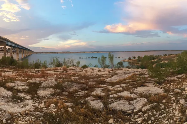
An oasis in the desert, Amistad National Recreation Area consists of the US portion of the International Amistad Reservoir. Amistad, a Spanish word meaning "friendship," is known for excellent water-b...
Park data from the National Park Service API. Alerts update every 2 hours.
More Details
What kind of drive is this?
This route is largely characterized by its highway driving, with 80% of the journey on major roads like I 10 and US Highway 90 East. You'll encounter a significant stretch of 237.1 miles on I 10, offering a consistent and fast-paced driving experience. As you transition to US Highway 90 East and Sanderson Highway, the road may offer a change of pace, but the overall feel remains that of a long-distance transit route designed for covering miles. The profile is clearly a long-distance drive, with the majority of it spent on well-maintained, high-speed roadways.
80% highway — fuel and pacing are the main things to plan.
22 navigation steps total — most of the decisions cluster near the start and finish.
Longest single stretch: 237.1 mi on I 10.
How Hard Is This Drive?
6/10
This is a straightforward highway drive that stays mostly on I 10 and US Highway 90 East. You will hit about 15 points where you need to pay attention to lane position or signs. The trickiest moment comes around 0.2 miles in near East Franklin Avenue.
Driving Effort6/10
Moderate - straightforward overall, but long enough or busy enough to require pacing
Balances navigation complexity with total wheel time.
This drive requires moderate attention. Across 625.8 miles you will encounter 15 spots where lane choice or exit timing matters. Not difficult for experienced highway drivers, but worth previewing the tricky sections before you go.
Where does it get tricky?
The main spots that need attention: at 0.2 miles (East Franklin Avenue): Navigation decision point; at 0.8 miles (I 10; US 180): Merge point - match speed before joining. Lane positioning matters here; at 167.6 miles (I 10): Highway fork - watch signs carefully.
Elevation Profile
Hilly terrain with moderate elevation changes
4,462 ft516 ft
Total Climb
1,015 ft
Total Descent
4,213 ft
Highest Point
4,462 ft
~89.4 mi in
Elevation Range
3,946 ft
Notable High Points
4,462 ft at ~89.4 miles+574 ft prominence
Towns Mentioned on Route Signs
Based on OSRM destination-sign hints, not a full list of every settlement the road passes.
On the drive from El Paso, TX to Freer, TX, road signs begin pointing toward Sanderson along the way.
El Paso is the sixth largest city in Texas, with 679,000 residents (2020). It is on the United States-Mexico border. The city on the other side of the border is Ciudad Juarez, Chihuahua. El Paso is often called the Sun City. Collectively, the city of El Paso and other nearby cities, such as Juarez and Las Cruces, New Mexico are referred to as The Borderland.
Top landmarks
•El Paso Museum of Art — art museum in El Paso, Texas
•Union Depot — historic place in El Paso, El Paso County, Texas
•Plaza Theatre — building in El Paso, El Paso County, Texas
Moderate complexity with 3 natural rest stops along the way.
Solo Traveler
11h 7m drive, plan rest stops for pacing.
Frequently Asked Questions
The longest stretch is about 237.1 miles on I 10. The full list of main roads is in the Roads section above.
Yes — a 2-day pace is more comfortable than one long haul. A sensible stopping point is after roughly 313 miles on day one.
Yes — we found about 27 rest areas or service plazas within a short detour of the route (from OpenStreetMap). See the Rest Stops tab under Nearby Places for locations and mile markers. Plan to stretch, use the bathroom, and top off fluids every 2–3 hours on longer drives.
It helps. This route has a higher-than-average number of complex decision points, which get harder in the dark. If the last hour of the trip is on surface roads or mountain grades, aim to arrive at Freer, TX before sunset when you can. Check the Trip Plan for departure windows that land you in daylight.
Only with planning. This is a long drive for kids — consider splitting it into two days rather than pushing through. Plan at least 3 meaningful breaks. There are 27 rest areas along the route for bathroom stops.
The main spots that need attention: at 0.2 miles (East Franklin Avenue): Navigation decision point; at 0.8 miles (I 10; US 180): Merge point - match speed before joining. Lane positioning matters here; at 167.6 miles (I 10): Highway fork - watch signs carefully.
Yes — Chamizal National Memorial and Amistad National Recreation Area. See the National Parks section for detour distances and tips on detours.
Not recommended in a single day. At 11.1 hours each way, a round trip means 22.3 hours of driving — that is an unsafe level of fatigue for most drivers. Plan at least one night at Freer, TX before the return drive.