Eagle River to Haines is 751.2 miles and takes about 49 hours 14 minutes via Alaska Marine Highway, with a fuel budget near $163 and enough daylight to finish in a day. This is a long-distance drive that spans across Alaska, utilizing ferry services as your primary mode of transit. With a recommended four days to complete, this trip offers a unique way to experience the state's vastness. Be prepared for a significant time commitment, but also for an unforgettable journey through Alaska's diverse landscapes. Planning ahead for ferry schedules will be key to a smooth experience.
Trip Pace
Best split across 4 days
Treat the return leg as its own travel day rather than an afterthought.
Break Rhythm
14 planned breaks
Plan on a short reset every 3 to 4 hours to stay fresh behind the wheel.
Midpoint
375.6 miles from Eagle River, AK
A natural place for your longest stop of the day
, about 21h 31m into the drive
.
Given the 49-hour 14-minute duration and recommended four days, pacing is crucial. Split your journey across multiple days, leveraging the ferry segments to break up travel time. Aim to depart in the morning to maximize daylight for any brief road portions and arrival at your destinations. Monitor your fuel costs, estimated at $163, and plan for refueling opportunities during land-based segments. A key consideration for this route is booking your ferry passage well in advance, as schedules can fill up, especially during peak travel seasons.
Morning Departure
Start early — leave by 6-7 AM to arrive at a reasonable hour.
Evening Departure
This is a long drive — plan for a morning departure or consider splitting it into two days.
This drive is better paced as a 4-day trip.
Plan roughly 14 meaningful breaks for fuel, food, and rest.
The halfway point lands around 375.6 miles from Eagle River, AK, or about 21h 31m into the drive.
The longest continuous stretch on this route runs about 334.5 miles.
Consider an overnight stop or starting very early.
Departure
Before you leave
Start with fuel, water, and navigation already sorted so the first hour feels easy.
First stop
Around 165 miles or 7h 40m in
Use this first pause for coffee, a restroom break, and a quick traffic check ahead.
Halfway reset
Around 375.6 miles or 21h 31m in
This is the best place for your longest stop, a real meal, and a full fuel check.
Overnight split
Day 1 wrap after about 187.8 miles or 9h 10m
Stop before fatigue turns the last few hours into a grind. You want day two to start fresh, not just resumed.
Final approach
Final hour starts around 42h 57m
Traffic, exits, and arrival timing usually matter more near Haines, AK than in the middle of the route.
Before You Leave
+
Open the route before leaving Eagle River, AK so your first major turns are already loaded.
+
Leave with enough water and a charging cable within reach, not packed away.
+
Check your fuel range against the first long segment, especially if you are starting outside city service areas.
+
Pick one backup stop option before the midpoint in case traffic changes your pacing.
+
Treat this as a 4-day road trip and book the overnight stop before the busiest arrival window.
Day 1
Settle into the route from Eagle River, AK
Aim for roughly 188 miles and 12.3 hours of wheel time on this day.
Day 2
Keep the middle miles efficient
Aim for roughly 188 miles and 12.3 hours of wheel time on this day.
Day 3
Keep the middle miles efficient
Aim for roughly 188 miles and 12.3 hours of wheel time on this day.
Day 4
Finish the approach into Haines, AK
Aim for roughly 188 miles and 12.3 hours of wheel time on this day.
Your first comfortable stop window is around 165 miles from Eagle River, AK.
This route usually feels better as a 4-day drive than as one long push.
Plan about 14 real breaks rather than only quick fuel stops.
The longest stretch is on Alaska Marine Highway - Whittier-Yakutat for about 334.5 miles.
Where to Stop
Rest stops, refuel points, and overnight suggestions along this route.
Place data sourced from public business listings. Hours and availability may vary.
Heads-up: tricky spots
5 of 11
5 decision points cluster between mile 0.1 and 751.2 — GPS handles the exact turns, but know they're coming. Your lane choice matters more than the turn itself.
5
0.1 mi into trip|~0m in|Old Glenn Highway
At end of road, turn left onto Old Glenn Highway
Navigation decision point
5
0.6 mi into trip|~1m in|AK 1 / Glenn Highway
Merge onto AK 1 / Glenn Highway
Merge point - match speed before joining. Lane positioning matters here
Use the straight / slight right lanes.
4
14.1 mi into trip|~18m in|AK 1 / Gambell Street
Turn left onto AK 1 / Gambell Street
Navigation decision point
5
408.1 mi into trip|~23h 39m in|Alaska Marine Highway - Juneau-Yakutat
Turn sharp right onto Alaska Marine Highway - Juneau-Yakutat
Sharp turn - reduce speed on approach
5
751.2 mi into trip|~49h 14m in|Dalton Street
Turn right onto Dalton Street
Navigation decision point
Fuel & Cost
Regular Gas
$146.87 one way
$293.74 round trip
$4.97/gal25.4 MPG avg263 kg CO2
Fuel Type
$/gal
One Way
Round Trip
midgrade
$5.28
$156.10
$312.19
premium
$5.46
$161.33
$322.66
diesel
$4.80
$141.84
$283.68
No toll roads detected on this route.
Estimated Trip Cost (one way, 1 person)
Fuel
$147
Hotel (3n)
$240–$420
Meals
$100–$200
Total
$487–$767
Rough estimate based on US averages. Hotel $80–$140/night, meals $25–$50/day.
Estimated CO2 emission: 262.8 kg one way.
Prices: EIA weekly data, 2026-07-13.
Driving Electric?
About $79 in charging
· 2 stops
· 67% less CO2
Vehicle Type
kWh
Stops
DC Fast
Home Charge
Average EV
225.4
2
$78.88
$36.06
Efficient EV
187.8
2
$65.73
$30.05
EV Truck/SUV
300.5
3
$105.17
$48.08
Gas CO2
263 kg
EV CO2
88 kg (67% less)
Plan for 2 charging stops, roughly every 270 miles. Allow 25-40 minutes per stop at a DC fast charger.
DC fast charging avg $0.35/kWh. Home charging avg $0.16/kWh. US grid CO2: 0.39 kg/kWh.
Travel Intel
Current conditions at both ends of the drive.
Forecast as of Jul 16, 2026
Origin
Eagle River, AK
Late night
in Eagle River on Sunday
Local time
12:45 AM
AKDT
Current temp
57°F
Light Rain
0 mph80% chanceLive forecast
Special Weather Statement
Special Weather Statement issued July 16 at 10:56AM AKDT by NWS Juneau AK
Special Weather Statement
Special Weather Statement issued July 16 at 10:42AM AKDT by NWS Juneau AK
Destination
Haines, AK
Late night
in Haines on Sunday
Local time
12:45 AM
AKDT
Current temp
65°F
Mostly Sunny
SE 5 mph0% chanceLive forecast
Special Weather Statement
Special Weather Statement issued July 16 at 10:56AM AKDT by NWS Juneau AK
Special Weather Statement
Special Weather Statement issued July 16 at 10:42AM AKDT by NWS Juneau AK
69°F
Gateway, AK
496 mi in
Seasonal Notes
Summer travel usually means heavier construction, hotter rest stops, and busier weekend traffic around major cities.
Winter travel shortens daylight, so a route that looks manageable on paper can feel much longer after dark.
Holiday weekends tend to make both departure and arrival windows slower than the raw route time suggests.
For long drives, weather on day two can matter just as much as conditions at departure, so check the whole travel window rather than only the first day.
Time zone
Same local time
Origin and destination are on the same clock, so arrival timing is easier to judge at a glance.
Temperature spread
8 degrees warmer at arrival
A meaningful temperature swing is a good cue to rethink layers, water, and how soon you want to arrive.
Road read
49h 14m on the road
This is long enough that the arrival forecast matters almost as much as departure conditions. Recheck both ends before you roll.
Weather data from the National Weather Service. Conditions may change; check closer to your travel date.
National Parks Near This Route
Worth a detour if your schedule allows.
Klondike Gold Rush National Historical Park
National Historical Park
Headlines screamed "Gold!" The dream of a better life catapulted thousands of people to Alaska and the Yukon Territory. Their journey shaped them, and changed the people they encountered and the north...
27 mi from route
~67 min detour
Free
near mile 751.2
Park data from the National Park Service API. Alerts update every 2 hours.
More Details
What kind of drive is this?
This route is not a typical highway drive, as it relies heavily on the Alaska Marine Highway system, meaning you'll spend a considerable amount of time on ferries. The "highway share" is 0%, indicating no traditional road driving on interstates or major highways. The longest uninterrupted stretch is 334.5 miles on the Alaska Marine Highway - Whittier-Yakutat ferry segment. Expect a journey that transitions from land to sea, offering a different kind of driving experience where the ferry becomes your road.
0% highway, the rest on surface roads — varied driving throughout.
22 navigation steps total — most of the decisions cluster near the start and finish.
Longest single stretch: 334.5 mi on Alaska Marine Highway - Whittier-Yakutat.
How Hard Is This Drive?
7/10
At 49h 14m, this is a long-haul route where pacing matters more than any single turn. This route has several spots where lane changes, forks, or exits need your full attention. The trickiest moment comes around 0.1 miles in near Old Glenn Highway.
Driving Effort7/10
Demanding - plan breaks and stay ahead of the key maneuvers
Balances navigation complexity with total wheel time.
This is a demanding drive. With 11 significant decision points across 751.2 miles, you will need to stay alert - especially through interchange areas and urban stretches. Consider splitting it into segments if you are not comfortable with fast highway navigation.
Where does it get tricky?
The main spots that need attention: at 0.1 miles (Old Glenn Highway): Navigation decision point; at 0.6 miles (AK 1 / Glenn Highway): Merge point - match speed before joining. Lane positioning matters here; at 14.1 miles (AK 1 / Gambell Street): Navigation decision point.
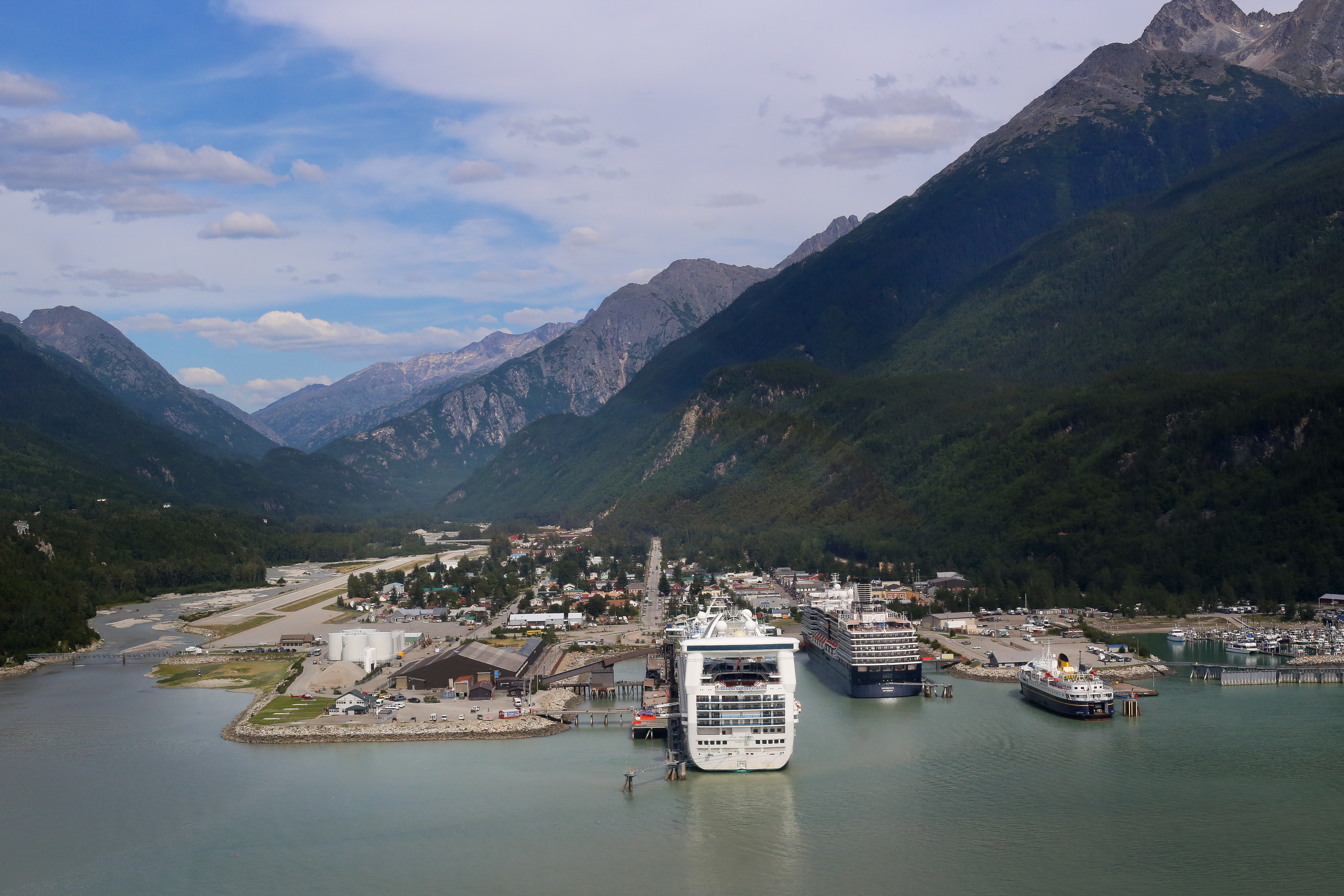
Haines is a small port community (population about 2,000) in Southeastern Alaska on the shores of the Lynn Canal, the state's longest fjord. It is surrounded by glacier-covered mountains of the Coast Range.
Long-haul drive route profile with national parks nearby.
Frequently Asked Questions
The longest stretch is about 334.5 miles on Alaska Marine Highway - Whittier-Yakutat. The full list of main roads is in the Roads section above.
Yes — a 4-day pace is more comfortable than one long haul. A sensible stopping point is after roughly 188 miles on day one.
Yes — we found about 1 rest area or service plaza within a short detour of the route (from OpenStreetMap). See the Rest Stops tab under Nearby Places for locations and mile markers. Plan to stretch, use the bathroom, and top off fluids every 2–3 hours on longer drives.
It helps. This route has a higher-than-average number of complex decision points, which get harder in the dark. If the last hour of the trip is on surface roads or mountain grades, aim to arrive at Haines, AK before sunset when you can. Check the Trip Plan for departure windows that land you in daylight.
Only with planning. This is a long drive for kids — consider splitting it into two days rather than pushing through. Plan at least 14 meaningful breaks. There are 1 rest area along the route for bathroom stops.
Mostly yes along the main roads, but rural stretches through AK can have sparse or no coverage. Before you leave, download offline Google Maps or Apple Maps for the route, and consider downloading music or podcasts instead of streaming. If you depend on data for navigation, keep a paper backup of the turn-by-turn directions.
The main spots that need attention: at 0.1 miles (Old Glenn Highway): Navigation decision point; at 0.6 miles (AK 1 / Glenn Highway): Merge point - match speed before joining. Lane positioning matters here; at 14.1 miles (AK 1 / Gambell Street): Navigation decision point.
Yes — Klondike Gold Rush National Historical Park. See the National Parks section for detour distances and tips on detours.
Not recommended in a single day. At 49.2 hours each way, a round trip means 98.5 hours of driving — that is an unsafe level of fatigue for most drivers. Plan at least one night at Haines, AK before the return drive.