If you are planning a trip from Eagle Mountain to Logan, expect a journey covering 120.2 miles of local terrain. The drive typically takes about 2 hours and 4 minutes, making it a perfectly manageable day trip that doesn't require an overnight stay. You will navigate through the Mountain West by sticking to local thoroughfares like North Church Way, North Liberty Way, and East Bobby Wren Boulevard rather than major interstates. Budgeting around $18 for fuel should cover your needs for this transit. Because this route avoids highways entirely, it offers a distinct, turn-heavy experience compared to standard freeway travel. It is a straightforward trek for those who prefer local roads over high-speed corridors.
Trip Pace
Same-day drive is realistic
A same-day return is realistic if you keep stops short.
Midpoint
59.5 miles from Eagle Mountain, UT
A natural place for your longest stop of the day
, about 1h 14m into the drive
.
Main Roads
Road
Distance
Duration
Veterans Memorial Highway
77.9 mi
1h 22m
US 89
22 mi
28m
1100 South
4.5 mi
5m
North Pony Express Parkway
3.9 mi
7m
Mountain View Corridor
2.3 mi
3m
Cory B Wride Memorial Highway
2.1 mi
3m
North Ranches Parkway
1.3 mi
2m
2100 North
1.3 mi
1m
Longest stretch:
Veterans Memorial Highway
— 77.9 mi, about 1h 22m
Turn-by-Turn Driving Directions
Step-by-step road directions between Eagle Mountain, UT and Logan, UT.
1
Start on East Independence Way
428 ft·18 sec·East Independence Way
2
Continue on North Church Way
0.1 mi·31 sec·North Church Way
3
Enter roundabout onto North Liberty Way
42 ft·2 sec·North Liberty Way
4
Continue on North Liberty Way
172 ft·12 sec·North Liberty Way
5
Turn left onto East Bobby Wren Boulevard
0.3 mi·42 sec·East Bobby Wren Boulevard
6
Turn right onto North Pony Express Parkway
3.9 mi·7 min·North Pony Express Parkway
7
Continue on East Pony Express Parkway
0.4 mi·56 sec·East Pony Express Parkway
8
Turn left onto North Ranches Parkway
1.3 mi·2 min·North Ranches Parkway
Use the left lane.
9
Turn right onto SR 73
2.1 mi·3 min·Cory B Wride Memorial Highway
Use the straight / right lanes.
10
Turn left onto SR 85
1.6 mi·2 min·Mountain View Corridor
Use the left lane.
11
Take the exit
0.4 mi·37 sec
12
Keep slight left at fork
0.4 mi·51 sec
Toward SR 194
13
Continue on SR 194
0.8 mi·51 sec·Mountain View Corridor
14
Continue on SR 194
1.3 mi·1 min·2100 North
Use the left lane.
15
Turn left onto 2300 West
167 ft·4 sec·2300 West
Use the left lane.
16
Continue on Triumph Boulevard
0.9 mi·2 min·Triumph Boulevard
Use the straight / left lanes.
17
Turn left onto Digital Drive
0.1 mi·17 sec·Digital Drive
Use the left lane.
18
Take the ramp
0.4 mi·55 sec
Toward I 15 North: Salt Lake City
19
Merge onto I 15; US 89
40 mi·42 min·Veterans Memorial Highway
Toward Salt Lake CityUse the straight / slight right lanes.
20
Keep slight left at fork onto I 15
38 mi·39 min·Veterans Memorial Highway
Use the straight / slight right lanes.
21
Take the exit onto I 15 Business; I 84 Business
0.2 mi·21 sec·I 15 Business; I 84 Business
Toward US 91
22
Keep slight right at fork onto I 15 Business; I 84 Business
0.3 mi·36 sec·I 15 Business; I 84 Business
23
Merge onto US 91; I 15 Bus; I 84 Bus
4.5 mi·5 min·1100 South
24
Continue on US 89; US 91
22 mi·28 min·US 89; US 91
25
Turn right onto 200 North
210 ft·11 sec·200 North
26
Turn left
106 ft·13 sec
27
Turn left
73 ft·5 sec
28
Arrive at destination
Trip Plan
Given the 2-hour duration, you have plenty of flexibility to plan your departure around your personal schedule. Because there are no designated stops in the data, it is wise to handle any necessary fueling or refreshments before you head out, as you will be sticking to local roads for the entire 120.2-mile distance. Since this route relies exclusively on local streets like North Liberty Way, keep a close watch on your GPS to navigate the frequent turns accurately. Taking this trip in a single day is easy, but ensure you are comfortable with a drive that lacks high-speed highway segments. A great tip for this specific route is to double-check your turn-by-turn navigation before leaving, as the reliance on local roads means you will be making more frequent maneuvers than you would on a standard highway drive.
Morning Departure
Leave by 9 AM and you'll arrive before lunch.
Evening Departure
Even a 4 PM departure gets you there before dark in summer.
You can normally do this drive in one day.
You may only need one short stretch break if traffic stays light.
The halfway point lands around 59.5 miles from Eagle Mountain, UT, or about 1h 14m into the drive.
The longest continuous stretch on this route runs about 77.9 miles.
This is a comfortable same-day trip.
Departure
Before you leave
Start with fuel, water, and navigation already sorted so the first hour feels easy.
First stop
Around 26 miles or 38m in
Use this first pause for coffee, a restroom break, and a quick traffic check ahead.
Halfway reset
Around 59.5 miles or 1h 14m in
This is the best place for your longest stop, a real meal, and a full fuel check.
Final approach
Final hour starts around 1h 56m
Traffic, exits, and arrival timing usually matter more near Logan, UT than in the middle of the route.
Before You Leave
+
Open the route before leaving Eagle Mountain, UT so your first major turns are already loaded.
+
Leave with enough water and a charging cable within reach, not packed away.
+
Check your fuel range against the first long segment, especially if you are starting outside city service areas.
Day 1
Settle into the route from Eagle Mountain, UT
This is one driving day of about 119 miles and 2h 23m.
Your first comfortable stop window is around 26 miles from Eagle Mountain, UT.
This route can stay practical as a one-day drive if traffic stays reasonable.
The longest stretch is on Veterans Memorial Highway for about 77.9 miles.
Where to Stop
Rest stops, refuel points, and overnight suggestions along this route.
Place data sourced from public business listings. Hours and availability may vary.
Heads-up: tricky spots
5 of 20
5 decision points cluster between mile 0.2 and 13.5 — GPS handles the exact turns, but know they're coming. Your lane choice matters more than the turn itself.
7
0.2 mi into trip|~0m in|North Liberty Way
Enter roundabout onto North Liberty Way
Roundabout - know your exit number before entering
6
6.2 mi into trip|~13m in|SR 73 / Cory B Wride Memorial Highway
Turn right onto SR 73 / Cory B Wride Memorial Highway
Lane positioning matters here
Use the straight / right lanes.
6
8.3 mi into trip|~16m in|SR 85 / Mountain View Corridor
Turn left onto SR 85 / Mountain View Corridor
Lane positioning matters here
Use the left lane.
6
12.6 mi into trip|~22m in|2300 West
Turn left onto 2300 West
Lane positioning matters here
Use the left lane.
6
13.5 mi into trip|~24m in|Digital Drive
Turn left onto Digital Drive
Lane positioning matters here
Use the left lane.
Fuel & Cost
Regular Gas
$18.86 one way
$37.71 round trip
$4.03/gal25.4 MPG avg42 kg CO2
Fuel Type
$/gal
One Way
Round Trip
midgrade
$4.22
$19.77
$39.53
premium
$4.53
$21.23
$42.46
diesel
$5.61
$26.27
$52.55
No toll roads detected on this route.
Estimated Trip Cost (one way, 1 person)
Fuel
$19
Meals
$25–$50
Total
$44–$69
Rough estimate based on US averages. Hotel $80–$140/night, meals $25–$50/day.
Estimated CO2 emission: 41.6 kg one way.
Prices: EIA weekly data, 2026-04-13.
Driving Electric?
About $12 in charging
· 0 stops
· 67% less CO2
Vehicle Type
kWh
Stops
DC Fast
Home Charge
Average EV
35.7
0
$12.49
$5.71
Efficient EV
29.8
0
$10.41
$4.76
EV Truck/SUV
47.6
0
$16.66
$7.62
Gas CO2
42 kg
EV CO2
14 kg (67% less)
This trip is well within single-charge range for most EVs. No charging stops needed if you start fully charged.
DC fast charging avg $0.35/kWh. Home charging avg $0.16/kWh. US grid CO2: 0.39 kg/kWh.
Travel Intel
Current conditions at both ends of the drive.
Forecast as of Apr 15, 2026
Origin
Eagle Mountain, UT
Night
in Eagle Mountain on Saturday
Local time
10:34 PM
MDT
Current temp
72°F
Unavailable
Live forecast
Destination
Logan, UT
Night
in Logan on Saturday
Local time
10:34 PM
MDT
Current temp
43°F
Unavailable
Live forecast
Seasonal Notes
Summer travel usually means heavier construction, hotter rest stops, and busier weekend traffic around major cities.
Winter travel shortens daylight, so a route that looks manageable on paper can feel much longer after dark.
Holiday weekends tend to make both departure and arrival windows slower than the raw route time suggests.
Time zone
Same local time
Origin and destination are on the same clock, so arrival timing is easier to judge at a glance.
Temperature spread
29 degrees cooler at arrival
A meaningful temperature swing is a good cue to rethink layers, water, and how soon you want to arrive.
Road read
2h 23m on the road
Use the two city cards together: check the sky where you start, then compare it with the local time and temperature at arrival.
Weather data from the National Weather Service. Conditions may change; check closer to your travel date.
National Parks Near This Route
Worth a detour if your schedule allows.
Timpanogos Cave National Monument
National Monument
The visitor center, caves, and cave tours have not yet opened for the 2026 season. Hike your way past stunning vistas to explore a hidden underground world. Taste the thrill of caving as you twist and...
10 mi from route
~24 min detour
$12
near mile 12.3
Caution: Tickets are required to enter Timpanogos Cave
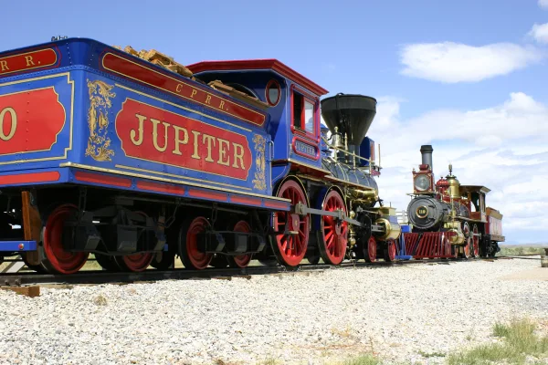
One of the greatest technological achievements of the 19th century is the completion of the first transcontinental railroad across the United States. Visitors to the park can see the location of the L...
27 mi from route
~67 min detour
$20
near mile 90.3
Park data from the National Park Service API. Alerts update every 2 hours.
More Details
What kind of drive is this?
Prepare for a turn-heavy local drive that demands your full attention behind the wheel. Since this route features a 0% highway share, you won't be dealing with the typical monotony of an interstate grind. The longest stretch you will encounter is 0 miles on North Church Way, meaning the road requires frequent navigation and adjustments rather than long, straight cruise-control sessions. As you transition between the specified local boulevards, the road's personality remains consistent, prioritizing local connectivity over sheer speed. Expect a hands-on driving experience where your focus remains on the immediate path ahead.
Only 24% highway — the rest is turn-by-turn surface driving.
28 navigation steps total — most of the decisions cluster near the start and finish.
Longest single stretch: 77.9 mi on Veterans Memorial Highway.
How Hard Is This Drive?
9/10
Expect a hands-on drive with frequent turns and local roads rather than long highway stretches. This route has several spots where lane changes, forks, or exits need your full attention. The trickiest moment comes around 0.2 miles in near North Liberty Way.
Driving Effort9/10
High effort - long or complex enough to need steady focus all day
Balances navigation complexity with total wheel time.
This is a demanding drive. With 20 significant decision points across 119 miles, you will need to stay alert - especially through interchange areas and urban stretches. Consider splitting it into segments if you are not comfortable with fast highway navigation.
Where does it get tricky?
The main spots that need attention: at 0.2 miles (North Liberty Way): Roundabout - know your exit number before entering; at 6.2 miles (SR 73 / Cory B Wride Memorial Highway): Lane positioning matters here; at 8.3 miles (SR 85 / Mountain View Corridor): Lane positioning matters here.
Towns Mentioned on Route Signs
Based on OSRM destination-sign hints, not a full list of every settlement the road passes.
On the drive from Eagle Mountain, UT to Logan, UT, road signs begin pointing toward Salt Lake City along the way.
Salt Lake City
14.1 mi in|~26m|via I 15; US 89
Who Is This Route For?
Weekend Trip
Doable as a same-day drive at 2h 23m. Total distance: 119 miles.
Family Friendly
Moderate complexity with 0 natural rest stops along the way.
Solo Traveler
2h 23m drive, comfortable solo distance.
Scenic Drive
Mostly surface roads route profile with national parks nearby.
Frequently Asked Questions
The longest stretch is about 77.9 miles on Veterans Memorial Highway. The full list of main roads is in the Roads section above.
It helps. This route has a higher-than-average number of complex decision points, which get harder in the dark. If the last hour of the trip is on surface roads or mountain grades, aim to arrive at Logan, UT before sunset when you can. Check the Trip Plan for departure windows that land you in daylight.
Only with planning. This is a long drive for kids — consider splitting it into two days rather than pushing through. Dedicated rest areas are limited, so plan gas or food stops as your bathroom breaks.
The main spots that need attention: at 0.2 miles (North Liberty Way): Roundabout - know your exit number before entering; at 6.2 miles (SR 73 / Cory B Wride Memorial Highway): Lane positioning matters here; at 8.3 miles (SR 85 / Mountain View Corridor): Lane positioning matters here.
Yes — Timpanogos Cave National Monument and Golden Spike National Historical Park. See the National Parks section for detour distances and tips on detours.
Yes. A round trip is manageable in a single day if you plan a break at Logan, UT before heading back.