Stretching 167.5 miles across the heart of Colorado, this journey from Durango to Grand Junction typically takes about 3 hours and 42 minutes. Because this is a compact trip through the Mountain West, it is perfectly suited for a single-day excursion, meaning you won't need to worry about booking an overnight stay. You can expect to spend approximately $23 on fuel, making it a budget-friendly option for your travel plans. Navigating out of Durango involves local roads like West 11th Street, Camino del Rio, and Main Avenue before you settle into the drive. Whether you are heading north for business or a change of scenery, the straightforward nature of this route makes it a practical choice for most drivers.
Trip Pace
Same-day drive is realistic
A same-day return is realistic if you keep stops short.
Break Rhythm
1 planned break
A short stop every 2 to 3 hours is enough for this drive.
Midpoint
83.3 miles from Durango, CO
A natural place for your longest stop of the day
, about 2h 6m into the drive
.
Main Roads
Road
Distance
Duration
Main Avenue
69.3 mi
1h 44m
US 50
50.2 mi
1h 4m
Main Street
36.5 mi
50m
North Townsend Avenue
3.7 mi
6m
G Road
2.3 mi
4m
G50 Road
2.1 mi
3m
Confluence Drive
0.8 mi
1m
Pitkin Avenue
0.7 mi
1m
Longest stretch:
Main Avenue
— 69.3 mi, about 1h 44m
Turn-by-Turn Driving Directions
Step-by-step road directions between Durango, CO and Grand Junction, CO.
1
Start on Main Avenue
99 ft·12 sec·Main Avenue
2
Turn left onto West 11th Street
0.1 mi·28 sec·West 11th Street
3
Turn right onto US 550
0.3 mi·36 sec·Camino del Rio
4
Continue on US 550
69 mi·1 hr 44 min·Main Avenue
5
Turn right onto 5th Street
265 ft·45 sec·5th Street
6
Continue on 2nd Avenue
384 ft·22 sec·2nd Avenue
7
Turn right onto 4th Street
384 ft·25 sec·4th Street
8
Turn left onto 3rd Avenue
393 ft·24 sec·3rd Avenue
9
Turn right onto US 550
36 mi·50 min·Main Street
Use the straight / right lanes.
10
Continue on US 550
3.7 mi·6 min·North Townsend Avenue
Use the straight lane.
11
Continue on US 50
17 mi·20 min·US 50
12
Turn left onto Confluence Drive
0.8 mi·1 min·Confluence Drive
Use the left lane.
13
Turn left onto West 5th Street
0.2 mi·26 sec·West 5th Street
Use the left lane.
14
Continue on G Road
1.6 mi·3 min·G Road
15
Continue on G Road
0.7 mi·1 min·G Road
16
Continue on G50 Road
2.1 mi·3 min·G50 Road
17
At end of road, turn left onto US 50
15 mi·17 min·US 50
18
Continue on US 50
14 mi·18 min·US 50
19
Continue on US 50
4.2 mi·7 min·US 50
Use the right lane.
20
Turn right onto I 70 BUS
0.7 mi·1 min·Pitkin Avenue
Use the straight / right lanes.
21
Arrive at destination
I 70 BUS
Trip Plan
Since this 167.5-mile trek is manageable in a single day, you have plenty of flexibility to plan your departure time around your personal schedule. With only one planned stop recommended, try to pace yourself to keep the 3 hour and 42 minute duration comfortable. Before you head out, ensure your vehicle is ready for a technical, turn-heavy route that relies entirely on local roads rather than high-speed highways. Budgeting $23 for fuel should keep you covered, but keeping a little extra set aside is always a wise move for any Mountain West road trip. My top tip for this specific drive is to prioritize your comfort during the transition from the city streets of Durango, as the technical nature of the road can be more taxing than a standard highway drive.
Morning Departure
An early start around 7-8 AM gets you there with plenty of daylight left.
Evening Departure
A late afternoon start means arriving after dark. Morning is better.
You can normally do this drive in one day.
Plan roughly 1 meaningful break for fuel, food, and rest.
The halfway point lands around 83.3 miles from Durango, CO, or about 2h 6m into the drive.
The longest continuous stretch on this route runs about 69.3 miles.
This is a comfortable same-day trip.
Departure
Before you leave
Start with fuel, water, and navigation already sorted so the first hour feels easy.
First stop
Around 37 miles or 56m in
Use this first pause for coffee, a restroom break, and a quick traffic check ahead.
Halfway reset
Around 83.3 miles or 2h 6m in
This is the best place for your longest stop, a real meal, and a full fuel check.
Final approach
Final hour starts around 3h 19m
Traffic, exits, and arrival timing usually matter more near Grand Junction, CO than in the middle of the route.
Before You Leave
+
Open the route before leaving Durango, CO so your first major turns are already loaded.
+
Leave with enough water and a charging cable within reach, not packed away.
+
Check your fuel range against the first long segment, especially if you are starting outside city service areas.
Day 1
Settle into the route from Durango, CO
This is one driving day of about 166.5 miles and 3h 59m.
Your first comfortable stop window is around 37 miles from Durango, CO.
This route can stay practical as a one-day drive if traffic stays reasonable.
Plan about 1 real break rather than only quick fuel stops.
The longest stretch is on Main Avenue for about 69.3 miles.
Where to Stop
Rest stops, refuel points, and overnight suggestions along this route.
Place data sourced from public business listings. Hours and availability may vary.
Heads-up: tricky spots
5 of 10
5 decision points cluster between mile 0 and 165.8 — GPS handles the exact turns, but know they're coming. Your lane choice matters more than the turn itself.
4
0 mi into trip|~0m in|West 11th Street
Turn left onto West 11th Street
Navigation decision point
6
69.9 mi into trip|~1h 47m in|US 550 / Main Street
Turn right onto US 550 / Main Street
Lane positioning matters here
Use the straight / right lanes.
5
127.3 mi into trip|~3h 5m in|Confluence Drive
Turn left onto Confluence Drive
Lane positioning matters here
Use the left lane.
6
128.1 mi into trip|~3h 6m in|West 5th Street
Turn left onto West 5th Street
Lane positioning matters here
Use the left lane.
6
165.8 mi into trip|~3h 58m in|I 70 BUS / Pitkin Avenue
Turn right onto I 70 BUS / Pitkin Avenue
Lane positioning matters here
Use the straight / right lanes.
Fuel & Cost
Regular Gas
$25.09 one way
$50.17 round trip
$3.83/gal25.4 MPG avg58 kg CO2
Fuel Type
$/gal
One Way
Round Trip
midgrade
$4.05
$26.56
$53.12
premium
$4.39
$28.80
$57.61
diesel
$5.61
$36.76
$73.52
No toll roads detected on this route.
Estimated Trip Cost (one way, 1 person)
Fuel
$25
Meals
$25–$50
Total
$50–$75
Rough estimate based on US averages. Hotel $80–$140/night, meals $25–$50/day.
Estimated CO2 emission: 58.3 kg one way.
Prices: EIA weekly data, 2026-04-13.
Driving Electric?
About $17 in charging
· 0 stops
· 67% less CO2
Vehicle Type
kWh
Stops
DC Fast
Home Charge
Average EV
49.9
0
$17.48
$7.99
Efficient EV
41.6
0
$14.57
$6.66
EV Truck/SUV
66.6
0
$23.31
$10.66
Gas CO2
58 kg
EV CO2
19 kg (67% less)
This trip is well within single-charge range for most EVs. No charging stops needed if you start fully charged.
DC fast charging avg $0.35/kWh. Home charging avg $0.16/kWh. US grid CO2: 0.39 kg/kWh.
Travel Intel
Current conditions at both ends of the drive.
Forecast as of Apr 15, 2026
Origin
Durango, CO
Night
in Durango on Saturday
Local time
10:34 PM
MDT
Current temp
36°F
Unavailable
Live forecast
Destination
Grand Junction, CO
Night
in Grand Junction on Saturday
Local time
10:34 PM
MDT
Current temp
76°F
Unavailable
Live forecast
27°F
Pandora, CO
83 mi in
Seasonal Notes
Summer travel usually means heavier construction, hotter rest stops, and busier weekend traffic around major cities.
Winter travel shortens daylight, so a route that looks manageable on paper can feel much longer after dark.
Holiday weekends tend to make both departure and arrival windows slower than the raw route time suggests.
Time zone
Same local time
Origin and destination are on the same clock, so arrival timing is easier to judge at a glance.
Temperature spread
40 degrees warmer at arrival
A meaningful temperature swing is a good cue to rethink layers, water, and how soon you want to arrive.
Road read
3h 59m on the road
Use the two city cards together: check the sky where you start, then compare it with the local time and temperature at arrival.
Weather data from the National Weather Service. Conditions may change; check closer to your travel date.
National Parks Near This Route
Worth a detour if your schedule allows.
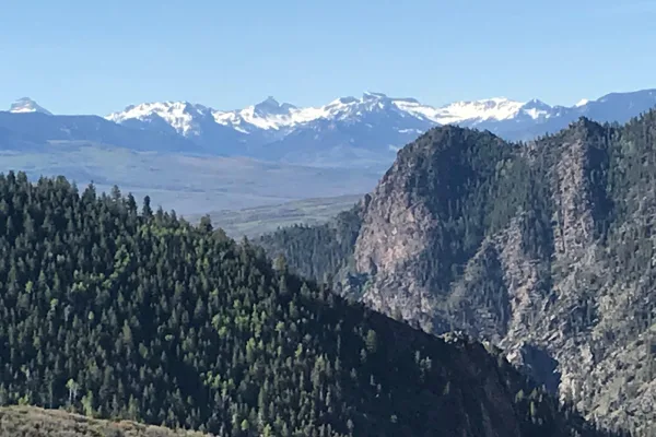
Colorado National Monument
National Monument
Colorado National Monument preserves one of the grand landscapes of the American West. But this treasure is much more than a monument. Towering monoliths exist within a vast plateau and canyon panoram...
8 mi from route
~19 min detour
$25
near mile 166.5
Big enough to be overwhelming, yet still intimate enough to feel the pulse of time. Come see some of the steepest cliffs, oldest rock, and craggiest spires in North America. Forces of nature and the G...
11 mi from route
~28 min detour
$30
near mile 109.1
Three reservoirs and surrounding lands make up this recreation area in western Colorado. It is a landscape of tradeoffs; natural and human made features exist together. Geologic wonders are abundant f...
27 mi from route
~67 min detour
Free
near mile 91.9
Park data from the National Park Service API. Alerts update every 2 hours.
More Details
What kind of drive is this?
Expect a turn-heavy local drive rather than a monotonous interstate cruise, as this route features 0% highway driving. You will spend your time navigating technical stretches that demand your full attention, a sharp contrast to the high-speed transit found on major interstates. Because the longest stretch is 0 miles on West 11th Street, you should prepare for a drive that requires frequent adjustments and constant engagement with the road. The character of this trip is defined by its local road composition, ensuring you feel every twist and turn along the way. Stay alert behind the wheel, as the lack of highway miles means you will be managing a more hands-on driving experience from start to finish.
30% highway, the rest on surface roads — varied driving throughout.
21 navigation steps total — most of the decisions cluster near the start and finish.
Longest single stretch: 69.3 mi on Main Avenue.
How Hard Is This Drive?
4/10
This route mixes highway mileage with some local-road sections near the start or finish. There are only a few real navigation decisions along the way. The trickiest moment comes early in the drive near West 11th Street.
Driving Effort4/10
Easy - simple navigation with a manageable amount of wheel time
Balances navigation complexity with total wheel time.
This is a straightforward 3h 59m drive. You will face about 10 decision points, but nothing that requires special attention if you follow navigation.
Where does it get tricky?
The main spots that need attention: near the start (West 11th Street): Navigation decision point; at 69.9 miles (US 550 / Main Street): Lane positioning matters here; at 127.3 miles (Confluence Drive): Lane positioning matters here.
Who Is This Route For?
Weekend Trip
Doable as a same-day drive at 3h 59m. Total distance: 166.5 miles.
Family Friendly
Moderate complexity with 1 natural rest stops along the way.
Mixed highway & surface route profile with national parks nearby.
Frequently Asked Questions
The longest stretch is about 69.3 miles on Main Avenue. The full list of main roads is in the Roads section above.
We did not find dedicated rest areas on this route. For a drive this long, plan bathroom and stretch breaks around gas stations, fast-food stops, or small-town downtowns — check the Nearby Places section for options.
Yes, with realistic expectations. Build in a stop roughly every 2 hours, have snacks and activities ready, and check the Nearby Places tabs for kid-friendly stops along the way.
The main spots that need attention: near the start (West 11th Street): Navigation decision point; at 69.9 miles (US 550 / Main Street): Lane positioning matters here; at 127.3 miles (Confluence Drive): Lane positioning matters here.
Yes — Colorado National Monument, Black Canyon Of The Gunnison National Park and Curecanti National Recreation Area. See the National Parks section for detour distances and tips on detours.
Possible but tiring. At 4.0 hours each way, an in-and-out day trip would put you behind the wheel for 8.0 hours — manageable with a long break at Grand Junction, CO, but most travelers stay overnight.