Connecting Decatur to Pell City is a straightforward 116-mile journey that typically takes about 2 hours and 15 minutes to complete. Since the entire trip stays within the Southeast region of Alabama, it is easily manageable as a single-day excursion without the need for an overnight stay. You should budget approximately $18 for fuel, making this a very cost-effective commute between these two Alabama hubs. Because the drive is relatively short and efficient, you have plenty of flexibility to plan your departure time around your personal schedule. Whether you are heading out for business or a quick change of pace, this route offers a predictable and reliable transit experience.
Trip Pace
Same-day drive is realistic
A same-day return is realistic if you keep stops short.
Midpoint
58 miles from Decatur, AL
A natural place for your longest stop of the day
, about 1h 8m into the drive
.
Main Roads
Road
Distance
Duration
I 65
71 mi
1h 16m
I 20
33.7 mi
38m
Point Mallard Parkway
4.2 mi
6m
6th Avenue Southeast
3 mi
5m
Martin Street
1.1 mi
1m
Lee Street Northeast
0.3 mi
<1m
Comer Avenue
0.2 mi
<1m
Cogswell Avenue
0.2 mi
<1m
Longest stretch:
I 65
— 71 mi, about 1h 16m
Turn-by-Turn Driving Directions
Step-by-step road directions between Decatur, AL and Pell City, AL.
1
Start on this road
426 ft·36 sec·this road
2
At end of road, turn left onto Ferry Street Northeast
164 ft·8 sec·Ferry Street Northeast
3
Turn left onto Lee Street Northeast
0.3 mi·53 sec·Lee Street Northeast
Use the left / straight / right lanes.
4
At end of road, turn right onto US 31
0.1 mi·14 sec·6th Avenue Northeast
Use the right lane.
5
Continue on US 31
3.0 mi·5 min·6th Avenue Southeast
Use the straight / right lanes.
6
Turn left onto AL 67
4.2 mi·6 min·Point Mallard Parkway
Use the left lane.
7
Take the ramp
0.4 mi·47 sec
Toward I-65 South: BirminghamUse the slight right lane.
8
Merge onto I 65
67 mi·1 hr 11 min·I 65
Use the straight / slight right lanes.
9
Take the exit
0.5 mi·38 sec
Exit 265Toward I 22 West, US 31: Memphis, FultondaleUse the slight right lane.
10
Keep slight left at fork
0.5 mi·37 sec
Toward I 22 West: MemphisUse the straight lane.
11
Keep slight left at fork
0.4 mi·27 sec
Toward MontgomeryUse the straight / slight right lanes.
12
Merge onto I 65
3.9 mi·4 min·I 65
Use the straight / slight right lanes.
13
Take the exit
0.2 mi·25 sec
Exit 261BToward I 20 East, I 59 North: Atlanta, Gadsden
14
Merge onto I 20; I 59
5.1 mi·6 min·I 20; I 59
Use the straight / slight right lanes.
15
Keep slight right at fork onto I 20
29 mi·32 min·I 20
Toward I 20 East: AtlantaUse the straight / slight right lanes.
16
Take the exit
0.2 mi·30 sec
Exit 158Toward US 231, AL 53: Ashville, Pell CityUse the slight right lane.
17
Turn right onto US 231
1.1 mi·1 min·Martin Street
18
Turn right onto Comer Avenue
0.2 mi·31 sec·Comer Avenue
19
Turn right onto US 78
0.2 mi·22 sec·Cogswell Avenue
20
Arrive at destination
US 78
Trip Plan
Since this is a quick 2-hour and 15-minute drive, you do not need an elaborate pacing strategy or multiple rest stops to reach your destination. Aim to time your departure to avoid peak commuting hours on the interstates, as traffic density can fluctuate on these major arteries. Keep your vehicle prepared for the 116-mile trek, though the $18 fuel estimate is quite modest for a trip of this length. Because the route relies so heavily on I-65 and I-20, stay alert for standard highway congestion as you near the transition points between these two major roads. Utilizing the Point Mallard Parkway early in your trip will help you get settled into your drive before you merge into the faster-paced interstate traffic.
Morning Departure
Leave by 9 AM and you'll arrive before lunch.
Evening Departure
Even a 4 PM departure gets you there before dark in summer.
You can normally do this drive in one day.
You may only need one short stretch break if traffic stays light.
The halfway point lands around 58 miles from Decatur, AL, or about 1h 8m into the drive.
The longest continuous stretch on this route runs about 71 miles.
This is a comfortable same-day trip.
Departure
Before you leave
Start with fuel, water, and navigation already sorted so the first hour feels easy.
First stop
Around 26 miles or 33m in
Use this first pause for coffee, a restroom break, and a quick traffic check ahead.
Halfway reset
Around 58 miles or 1h 8m in
This is the best place for your longest stop, a real meal, and a full fuel check.
Final approach
Final hour starts around 1h 51m
Traffic, exits, and arrival timing usually matter more near Pell City, AL than in the middle of the route.
Before You Leave
+
Open the route before leaving Decatur, AL so your first major turns are already loaded.
+
Leave with enough water and a charging cable within reach, not packed away.
+
Check your fuel range against the first long segment, especially if you are starting outside city service areas.
Day 1
Settle into the route from Decatur, AL
This is one driving day of about 116 miles and 2h 15m.
Your first comfortable stop window is around 26 miles from Decatur, AL.
This route can stay practical as a one-day drive if traffic stays reasonable.
The longest stretch is on I 65 for about 71 miles.
Where to Stop
Rest stops, refuel points, and overnight suggestions along this route.
Place data sourced from public business listings. Hours and availability may vary.
Heads-up: tricky spots
5 of 16
5 decision points cluster between mile 0.4 and 114.3 — GPS handles the exact turns, but know they're coming. Your lane choice matters more than the turn itself.
8
0.4 mi into trip|~1m in|US 31 / 6th Avenue Northeast
At end of road, turn right onto US 31 / 6th Avenue Northeast
Lane positioning matters here
Use the right lane.
8
75.2 mi into trip|~1h 26m in
Take the exit toward I 22 West, US 31: Memphis, Fultondale
Exit ramp - move to the correct lane early. Lane positioning matters here. Multiple destination signs - pick the right one
Use the slight right lane.
Exit 265
Toward I 22 West, US 31: Memphis, Fultondale
7
75.7 mi into trip|~1h 27m in
Keep slight left at fork toward I 22 West: Memphis
Highway fork - watch signs carefully. Lane positioning matters here
Use the straight lane.
Toward I 22 West: Memphis
7
76.2 mi into trip|~1h 27m in
Keep slight left at fork toward Montgomery
Highway fork - watch signs carefully. Lane positioning matters here
Use the straight / slight right lanes.
Toward Montgomery
8
114.3 mi into trip|~2h 12m in
Take the exit toward US 231, AL 53: Ashville, Pell City
Exit ramp - move to the correct lane early. Lane positioning matters here. Multiple destination signs - pick the right one
Use the slight right lane.
Exit 158
Toward US 231, AL 53: Ashville, Pell City
Fuel & Cost
Regular Gas
$17.52 one way
$35.04 round trip
$3.84/gal25.4 MPG avg41 kg CO2
Fuel Type
$/gal
One Way
Round Trip
midgrade
$4.21
$19.23
$38.46
premium
$4.56
$20.82
$41.64
diesel
$5.61
$25.61
$51.22
No toll roads detected on this route.
Estimated Trip Cost (one way, 1 person)
Fuel
$18
Meals
$25–$50
Total
$43–$68
Rough estimate based on US averages. Hotel $80–$140/night, meals $25–$50/day.
Estimated CO2 emission: 40.6 kg one way.
Prices: EIA weekly data, 2026-04-13.
Driving Electric?
About $12 in charging
· 0 stops
· 66% less CO2
Vehicle Type
kWh
Stops
DC Fast
Home Charge
Average EV
34.8
0
$12.18
$5.57
Efficient EV
29
0
$10.15
$4.64
EV Truck/SUV
46.4
0
$16.24
$7.42
Gas CO2
41 kg
EV CO2
14 kg (66% less)
This trip is well within single-charge range for most EVs. No charging stops needed if you start fully charged.
DC fast charging avg $0.35/kWh. Home charging avg $0.16/kWh. US grid CO2: 0.39 kg/kWh.
Travel Intel
Current conditions at both ends of the drive.
Forecast as of Apr 12, 2026
Origin
Decatur, AL
Late night
in Decatur on Tuesday
Local time
3:12 AM
CDT
Current temp
86°F
Mostly Sunny
S 15 mph0% chanceLive forecast
Red Flag Warning
Red Flag Warning issued April 12 at 11:42AM CDT until April 12 at 7:00PM CDT by NWS Birmingham AL
Red Flag Warning
Red Flag Warning issued April 12 at 10:04AM CDT until April 12 at 7:00PM CDT by NWS Huntsville AL
Destination
Pell City, AL
Late night
in Pell City on Tuesday
Local time
3:12 AM
CDT
Current temp
57°F
Unavailable
Live forecast
58°F
Kimberly, AL
58 mi in
Seasonal Notes
Summer travel usually means heavier construction, hotter rest stops, and busier weekend traffic around major cities.
Winter travel shortens daylight, so a route that looks manageable on paper can feel much longer after dark.
Holiday weekends tend to make both departure and arrival windows slower than the raw route time suggests.
Time zone
Same local time
Origin and destination are on the same clock, so arrival timing is easier to judge at a glance.
Temperature spread
29 degrees cooler at arrival
A meaningful temperature swing is a good cue to rethink layers, water, and how soon you want to arrive.
Road read
2h 15m on the road
The weather snapshot is not static. If you are leaving later, give both cities one more quick forecast check before departure.
Weather data from the National Weather Service. Conditions may change; check closer to your travel date.
National Parks Near This Route
Worth a detour if your schedule allows.
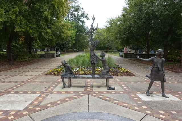
Birmingham Civil Rights National Monument
National Monument
In 1963, images of snarling police dogs unleashed against non-violent protesters and of children being sprayed with high-pressure hoses appeared in print and television news around the world. These dr...
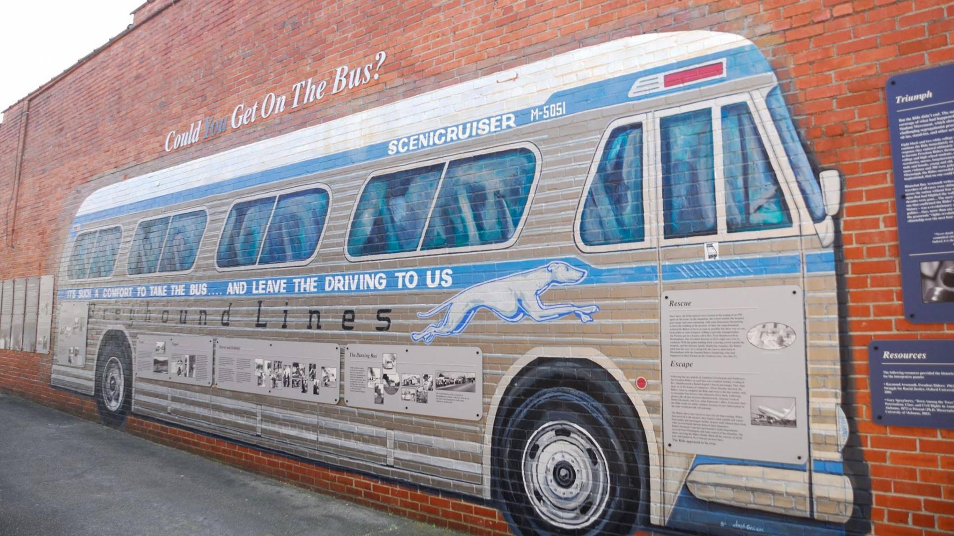
In 1961, a small interracial band of “Freedom Riders” challenged discriminatory laws requiring separation of the races in interstate travel. They were attacked by white segregationists, who firebombed...
22 mi from route
~55 min detour
Free
near mile 116
Park data from the National Park Service API. Alerts update every 2 hours.
More Details
What kind of drive is this?
Expect a highly efficient, highway-focused drive that keeps you moving quickly across the state. With 94% of the route consisting of highway travel, you will spend most of your time on I-65 and I-20, supplemented by stretches on Point Mallard Parkway. The longest uninterrupted portion of the trip is a 71-mile segment on I-65, which allows for consistent cruising speeds. While this path is designed for speed rather than winding scenery, it remains a practical way to traverse the distance. Prepare for a steady, focused experience behind the wheel as you transition between these two main interstate corridors.
94% highway — fuel and pacing are the main things to plan.
20 navigation steps total — most of the decisions cluster near the start and finish.
Longest single stretch: 71 mi on I 65.
How Hard Is This Drive?
10/10
This is a straightforward highway drive that stays mostly on I 65 and I 20. This route has several spots where lane changes, forks, or exits need your full attention. The trickiest moment comes around 0.4 miles in near US 31 / 6th Avenue Northeast.
Driving Effort10/10
High effort - long or complex enough to need steady focus all day
Balances navigation complexity with total wheel time.
This is a demanding drive. With 16 significant decision points across 116 miles, you will need to stay alert - especially through interchange areas and urban stretches. Consider splitting it into segments if you are not comfortable with fast highway navigation.
Where does it get tricky?
The main spots that need attention: at 0.4 miles (US 31 / 6th Avenue Northeast): Lane positioning matters here; at 75.2 miles: Exit ramp - move to the correct lane early. Lane positioning matters here. Multiple destination signs - pick the right one; at 75.7 miles: Highway fork - watch signs carefully. Lane positioning matters here.
Elevation Profile
Mostly flat terrain
670 ft384 ft
Total Climb
286 ft
Total Descent
307 ft
Highest Point
670 ft
~99.5 mi in
Elevation Range
286 ft
Towns Mentioned on Route Signs
Based on OSRM destination-sign hints, not a full list of every settlement the road passes.
Between Decatur, AL and Pell City, AL, road signs point toward Fultondale, Montgomery and Gadsden.
Fultondale
75.2 mi in|~1h 26m
Montgomery
76.2 mi in|~1h 27m
Gadsden
80.5 mi in|~1h 33m
Who Is This Route For?
Weekend Trip
Doable as a same-day drive at 2h 15m. Total distance: 116 miles.
Family Friendly
Moderate complexity with 0 natural rest stops along the way.
Solo Traveler
2h 15m drive, comfortable solo distance.
First-Time Driver
Mostly highway driving (94%). Some complex stretches to watch for.
Frequently Asked Questions
The longest stretch is about 71 miles on I 65. The full list of main roads is in the Roads section above.
It helps. This route has a higher-than-average number of complex decision points, which get harder in the dark. If the last hour of the trip is on surface roads or mountain grades, aim to arrive at Pell City, AL before sunset when you can. Check the Trip Plan for departure windows that land you in daylight.
Only with planning. This is a long drive for kids — consider splitting it into two days rather than pushing through. Dedicated rest areas are limited, so plan gas or food stops as your bathroom breaks.
The main spots that need attention: at 0.4 miles (US 31 / 6th Avenue Northeast): Lane positioning matters here; at 75.2 miles: Exit ramp - move to the correct lane early. Lane positioning matters here. Multiple destination signs - pick the right one; at 75.7 miles: Highway fork - watch signs carefully. Lane positioning matters here.
Yes — Birmingham Civil Rights National Monument and Freedom Riders National Monument. See the National Parks section for detour distances and tips on detours.
Yes. A round trip is manageable in a single day if you plan a break at Pell City, AL before heading back.