This 115.2-mile journey from Cresco, IA to Dubuque, IA takes approximately 2 hours and 52 minutes. Designed as a single-day trip, it offers a straightforward drive through the Midwest. You can expect a fuel cost of around $18 for this route, which features a mix of driving profiles. With only one recommended stop, this trip is ideal for a quick getaway or an efficient transfer between these Iowa locations. The relatively short duration makes it easy to accomplish without needing an overnight stay.
Trip Pace
Same-day drive is realistic
A same-day return is realistic if you keep stops short.
Break Rhythm
1 planned break
A short stop every 2 to 3 hours is enough for this drive.
Midpoint
57.6 miles from Cresco, IA
A natural place for your longest stop of the day
, about 1h 28m into the drive
.
Main Roads
Road
Distance
Duration
State Highway 9
24.4 mi
36m
IA 3
18 mi
24m
East Military Road
15.2 mi
20m
US 52
14.5 mi
19m
Great River Road
12 mi
16m
Frankville Road
9.3 mi
16m
Garber Road
4.7 mi
7m
East Main Street
4.5 mi
6m
Longest stretch:
State Highway 9
— 24.4 mi, about 36m
Turn-by-Turn Driving Directions
Step-by-step road directions between Cresco, IA and Dubuque, IA.
1
Start on 8th Avenue East
0.4 mi·1 min·8th Avenue East
2
Turn right onto 8th Street East
0.7 mi·1 min·8th Street East
3
At end of road, turn left onto IA 9
0.3 mi·26 sec·2nd Avenue Southeast
4
Continue on IA 9
1.0 mi·1 min·State Highway 9
5
Continue on IA 9
6.5 mi·9 min·State Highway 9
6
Continue on IA 9
1.0 mi·1 min·North Street
7
Turn straight onto IA 9
17 mi·25 min·State Highway 9
8
Turn right onto CR W4B
9.3 mi·16 min·Frankville Road
9
At end of road, turn right onto IA 51
4.0 mi·5 min·State Highway 51
10
Continue on IA 51
0.4 mi·44 sec·North Lawler Street
11
Turn left onto US 18; US 52
15 mi·20 min·East Military Road
12
Turn right onto US 52
15 mi·19 min·US 52
13
Turn right onto Kale Avenue
2.4 mi·3 min·Kale Avenue
14
Turn left onto CR C7X
4.7 mi·7 min·Garber Road
15
At end of road, turn right onto US 52
385 ft·9 sec·South 5th Street
16
Continue on US 52
12 mi·16 min·Great River Road
17
Turn left onto 1st Street East
0.2 mi·26 sec·1st Street East
18
At end of road, turn left onto IA 3
4.5 mi·6 min·East Main Street
19
Enter roundabout onto IA 3
123 ft·1 sec·IA 3
20
Continue on IA 3
18 mi·24 min·IA 3
21
Continue on Central Avenue
3.2 mi·8 min·Central Avenue
22
Arrive at destination
Central Avenue
Trip Plan
Given the 2-hour 52-minute duration, departing in the morning allows ample time to reach Dubuque with flexibility. Plan for one stop to break up the 115.2 miles, perhaps around the longest stretch of 24.4 miles on State Highway 9. The estimated fuel cost is $18, so ensure your tank is adequately filled before you leave Cresco. While this is a manageable drive, paying attention to local road conditions as you get closer to Dubuque can enhance your arrival experience.
Morning Departure
Leave by 9 AM and you'll arrive before lunch.
Evening Departure
Even a 4 PM departure gets you there before dark in summer.
You can normally do this drive in one day.
Plan roughly 1 meaningful break for fuel, food, and rest.
The halfway point lands around 57.6 miles from Cresco, IA, or about 1h 28m into the drive.
The longest continuous stretch on this route runs about 24.4 miles.
This is a comfortable same-day trip.
Departure
Before you leave
Start with fuel, water, and navigation already sorted so the first hour feels easy.
First stop
Around 25 miles or 39m in
Use this first pause for coffee, a restroom break, and a quick traffic check ahead.
Halfway reset
Around 57.6 miles or 1h 28m in
This is the best place for your longest stop, a real meal, and a full fuel check.
Final approach
Final hour starts around 2h 19m
Traffic, exits, and arrival timing usually matter more near Dubuque, IA than in the middle of the route.
Before You Leave
+
Open the route before leaving Cresco, IA so your first major turns are already loaded.
+
Leave with enough water and a charging cable within reach, not packed away.
+
Check your fuel range against the first long segment, especially if you are starting outside city service areas.
Day 1
Settle into the route from Cresco, IA
This is one driving day of about 115.2 miles and 2h 52m.
Your first comfortable stop window is around 25 miles from Cresco, IA.
This route can stay practical as a one-day drive if traffic stays reasonable.
Plan about 1 real break rather than only quick fuel stops.
The longest stretch is on State Highway 9 for about 24.4 miles.
Where to Stop
Rest stops, refuel points, and overnight suggestions along this route.
The midpoint is around 57.6 miles from Cresco, IA, which is a good place for a longer meal and fuel stop.
These stop ideas are pacing suggestions — the exact town or exit can change with traffic, hotel plans, and fuel range.
Nearby Places
Restaurants, cafes, gas stations and more along your route.
Top Restaurant
Sunshine Family Restaurant West
4.4
★ ★ ★ ★ ☆
Dubuque, Iowa
Near the end, short detour
2.9 mi from route
~7 min detour
$10 to $20
mile 115.2
Hours: 6 am–2 pm
+15635573000
Sunshine Family Restaurant West
4.4
★ ★ ★ ★ ☆
Near the end, short detour
2.9 mi from route
~7 min detour
$10 to $20
mile 115.2
Dubuque, Iowa
Hours: 6 am–2 pm
+15635573000
Place data sourced from public business listings. Hours and availability may vary.
Heads-up: tricky spots
5 of 12
5 decision points cluster between mile 1.1 and 89.5 — GPS handles the exact turns, but know they're coming. Your lane choice matters more than the turn itself.
4
1.1 mi into trip|~3m in|IA 9 / 2nd Avenue Southeast
At end of road, turn left onto IA 9 / 2nd Avenue Southeast
Navigation decision point
4
36.1 mi into trip|~58m in|IA 51 / State Highway 51
At end of road, turn right onto IA 51 / State Highway 51
Navigation decision point
4
55.6 mi into trip|~1h 25m in|US 52
Turn right onto US 52
Navigation decision point
4
77.3 mi into trip|~1h 56m in|US 52 / South 5th Street
At end of road, turn right onto US 52 / South 5th Street
Navigation decision point
4
89.5 mi into trip|~2h 13m in|IA 3 / East Main Street
At end of road, turn left onto IA 3 / East Main Street
Navigation decision point
Fuel & Cost
Regular Gas
$18.01 one way
$36.02 round trip
$3.97/gal25.4 MPG avg40 kg CO2
Fuel Type
$/gal
One Way
Round Trip
midgrade
$4.36
$19.77
$39.55
premium
$4.89
$22.17
$44.34
diesel
$5.61
$25.43
$50.87
No toll roads detected on this route.
Estimated Trip Cost (one way, 1 person)
Fuel
$18
Meals
$25–$50
Total
$43–$68
Rough estimate based on US averages. Hotel $80–$140/night, meals $25–$50/day.
Estimated CO2 emission: 40.3 kg one way.
Prices: EIA weekly data, 2026-04-13.
Driving Electric?
About $12 in charging
· 0 stops
· 68% less CO2
Vehicle Type
kWh
Stops
DC Fast
Home Charge
Average EV
34.6
0
$12.10
$5.53
Efficient EV
28.8
0
$10.08
$4.61
EV Truck/SUV
46.1
0
$16.13
$7.37
Gas CO2
40 kg
EV CO2
13 kg (68% less)
This trip is well within single-charge range for most EVs. No charging stops needed if you start fully charged.
DC fast charging avg $0.35/kWh. Home charging avg $0.16/kWh. US grid CO2: 0.39 kg/kWh.
Travel Intel
Current conditions at both ends of the drive.
Forecast as of Apr 15, 2026
Origin
Cresco, IA
Night
in Cresco on Saturday
Local time
11:19 PM
CDT
Current temp
46°F
Unavailable
Live forecast
Destination
Dubuque, IA
Night
in Dubuque on Saturday
Local time
11:19 PM
CDT
Current temp
47°F
Unavailable
Live forecast
69°F
Bloomington, WI
58 mi in
Seasonal Notes
Summer travel usually means heavier construction, hotter rest stops, and busier weekend traffic around major cities.
Winter travel shortens daylight, so a route that looks manageable on paper can feel much longer after dark.
Holiday weekends tend to make both departure and arrival windows slower than the raw route time suggests.
Time zone
Same local time
Origin and destination are on the same clock, so arrival timing is easier to judge at a glance.
Temperature spread
1 degrees warmer at arrival
A meaningful temperature swing is a good cue to rethink layers, water, and how soon you want to arrive.
Road read
2h 52m on the road
Use the two city cards together: check the sky where you start, then compare it with the local time and temperature at arrival.
Weather data from the National Weather Service. Conditions may change; check closer to your travel date.
National Parks Near This Route
Worth a detour if your schedule allows.
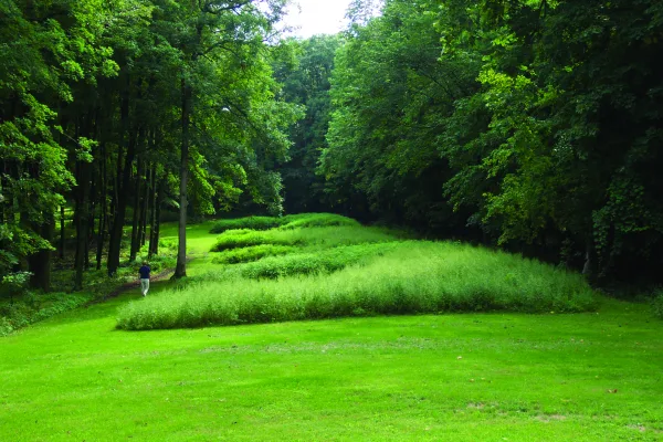
Effigy Mounds National Monument
National Monument
The mounds preserved here are considered sacred by many Americans, especially the Monument's 20 culturally associated American Indian tribes. A visit offers opportunities to contemplate the meanings o...
8 mi from route
~19 min detour
Free
near mile 55.6
Park data from the National Park Service API. Alerts update every 2 hours.
More Details
What kind of drive is this?
This route offers a mixed driving experience, with 53% of the journey on highways. You'll navigate primarily via State Highway 9 and IA 3, with a segment on East Military Road contributing to the drive's character. The longest uninterrupted stretch measures 24.4 miles on State Highway 9, providing a good period of consistent travel. Expect the road to transition between more open highway sections and potentially more localized driving as you approach your destination.
53% highway, the rest on surface roads — varied driving throughout.
22 navigation steps total — most of the decisions cluster near the start and finish.
Longest single stretch: 24.4 mi on State Highway 9.
How Hard Is This Drive?
3/10
This route mixes highway mileage with some local-road sections near the start or finish. There are only a few real navigation decisions along the way. The trickiest moment comes around 1.1 miles in near IA 9 / 2nd Avenue Southeast.
Driving Effort3/10
Easy - simple navigation with a manageable amount of wheel time
Balances navigation complexity with total wheel time.
This is a straightforward 2h 52m drive. You will face about 12 decision points, but nothing that requires special attention if you follow navigation.
Where does it get tricky?
The main spots that need attention: at 1.1 miles (IA 9 / 2nd Avenue Southeast): Navigation decision point; at 36.1 miles (IA 51 / State Highway 51): Navigation decision point; at 55.6 miles (US 52): Navigation decision point.
Dubuque, founded in 1833, is the oldest city in Iowa. A port on the upper Mississippi River, it is situated along scenic bluffs facing the river, and has its roots in a mining and trading settlement established in the area by Quebec-born entrepreneur Julien Dubuque in 1788. The city's population is 57,686 (2000 Census), and the estimated population of the Dubuque metropolitan area is 93,072.
Mixed highway & surface route profile with national parks nearby.
Frequently Asked Questions
The longest stretch is about 24.4 miles on State Highway 9. The full list of main roads is in the Roads section above.
Yes, with realistic expectations. Build in a stop roughly every 2 hours, have snacks and activities ready, and check the Nearby Places tabs for kid-friendly stops along the way.
The main spots that need attention: at 1.1 miles (IA 9 / 2nd Avenue Southeast): Navigation decision point; at 36.1 miles (IA 51 / State Highway 51): Navigation decision point; at 55.6 miles (US 52): Navigation decision point.
Yes — Effigy Mounds National Monument. See the National Parks section for detour distances and tips on detours.
Yes. A round trip is manageable in a single day if you plan a break at Dubuque, IA before heading back.