Covington, KY to Hardinsburg, KY is 159.3 miles and takes about 3h 15m via I 71 and US 60, with a fuel budget near $25 and enough daylight to finish in a day. This drive stays within Kentucky, moving from the Southeast region into the Southeast region. It's a straightforward, highway-focused trip that should be manageable for most drivers in a single day. Plan for a relatively quick journey with minimal complications as you head southwest.
Trip Pace
Same-day drive is realistic
A same-day return is realistic if you keep stops short.
Break Rhythm
1 planned break
A short stop every 2 to 3 hours is enough for this drive.
Midpoint
79.6 miles from Covington, KY
A natural place for your longest stop of the day
, about 1h 31m into the drive
.
Main Roads
Road
Distance
Duration
I 71
94.1 mi
1h 45m
US 60
31.3 mi
35m
Dixie Highway
22.6 mi
33m
7th Street Road
2.6 mi
5m
State Highway N259
1.6 mi
2m
I 64
1.5 mi
1m
South 9th Street
1.2 mi
1m
South 7th Street
0.9 mi
1m
Longest stretch:
I 71
— 94.1 mi, about 1h 45m
Turn-by-Turn Driving Directions
Step-by-step road directions between Covington, KY and Hardinsburg, KY.
1
Start on East 7th Street
12 ft·4 sec·East 7th Street
2
Turn right onto KY 17
0.4 mi·1 min·Scott Boulevard
3
Turn right onto KY 1120
0.7 mi·1 min·East Martin Luther King Junior Boulevard
Use the straight / right lanes.
4
Continue on KY 1120
203 ft·13 sec·West 12th Street
Use the straight lane.
5
Take the ramp
0.3 mi·43 sec
Toward I 71 South, I 75 South
6
Merge onto I 71; I 75
17 mi·20 min·I 71; I 75
Use the straight / slight right lanes.
7
Take the exit onto I 71
77 mi·1 hr 24 min·I 71
Exit 173Toward I 71 South: LouisvilleUse the straight / slight right lanes.
8
Take the exit
0.6 mi·1 min
Exit 1AToward I 64 West: Saint LouisUse the slight right lane.
9
Merge onto I 64
1.5 mi·1 min·I 64
Use the straight / slight right lanes.
10
Take the exit
0.4 mi·55 sec
Exit 4Toward 9th Street, Roy Wilkins AvenueUse the straight / slight right lanes.
11
Keep slight left at fork
368 ft·11 sec
Toward 9th StreetUse the straight / slight right lanes.
12
Turn straight onto Roy Wilkins Avenue
0.5 mi·54 sec·Roy Wilkins Avenue
Use the straight / left lanes.
13
Continue on South 9th Street
1.2 mi·1 min·South 9th Street
14
Continue on South 7th Street
0.9 mi·1 min·South 7th Street
15
Continue on KY 1931
2.0 mi·3 min·7th Street Road
16
Continue on US 60 Alternate
0.6 mi·1 min·7th Street Road
Use the right lane.
17
Turn slight left onto US 31W; US 60
23 mi·33 min·Dixie Highway
Use the left lane.
18
Turn right onto US 60
31 mi·35 min·US 60
19
Turn right onto State Highway N259
1.6 mi·2 min·State Highway N259
20
Continue on East 3rd Street
0.5 mi·48 sec·East 3rd Street
21
Arrive at destination
3rd Street
Trip Plan
Given the 3h 15m duration, this is a perfect same-day trip, so you can leave any time of day. With only one suggested stop, you have a lot of flexibility on when and where to take breaks. You'll want to keep an eye on your fuel, especially during the 94.1-mile stretch on I 71, as services can be spread out. Consider filling up before you leave Covington or at a major exit along I 71 to ensure you're covered.
Morning Departure
An early start around 7-8 AM gets you there with plenty of daylight left.
Evening Departure
A late afternoon start means arriving after dark. Morning is better.
You can normally do this drive in one day.
Plan roughly 1 meaningful break for fuel, food, and rest.
The halfway point lands around 79.6 miles from Covington, KY, or about 1h 31m into the drive.
The longest continuous stretch on this route runs about 94.1 miles.
This is a comfortable same-day trip.
Departure
Before you leave
Start with fuel, water, and navigation already sorted so the first hour feels easy.
First stop
Around 35 miles or 42m in
Use this first pause for coffee, a restroom break, and a quick traffic check ahead.
Halfway reset
Around 79.6 miles or 1h 31m in
This is the best place for your longest stop, a real meal, and a full fuel check.
Final approach
Final hour starts around 2h 41m
Traffic, exits, and arrival timing usually matter more near Hardinsburg, KY than in the middle of the route.
Before You Leave
+
Open the route before leaving Covington, KY so your first major turns are already loaded.
+
Leave with enough water and a charging cable within reach, not packed away.
+
Check your fuel range against the first long segment, especially if you are starting outside city service areas.
Day 1
Settle into the route from Covington, KY
This is one driving day of about 159.3 miles and 3h 15m.
Your first comfortable stop window is around 35 miles from Covington, KY.
This route can stay practical as a one-day drive if traffic stays reasonable.
Plan about 1 real break rather than only quick fuel stops.
The longest stretch is on I 71 for about 94.1 miles.
Where to Stop
Rest stops, refuel points, and overnight suggestions along this route.
Place data sourced from public business listings. Hours and availability may vary.
Heads-up: tricky spots
5 of 14
5 decision points cluster between mile 1.1 and 98 — GPS handles the exact turns, but know they're coming. Your lane choice matters more than the turn itself.
6
1.1 mi into trip|~3m in
Take the ramp toward I 71 South, I 75 South
Multiple destination signs - pick the right one
Toward I 71 South, I 75 South
7
18.8 mi into trip|~24m in|I 71
Take the exit onto I 71 toward I 71 South: Louisville
Exit ramp - move to the correct lane early. Lane positioning matters here
Use the straight / slight right lanes.
Exit 173
Toward I 71 South: Louisville
7
95.5 mi into trip|~1h 49m in
Take the exit toward I 64 West: Saint Louis
Exit ramp - move to the correct lane early. Lane positioning matters here
Use the slight right lane.
Exit 1A
Toward I 64 West: Saint Louis
8
97.5 mi into trip|~1h 52m in
Take the exit toward 9th Street, Roy Wilkins Avenue
Exit ramp - move to the correct lane early. Lane positioning matters here. Multiple destination signs - pick the right one
Use the straight / slight right lanes.
Exit 4
Toward 9th Street, Roy Wilkins Avenue
7
98 mi into trip|~1h 53m in
Keep slight left at fork toward 9th Street
Highway fork - watch signs carefully. Lane positioning matters here
Use the straight / slight right lanes.
Toward 9th Street
Fuel & Cost
Regular Gas
$24.90 one way
$49.81 round trip
$3.97/gal25.4 MPG avg56 kg CO2
Fuel Type
$/gal
One Way
Round Trip
midgrade
$4.36
$27.34
$54.69
premium
$4.89
$30.66
$61.31
diesel
$5.61
$35.17
$70.34
No toll roads detected on this route.
Estimated Trip Cost (one way, 1 person)
Fuel
$25
Meals
$25–$50
Total
$50–$75
Rough estimate based on US averages. Hotel $80–$140/night, meals $25–$50/day.
Estimated CO2 emission: 55.7 kg one way.
Prices: EIA weekly data, 2026-04-13.
EV Charging Along Route
11 DC fast chargers
· Coverage: excellent
Florence, KY - Meijer - Tesla Supercharger
Florence, KY
Tesla
12 DCFC
Valley Plaza Parkway - Tesla Supercharger
Fort Mitchell, KY
Tesla
8 DCFC
Meijer - Tesla Supercharger
Louisville, KY
Tesla
8 DCFC
Meijer #164 Louisville Town Center(Louisville, KY)
Station data from NREL Alternative Fuel Stations database.
Driving Electric?
About $17 in charging
· 0 stops
· 66% less CO2
Vehicle Type
kWh
Stops
DC Fast
Home Charge
Average EV
47.8
0
$16.73
$7.65
Efficient EV
39.8
0
$13.94
$6.37
EV Truck/SUV
63.7
0
$22.30
$10.20
Gas CO2
56 kg
EV CO2
19 kg (66% less)
This trip is well within single-charge range for most EVs. No charging stops needed if you start fully charged.
DC fast charging avg $0.35/kWh. Home charging avg $0.16/kWh. US grid CO2: 0.39 kg/kWh.
Travel Intel
Current conditions at both ends of the drive.
Forecast as of Apr 14, 2026
Origin
Covington, KY
Late night
in Covington on Sunday
Local time
12:22 AM
EDT
Current temp
39°F
Unavailable
Live forecast
Destination
Hardinsburg, KY
Night
in Hardinsburg on Saturday
Local time
11:22 PM
CDT
Current temp
75°F
Unavailable
Live forecast
Seasonal Notes
Summer travel usually means heavier construction, hotter rest stops, and busier weekend traffic around major cities.
Winter travel shortens daylight, so a route that looks manageable on paper can feel much longer after dark.
Holiday weekends tend to make both departure and arrival windows slower than the raw route time suggests.
Time zone
1 hour earlier
The destination clock does not match departure time, so double-check hotel check-in windows and late arrival plans.
Temperature spread
36 degrees warmer at arrival
A meaningful temperature swing is a good cue to rethink layers, water, and how soon you want to arrive.
Road read
3h 15m on the road
Use the two city cards together: check the sky where you start, then compare it with the local time and temperature at arrival.
Weather data from the National Weather Service. Conditions may change; check closer to your travel date.
National Parks Near This Route
Worth a detour if your schedule allows.
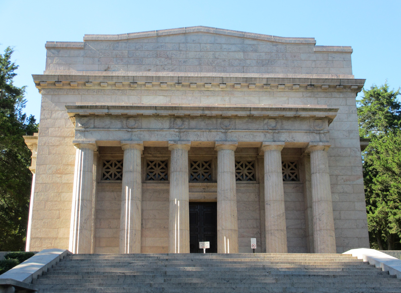
Abraham Lincoln Birthplace National Historical Park
National Historical Park
For over a century people from around the world have come to rural Central Kentucky to honor the humble beginnings of our 16th president, Abraham Lincoln. His early life on Kentucky's frontier shaped...
29 mi from route
~71 min detour
Free
near mile 126.3
Park data from the National Park Service API. Alerts update every 2 hours.
More Details
What kind of drive is this?
This route is primarily a highway-focused drive, with 80% of the journey on faster roads like I 71 and Dixie Highway. You'll experience a longest uninterrupted stretch of 94.1 miles on I 71, offering a good opportunity to settle in and make steady progress. The profile suggests a largely uninterrupted driving experience, making it efficient for covering ground. Expect a mix of interstate travel and potentially some highway stretches on US 60 as you get closer to your destination.
80% highway — fuel and pacing are the main things to plan.
21 navigation steps total — most of the decisions cluster near the start and finish.
Longest single stretch: 94.1 mi on I 71.
How Hard Is This Drive?
7/10
This is a straightforward highway drive that stays mostly on I 71 and US 60. This route has several spots where lane changes, forks, or exits need your full attention. The trickiest moment comes around 1.1 miles in.
Driving Effort7/10
Demanding - plan breaks and stay ahead of the key maneuvers
Balances navigation complexity with total wheel time.
This is a demanding drive. With 14 significant decision points across 159.3 miles, you will need to stay alert - especially through interchange areas and urban stretches. Consider splitting it into segments if you are not comfortable with fast highway navigation.
Where does it get tricky?
The main spots that need attention: at 1.1 miles: Multiple destination signs - pick the right one; at 18.8 miles (I 71): Exit ramp - move to the correct lane early. Lane positioning matters here; at 95.5 miles: Exit ramp - move to the correct lane early. Lane positioning matters here.
Elevation Profile
Mostly flat terrain
864 ft447 ft
Total Climb
832 ft
Total Descent
629 ft
Highest Point
864 ft
~11.4 mi in
Elevation Range
417 ft
Who Is This Route For?
Weekend Trip
Doable as a same-day drive at 3h 15m. Total distance: 159.3 miles.
Family Friendly
Moderate complexity with 1 natural rest stops along the way.
Solo Traveler
3h 15m drive, comfortable solo distance.
First-Time Driver
Mostly highway driving (80%). Some complex stretches to watch for.
Frequently Asked Questions
The longest stretch is about 94.1 miles on I 71. The full list of main roads is in the Roads section above.
We did not find dedicated rest areas on this route. For a drive this long, plan bathroom and stretch breaks around gas stations, fast-food stops, or small-town downtowns — check the Nearby Places section for options.
It helps. This route has a higher-than-average number of complex decision points, which get harder in the dark. If the last hour of the trip is on surface roads or mountain grades, aim to arrive at Hardinsburg, KY before sunset when you can. Check the Trip Plan for departure windows that land you in daylight.
Only with planning. This is a long drive for kids — consider splitting it into two days rather than pushing through. Plan at least 1 meaningful breaks. Dedicated rest areas are limited, so plan gas or food stops as your bathroom breaks.
The main spots that need attention: at 1.1 miles: Multiple destination signs - pick the right one; at 18.8 miles (I 71): Exit ramp - move to the correct lane early. Lane positioning matters here; at 95.5 miles: Exit ramp - move to the correct lane early. Lane positioning matters here.
Yes — Abraham Lincoln Birthplace National Historical Park. See the National Parks section for detour distances and tips on detours.
Possible but tiring. At 3.3 hours each way, an in-and-out day trip would put you behind the wheel for 6.5 hours — manageable with a long break at Hardinsburg, KY, but most travelers stay overnight.