This 144.4-mile drive from Conway to Dermott, Arkansas, is a straightforward journey that can easily be completed in a single day, taking approximately 2 hours and 47 minutes. Primarily utilizing US 65, I-530, and I-40, this route is almost entirely highway driving, making it efficient for covering ground. With a fuel cost estimated at $22, it's an economical option for a quick trip within the Southeast region. Plan for a comfortable day trip, as the drive is well within manageable limits for a single day's travel without needing an overnight stop.
Trip Pace
Same-day drive is realistic
A same-day return is realistic if you keep stops short.
Break Rhythm
1 planned break
A short stop every 2 to 3 hours is enough for this drive.
Midpoint
72.2 miles from Conway, AR
A natural place for your longest stop of the day
, about 1h 18m into the drive
.
Main Roads
Road
Distance
Duration
US 65
65.8 mi
1h 21m
I 530
46.1 mi
47m
I 40
25.9 mi
26m
US 165
2 mi
3m
AR 35
1.8 mi
3m
Wiley A Branton Sr Highway
1.2 mi
1m
Oak Street
1.1 mi
2m
Central Landing Boulevard
0.2 mi
<1m
Longest stretch:
US 65
— 65.8 mi, about 1h 21m
Turn-by-Turn Driving Directions
Step-by-step road directions between Conway, AR and Dermott, AR.
1
Start on Main Street
104 ft·6 sec·Main Street
2
Turn right onto Locust Avenue
497 ft·14 sec·Locust Avenue
3
Turn right onto Oak Street
1.1 mi·2 min·Oak Street
4
Turn right onto Central Landing Boulevard
0.2 mi·34 sec·Central Landing Boulevard
5
Take the ramp
0.2 mi·25 sec
6
Merge onto I 40; US 65
26 mi·26 min·I 40; US 65
7
Take the exit onto US 65
4.6 mi·6 min·US 65
8
Keep slight left at fork onto I 530; US 65; US 167
46 mi·47 min·I 530; US 65; US 167
Use the slight left / slight right lanes.
9
Keep slight left at fork onto I 530; US 65
1.2 mi·1 min·Wiley A Branton Sr Highway
10
Continue on US 65; US 425
38 mi·46 min·US 65; US 425
11
Continue on US 65; US 165
24 mi·29 min·US 65; US 165
12
Turn right onto US 165
2.0 mi·3 min·US 165
13
Turn right onto AR 35
1.8 mi·3 min·AR 35
14
Turn right onto South Main Street
162 ft·4 sec·South Main Street
15
Arrive at destination
South Main Street
Trip Plan
Given the relatively short duration of under three hours, this route is ideal for a day trip, offering flexibility in your departure time. Leaving in the morning will allow you to arrive with ample time to explore your destination or return before evening. While the drive is efficient, remember that the longest stretch without a major change in road is over 65 miles, so consider a brief stop around that point if needed. Keep an eye on your fuel gauge, especially before embarking on the 65.8-mile segment on US 65, to ensure a smooth and uninterrupted journey.
Morning Departure
Leave by 9 AM and you'll arrive before lunch.
Evening Departure
Even a 4 PM departure gets you there before dark in summer.
You can normally do this drive in one day.
Plan roughly 1 meaningful break for fuel, food, and rest.
The halfway point lands around 72.2 miles from Conway, AR, or about 1h 18m into the drive.
The longest continuous stretch on this route runs about 65.8 miles.
This is a comfortable same-day trip.
Departure
Before you leave
Start with fuel, water, and navigation already sorted so the first hour feels easy.
First stop
Around 32 miles or 36m in
Use this first pause for coffee, a restroom break, and a quick traffic check ahead.
Halfway reset
Around 72.2 miles or 1h 18m in
This is the best place for your longest stop, a real meal, and a full fuel check.
Final approach
Final hour starts around 2h 14m
Traffic, exits, and arrival timing usually matter more near Dermott, AR than in the middle of the route.
Before You Leave
+
Open the route before leaving Conway, AR so your first major turns are already loaded.
+
Leave with enough water and a charging cable within reach, not packed away.
+
Check your fuel range against the first long segment, especially if you are starting outside city service areas.
Day 1
Settle into the route from Conway, AR
This is one driving day of about 144.4 miles and 2h 47m.
Your first comfortable stop window is around 32 miles from Conway, AR.
This route can stay practical as a one-day drive if traffic stays reasonable.
Plan about 1 real break rather than only quick fuel stops.
The longest stretch is on US 65 for about 65.8 miles.
Where to Stop
Rest stops, refuel points, and overnight suggestions along this route.
Place data sourced from public business listings. Hours and availability may vary.
Heads-up: tricky spots
5 of 10
5 decision points cluster between mile 0 and 144.4 — GPS handles the exact turns, but know they're coming. Your lane choice matters more than the turn itself.
4
0 mi into trip|~0m in|Locust Avenue
Turn right onto Locust Avenue
Navigation decision point
6
32.2 mi into trip|~36m in|I 530; US 65; US 167
Keep slight left at fork onto I 530; US 65; US 167
Highway fork - watch signs carefully. Lane positioning matters here
Use the slight left / slight right lanes.
4
78.3 mi into trip|~1h 24m in|I 530; US 65 / Wiley A Branton Sr Highway
Keep slight left at fork onto I 530; US 65 / Wiley A Branton Sr Highway
Highway fork - watch signs carefully
4
142.6 mi into trip|~2h 44m in|AR 35
Turn right onto AR 35
Navigation decision point
4
144.4 mi into trip|~2h 47m in|South Main Street
Turn right onto South Main Street
Navigation decision point
Fuel & Cost
Regular Gas
$21.81 one way
$43.62 round trip
$3.84/gal25.4 MPG avg51 kg CO2
Fuel Type
$/gal
One Way
Round Trip
midgrade
$4.21
$23.94
$47.88
premium
$4.56
$25.92
$51.84
diesel
$5.61
$31.88
$63.76
No toll roads detected on this route.
Estimated Trip Cost (one way, 1 person)
Fuel
$22
Meals
$25–$50
Total
$47–$72
Rough estimate based on US averages. Hotel $80–$140/night, meals $25–$50/day.
Estimated CO2 emission: 50.5 kg one way.
Prices: EIA weekly data, 2026-04-13.
Driving Electric?
About $15 in charging
· 0 stops
· 67% less CO2
Vehicle Type
kWh
Stops
DC Fast
Home Charge
Average EV
43.3
0
$15.16
$6.93
Efficient EV
36.1
0
$12.64
$5.78
EV Truck/SUV
57.8
0
$20.22
$9.24
Gas CO2
51 kg
EV CO2
17 kg (67% less)
This trip is well within single-charge range for most EVs. No charging stops needed if you start fully charged.
DC fast charging avg $0.35/kWh. Home charging avg $0.16/kWh. US grid CO2: 0.39 kg/kWh.
Travel Intel
Current conditions at both ends of the drive.
Forecast as of Apr 20, 2026
Origin
Conway, AR
Late night
in Conway on Tuesday
Local time
4:07 AM
CDT
Current temp
77°F
Unavailable
Live forecast
Destination
Dermott, AR
Late night
in Dermott on Tuesday
Local time
4:07 AM
CDT
Current temp
81°F
Unavailable
Live forecast
79°F
Walnut Ridge, AR
72 mi in
Seasonal Notes
Summer travel usually means heavier construction, hotter rest stops, and busier weekend traffic around major cities.
Winter travel shortens daylight, so a route that looks manageable on paper can feel much longer after dark.
Holiday weekends tend to make both departure and arrival windows slower than the raw route time suggests.
Time zone
Same local time
Origin and destination are on the same clock, so arrival timing is easier to judge at a glance.
Temperature spread
4 degrees warmer at arrival
A meaningful temperature swing is a good cue to rethink layers, water, and how soon you want to arrive.
Road read
2h 47m on the road
Use the two city cards together: check the sky where you start, then compare it with the local time and temperature at arrival.
Weather data from the National Weather Service. Conditions may change; check closer to your travel date.
National Parks Near This Route
Worth a detour if your schedule allows.
Arkansas Post National Memorial
National Memorial
Located at the confluence of two rivers, Arkansas Post has served as a gathering place for many cultures throughout human history - it represents cultural cooperation, conflict, synthesis, and diversi...
13 mi from route
~32 min detour
Free
near mile 114.5
Park data from the National Park Service API. Alerts update every 2 hours.
More Details
What kind of drive is this?
Expect a predominantly highway-focused experience on this trip, with 98% of the journey on major roadways. You'll encounter stretches on US 65, I-530, and I-40, offering a consistent pace for most of the drive. The longest uninterrupted segment you'll navigate is 65.8 miles on US 65, providing a good opportunity to settle into a rhythm. This profile suggests a drive that prioritizes speed and directness over winding scenic byways.
98% highway — fuel and pacing are the main things to plan.
15 navigation steps total — most of the decisions cluster near the start and finish.
Longest single stretch: 65.8 mi on US 65.
How Hard Is This Drive?
4/10
This is a straightforward highway drive that stays mostly on US 65 and I 530. There are only a few real navigation decisions along the way. The trickiest moment comes early in the drive near Locust Avenue.
Driving Effort4/10
Easy - simple navigation with a manageable amount of wheel time
Balances navigation complexity with total wheel time.
This is a straightforward 2h 47m drive. You will face about 10 decision points, but nothing that requires special attention if you follow navigation.
Where does it get tricky?
The main spots that need attention: near the start (Locust Avenue): Navigation decision point; at 32.2 miles (I 530; US 65; US 167): Highway fork - watch signs carefully. Lane positioning matters here; at 78.3 miles (I 530; US 65 / Wiley A Branton Sr Highway): Highway fork - watch signs carefully.
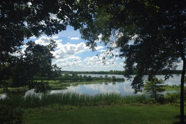
Conway is a college town in the Central region of Arkansas, northwest of Little Rock. Do not be deceived into thinking Conway is just another suburb of Little Rock. The "City of Colleges" has crafted its own unique identity, with beautiful college campuses, peaceful nature trails, access to two gorgeous lakes, one impressive river, and plenty of restaurants and shops to boot.
The longest stretch is about 65.8 miles on US 65. The full list of main roads is in the Roads section above.
Yes, with realistic expectations. Build in a stop roughly every 2 hours, have snacks and activities ready, and check the Nearby Places tabs for kid-friendly stops along the way.
The main spots that need attention: near the start (Locust Avenue): Navigation decision point; at 32.2 miles (I 530; US 65; US 167): Highway fork - watch signs carefully. Lane positioning matters here; at 78.3 miles (I 530; US 65 / Wiley A Branton Sr Highway): Highway fork - watch signs carefully.
Yes — Arkansas Post National Memorial. See the National Parks section for detour distances and tips on detours.
Yes. A round trip is manageable in a single day if you plan a break at Dermott, AR before heading back.