This 375.4-mile journey from Clayton to Carlsbad, New Mexico, is a substantial day trip, estimated to take around 7 hours and 5 minutes of pure driving time. You'll be navigating primarily via South 1st Street and US 385 South, with a portion on West 1st Street. With a fuel cost estimated at $57, this route through the Desert Southwest offers a straightforward, turn-heavy local drive experience. Planning for about 2 stops along the way is advisable to break up the drive. Consider this a solid option if you're looking for a direct route within New Mexico.
Trip Pace
Same-day drive is realistic
A same-day return is possible, but it will make for a full day on the road.
Break Rhythm
2 planned breaks
Plan on a short reset every 3 to 4 hours to stay fresh behind the wheel.
Midpoint
187.7 miles from Clayton, NM
A natural place for your longest stop of the day
, about 3h 24m into the drive
.
Main Roads
Road
Distance
Duration
US 385
80.1 mi
1h 24m
North 1st Street
73.7 mi
1h 17m
South 1st Street
56.3 mi
1h 4m
US Highway 82
32 mi
40m
West Carlsbad Highway
29.6 mi
33m
TX 214
24.8 mi
26m
West 1st Street
20.8 mi
21m
Hobbs Highway
20.4 mi
21m
Longest stretch:
US 385
— 80.1 mi, about 1h 24m
Turn-by-Turn Driving Directions
Step-by-step road directions between Clayton, NM and Carlsbad, NM.
1
Start on US 56; US 64; US 412
45 ft·8 sec·Main Street
2
Turn left onto US 87
56 mi·1 hr 4 min·South 1st Street
Use the left lane.
3
Continue on US 87; US 385
4.7 mi·5 min·US 87; US 385
4
Take the exit onto US 385
80 mi·1 hr 24 min·US 385
Toward US 385 South: Channing
5
Turn right onto US 60
21 mi·21 min·West 1st Street
6
Continue on US 60
1.3 mi·2 min·US 60
7
Turn left onto Grand Avenue
3.8 mi·5 min·Grand Avenue
8
Continue on TX 214
25 mi·26 min·TX 214
9
Keep slight right at fork
323 ft·5 sec
10
Turn straight onto US 70; TX 214
74 mi·1 hr 17 min·North 1st Street
11
Turn slight right
362 ft·13 sec
12
Turn straight onto US 82; US 380
0.9 mi·1 min·Cowboy Way
13
Turn left onto US 82
0.4 mi·35 sec·Highway 82
14
Continue on US 82
32 mi·40 min·US Highway 82
15
Continue on US 82
1.2 mi·1 min·Tatum Highway
16
Continue on US 82
1.0 mi·1 min·North Main Street
17
Continue on US 82
1.2 mi·1 min·South Main Avenue
18
Turn right onto McAlister Drive
0.1 mi·27 sec·McAlister Drive
19
Turn right onto NM 483
387 ft·13 sec·West Avenue R
20
Turn left onto NM 483
2.3 mi·4 min·South 2nd Street
21
Continue on NM 483
14 mi·24 min·South NM Highway 483
22
Turn right onto US 62; US 180
30 mi·33 min·West Carlsbad Highway
23
Continue on US 62; US 180
20 mi·21 min·Hobbs Highway
24
Continue on US 62; US 180
6.5 mi·8 min·East Greene Street
25
Turn right onto US 285
0.2 mi·14 sec·South Canal Street
26
Arrive at destination
US 285
Trip Plan
Given the 7-hour driving duration, starting your trip from Clayton early in the morning is highly recommended to maximize daylight and minimize driving in the dark. With 2 planned stops, you can pace yourself effectively, perhaps one mid-morning and another for lunch. Keep an eye on your fuel gauge, as services might be more spread out on the local road segments. The $57 fuel cost is an estimate, so it's wise to have a bit extra budgeted. A specific tip for this route would be to familiarize yourself with the turn sequences along US 385 South and West 1st Street before you depart, as the 'turn-heavy' profile suggests you'll be making several directional changes.
Morning Departure
Start early — leave by 6-7 AM to arrive at a reasonable hour.
Evening Departure
This is a long drive — plan for a morning departure or consider splitting it into two days.
You can normally do this drive in one day.
Plan roughly 2 meaningful breaks for fuel, food, and rest.
The halfway point lands around 187.7 miles from Clayton, NM, or about 3h 24m into the drive.
The longest continuous stretch on this route runs about 80.1 miles.
This is a comfortable same-day trip.
Departure
Before you leave
Start with fuel, water, and navigation already sorted so the first hour feels easy.
First stop
Around 83 miles or 1h 32m in
Use this first pause for coffee, a restroom break, and a quick traffic check ahead.
Halfway reset
Around 187.7 miles or 3h 24m in
This is the best place for your longest stop, a real meal, and a full fuel check.
Final approach
Final hour starts around 5h 55m
Traffic, exits, and arrival timing usually matter more near Carlsbad, NM than in the middle of the route.
Before You Leave
+
Open the route before leaving Clayton, NM so your first major turns are already loaded.
+
Leave with enough water and a charging cable within reach, not packed away.
+
Check your fuel range against the first long segment, especially if you are starting outside city service areas.
+
Pick one backup stop option before the midpoint in case traffic changes your pacing.
Day 1
Settle into the route from Clayton, NM
This is one driving day of about 375.4 miles and 7h 5m.
Your first comfortable stop window is around 83 miles from Clayton, NM.
This route can stay practical as a one-day drive if traffic stays reasonable.
Plan about 2 real breaks rather than only quick fuel stops.
The longest stretch is on US 385 for about 80.1 miles.
Where to Stop
Rest stops, refuel points, and overnight suggestions along this route.
Place data sourced from public business listings. Hours and availability may vary.
Heads-up: tricky spots
5 of 11
5 decision points cluster between mile 0 and 302.6 — GPS handles the exact turns, but know they're coming. Your lane choice matters more than the turn itself.
6
0 mi into trip|~0m in|US 87 / South 1st Street
Turn left onto US 87 / South 1st Street
Lane positioning matters here
Use the left lane.
4
61 mi into trip|~1h 9m in|US 385
Take the exit onto US 385 toward US 385 South: Channing
Exit ramp - move to the correct lane early
Toward US 385 South: Channing
4
163.2 mi into trip|~2h 57m in|Grand Avenue
Turn left onto Grand Avenue
Navigation decision point
4
191.8 mi into trip|~3h 28m in
Keep slight right at fork
Highway fork - watch signs carefully
4
302.6 mi into trip|~5h 33m in|NM 483 / West Avenue R
Turn right onto NM 483 / West Avenue R
Navigation decision point
Fuel & Cost
Regular Gas
$52.11 one way
$104.23 round trip
$3.53/gal25.4 MPG avg131 kg CO2
Fuel Type
$/gal
One Way
Round Trip
midgrade
$3.95
$58.31
$116.61
premium
$4.29
$63.39
$126.78
diesel
$4.80
$70.88
$141.77
No toll roads detected on this route.
Estimated Trip Cost (one way, 1 person)
Fuel
$52
Meals
$25–$50
Total
$77–$102
Rough estimate based on US averages. Hotel $80–$140/night, meals $25–$50/day.
Estimated CO2 emission: 131.3 kg one way.
Prices: EIA weekly data, 2026-07-13.
Driving Electric?
About $39 in charging
· 1 stop
· 66% less CO2
Vehicle Type
kWh
Stops
DC Fast
Home Charge
Average EV
112.6
1
$39.42
$18.02
Efficient EV
93.9
1
$32.85
$15.02
EV Truck/SUV
150.2
1
$52.56
$24.03
Gas CO2
131 kg
EV CO2
44 kg (66% less)
Plan for 1 charging stop. A 30-minute DC fast charge mid-route should be enough to complete the trip comfortably.
DC fast charging avg $0.35/kWh. Home charging avg $0.16/kWh. US grid CO2: 0.39 kg/kWh.
Travel Intel
Current conditions at both ends of the drive.
Forecast as of Jul 17, 2026
Origin
Clayton, NM
Late night
in Clayton on Sunday
Local time
12:28 AM
MDT
Current temp
60°F
Mostly Clear
S 10 mph2% chanceLive forecast
Flood Watch
Flood Watch issued July 16 at 8:32PM MDT until July 17 at 5:00PM MDT by NWS Albuquerque NM
Flood Warning
Flood Warning issued July 16 at 8:28PM MDT until July 16 at 10:15PM MDT by NWS Albuquerque NM
Destination
Carlsbad, NM
Late night
in Carlsbad on Sunday
Local time
12:28 AM
MDT
Current temp
68°F
Partly Cloudy
SE 10 to 15 mph4% chanceLive forecast
Flood Watch
Flood Watch issued July 16 at 8:32PM MDT until July 17 at 5:00PM MDT by NWS Albuquerque NM
Flood Warning
Flood Warning issued July 16 at 8:28PM MDT until July 16 at 10:15PM MDT by NWS Albuquerque NM
Seasonal Notes
Summer travel usually means heavier construction, hotter rest stops, and busier weekend traffic around major cities.
Winter travel shortens daylight, so a route that looks manageable on paper can feel much longer after dark.
Holiday weekends tend to make both departure and arrival windows slower than the raw route time suggests.
Time zone
Same local time
Origin and destination are on the same clock, so arrival timing is easier to judge at a glance.
Temperature spread
8 degrees warmer at arrival
A meaningful temperature swing is a good cue to rethink layers, water, and how soon you want to arrive.
Road read
7h 5m on the road
Start early — leave by 6-7 AM to arrive at a reasonable hour.
Weather data from the National Weather Service. Conditions may change; check closer to your travel date.
National Parks Near This Route
Worth a detour if your schedule allows.
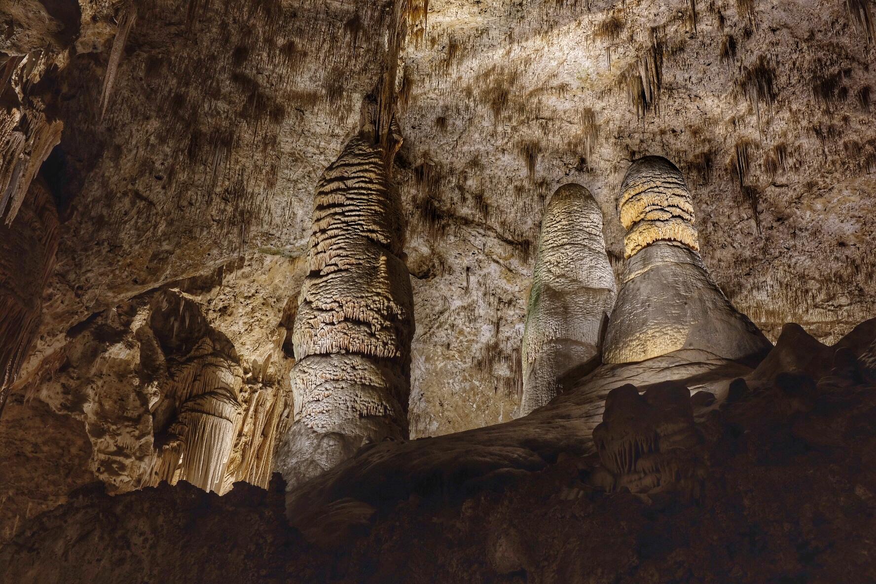
Carlsbad Caverns National Park
National Park
High ancient sea ledges, deep rocky canyons, flowering cactus, and desert wildlife—treasures above the ground in the Chihuahuan Desert. Hidden beneath the surface are more than 119 caves—formed when s...
27 mi from route
~68 min detour
$1
near mile 375.4
Park data from the National Park Service API. Alerts update every 2 hours.
More Details
What kind of drive is this?
Expect a turn-heavy local drive on this route, as indicated by its 0% highway share. The journey doesn't feature long stretches of uninterrupted highway; instead, you'll be navigating more local roads and county routes. This means the driving pace might be more variable, and you'll likely encounter more frequent turns and changes in speed limits. While there's no specified longest stretch, the profile suggests a more engaging, less monotonous driving experience than a pure interstate cruise. The road conditions will likely reflect a mix of well-maintained main arteries and potentially smaller local roads.
42% highway, the rest on surface roads — varied driving throughout.
26 navigation steps total — most of the decisions cluster near the start and finish.
Longest single stretch: 80.1 mi on US 385.
How Hard Is This Drive?
4/10
This route mixes highway mileage with some local-road sections near the start or finish. There are only a few real navigation decisions along the way. The trickiest moment comes early in the drive near US 87 / South 1st Street.
Driving Effort4/10
Easy - simple navigation with a manageable amount of wheel time
Balances navigation complexity with total wheel time.
The route itself is not hard, but at 7h 5m, endurance matters. Plan breaks every 2-3 hours. The 11 decision points are all manageable with basic attention.
Where does it get tricky?
The main spots that need attention: near the start (US 87 / South 1st Street): Lane positioning matters here; at 61 miles (US 385): Exit ramp - move to the correct lane early; at 163.2 miles (Grand Avenue): Navigation decision point.
Mixed highway & surface route profile with national parks nearby.
Frequently Asked Questions
The longest stretch is about 80.1 miles on US 385. The full list of main roads is in the Roads section above.
Yes — we found about 7 rest areas or service plazas within a short detour of the route (from OpenStreetMap). See the Rest Stops tab under Nearby Places for locations and mile markers. Plan to stretch, use the bathroom, and top off fluids every 2–3 hours on longer drives.
It helps. This is a long drive, so arriving tired and in the dark compounds. If the last hour of the trip is on surface roads or mountain grades, aim to arrive at Carlsbad, NM before sunset when you can. Check the Trip Plan for departure windows that land you in daylight.
Only with planning. This is a long drive for kids — consider splitting it into two days rather than pushing through. Plan at least 2 meaningful breaks. There are 7 rest areas along the route for bathroom stops.
Mostly yes along the main roads, but rural stretches through NM can have sparse or no coverage. Before you leave, download offline Google Maps or Apple Maps for the route, and consider downloading music or podcasts instead of streaming. If you depend on data for navigation, keep a paper backup of the turn-by-turn directions.
The main spots that need attention: near the start (US 87 / South 1st Street): Lane positioning matters here; at 61 miles (US 385): Exit ramp - move to the correct lane early; at 163.2 miles (Grand Avenue): Navigation decision point.
Yes — Carlsbad Caverns National Park. See the National Parks section for detour distances and tips on detours.
Not recommended in a single day. At 7.1 hours each way, a round trip means 14.2 hours of driving — that is an unsafe level of fatigue for most drivers. Plan at least one night at Carlsbad, NM before the return drive.