Origin
Choteau, MT
Late night in Choteau on Sunday
Local time
1:56 AM
MDT
Current temp
65°F
Unavailable
Live forecast
Compiled and reviewed by the US Trip Planner planning team at COD Solutions Oy · Last reviewed Apr 19, 2026 · Editorial standards
Drive Time
3h 17m
Distance
165.2 mi
266 km
Drive Score
8/10
Great drive
Same Day?
Yes, doable
Fuel Cost
$26
one way
EV Charging
Unknown
Estimated drive times based on typical traffic patterns. Actual times may vary with weather, construction, and real-time conditions.

Choteau, MT
Wikimedia Commons

Whitefish, MT
Wikimedia Commons
Spanning 165.2 miles across Montana’s Mountain West, this trip from Choteau to Whitefish is a straightforward journey that typically takes about 3 hours and 17 minutes. You can easily conquer this distance in a single day, making it an efficient choice if you are looking to move between these two hubs without an overnight split. Budget approximately $26 for fuel to cover the distance, though it is always wise to keep an eye on local gas prices. The route relies primarily on US 2 and US 89, keeping you on well-traveled thoroughfares for the vast majority of the time. Whether you are commuting or heading out for a weekend getaway, this path offers a reliable connection through the heart of the state. It functions perfectly as a standalone day trip, giving you plenty of time to settle in at your destination by evening.
Trip Pace
Same-day drive is realistic
A same-day return is realistic if you keep stops short.
Break Rhythm
1 planned break
A short stop every 2 to 3 hours is enough for this drive.
Midpoint
82.6 miles from Choteau, MT
A natural place for your longest stop of the day , about 1h 35m into the drive .
| Road | Distance | Duration |
|---|---|---|
| US 2 | 80.2 mi | 1h 32m |
| United States Highway 89 | 49.2 mi | 53m |
| 13th Lane Northwest | 12.9 mi | 15m |
| US Route 2 | 7.5 mi | 10m |
| Main Avenue North | 6 mi | 7m |
| MT 40 | 4.5 mi | 5m |
| 9th Street | 2 mi | 4m |
| Spokane Avenue | 1.7 mi | 3m |
Step-by-step road directions between Choteau, MT and Whitefish, MT.
Start on US 89
Continue on US 89
Continue on US 89
At end of road, turn left onto US 2; US 89
Enter roundabout onto US 2
Continue on US 2
Turn right
At end of road, turn left onto Old US 2
Turn right onto US 2
Continue on US 2
Continue on US 2
Continue on US 2
Continue on MT 40
Turn right onto US 93
Continue on US 93
Turn left onto US 93
Turn right
Arrive at destination
Since this is a relatively short drive, you have the advantage of flexibility in your departure time, though leaving early in the morning is always a smart way to beat potential traffic. Plan for at least one stop during the trip to stretch your legs and refresh, as this will help keep you alert during the longer stretches on US 2. Keep in mind that while the $26 fuel estimate is a helpful baseline, your actual costs may vary based on your vehicle's efficiency and local market fluctuations. Because this route is concentrated on major highways, ensure your vehicle is prepared for consistent speeds rather than stop-and-go city driving. A pro tip for this specific route is to check your fuel level before hitting the 80.2-mile stretch on US 2 to ensure you aren't caught off guard between service points.
Morning Departure
An early start around 7-8 AM gets you there with plenty of daylight left.
Evening Departure
A late afternoon start means arriving after dark. Morning is better.
This is a comfortable same-day trip.
Departure
Before you leave
Start with fuel, water, and navigation already sorted so the first hour feels easy.
First stop
Around 36 miles or 41m in
Use this first pause for coffee, a restroom break, and a quick traffic check ahead.
Halfway reset
Around 82.6 miles or 1h 35m in
This is the best place for your longest stop, a real meal, and a full fuel check.
Final approach
Final hour starts around 2h 33m
Traffic, exits, and arrival timing usually matter more near Whitefish, MT than in the middle of the route.
Open the route before leaving Choteau, MT so your first major turns are already loaded.
Leave with enough water and a charging cable within reach, not packed away.
Check your fuel range against the first long segment, especially if you are starting outside city service areas.
Day 1
Settle into the route from Choteau, MT
This is one driving day of about 165.2 miles and 3h 17m.
Rest stops, refuel points, and overnight suggestions along this route.

Mid-route town
Meal stop
83 mi into the route
Best for: Lunch, fuel, and a longer reset
This sits close to the middle of the route, so it works well for the longest stop of the day.
A short stop after about 36 miles helps settle the day before fatigue starts building.
The midpoint is around 82.6 miles from Choteau, MT, which is a good place for a longer meal and fuel stop.
Before the longest stretch
Fuel checkTop up before US 2 if your tank is already low. That segment runs about 80.2 miles.
These stop ideas are pacing suggestions — the exact town or exit can change with traffic, hotel plans, and fuel range.
5 decision points cluster between mile 68 and 165.2 — GPS handles the exact turns, but know they're coming. Your lane choice matters more than the turn itself.
At end of road, turn left onto US 2; US 89
Navigation decision point
Enter roundabout onto US 2
Roundabout - know your exit number before entering
Turn right
Navigation decision point
At end of road, turn left onto Old US 2
Navigation decision point
Turn right
Navigation decision point
Regular Gas
$26.18 one way
$52.36 round trip
| Fuel Type | $/gal | One Way | Round Trip |
|---|---|---|---|
| midgrade | $4.22 | $27.44 | $54.88 |
| premium | $4.53 | $29.47 | $58.94 |
| diesel | $5.61 | $36.47 | $72.95 |
No toll roads detected on this route.
Estimated Trip Cost (one way, 1 person)
Fuel
$26
Meals
$25–$50
Total
$51–$76
Rough estimate based on US averages. Hotel $80–$140/night, meals $25–$50/day.
Estimated CO2 emission: 57.8 kg one way. Prices: EIA weekly data, 2026-04-13.
Driving Electric?
About $17 in charging · 0 stops · 67% less CO2
| Vehicle Type | kWh | Stops | DC Fast | Home Charge |
|---|---|---|---|---|
| Average EV | 49.6 | 0 | $17.35 | $7.93 |
| Efficient EV | 41.3 | 0 | $14.45 | $6.61 |
| EV Truck/SUV | 66.1 | 0 | $23.13 | $10.57 |
Gas CO2
58 kg
EV CO2
19 kg (67% less)
This trip is well within single-charge range for most EVs. No charging stops needed if you start fully charged.
DC fast charging avg $0.35/kWh. Home charging avg $0.16/kWh. US grid CO2: 0.39 kg/kWh.
Current conditions at both ends of the drive.
Origin
Late night in Choteau on Sunday
Local time
1:56 AM
MDT
Current temp
65°F
Unavailable
Destination
Late night in Whitefish on Sunday
Local time
1:56 AM
MDT
Current temp
40°F
Unavailable
Seasonal Notes
Summer travel usually means heavier construction, hotter rest stops, and busier weekend traffic around major cities.
Winter travel shortens daylight, so a route that looks manageable on paper can feel much longer after dark.
Holiday weekends tend to make both departure and arrival windows slower than the raw route time suggests.
Time zone
Origin and destination are on the same clock, so arrival timing is easier to judge at a glance.
Temperature spread
A meaningful temperature swing is a good cue to rethink layers, water, and how soon you want to arrive.
Road read
Use the two city cards together: check the sky where you start, then compare it with the local time and temperature at arrival.
Weather data from the National Weather Service. Conditions may change; check closer to your travel date.
Worth a detour if your schedule allows.
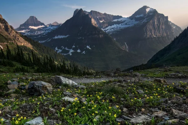
National Park
A showcase of melting glaciers, alpine meadows, carved valleys, and spectacular lakes. With over 700 miles of trails, Glacier is a paradise for adventurous visitors seeking a landscape steeped in huma...
Park data from the National Park Service API. Alerts update every 2 hours.
Expect a highway-focused experience, as 86% of this 165.2-mile journey takes place on major routes like US 2 and US 89. You will settle into a rhythmic pace, especially during the longest uninterrupted stretch of 80.2 miles on US 2, which allows for consistent cruising. While the drive consists mostly of high-speed highway segments, you will navigate some variety as you transition between these main arteries. The road feels practical and direct, prioritizing efficiency over technical maneuvers or winding backroads. Being behind the wheel here means spending most of your time focused on the open road, providing a steady and predictable driving experience from start to finish.
This is a straightforward highway drive that stays mostly on US 2 and United States Highway 89. There are only a few real navigation decisions along the way. The trickiest moment comes around 68 miles in near US 2; US 89.
Easy - simple navigation with a manageable amount of wheel time
Balances navigation complexity with total wheel time.
This is a straightforward 3h 17m drive. You will face about 8 decision points, but nothing that requires special attention if you follow navigation.
Where does it get tricky?
The main spots that need attention: at 68 miles (US 2; US 89): Navigation decision point; at 71.9 miles (US 2): Roundabout - know your exit number before entering; at 144.2 miles: Navigation decision point.
High-altitude sections with notable climbs
Total Climb
1,996 ft
Total Descent
2,780 ft
Highest Point
5,245 ft
~96.4 mi in
Elevation Range
2,210 ft
Notable High Points
Weekend Trip
Doable as a same-day drive at 3h 17m. Total distance: 165.2 miles.
Family Friendly
Moderate complexity with 1 natural rest stops along the way.
Solo Traveler
3h 17m drive, comfortable solo distance.
First-Time Driver
Mostly highway driving (86%). Straightforward navigation.
Compiled by the US Trip Planner planning team at COD Solutions Oy from open government datasets — OSRM over OpenStreetMap for geometry, EIA for fuel prices, USGS 3DEP for elevation, and NPS for national parks. See our methodology for refresh cadence and limitations.
Was this helpful?
Thanks for your feedback!
Your tip has been submitted. Thanks!
/500
Recent Tips
·
Explore more options from Choteau, MT or browse trips ending in Whitefish, MT.
Looking for more statewide routes? Browse MT road trips.