Trip from Chelsea, MA to Lanett, AL

Pin this trip

Compiled and reviewed by the US Trip Planner planning team at COD Solutions Oy · Last reviewed Oct 23, 2026 · Editorial standards

Drive Time

23h

Distance

1163.1 mi

1,872 km

Drive Score

6/10

Good drive

Same Day?

3-day trip

Fuel Cost

$201

one way

EV Charging

Good

8 stations

Best Time to Leave

Save up to 62 min
4 AM
22h 40m ★
6 AM
23h 0m
8 AM
23h 42m
10 AM
23h 15m
12 PM
23h 11m
3 PM
23h 17m
5 PM
23h 40m
8 PM
22h 48m

Estimated drive times based on typical traffic patterns. Actual times may vary with weather, construction, and real-time conditions.

Downtown Chelsea, MA, MA

Chelsea, MA

Italo Melo

city in Chambers County, Alabama, United States

Lanett, AL

Wikimedia Commons

Trip Overview

Chelsea, MA to Lanett, AL is 1163.1 miles and takes about 23h via I 95 and I 85, with a fuel budget near $193 and enough daylight to finish in a day. This long-haul drive takes you from the Northeast down to the Southeast, covering a significant portion of the East Coast. You'll spend most of your time on major interstates, making it a straightforward trip if you're looking to cover ground efficiently. With a recommended 3 days for the drive, you can break it up into manageable segments. Plan for a substantial amount of time on the road, but the route is well-serviced.

Trip Pace

Best split across 3 days

Treat the return leg as its own travel day rather than an afterthought.

Break Rhythm

6 planned breaks

Plan on a short reset every 3 to 4 hours to stay fresh behind the wheel.

Midpoint

581.5 miles from Chelsea, MA

A natural place for your longest stop of the day , about 12h 1m into the drive .

Main Roads

Road Distance Duration
I 85 467.1 mi 8h 49m
Richmond-Petersburg Turnpike 108.4 mi 2h 2m
I 95 93.1 mi 1h 52m
New Jersey Turnpike Western Spur 64.6 mi 1h 18m
Massachusetts Turnpike 55.3 mi 1h 6m
New Jersey Turnpike 52.9 mi 1h 1m
Henry G. Shirley Memorial Highway 45.7 mi 55m
John F. Kennedy Memorial Highway 41.3 mi 47m
Longest stretch: I 85 — 467.1 mi, about 8h 49m

Traffic on I-85

Hour-of-day weekday pattern from 693 FHWA count stations on your route.

Peak

4 PM

~2,733 veh/hr typical · worst 3,355

Quietest

2 AM

~350 veh/hr

Peak-to-quiet ratio

7.8×

busier at peak than in the quiet hours

12a 6a noon 6p 11p

Averaged across 105 weeks of 2023 FHWA Travel Monitoring Analysis System data. Weekday hours only (Mon–Fri).

Turn-by-Turn Driving Directions

Step-by-step road directions between Chelsea, MA and Lanett, AL.

1

Start on Shawmut Street

212 ft · 13 sec · Shawmut Street
2

Turn right onto Chester Avenue

526 ft · 25 sec · Chester Avenue
3

At end of road, turn right onto Hawthorn Street

403 ft · 6 sec · Hawthorn Street
4

Continue on Broadway

450 ft · 7 sec · Broadway
5

Turn left onto City Hall Avenue

434 ft · 19 sec · City Hall Avenue
6

Turn left onto Chestnut Street

0.1 mi · 16 sec · Chestnut Street
7

Turn right onto Fifth Street

0.1 mi · 19 sec · Fifth Street
8

Take the ramp

0.2 mi · 25 sec
Toward US 1 South: Boston
9

Merge onto US 1

0.1 mi · 8 sec · Northeast Expressway
10

Continue on US 1

4.0 mi · 6 min · Tobin Bridge
Use the straight / slight right lanes.
11

Take the exit

0.1 mi · 14 sec
Exit 16A Toward I 90 West: Mass Pike, South Station Use the straight / slight right lanes.
12

Keep slight left at fork

0.6 mi · 1 min
Toward I 90 Toll West: Albany Street Use the slight left lane.
13

Keep slight right at fork

0.1 mi · 13 sec
Toward I 90 West: Albany Street, Mass Pike
14

Keep slight right at fork

0.2 mi · 20 sec
Toward I 90 West: Mass Pike, Worcester Use the slight left / slight right lanes.
15

Merge onto I 90

55 mi · 1 hr 6 min · Massachusetts Turnpike
Use the straight / slight right lanes.
16

Keep slight right at fork onto I 84

34 mi · 39 min · Wilbur Cross Highway
Exit 78 Toward I 84: Hartford, New York City Use the slight right lane.
17

Keep slight right at fork onto I 84

8.0 mi · 9 min · I 84
Use the straight / right lanes.
18

Keep slight left at fork onto CT 15

1.9 mi · 2 min · CT 15
Toward CT 15 South: New York City Use the slight left lane.
19

Take the exit

0.6 mi · 53 sec
Exit 86 Toward I 91 South: New Haven, New York City Use the slight right lane.
20

Merge onto I 91

17 mi · 19 min · I 91
Use the straight / slight right lanes.
21

Take the exit

0.3 mi · 34 sec
Exit 17 Toward CT 15 South Use the slight right lane.
22

Keep slight left at fork

437 ft · 8 sec
Toward CT 15 South Use the straight / slight right lanes.
23

Merge onto CT 15

30 mi · 37 min · CT 15
Use the straight / slight right lanes.
24

Take the exit

0.2 mi · 23 sec
Exit 34 Toward CT 8, CT 108: Bridgeport, Waterbury Use the straight / slight right lanes.
25

Keep slight left at fork

0.4 mi · 48 sec
Toward CT 8 South, CT 108 South: Bridgeport
26

Keep slight left at fork

0.8 mi · 1 min
Toward CT 8 South: Bridgeport Use the slight left lane.
27

Merge onto CT 8

4.5 mi · 5 min · CT 8
28

Keep slight right at fork

0.3 mi · 42 sec
Toward I 95 South: New York City Use the slight right lane.
29

Merge onto I 95

29 mi · 39 min · I 95
Use the straight / slight right lanes.
30

Keep slight left at fork onto I 95

14 mi · 19 min · New England Thruway
Use the straight / slight right lanes.
31

Continue on I 95

1.3 mi · 2 min · Bruckner Expressway
Use the straight / right lanes.
32

Keep slight right at fork onto I 95

0.6 mi · 54 sec · Bruckner Expressway
Toward I 95 South: George Washington Bridge Use the slight left / slight right lanes.
33

Keep slight right at fork onto I 95

5.4 mi · 6 min · I 95
Toward I 95 South, to I 678 South: Cross Bronx Expressway, George Washington Bridge, Newark, Whitestone Bridge Use the slight right lane.
34

Keep slight left at fork onto I 95; US 1

0.7 mi · 1 min · Trans-Manhattan Expressway
Toward Upper Level
35

Continue on I 95; US 1

0.6 mi · 59 sec · George Washington Bridge (upper level)
36

Continue on I 95 EXPR; US 1 EXPR; US 9 EXPR

0.5 mi · 48 sec · I 95 EXPR; US 1 EXPR; US 9 EXPR
37

Keep slight left at fork onto I 95 EXPR; US 1 EXPR; US 9 EXPR

0.6 mi · 39 sec · I 95 EXPR; US 1 EXPR; US 9 EXPR
Use the straight / slight right lanes.
38

Keep slight left at fork onto I 95 EXPR; NJTP

2.7 mi · 3 min · I 95 EXPR; NJTP
Use the straight / slight right lanes.
39

Keep slight right at fork

0.4 mi · 29 sec
Toward I 95 South, NJTP South: Newark Use the straight / slight left lanes.
40

Merge onto I 95; NJTP

2.0 mi · 2 min · New Jersey Turnpike
Use the straight / slight right lanes.
41

Keep slight left at fork onto I 95; NJTP

2.6 mi · 3 min · New Jersey Turnpike Western Spur
Toward I 95 South: Turnpike South, Exit 16W Use the straight / slight right lanes.
42

Take the exit

0.5 mi · 43 sec
Use the slight left / straight lanes.
43

Merge onto I 95

7.4 mi · 10 min · New Jersey Turnpike Western Spur
44

Keep slight left at fork onto I 95; NJTP

55 mi · 1 hr 4 min · New Jersey Turnpike Western Spur
Use the slight left / slight right lanes.
45

Keep slight left at fork onto NJTP

49 mi · 56 min · New Jersey Turnpike
Toward NJTP South: Camden, Wilmington
46

Take the exit

0.2 mi · 15 sec
47

Continue on this road

0.3 mi · 23 sec · this road
48

Merge onto NJTP

2.0 mi · 2 min · New Jersey Turnpike
49

Merge onto I 295; US 40

3.4 mi · 6 min · I 295; US 40
Use the straight / right lanes.
50

Take the exit

479 ft · 8 sec
Toward DE 9: New Castle, Veterans Memorial Park, Wilmington Use the straight / slight right lanes.
51

Keep slight left at fork

0.2 mi · 14 sec
Toward DE 9 South: New Castle, Veterans Memorial Park Use the straight / slight right lanes.
52

Keep slight left at fork

0.3 mi · 31 sec
53

Merge onto I 295; US 40

12 mi · 14 min · Delaware Turnpike
Use the straight lane.
54

Keep slight left at fork onto I 95

2.2 mi · 2 min · Delaware Turnpike
Use the slight left lane.
55

Continue on I 95

41 mi · 47 min · John F. Kennedy Memorial Highway
Use the straight / slight right lanes.
56

Keep slight left at fork onto Express Toll Lanes

6.5 mi · 7 min · Express Toll Lanes
Use the slight left lane.
57

Keep slight left at fork onto Express Toll Lanes

1.2 mi · 1 min · Express Toll Lanes
Use the slight left lane.
58

Merge onto I 895

3.8 mi · 5 min · Harbor Tunnel Thruway
59

Continue on I 895

1.4 mi · 2 min · Baltimore Harbor Tunnel
60

Continue on I 895

2.2 mi · 3 min · Harbor Tunnel Thruway
Use the straight / slight right lanes.
61

Continue on I 895

0.5 mi · 39 sec · Harbor Tunnel Throughway
62

Keep slight left at fork onto I 895

0.5 mi · 41 sec · Harbor Tunnel Throughway
Use the straight / slight right lanes.
63

Continue on I 895

1.3 mi · 1 min · Harbor Tunnel Thruway
64

Take the exit

0.5 mi · 59 sec
Exit 4 Toward MD 295 South: Essex, BWI Marshall Airport Use the straight / right lanes.
65

Merge onto MD 295

27 mi · 37 min · Baltimore-Washington Parkway
Use the straight / slight right lanes.
66

Keep slight left at fork

0.5 mi · 35 sec
Toward US 50 East: Richmond, Annapolis Use the slight left / slight right lanes.
67

Continue on MD 201

2.2 mi · 3 min · Kenilworth Avenue Freeway
Use the straight / slight right lanes.
68

Continue on DC 295

2.1 mi · 3 min · Anacostia Freeway
69

Take the exit

0.3 mi · 37 sec
Exit 1B-C Toward I 695 : Downtown Use the straight / slight right lanes.
70

Keep slight right at fork

0.1 mi · 15 sec
Toward I 695 West: Downtown
71

Merge onto I 695

1.9 mi · 3 min · Southeast Freeway
Use the straight / slight right lanes.
72

Continue on I 395

0.7 mi · 1 min · Southwest Freeway
Use the straight / slight right lanes.
73

Continue on I 395

1.1 mi · 2 min · Francis Case Memorial Bridge
Use the straight / slight right lanes.
74

Continue on I 395; US 1

9.4 mi · 12 min · Henry G. Shirley Memorial Highway
Use the straight / slight left lanes.
75

Continue on I 395

36 mi · 43 min · Henry G. Shirley Memorial Highway
Exit 1A Toward I 95 South: Richmond Use the straight / slight right lanes.
76

Keep slight left at fork onto I 95

58 mi · 1 hr 5 min · I 95
Use the straight lane.
77

Keep slight left at fork onto I 95

24 mi · 30 min · Richmond-Petersburg Turnpike
Use the straight / slight right lanes.
78

Keep slight right at fork onto I 85

84 mi · 1 hr 31 min · Richmond-Petersburg Turnpike
Exit 51 Toward I 85 South, US 460 West: Durham Use the straight / slight right lanes.
79

Keep slight right at fork onto I 85

44 mi · 48 min · I 85
Use the straight / slight right lanes.
80

Keep slight left at fork onto I 85; US 70

42 mi · 48 min · I 85; US 70
Use the straight / slight right lanes.
81

Keep slight right at fork onto I 40

7.7 mi · 9 min · I 40
Use the straight / slight left lanes.
82

Keep slight left at fork onto US 29

5.4 mi · 5 min · US 29
Toward I 85 Business South, US 29 South, US 70 West: Charlotte Use the left lane.
83

Keep slight left at fork onto I 85

298 mi · 5 hr 38 min · I 85
Use the straight / slight right lanes.
84

Keep slight right at fork onto I 85

27 mi · 32 min · I 85
Use the straight / slight right lanes.
85

Continue on I 75; I 85

2.3 mi · 3 min · James Wendell George Parkway
Use the straight / slight right lanes.
86

Keep slight right at fork onto I 85

56 mi · 1 hr · I 85
Exit 242 Toward I 85 South: Airport Domestic, Montgomery Use the straight / slight right lanes.
87

Keep slight left at fork onto I 85

19 mi · 20 min · Pearl Harbor Memorial Highway
88

Take the exit

0.2 mi · 26 sec
Toward GA 18: West Point, Pine Mountain
89

Keep slight right at fork

337 ft · 8 sec
90

Turn straight onto GA 18

1.9 mi · 3 min · East 10th Street
Use the straight / right lanes.
91

Continue on US 29; GA 14

0.1 mi · 22 sec · 2nd Avenue
Use the straight / right lanes.
92

At end of road, turn right onto US 29; GA 14

400 ft · 16 sec · West 7th Street
93

Turn left onto US 29; GA 14

0.2 mi · 26 sec · 3rd Avenue
Use the left lane.
94

Continue on US 29

0.3 mi · 33 sec · North Gilmer Avenue
95

Turn right onto North 4th Street

0.1 mi · 37 sec · North 4th Street
96

Turn left onto North Lanier Avenue

0.1 mi · 30 sec · North Lanier Avenue
97

Arrive at destination

North Lanier Avenue

Trip Plan

Given the 23-hour duration, this trip is best split over 3 days to avoid excessive fatigue. Aim to depart early in the morning on your first day to maximize daylight driving. You'll make 6 planned stops, averaging about 7.5 hours of driving per day. Keep an eye on your fuel levels, especially on longer stretches like the 467.1-mile segment on I 85, where services might be less frequent. The Richmond-Petersburg Turnpike is a toll road, so be prepared for that expense and potential delays.

Morning Departure

Start early — leave by 6-7 AM to arrive at a reasonable hour.

Evening Departure

This is a long drive — plan for a morning departure or consider splitting it into two days.

This drive is better paced as a 3-day trip.
Plan roughly 6 meaningful breaks for fuel, food, and rest.
The halfway point lands around 581.5 miles from Chelsea, MA, or about 12h 1m into the drive.
The longest continuous stretch on this route runs about 467.1 miles.

Consider an overnight stop or starting very early.

Departure

Before you leave

Start with fuel, water, and navigation already sorted so the first hour feels easy.

First stop

Around 220 miles or 4h 39m in

Use this first pause for coffee, a restroom break, and a quick traffic check ahead.

Halfway reset

Around 581.5 miles or 12h 1m in

This is the best place for your longest stop, a real meal, and a full fuel check.

Overnight split

Day 1 wrap after about 387.7 miles or 7h 59m

Stop before fatigue turns the last few hours into a grind. You want day two to start fresh, not just resumed.

Final approach

Final hour starts around 21h 51m

Traffic, exits, and arrival timing usually matter more near Lanett, AL than in the middle of the route.

Before You Leave

+

Open the route before leaving Chelsea, MA so your first major turns are already loaded.

+

Leave with enough water and a charging cable within reach, not packed away.

+

Check your fuel range against the first long segment, especially if you are starting outside city service areas.

+

Pick one backup stop option before the midpoint in case traffic changes your pacing.

+

Treat this as a 3-day road trip and book the overnight stop before the busiest arrival window.

Day 1

Settle into the route from Chelsea, MA

Aim for roughly 388 miles and 7.7 hours of wheel time on this day.

Day 2

Keep the middle miles efficient

Aim for roughly 388 miles and 7.7 hours of wheel time on this day.

Day 3

Finish the approach into Lanett, AL

Aim for roughly 388 miles and 7.7 hours of wheel time on this day.

Your first comfortable stop window is around 220 miles from Chelsea, MA.
This route usually feels better as a 3-day drive than as one long push.
Plan about 6 real breaks rather than only quick fuel stops.
The longest stretch is on I 85 for about 467.1 miles.

Where to Stop

Rest stops, refuel points, and overnight suggestions along this route.

most populous city in the United States

First major stop

Coffee and fuel

New York City, NY

384 mi into the route

Best for: Coffee, fuel, and an easy first stretch

This is a natural early stop once the first hours of the drive are behind you.

city in Halifax County, North Carolina, United States

Second major stop

Overnight candidate

Roanoke Rapids, NC

768 mi into the route

Best for: Hotel check-in, dinner, and a fresh start

This lines up well with a realistic day-end stop if you are breaking the drive into stages.

Find hotels in Roanoke Rapids, NC

Overnight Options

Night 1

New York City, NY

388 mi · about 7.7h in

A practical overnight split lands near New York City, NY after about 388 miles or 7.7 hours of driving.

Find hotels

Night 2

Roanoke Rapids, NC

775 mi · about 15.3h in

A practical overnight split lands near Roanoke Rapids, NC after about 775 miles or 15.3 hours of driving.

Find hotels

Pacing Suggestions

New York City, NY

Fuel and coffee

A short stop after about 220 miles helps settle the day before fatigue starts building.

Washington, DC

Meal break

The midpoint is around 581.5 miles from Chelsea, MA, which is a good place for a longer meal and fuel stop.

Before the longest stretch

Fuel check

Top up before I 85 if your tank is already low. That segment runs about 467.1 miles.

Overnight split

Hotel stop

For a steadier pace, wrap day one after about 388 miles or 7.7 hours on the road.

These stop ideas are pacing suggestions — the exact town or exit can change with traffic, hotel plans, and fuel range.

Stops Along Your Drive

Picked by where they fit in your drive — first break, midpoint reset, final stretch.

G & M Restaurant

4.4 ★ ★ ★ ★ ☆

Around the midpoint, ~10 min detour

Early stretch 4.2 mi from route ~10 min detour Moderately

Linthicum Heights, Maryland

Hours: 11 am–9 pm

+14106361777

Visit website

Tesla Supercharger

4.3 ★ ★ ★ ★ ☆

Around the midpoint, right off the route

Halfway reset 0.1 mi from route

Henderson, North Carolina

Hours: Open 24 hours

Visit website

Rivian Waypoints

4.9 ★ ★ ★ ★ ★

Around the midpoint, right off the route

Halfway reset 0.8 mi from route ~2 min detour

Henderson, North Carolina

Hours: Open 24 hours

+18337484267

Visit website

Electrify America Charging Station

3.8 ★ ★ ★ ★ ☆

Around the midpoint, right off the route

Halfway reset 0.6 mi from route ~1 min detour

Henderson, North Carolina

Hours: Open 24 hours

+18336322778

Visit website

ChargePoint Charging Station

4.7 ★ ★ ★ ★ ★

Around the midpoint, short detour

Halfway reset 1.1 mi from route ~3 min detour

Henderson, North Carolina

Hours: Open 24 hours

+18887584389

Visit website

Electrify America Charging Station

4.2 ★ ★ ★ ★ ☆

Around the midpoint, short detour

Early stretch 1.6 mi from route ~4 min detour

Hanover, Maryland

Hours: Open 24 hours

+18336322778

Visit website

Rivian Adventure Network

4.0 ★ ★ ★ ★ ☆

Around the midpoint, right off the route

Halfway reset 0.8 mi from route ~2 min detour

Henderson, North Carolina

Hours: Open 24 hours

+18665761495

Visit website

Tesla Supercharger

4.0 ★ ★ ★ ★ ☆

Early in the drive, short detour

Early stretch 1.4 mi from route ~3 min detour

Edison, New Jersey

Hours: Open 24 hours

Visit website

ChargePoint Charging Station

4.3 ★ ★ ★ ★ ☆

Early in the drive, short detour

Early stretch 1.5 mi from route ~4 min detour

Highland Park, New Jersey

Hours: Open 24 hours

+18887584389

Visit website

Children's Museum of Atlanta

4.4 ★ ★ ★ ★ ☆

Near the end, right off the route

Home stretch 0.5 mi from route ~1 min detour

Atlanta, Georgia

Hours: Closed

+14046595437

Visit website

Zoo Atlanta

4.5 ★ ★ ★ ★ ★

Near the end, short detour

Home stretch 2.3 mi from route ~6 min detour

Atlanta, Georgia

Hours: 9 am–3:30 pm

+14046245600

Visit website

Place data sourced from public business listings. Hours and availability may vary.

Heads-up: tricky spots

5 of 76

5 decision points cluster between mile 5.7 and 1085.5 — GPS handles the exact turns, but know they're coming. Your lane choice matters more than the turn itself.

9
5.7 mi into trip | ~10m in

Keep slight right at fork toward I 90 West: Mass Pike, Worcester

Highway fork - watch signs carefully. Lane positioning matters here. Multiple destination signs - pick the right one

Use the slight left / slight right lanes. Toward I 90 West: Mass Pike, Worcester
9
61.2 mi into trip | ~1h 16m in | I 84 / Wilbur Cross Highway

Keep slight right at fork onto I 84 / Wilbur Cross Highway toward I 84: Hartford, New York City

Highway fork - watch signs carefully. Lane positioning matters here. Multiple destination signs - pick the right one

Use the slight right lane. Exit 78 Toward I 84: Hartford, New York City
9
336.7 mi into trip | ~6h 59m in

Keep slight left at fork toward DE 9 South: New Castle, Veterans Memorial Park

Highway fork - watch signs carefully. Lane positioning matters here. Multiple destination signs - pick the right one

Use the straight / slight right lanes. Toward DE 9 South: New Castle, Veterans Memoria...
9
574.2 mi into trip | ~11h 53m in | I 85 / Richmond-Petersburg Turnpike

Keep slight right at fork onto I 85 / Richmond-Petersburg Turnpike toward I 85 South, US 460 West: Durham

Highway fork - watch signs carefully. Lane positioning matters here. Multiple destination signs - pick the right one

Use the straight / slight right lanes. Exit 51 Toward I 85 South, US 460 West: Durham
9
1085.5 mi into trip | ~21h 31m in | I 85

Keep slight right at fork onto I 85 toward I 85 South: Airport Domestic, Montgomery

Highway fork - watch signs carefully. Lane positioning matters here. Multiple destination signs - pick the right one

Use the straight / slight right lanes. Exit 242 Toward I 85 South: Airport Domestic, Montgomery

Fuel & Cost

Regular Gas

$200.80 one way

$401.59 round trip

$4.39/gal 25.4 MPG avg 407 kg CO2
Fuel Type $/gal One Way Round Trip
midgrade $4.86 $222.45 $444.91
premium $5.27 $241.09 $482.18
diesel $6.28 $287.39 $574.77

Estimated Tolls: $45.85

New Jersey Turnpike (117.4 mi) $16.46
George Washington Bridge $16.00
Richmond-Petersburg Turnpike (84.4 mi) $5.91
Massachusetts Turnpike (55.3 mi) $3.32
Richmond-Petersburg Turnpike (24 mi) $1.68
New England Thruway (14.3 mi) $1.00
Delaware Turnpike (11.6 mi) $0.81
Harbor Tunnel Thruway (7.3 mi) $0.51
Delaware Turnpike (2.2 mi) $0.16

Toll estimates based on average 2024-2025 rates. EZ-Pass/SunPass discounts may lower the actual cost.

Estimated Trip Cost (one way, 1 person)

Fuel

$201

Tolls

$46

Hotel (2n)

$160–$280

Meals

$75–$150

Total

$482–$677

Rough estimate based on US averages. Hotel $80–$140/night, meals $25–$50/day.

Estimated CO2 emission: 406.9 kg one way. Prices: EIA weekly data, 2026-10-19.

Driving Electric?

About $122 in charging · 4 stops · 67% less CO2

Vehicle Type kWh Stops DC Fast Home Charge
Average EV 348.9 4 $122.13 $55.83
Efficient EV 290.8 3 $101.77 $46.52
EV Truck/SUV 465.2 5 $162.83 $74.44

Gas CO2

407 kg

EV CO2

136 kg (67% less)

This is a long EV road trip requiring 4 charging stops. Plan your route around charger locations and allow extra time for charging.

DC fast charging avg $0.35/kWh. Home charging avg $0.16/kWh. US grid CO2: 0.39 kg/kWh.

Travel Intel

Current conditions at both ends of the drive.

Forecast as of Oct 23, 2026

Origin

Chelsea, MA

Evening in Chelsea on Friday

Local time

6:01 PM

EDT

Current temp

40°F

Clear

N 15 mph 0% chance Live forecast

Destination

Lanett, AL

Evening in Lanett on Friday

Local time

5:01 PM

CDT

Current temp

46°F

Clear

0 mph 0% chance Live forecast

Seasonal Notes

Summer travel usually means heavier construction, hotter rest stops, and busier weekend traffic around major cities.

Winter travel shortens daylight, so a route that looks manageable on paper can feel much longer after dark.

Holiday weekends tend to make both departure and arrival windows slower than the raw route time suggests.

For long drives, weather on day two can matter just as much as conditions at departure, so check the whole travel window rather than only the first day.

Time zone

1 hour earlier

The destination clock does not match departure time, so double-check hotel check-in windows and late arrival plans.

Temperature spread

6 degrees warmer at arrival

A meaningful temperature swing is a good cue to rethink layers, water, and how soon you want to arrive.

Road read

23h on the road

This is long enough that the arrival forecast matters almost as much as departure conditions. Recheck both ends before you roll.

Weather data from the National Weather Service. Conditions may change; check closer to your travel date.

National Parks Near This Route

Worth a detour if your schedule allows.

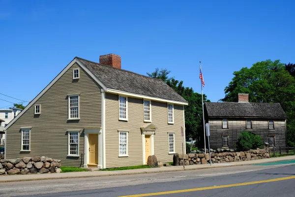
Boston National Historical Park

Boston National Historical Park

National Historical Park

Discover how one city could be the Cradle of Liberty, site of the first major battle of American Revolution, and home to many who espoused that freedom can be extended to all.

2 mi from route ~5 min detour Free
Park Closure: USS Cassin Young
View on nps.gov
Boston Harbor Islands National Recreation Area

Boston Harbor Islands National Recreation Area

National Recreation Area

. . . where you can walk a Civil War-era fort, view historic lighthouses, explore tide pools, hike lush trails, camp under the stars, or relax while fishing, picnicking, or swimming—all within reach o...

7 mi from route ~19 min detour Free
View on nps.gov
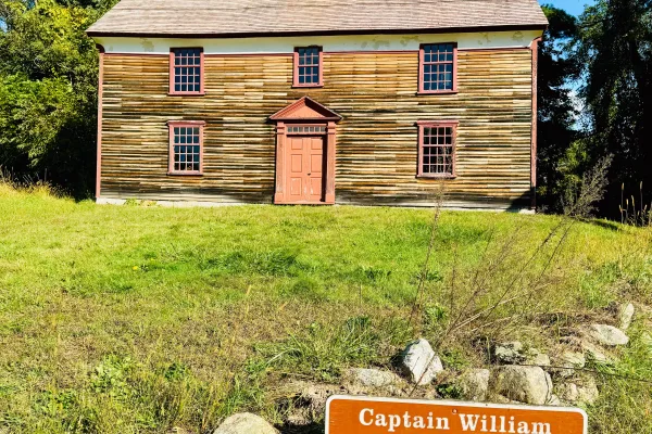
Adams National Historical Park

Adams National Historical Park

National Historical Park

From the sweet little farm at the foot of Penn’s Hill to the gentleman’s country estate at Peace field, Adams National Historical Park is the story of “heroes, statesmen, philosophers…and learned wome...

9 mi from route ~24 min detour $15
View on nps.gov
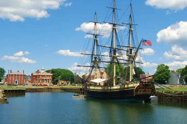
Salem Maritime National Historical Park

Salem Maritime National Historical Park

National Historical Park

Originally established in 1938 as the first National Historic Site in the United States, Salem Maritime National Historical Park consists of nine acres of land and twelve historic structures along the...

12 mi from route ~29 min detour Free
View on nps.gov
Minute Man National Historical Park

Minute Man National Historical Park

National Historical Park

At Minute Man National Historical Park the opening battle of the Revolution is brought to life as visitors explore the battlefields and structures associated with April 19, 1775, and witness the Ameri...

15 mi from route ~37 min detour Free
View on nps.gov
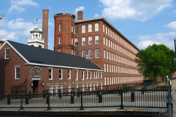
Lowell National Historical Park

Lowell National Historical Park

National Historical Park

Lowell’s water-powered textile mills catapulted the nation – including immigrant families and early female factory workers – into an uncertain new industrial era. Nearly 200 years later, the changes t...

23 mi from route ~57 min detour Free
View on nps.gov

Park data from the National Park Service API. Alerts update every 2 hours.

What kind of drive is this?

This route is predominantly interstate driving, with 84% of the 1163.1 miles on highways like I 95 and I 85. The longest continuous stretch you'll encounter is 467.1 miles on I 85. Expect numerous exits and potential for urban merging as you pass through various metropolitan areas along the East Coast. The transition to surface roads would occur after covering the vast majority of your mileage on the interstate system.

84% highway — fuel and pacing are the main things to plan.
97 navigation steps total — most of the decisions cluster near the start and finish.
Longest single stretch: 467.1 mi on I 85.

How Hard Is This Drive?

10/10

This is a straightforward highway drive that stays mostly on I 85 and Richmond-Petersburg Turnpike. This route has several spots where lane changes, forks, or exits need your full attention. The trickiest moment comes around 5.7 miles in.

Driving Effort 10/10

High effort - long or complex enough to need steady focus all day

Balances navigation complexity with total wheel time.

This is a demanding drive. With 76 significant decision points across 1163.1 miles, you will need to stay alert - especially through interchange areas and urban stretches. Consider splitting it into segments if you are not comfortable with fast highway navigation.

Where does it get tricky?

The main spots that need attention: at 5.7 miles: Highway fork - watch signs carefully. Lane positioning matters here. Multiple destination signs - pick the right one; at 61.2 miles (I 84 / Wilbur Cross Highway): Highway fork - watch signs carefully. Lane positioning matters here. Multiple destination signs - pick the right one; at 336.7 miles: Highway fork - watch signs carefully. Lane positioning matters here. Multiple destination signs - pick the right one.

Elevation Profile

Gently rolling terrain

974 ft 21 ft

Total Climb

1,599 ft

Total Descent

1,053 ft

Highest Point

974 ft

~1080 mi in

Elevation Range

954 ft

Towns Mentioned on Route Signs

Based on OSRM destination-sign hints, not a full list of every settlement the road passes.

Between Chelsea, MA and Lanett, AL, road signs point toward New York City, Waterbury, Newark, Upper Level, Njtp South: Newark and Exit 16W - among others.

New York City

61.2 mi in | ~1h 16m | via I 84

Waterbury

152.1 mi in | ~3h 6m

Newark

203.9 mi in | ~4h 18m | via I 95

Upper Level

209.3 mi in | ~4h 24m | via I 95; US 1

Njtp South: Newark

214.4 mi in | ~4h 32m

Exit 16W

216.8 mi in | ~4h 35m | via I 95; NJTP

Njtp South: Camden

281.8 mi in | ~5h 54m | via NJTP

Wilmington

281.8 mi in | ~5h 54m | via NJTP

Veterans Memorial Park

336.6 mi in | ~6h 59m

Bwi Marshall Airport

409.7 mi in | ~8h 28m

Annapolis

437.2 mi in | ~9h 7m

Montgomery

1085.5 mi in | ~21h 31m | via I 85

About the Cities

Starting in Chelsea, MA

Full guide →

Founded 1624

Everett is a city in Massachusetts with a population of 49,000 (2020). Chelsea is a city with a population of 41,000 (2020).

Top landmarks

  • • Luna — tugboat
  • • Revere Beach Parkway — historic parkway in the suburbs immediately north of Boston, Massachusetts, USA
  • • Bellingham–Cary House — historic house in Massachusetts, United States

Arriving in Lanett, AL

Full guide →

City content from Wikivoyage (CC BY-SA 4.0) and Wikidata (CC0).

Frequently Asked Questions

The longest stretch is about 467.1 miles on I 85. The full list of main roads is in the Roads section above.

Yes — a 3-day pace is more comfortable than one long haul. A sensible stopping point is after roughly 388 miles on day one.

Expect about $45.85 in tolls one way, starting with New Jersey Turnpike. Most Northeast and Midwest toll agencies accept E-ZPass; in the West and Texas, transponders like TxTag or FasTrak apply. If you do not have a transponder, cashless tolling plates will mail a bill to the vehicle's registered address — usually with a surcharge, so a rental-car toll pass is often cheaper than paying by mail.

We did not find dedicated rest areas on this route. For a drive this long, plan bathroom and stretch breaks around gas stations, fast-food stops, or small-town downtowns — check the Nearby Places section for options.

It helps. This route has a higher-than-average number of complex decision points, which get harder in the dark. If the last hour of the trip is on surface roads or mountain grades, aim to arrive at Lanett, AL before sunset when you can. Check the Trip Plan for departure windows that land you in daylight.

Only with planning. This is a long drive for kids — consider splitting it into two days rather than pushing through. Plan at least 6 meaningful breaks. Dedicated rest areas are limited, so plan gas or food stops as your bathroom breaks.

The main spots that need attention: at 5.7 miles: Highway fork - watch signs carefully. Lane positioning matters here. Multiple destination signs - pick the right one; at 61.2 miles (I 84 / Wilbur Cross Highway): Highway fork - watch signs carefully. Lane positioning matters here. Multiple destination signs - pick the right one; at 336.7 miles: Highway fork - watch signs carefully. Lane positioning matters here. Multiple destination signs - pick the right one.

Yes — Boston National Historical Park, Boston Harbor Islands National Recreation Area and Adams National Historical Park (6 total within detour distance). See the National Parks section for detour distances and tips on detours.

Not recommended in a single day. At 23.0 hours each way, a round trip means 46.0 hours of driving — that is an unsafe level of fatigue for most drivers. Plan at least one night at Lanett, AL before the return drive.

How this page is built

Compiled by the US Trip Planner planning team at COD Solutions Oy from open government datasets — OSRM over OpenStreetMap for geometry, EIA for fuel prices, USGS 3DEP for elevation, NPS for national parks, and FHWA TMAS for hourly traffic volumes. See our methodology for refresh cadence and limitations.

Was this helpful?

Thanks for your feedback!

Your tip has been submitted. Thanks!

/500

Explore More

Continue From Lanett, AL

Explore more options from Chelsea, MA or browse trips ending in Lanett, AL.

Looking for more statewide routes? Browse MA road trips.