Connecting Brownsville to Orlando covers 231.7 miles of Florida transit in approximately 4 hours and 23 minutes. Because this journey is entirely highway-focused, it is easily manageable as a single-day trip without the need for an overnight stay. You should budget roughly $39 for fuel to complete the trek. Navigating via Florida’s Turnpike, I-95, and I-4, you will transition from the local landscape into the central hub of the state. It is a straightforward, efficient route designed for those who prioritize speed and direct access over scenic detours.
Trip Pace
Same-day drive is realistic
A same-day return is possible, but it will make for a full day on the road.
Break Rhythm
1 planned break
Plan on a short reset every 3 to 4 hours to stay fresh behind the wheel.
Midpoint
115.9 miles from Brownsville, FL
A natural place for your longest stop of the day
, about 2h 12m into the drive
.
Main Roads
Road
Distance
Duration
Florida's Turnpike
214.5 mi
3h 54m
I 95
5.7 mi
7m
I 4
4.3 mi
5m
Northwest 62nd Street
2.2 mi
4m
South Division Avenue
1.2 mi
3m
Northwest 27th Avenue
0.6 mi
1m
West South Street
0.3 mi
<1m
Northwest 5th Court
<0.1 mi
<1m
Longest stretch:
Florida's Turnpike
— 214.5 mi, about 3h 54m
Traffic on I-95
Hour-of-day weekday pattern from 19 FHWA count stations on your route.
Peak
4 PM
~5,207 veh/hr typical
· worst 6,073
Quietest
2 AM
~284 veh/hr
Peak-to-quiet ratio
18.3×
busier at peak than in the quiet hours
12a6anoon6p11p
Averaged across 52 weeks of 2023 FHWA Travel Monitoring Analysis System data. Weekday hours only (Mon–Fri).
Turn-by-Turn Driving Directions
Step-by-step road directions between Brownsville, FL and Orlando, FL.
1
Start on this road
401 ft·32 sec·this road
2
Turn left
75 ft·7 sec
3
Turn right onto Northwest 53rd Street
178 ft·7 sec·Northwest 53rd Street
4
Turn left onto SR 9
0.6 mi·1 min·Northwest 27th Avenue
5
Turn right onto Northwest 62nd Street
2.2 mi·4 min·Northwest 62nd Street
6
Turn left onto Northwest 5th Court
279 ft·7 sec·Northwest 5th Court
Use the straight / left / right lanes.
7
Take the ramp
0.2 mi·25 sec
Toward I 95 North: Fort Lauderdale
8
Merge onto I 95
5.7 mi·7 min·I 95
Use the straight / slight right lanes.
9
Take the exit
0.8 mi·1 min
Exit 12AToward SR 826 West: Florida's Turnpike TollUse the slight left lane.
10
Keep slight left at fork
0.4 mi·54 sec
Toward Florida's Turnpike
11
Merge onto Florida's Turnpike
215 mi·3 hr 54 min·Florida's Turnpike
Use the straight / slight right lanes.
12
Take the exit
0.4 mi·54 sec
Exit 259Toward I 4: Orlando, TampaUse the straight / slight right lanes.
13
Keep slight right at fork
0.3 mi·38 sec
Toward I 4 East: Downtown Orlando
14
Merge onto I 4
4.3 mi·5 min·I 4
Use the straight / slight right lanes.
15
Take the exit
0.3 mi·43 sec
Exit 81Toward Kaley Avenue, Michigan StreetUse the slight right lane.
16
Keep slight right at fork
0.1 mi·14 sec
17
Turn slight right onto West Kaley Street
264 ft·14 sec·West Kaley Street
18
Turn left onto South Division Avenue
1.2 mi·3 min·South Division Avenue
Use the left lane.
19
Turn right onto West South Street
0.3 mi·51 sec·West South Street
20
Turn slight right
103 ft·3 sec
21
Arrive at destination
Trip Plan
To keep your drive smooth, plan for at least one dedicated stop to stretch your legs and refresh during the 4-hour and 23-minute transit. Given the heavy reliance on major interstates like I-4, try to time your departure to avoid peak rush hour traffic near your destination. Since the longest stretch spans 214.5 miles, ensure your fuel tank is topped off before you commit to the main section of the Turnpike. This flexibility allows you to arrive in Orlando feeling sharp rather than fatigued. Keep a close eye on digital traffic signs for real-time updates, as these primary arteries are prone to sudden congestion.
Morning Departure
An early start around 7-8 AM gets you there with plenty of daylight left.
Evening Departure
A late afternoon start means arriving after dark. Morning is better.
You can normally do this drive in one day.
Plan roughly 1 meaningful break for fuel, food, and rest.
The halfway point lands around 115.9 miles from Brownsville, FL, or about 2h 12m into the drive.
The longest continuous stretch on this route runs about 214.5 miles.
This is a comfortable same-day trip.
Departure
Before you leave
Start with fuel, water, and navigation already sorted so the first hour feels easy.
First stop
Around 51 miles or 1h 1m in
Use this first pause for coffee, a restroom break, and a quick traffic check ahead.
Halfway reset
Around 115.9 miles or 2h 12m in
This is the best place for your longest stop, a real meal, and a full fuel check.
Final approach
Final hour starts around 3h 33m
Traffic, exits, and arrival timing usually matter more near Orlando, FL than in the middle of the route.
Before You Leave
+
Open the route before leaving Brownsville, FL so your first major turns are already loaded.
+
Leave with enough water and a charging cable within reach, not packed away.
+
Check your fuel range against the first long segment, especially if you are starting outside city service areas.
Day 1
Settle into the route from Brownsville, FL
This is one driving day of about 231.7 miles and 4h 23m.
Your first comfortable stop window is around 51 miles from Brownsville, FL.
This route can stay practical as a one-day drive if traffic stays reasonable.
Plan about 1 real break rather than only quick fuel stops.
The longest stretch is on Florida's Turnpike for about 214.5 miles.
Where to Stop
Rest stops, refuel points, and overnight suggestions along this route.
Place data sourced from public business listings. Hours and availability may vary.
Heads-up: tricky spots
5 of 16
5 decision points cluster between mile 2.9 and 230.1 — GPS handles the exact turns, but know they're coming. Your lane choice matters more than the turn itself.
6
2.9 mi into trip|~6m in|Northwest 5th Court
Turn left onto Northwest 5th Court
Lane positioning matters here
Use the straight / left / right lanes.
7
8.9 mi into trip|~14m in
Take the exit toward SR 826 West: Florida's Turnpike Toll
Exit ramp - move to the correct lane early. Lane positioning matters here
Use the slight left lane.
Exit 12A
Toward SR 826 West: Florida's Turnpike Toll
8
224.6 mi into trip|~4h 11m in
Take the exit toward I 4: Orlando, Tampa
Exit ramp - move to the correct lane early. Lane positioning matters here. Multiple destination signs - pick the right one
Use the straight / slight right lanes.
Exit 259
Toward I 4: Orlando, Tampa
8
229.7 mi into trip|~4h 18m in
Take the exit toward Kaley Avenue, Michigan Street
Exit ramp - move to the correct lane early. Lane positioning matters here. Multiple destination signs - pick the right one
Use the slight right lane.
Exit 81
Toward Kaley Avenue, Michigan Street
6
230.1 mi into trip|~4h 19m in|South Division Avenue
Turn left onto South Division Avenue
Lane positioning matters here
Use the left lane.
Fuel & Cost
Regular Gas
$35.07 one way
$70.15 round trip
$3.85/gal25.4 MPG avg81 kg CO2
Fuel Type
$/gal
One Way
Round Trip
midgrade
$4.22
$38.49
$76.97
premium
$4.55
$41.51
$83.01
diesel
$4.80
$43.75
$87.50
Estimated Tolls: $15.02
Florida's Turnpike
(214.5 mi)$15.02
Toll estimates based on average 2024-2025 rates. EZ-Pass/SunPass discounts may lower the actual cost.
Estimated Trip Cost (one way, 1 person)
Fuel
$35
Tolls
$15
Meals
$25–$50
Total
$75–$100
Rough estimate based on US averages. Hotel $80–$140/night, meals $25–$50/day.
Estimated CO2 emission: 81.1 kg one way.
Prices: EIA weekly data, 2026-07-13.
Driving Electric?
About $24 in charging
· 0 stops
· 67% less CO2
Vehicle Type
kWh
Stops
DC Fast
Home Charge
Average EV
69.5
0
$24.33
$11.12
Efficient EV
57.9
0
$20.27
$9.27
EV Truck/SUV
92.7
1
$32.44
$14.83
Gas CO2
81 kg
EV CO2
27 kg (67% less)
Plan for 0 charging stops, roughly every 270 miles. Allow 25-40 minutes per stop at a DC fast charger.
DC fast charging avg $0.35/kWh. Home charging avg $0.16/kWh. US grid CO2: 0.39 kg/kWh.
Travel Intel
Current conditions at both ends of the drive.
Forecast as of Jul 18, 2026
Origin
Brownsville, FL
Afternoon
in Brownsville on Sunday
Local time
3:17 PM
EDT
Current temp
91°F
Partly Sunny
SE 12 mph14% chanceLive forecast
Destination
Orlando, FL
Afternoon
in Orlando on Sunday
Local time
3:17 PM
EDT
Current temp
93°F
Chance Showers And Thunderstorms
S 10 mph39% chanceLive forecast
Seasonal Notes
Summer travel usually means heavier construction, hotter rest stops, and busier weekend traffic around major cities.
Winter travel shortens daylight, so a route that looks manageable on paper can feel much longer after dark.
Holiday weekends tend to make both departure and arrival windows slower than the raw route time suggests.
Time zone
Same local time
Origin and destination are on the same clock, so arrival timing is easier to judge at a glance.
Temperature spread
2 degrees warmer at arrival
A meaningful temperature swing is a good cue to rethink layers, water, and how soon you want to arrive.
Road read
4h 23m on the road
An early start around 7-8 AM gets you there with plenty of daylight left.
Weather data from the National Weather Service. Conditions may change; check closer to your travel date.
National Parks Near This Route
Worth a detour if your schedule allows.
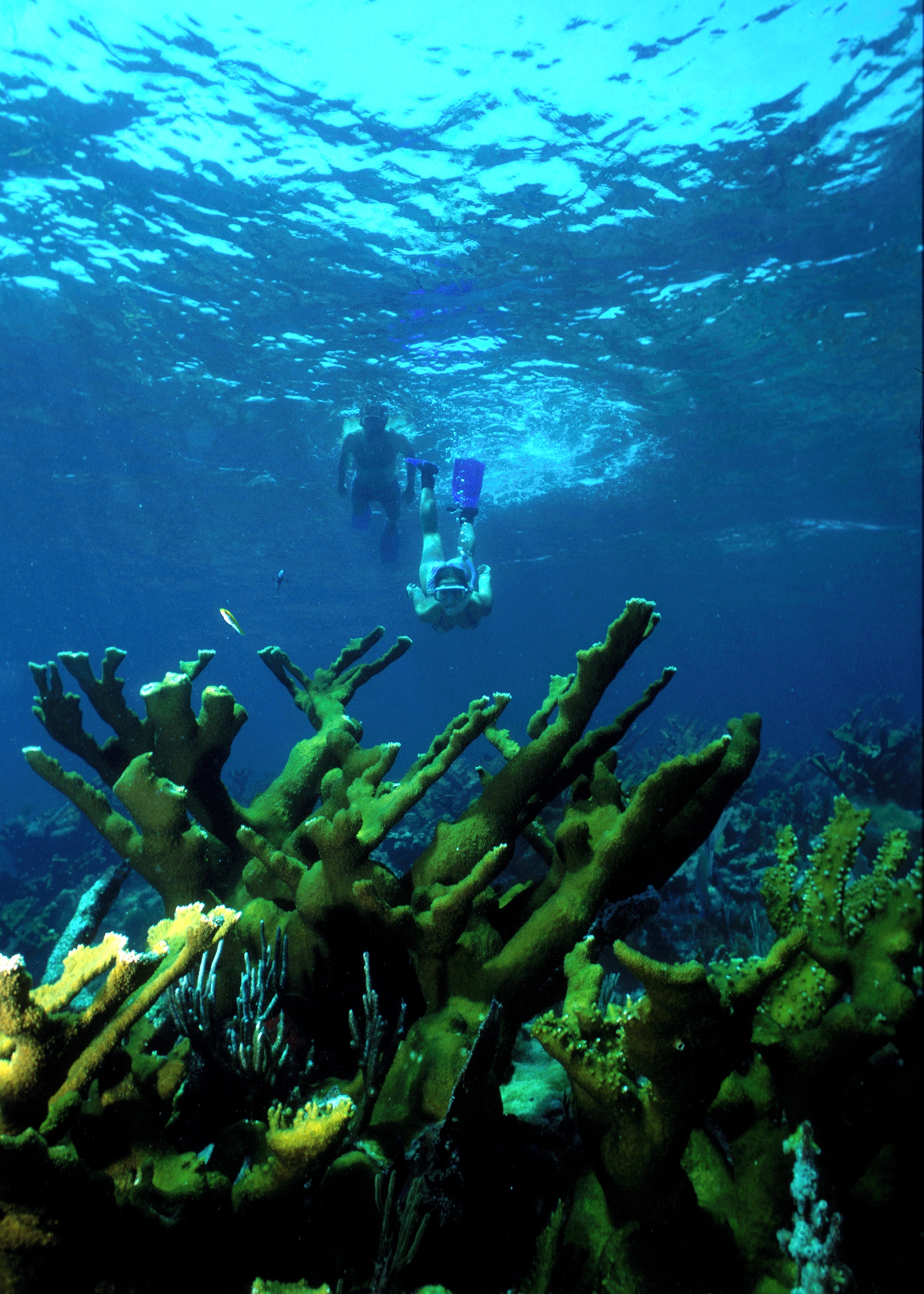
Biscayne National Park
National Park
Within sight of Miami, yet worlds away, Biscayne protects a rare combination of aquamarine waters, emerald islands, and fish-bejeweled coral reefs. Evidence of 10,000 years of human history is here to...
Park data from the National Park Service API. Alerts update every 2 hours.
More Details
What kind of drive is this?
Expect a high-speed, interstate-heavy experience, as 97% of this trip consists of highway driving. You will spend the vast majority of your time on the road—specifically 214.5 miles—navigating Florida’s Turnpike, which sets the pace for the entire journey. The drive maintains a consistent, fast-moving character that requires sustained focus rather than technical maneuvering. While you will eventually merge onto I-95 and I-4, the personality of the route remains functional and utilitarian throughout. It is an ideal path if you want to cover ground quickly without the stop-and-start nature of local surface streets.
97% highway — fuel and pacing are the main things to plan.
21 navigation steps total — most of the decisions cluster near the start and finish.
Longest single stretch: 214.5 mi on Florida's Turnpike.
How Hard Is This Drive?
9/10
This is a straightforward highway drive that stays mostly on Florida's Turnpike and I 95. This route has several spots where lane changes, forks, or exits need your full attention. The trickiest moment comes around 2.9 miles in near Northwest 5th Court.
Driving Effort9/10
High effort - long or complex enough to need steady focus all day
Balances navigation complexity with total wheel time.
This is a demanding drive. With 16 significant decision points across 231.7 miles, you will need to stay alert - especially through interchange areas and urban stretches. Consider splitting it into segments if you are not comfortable with fast highway navigation.
Where does it get tricky?
The main spots that need attention: at 2.9 miles (Northwest 5th Court): Lane positioning matters here; at 8.9 miles: Exit ramp - move to the correct lane early. Lane positioning matters here; at 224.6 miles: Exit ramp - move to the correct lane early. Lane positioning matters here. Multiple destination signs - pick the right one.
For the broader urban area including suburbs and other nearby destinations, please see the Greater Orlando article.
Orlando deserves its reputation as the theme park capital of the world, with an estimated 52 million visitors a year. The city is best known for its theme parks Walt Disney World and Universal Orlando, but it holds a lot to offer besides those two amusement meccas. Countless hotels and restaurants cater to business conventions and other events hosted by organizations from all over the country. Outside the theme park districts and hotels, however, lies much more to be explored, including downtown, areas of untouched wilderness, world-class museums and theaters, and old towns with dining and nightlife.
At the center of the state of Florida, in Orange County, Orlando is about an hour from each coast.
Top landmarks
•Universal Studios Florida — theme park in the United States
•Universal's Islands of Adventure — theme park, part of Universal Orlando Resort
•Universal Epic Universe — theme park in Orlando, Florida
Doable as a same-day drive at 4h 23m. Total distance: 231.7 miles.
Family Friendly
Moderate complexity with 1 natural rest stops along the way.
Solo Traveler
4h 23m drive, comfortable solo distance.
First-Time Driver
Mostly highway driving (97%). Some complex stretches to watch for.
Frequently Asked Questions
The longest stretch is about 214.5 miles on Florida's Turnpike. The full list of main roads is in the Roads section above.
Expect about $15.02 in tolls one way, starting with Florida's Turnpike. Most Northeast and Midwest toll agencies accept E-ZPass; in the West and Texas, transponders like TxTag or FasTrak apply. If you do not have a transponder, cashless tolling plates will mail a bill to the vehicle's registered address — usually with a surcharge, so a rental-car toll pass is often cheaper than paying by mail.
Yes — we found about 12 rest areas or service plazas within a short detour of the route (from OpenStreetMap). See the Rest Stops tab under Nearby Places for locations and mile markers. Plan to stretch, use the bathroom, and top off fluids every 2–3 hours on longer drives.
It helps. This route has a higher-than-average number of complex decision points, which get harder in the dark. If the last hour of the trip is on surface roads or mountain grades, aim to arrive at Orlando, FL before sunset when you can. Check the Trip Plan for departure windows that land you in daylight.
Only with planning. This is a long drive for kids — consider splitting it into two days rather than pushing through. Plan at least 1 meaningful breaks. There are 12 rest areas along the route for bathroom stops.
The main spots that need attention: at 2.9 miles (Northwest 5th Court): Lane positioning matters here; at 8.9 miles: Exit ramp - move to the correct lane early. Lane positioning matters here; at 224.6 miles: Exit ramp - move to the correct lane early. Lane positioning matters here. Multiple destination signs - pick the right one.
Yes — Biscayne National Park. See the National Parks section for detour distances and tips on detours.
Possible but tiring. At 4.4 hours each way, an in-and-out day trip would put you behind the wheel for 8.8 hours — manageable with a long break at Orlando, FL, but most travelers stay overnight.