Trip from Brent, FL to North Fort Myers, FL

Pin this trip

Compiled and reviewed by the US Trip Planner planning team at COD Solutions Oy · Last reviewed Jul 21, 2026 · Editorial standards

Drive Time

10h 29m

Distance

580.1 mi

934 km

Drive Score

8/10

Great drive

Same Day?

2-day trip

Fuel Cost

$88

one way

EV Charging

Good

8 stations

Best Time to Leave

Save up to 28 min
4 AM
10h 20m ★
6 AM
10h 29m
8 AM
10h 48m
10 AM
10h 36m
12 PM
10h 34m
3 PM
10h 37m
5 PM
10h 47m
8 PM
10h 23m

Estimated drive times based on typical traffic patterns. Actual times may vary with weather, construction, and real-time conditions.

Downtown Brent, FL, FL

Brent, FL

DΛVΞ GΛRCIΛ

census designated place in Lee County, Florida, United States

North Fort Myers, FL

Wikimedia Commons

Trip Overview

Brent, FL to North Fort Myers, FL is 580.1 miles and takes about 10h 29m via I 10 and I 75, with a fuel budget near $100 and best suited for two days. This long-haul drive stays within Florida, taking you across the state. It's a significant distance, so planning for an overnight stop is wise to avoid exhaustion. Consider this route if you're looking for a direct, primarily highway path to reach your destination without extensive detours.

Trip Pace

Best split across 2 days

Treat the return leg as its own travel day rather than an afterthought.

Break Rhythm

2 planned breaks

Plan on a short reset every 3 to 4 hours to stay fresh behind the wheel.

Midpoint

290.1 miles from Brent, FL

A natural place for your longest stop of the day , about 5h 13m into the drive .

Main Roads

Road Distance Duration
I 10 282.9 mi 5h 3m
I 75 277 mi 4h 56m
Tamiami Trail 11.4 mi 14m
North Tamiami Trail 3.8 mi 5m
Reubin O'Donovan Askew Parkway 0.9 mi 1m
Tuckers Grade 0.9 mi 1m
Brent Lane 0.4 mi 1m
East Brent Lane 0.1 mi <1m
Longest stretch: I 10 — 282.9 mi, about 5h 3m

Traffic on I-75

Hour-of-day weekday pattern from 134 FHWA count stations on your route.

Peak

3 PM

~3,414 veh/hr typical · worst 4,204

Quietest

2 AM

~374 veh/hr

Peak-to-quiet ratio

9.1×

busier at peak than in the quiet hours

12a 6a noon 6p 11p

Averaged across 52 weeks of 2023 FHWA Travel Monitoring Analysis System data. Weekday hours only (Mon–Fri).

Turn-by-Turn Driving Directions

Step-by-step road directions between Brent, FL and North Fort Myers, FL.

1

Start on East Brent Lane

0.1 mi · 26 sec · East Brent Lane
2

Continue on FL 296

0.4 mi · 1 min · Brent Lane
3

Turn left

0.3 mi · 36 sec
4

Keep slight left at fork

0.5 mi · 54 sec
Toward I 110 North Use the straight / slight right lanes.
5

Merge onto I 110

0.9 mi · 1 min · Reubin O'Donovan Askew Parkway
6

Keep slight right at fork

0.3 mi · 28 sec
Exit 6 Toward I 10 East, FL 291: Tallahassee, Davis Highway Use the straight / slight right lanes.
7

Keep slight left at fork

0.7 mi · 1 min
Toward I 10 East: Tallahassee
8

Merge onto I 10

283 mi · 5 hr 3 min · I 10
Use the straight / slight right lanes.
9

Take the exit

0.4 mi · 37 sec
Exit 296A Toward I-75 South: Tampa
10

Merge onto I 75

161 mi · 2 hr 52 min · I 75
Use the straight lane.
11

Keep slight left at fork onto I 75

74 mi · 1 hr 19 min · I 75
Toward South I 75: Naples Use the straight / slight right lanes.
12

Keep slight left at fork onto I 75

42 mi · 45 min · I 75
Use the straight / slight right lanes.
13

Take the exit

0.3 mi · 37 sec
Exit 158 Toward CR 762: North Fort Myers, Cape Coral
14

Keep slight right at fork

0.2 mi · 21 sec
Toward CR 762 West, to US 41
15

Turn straight onto CR 762

0.9 mi · 1 min · Tuckers Grade
16

Turn left onto US 41

11 mi · 14 min · Tamiami Trail
Use the right lane.
17

Continue on US 41 Business

3.7 mi · 5 min · North Tamiami Trail
18

Continue on US 41 Business

0.2 mi · 21 sec · North Tamiami Trail
Use the left lane.
19

Arrive at destination

US 41 Business

Trip Plan

Given the 10h 29m estimated drive time, splitting this trip over two days is highly recommended. Aim to depart early in the morning on your first day to cover a substantial distance, perhaps around 5-6 hours of driving, before finding an overnight stop. The longest stretch on I 10 is over 280 miles, so plan your fuel stops accordingly. Keep an eye on your fuel gauge, especially during that extended interstate segment, and consider making your second day shorter to arrive at your destination feeling refreshed.

Morning Departure

Start early — leave by 6-7 AM to arrive at a reasonable hour.

Evening Departure

This is a long drive — plan for a morning departure or consider splitting it into two days.

This drive is better paced as a 2-day trip.
Plan roughly 2 meaningful breaks for fuel, food, and rest.
The halfway point lands around 290.1 miles from Brent, FL, or about 5h 13m into the drive.
The longest continuous stretch on this route runs about 282.9 miles.

Consider an overnight stop or starting very early.

Departure

Before you leave

Start with fuel, water, and navigation already sorted so the first hour feels easy.

First stop

Around 128 miles or 2h 19m in

Use this first pause for coffee, a restroom break, and a quick traffic check ahead.

Halfway reset

Around 290.1 miles or 5h 13m in

This is the best place for your longest stop, a real meal, and a full fuel check.

Overnight split

Day 1 wrap after about 290.1 miles or 5h 13m

Stop before fatigue turns the last few hours into a grind. You want day two to start fresh, not just resumed.

Final approach

Final hour starts around 9h 20m

Traffic, exits, and arrival timing usually matter more near North Fort Myers, FL than in the middle of the route.

Before You Leave

+

Open the route before leaving Brent, FL so your first major turns are already loaded.

+

Leave with enough water and a charging cable within reach, not packed away.

+

Check your fuel range against the first long segment, especially if you are starting outside city service areas.

+

Pick one backup stop option before the midpoint in case traffic changes your pacing.

+

Treat this as a 2-day road trip and book the overnight stop before the busiest arrival window.

Day 1

Settle into the route from Brent, FL

Aim for roughly 290 miles and 5.2 hours of wheel time on this day.

Day 2

Finish the approach into North Fort Myers, FL

Aim for roughly 290 miles and 5.2 hours of wheel time on this day.

Your first comfortable stop window is around 128 miles from Brent, FL.
This route usually feels better as a 2-day drive than as one long push.
Plan about 2 real breaks rather than only quick fuel stops.
The longest stretch is on I 10 for about 282.9 miles.

Where to Stop

Rest stops, refuel points, and overnight suggestions along this route.

Downtown Tallahassee, FL, FL

First major stop

Coffee and fuel

Tallahassee, FL

191 mi into the route

Best for: Coffee, fuel, and an easy first stretch

This is a natural early stop once the first hours of the drive are behind you.

city in Florida, United States

Second major stop

Overnight candidate

Tampa, FL

383 mi into the route

Best for: Hotel check-in, dinner, and a fresh start

This lines up well with a realistic day-end stop if you are breaking the drive into stages.

Find hotels in Tampa, FL

Overnight Options

Night 1

Gainesville, FL

290 mi · about 5.2h in

A practical overnight split lands near Gainesville, FL after about 290 miles or 5.2 hours of driving.

Find hotels

Pacing Suggestions

Chipley, FL

Fuel and coffee

A short stop after about 128 miles helps settle the day before fatigue starts building.

Starke, FL

Meal break

The midpoint is around 290.1 miles from Brent, FL, which is a good place for a longer meal and fuel stop.

Before the longest stretch

Fuel check

Top up before I 10 if your tank is already low. That segment runs about 282.9 miles.

Overnight split

Hotel stop

For a steadier pace, wrap day one after about 290 miles or 5.2 hours on the road.

These stop ideas are pacing suggestions — the exact town or exit can change with traffic, hotel plans, and fuel range.

Stops Along Your Drive

Picked by where they fit in your drive — first break, midpoint reset, final stretch.

Best meal stop · home stretch

Ford's Garage Ft. Myers

4.5 ★ ★ ★ ★ ★

Fort Myers, Florida

Near the end, short detour

Home stretch · 0min to go 1.7 mi from route ~4 min detour $20 to $30

Hours: 11 AM–10 PM

+12393323673

Visit website

The Twisted Horse Bar and Grill

4.7 ★ ★ ★ ★ ★

North Fort Myers, Florida

0.8 mi

Oasis Restaurant

4.6 ★ ★ ★ ★ ★

Fort Myers, Florida

2 mi

Best coffee break · final third

Socotra Yemeni Coffee & Co.

4.8 ★ ★ ★ ★ ★

Temple Terrace, Florida

Later in the drive, short detour

Final third · 2h 15m to go 1.4 mi from route ~4 min detour $10 to $20

Hours: 8 am–10 pm

+18137907444

Visit website

The Muddy Root Kava Cafe

4.8 ★ ★ ★ ★ ★

Tampa, Florida

1.2 mi

Opus Coffee - UF Health Springhill

4.5 ★ ★ ★ ★ ★

Gainesville, Florida

0.7 mi

Ford's Garage Ft. Myers

4.5 ★ ★ ★ ★ ★

Near the end, short detour

Home stretch 1.7 mi from route ~4 min detour $20 to $30

Fort Myers, Florida

Hours: 11 AM–10 PM

+12393323673

Visit website

The Twisted Horse Bar and Grill

4.7 ★ ★ ★ ★ ★

Near the end, right off the route

Home stretch 0.8 mi from route ~2 min detour $10 to $20

North Fort Myers, Florida

Hours: 11 AM–12 AM

+12393608937

Oasis Restaurant

4.6 ★ ★ ★ ★ ★

Near the end, short detour

Home stretch 2 mi from route ~5 min detour $10 to $20

Fort Myers, Florida

Hours: 7:30 AM–2 PM

+12393341566

Visit website

bullig

4.6 ★ ★ ★ ★ ★

Near the end, short detour

Home stretch 2 mi from route ~5 min detour $10 to $20

Fort Myers, Florida

Hours: 8 AM–2 PM

+12397388582

Seed & Bean Market (Fort Myers)

4.4 ★ ★ ★ ★ ☆

Near the end, short detour

Home stretch 1.7 mi from route ~4 min detour $10 to $20

Fort Myers, Florida

Hours: 7 AM–6 PM

+12392438137

Visit website

Two Cuban Guy's Home of Garcia's Place

4.7 ★ ★ ★ ★ ★

Around the midpoint, ~9 min detour

Halfway reset 3.5 mi from route ~9 min detour $10 to $20

Lake City, Florida

Hours: 11 am–6 pm

+13057755055

Anna Maria Oyster Bar - North Port

4.6 ★ ★ ★ ★ ★

Near the end, ~10 min detour

Home stretch 4.1 mi from route ~10 min detour $20 to $30

North Port, Florida

Hours: 11 AM–9 PM

+19412072662

Visit website

Alvaro's Family Restaurant

4.4 ★ ★ ★ ★ ☆

Near the end, ~10 min detour

Home stretch 4.1 mi from route ~10 min detour $10 to $20

North Port, Florida

Hours: 7 AM–8 PM

+19414263619

Visit website

Socotra Yemeni Coffee & Co.

4.8 ★ ★ ★ ★ ★

Later in the drive, short detour

Final third 1.4 mi from route ~4 min detour $10 to $20

Temple Terrace, Florida

Hours: 8 am–10 pm

+18137907444

Visit website

The Muddy Root Kava Cafe

4.8 ★ ★ ★ ★ ★

Later in the drive, short detour

Final third 1.2 mi from route ~3 min detour $10 to $20

Tampa, Florida

Hours: 7 am–12 pm

+18132847491

Visit website

Opus Coffee - UF Health Springhill

4.5 ★ ★ ★ ★ ★

Around the midpoint, right off the route

Halfway reset 0.7 mi from route ~2 min detour $1 to $10

Gainesville, Florida

Hours: 7:30 am–4 pm

+13522268512

Visit website

Peter's German Café

4.9 ★ ★ ★ ★ ★

Near the end, short detour

Home stretch 1.7 mi from route ~4 min detour $10 to $20

Fort Myers, Florida

Hours: 7 AM–2 PM

+12394005282

Visit website

Green Cup Café

4.7 ★ ★ ★ ★ ★

Near the end, short detour

Home stretch 1.7 mi from route ~4 min detour $10 to $20

Fort Myers, Florida

Hours: 9 AM–6 PM

Visit website

Wisteria Tea Room & Café

4.8 ★ ★ ★ ★ ★

Near the end, short detour

Home stretch 1.8 mi from route ~5 min detour $40 to $50

Fort Myers, Florida

Hours: 10:45 AM–2:30 PM

+12396894436

Visit website

Rosie's Breakfast Cafe

4.7 ★ ★ ★ ★ ★

Near the end, short detour

Home stretch 1.9 mi from route ~5 min detour $10 to $20

North Fort Myers, Florida

Hours: 7:30 AM–3:30 PM

Qamaria Yemeni Coffee Co.

4.8 ★ ★ ★ ★ ★

Later in the drive, short detour

Final third 2.4 mi from route ~6 min detour $10 to $20

Temple Terrace, Florida

Hours: 7 am–11 pm

+18132846137

Visit website

Tesla Supercharger

4.7 ★ ★ ★ ★ ★

Around the midpoint, right off the route

Halfway reset 0.6 mi from route ~2 min detour

Gainesville, Florida

Hours: Open 24 hours

Visit website

ChargePoint Charging Station

5.0 ★ ★ ★ ★ ★

Near the start, right off the route

0.8 mi from route ~2 min detour

Pensacola, Florida

Hours: Open 24 hours

+18887584389

Visit website

ChargePoint Charging Station

5.0 ★ ★ ★ ★ ★

Near the start, short detour

1.4 mi from route ~4 min detour

Pensacola, Florida

Hours: 7 am–8 pm

+18887584389

Visit website

Electrify America Charging Station

3.3 ★ ★ ★ ☆ ☆

Near the start, short detour

1.5 mi from route ~4 min detour

Pensacola, Florida

Hours: Open 24 hours

+18336322778

Visit website

Tesla Supercharger

4.7 ★ ★ ★ ★ ★

Around the midpoint, short detour

Halfway reset 2.1 mi from route ~5 min detour

Gainesville, Florida

Hours: Open 24 hours

+18777983752

Visit website

ChargePoint Charging Station

4.0 ★ ★ ★ ★ ☆

Near the start, short detour

1.7 mi from route ~4 min detour

Pensacola, Florida

Hours: Open 24 hours

+18887584389

Visit website

Tesla Supercharger

4.6 ★ ★ ★ ★ ★

Around the midpoint, short detour

Final third 2.8 mi from route ~7 min detour

Ocala, Florida

Hours: Open 24 hours

+18777983752

Visit website

Tesla Supercharger

4.2 ★ ★ ★ ★ ☆

Around the midpoint, short detour

Final third 3.1 mi from route ~8 min detour

Ocala, Florida

Hours: Open 24 hours

Visit website

Alachua County Rest Area (I-75 southbound)

0 mi from route

10270

0.1 mi from route

Pilot Travel Center

0.1 mi from route

Pilot Travel Center

0.1 mi from route

Pilot Travel Center

0.1 mi from route

Leon County Rest Area Westbound

0.1 mi from route

Leon County Rest Area Eastbound

0.1 mi from route

Columbia County Rest Area (I-75 northbound)

0.1 mi from route

Jefferson County Rest Area Westbound

0.1 mi from route

Gadsden County Rest Area

0.1 mi from route

Okaloosa County Rest Area Westbound

0.1 mi from route

Okaloosa County Rest Area Eastbound

0.1 mi from route

Jackson County Rest Area Westbound

0.1 mi from route

Jackson County Rest Area Eastbound

0.1 mi from route

Madison County Rest Area Westbound

0.1 mi from route

Pasco County Rest Area Northbound

0.1 mi from route

Sumter County Rest Area Northbound

0.1 mi from route

Columbia County Rest Area (I-75 northbound)

0.1 mi from route

Alachua County Rest Area (I-75 northbound)

0.1 mi from route

Marion County Rest Area Northbound

0.1 mi from route

Hillsborough County Rest Area Northbound

0.1 mi from route

Charlotte County Truck Stop Northbound

0.1 mi from route

Love's Travel Stop

0.1 mi from route

Petro Stopping Centers

0.2 mi from route

Flying J Travel Center

0.2 mi from route

Pilot Travel Center

0.2 mi from route

TA

0.2 mi from route

Pilot Travel Center

0.2 mi from route

Jefferson County Rest Area Eastbound

0.2 mi from route

Madison County Rest Area Eastbound

0.2 mi from route

Suwannee County Rest Area Eastbound

0.2 mi from route

Columbia County Rest Area Westbound

0.2 mi from route

Pasco County Rest Area Southbound

0.2 mi from route

Columbia County Rest Area (I-75 southbound)

0.2 mi from route

Marion County Rest Area Southbound

0.2 mi from route

Wildwood I-75 Weigh Station Northbound

0.2 mi from route

Hillsborough County Rest Area Southbound

0.2 mi from route

Ponce de Leon Rest Area

0.2 mi from route

Love's Travel Stop

0.2 mi from route

Flying J Travel Center

0.2 mi from route

Pilot Travel Center

0.2 mi from route

Love's Travel Stop

0.2 mi from route

Service Plaza

0.2 mi from route

Love's Travel Stop

0.2 mi from route

Busy Bee Truck Stop

0.2 mi from route

TA

0.2 mi from route

Love's Travel Stop

0.2 mi from route

Service Plaza

0.2 mi from route

Love's Travel Stop

0.2 mi from route

Love's Travel Stop

0.2 mi from route

Service Plaza

0.2 mi from route

TA

0.2 mi from route

ONE9 Travel Center

0.3 mi from route

Santa Rosa County Rest Area Eastbound

0.3 mi from route

Santa Rosa County Rest Area Westbound

0.3 mi from route

Wildwood I-75 Weigh Station Southbound

0.3 mi from route

Pilot Travel Center

0.3 mi from route

Pilot Travel Center

0.4 mi from route

Holmes County Rest Area

0.4 mi from route

Service Plaza

1.4 mi from route

Flying J Travel Center

1.5 mi from route

TA

1.7 mi from route

Santa Fe College Teaching Zoo

4.7 ★ ★ ★ ★ ★

Around the midpoint, right off the route

Halfway reset 0.1 mi from route

Gainesville, Florida

Hours: 9 am–3 pm

+13523955633

Visit website

Kika Silva Pla Planetarium at Santa Fe College

4.6 ★ ★ ★ ★ ★

Around the midpoint, right off the route

Halfway reset 0.3 mi from route ~1 min detour

Gainesville, Florida

Hours: Closed

+13523955381

Visit website

Scott Springs Park

4.6 ★ ★ ★ ★ ★

Around the midpoint, short detour

Final third 1.9 mi from route ~5 min detour

Ocala, Florida

Hours: 9 am–7 pm

+13523685517

Visit website

Tom Bennett Park

4.7 ★ ★ ★ ★ ★

Near the end, short detour

Home stretch 2.1 mi from route ~5 min detour

Bradenton, Florida

Hours: 7 am–8 pm

Visit website

Go Retro

4.4 ★ ★ ★ ★ ☆

Near the start, short detour

2.7 mi from route ~7 min detour

Pensacola, Florida

Hours: 8:30 am–4:30 pm

+18504665220

Visit website

Devil's Millhopper Geological State Park

4.5 ★ ★ ★ ★ ★

Around the midpoint, short detour

Halfway reset 3.2 mi from route ~8 min detour

Gainesville, Florida

+13529552008

Visit website

Possum Creek Park

4.6 ★ ★ ★ ★ ★

Around the midpoint, ~9 min detour

Halfway reset 3.5 mi from route ~9 min detour

Gainesville, Florida

+13523345067

Visit website

Pensacola MESS Hall

4.7 ★ ★ ★ ★ ★

Near the start, ~10 min detour

3.8 mi from route ~10 min detour

Pensacola, Florida

Hours: 12–5 pm

+18779376377

Visit website

Place data sourced from public business listings. Hours and availability may vary.

Heads-up: tricky spots

5 of 14

5 decision points cluster between mile 0.9 and 563.9 — GPS handles the exact turns, but know they're coming. Your lane choice matters more than the turn itself.

7
0.9 mi into trip | ~2m in

Keep slight left at fork toward I 110 North

Highway fork - watch signs carefully. Lane positioning matters here

Use the straight / slight right lanes. Toward I 110 North
9
2.3 mi into trip | ~4m in

Keep slight right at fork toward I 10 East, FL 291: Tallahassee, Davis Highway

Highway fork - watch signs carefully. Lane positioning matters here. Multiple destination signs - pick the right one

Use the straight / slight right lanes. Exit 6 Toward I 10 East, FL 291: Tallahassee, Davis Hi...
7
447.1 mi into trip | ~8h 1m in | I 75

Keep slight left at fork onto I 75 toward South I 75: Naples

Highway fork - watch signs carefully. Lane positioning matters here

Use the straight / slight right lanes. Toward South I 75: Naples
6
521.4 mi into trip | ~9h 21m in | I 75

Keep slight left at fork onto I 75

Highway fork - watch signs carefully. Lane positioning matters here

Use the straight / slight right lanes.
7
563.9 mi into trip | ~10h 7m in

Keep slight right at fork toward CR 762 West, to US 41

Highway fork - watch signs carefully. Multiple destination signs - pick the right one

Toward CR 762 West, to US 41

Fuel & Cost

Regular Gas

$87.81 one way

$175.63 round trip

$3.85/gal 25.4 MPG avg 203 kg CO2
Fuel Type $/gal One Way Round Trip
midgrade $4.22 $96.36 $192.71
premium $4.55 $103.92 $207.83
diesel $4.80 $109.53 $219.07

No toll roads detected on this route.

Estimated Trip Cost (one way, 1 person)

Fuel

$88

Hotel (1n)

$80–$140

Meals

$50–$100

Total

$218–$328

Rough estimate based on US averages. Hotel $80–$140/night, meals $25–$50/day.

Estimated CO2 emission: 203 kg one way. Prices: EIA weekly data, 2026-07-13.

Driving Electric?

About $61 in charging · 2 stops · 67% less CO2

Vehicle Type kWh Stops DC Fast Home Charge
Average EV 174 2 $60.91 $27.84
Efficient EV 145 1 $50.76 $23.20
EV Truck/SUV 232 2 $81.21 $37.13

Gas CO2

203 kg

EV CO2

68 kg (67% less)

Plan for 2 charging stops, roughly every 270 miles. Allow 25-40 minutes per stop at a DC fast charger.

DC fast charging avg $0.35/kWh. Home charging avg $0.16/kWh. US grid CO2: 0.39 kg/kWh.

Travel Intel

Current conditions at both ends of the drive.

Forecast as of Jul 19, 2026

Origin

Brent, FL

Late night in Brent on Tuesday

Local time

3:48 AM

CDT

Current temp

76°F

Chance Showers And Thunderstorms

NE 0 to 5 mph 41% chance Live forecast

Destination

North Fort Myers, FL

Late night in North Fort Myers on Tuesday

Local time

4:48 AM

EDT

Current temp

77°F

Isolated Showers And Thunderstorms

SE 7 mph 20% chance Live forecast

Seasonal Notes

Summer travel usually means heavier construction, hotter rest stops, and busier weekend traffic around major cities.

Winter travel shortens daylight, so a route that looks manageable on paper can feel much longer after dark.

Holiday weekends tend to make both departure and arrival windows slower than the raw route time suggests.

For long drives, weather on day two can matter just as much as conditions at departure, so check the whole travel window rather than only the first day.

Time zone

1 hour later

The destination clock does not match departure time, so double-check hotel check-in windows and late arrival plans.

Temperature spread

1 degrees warmer at arrival

A meaningful temperature swing is a good cue to rethink layers, water, and how soon you want to arrive.

Road read

10h 29m on the road

This is long enough that the arrival forecast matters almost as much as departure conditions. Recheck both ends before you roll.

Weather data from the National Weather Service. Conditions may change; check closer to your travel date.

National Parks Near This Route

Worth a detour if your schedule allows.

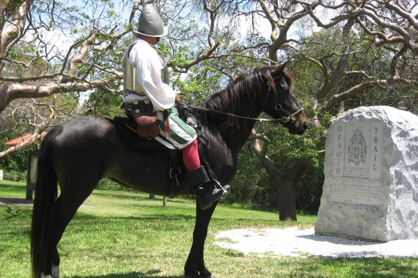
De Soto National Memorial

De Soto National Memorial

National Memorial

In May 1539, Conquistador Hernando de Soto’s army of soldiers, hired mercenaries, craftsmen, and clergy made landfall in Tampa Bay. They were met with fierce resistance of indigenous people protecting...

10 mi from route ~26 min detour Free near mile 500.1
View on nps.gov
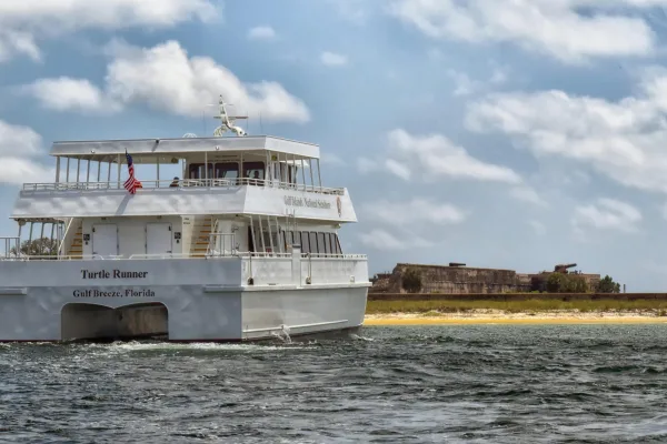
Gulf Islands National Seashore

Gulf Islands National Seashore

National Seashore

Millions of visitors are drawn to the Gulf of America for Gulf Islands National Seashore's emerald coast waters, magnificent white beaches, fertile marshes and historical landscapes. Come explore with...

10 mi from route ~26 min detour $25
View on nps.gov

Park data from the National Park Service API. Alerts update every 2 hours.

What kind of drive is this?

This drive is mostly highway, with 97% of the 580.1 miles on interstates. You'll experience a long stretch of 282.9 miles on I 10, which means extended periods of consistent cruising. Expect the highway portion to conclude as you transition to Tamiami Trail for the final leg. The sheer length of the interstate segments suggests a focus on efficient travel.

97% highway — fuel and pacing are the main things to plan.
19 navigation steps total — most of the decisions cluster near the start and finish.
Longest single stretch: 282.9 mi on I 10.

How Hard Is This Drive?

8/10

This is a straightforward highway drive that stays mostly on I 10 and I 75. This route has several spots where lane changes, forks, or exits need your full attention. The trickiest moment comes around 0.9 miles in.

Driving Effort 8/10

Demanding - plan breaks and stay ahead of the key maneuvers

Balances navigation complexity with total wheel time.

This is a demanding drive. With 14 significant decision points across 580.1 miles, you will need to stay alert - especially through interchange areas and urban stretches. Consider splitting it into segments if you are not comfortable with fast highway navigation.

Where does it get tricky?

The main spots that need attention: at 0.9 miles: Highway fork - watch signs carefully. Lane positioning matters here; at 2.3 miles: Highway fork - watch signs carefully. Lane positioning matters here. Multiple destination signs - pick the right one; at 447.1 miles (I 75): Highway fork - watch signs carefully. Lane positioning matters here.

Elevation Profile

Mostly flat terrain

263 ft -1 ft

Total Climb

315 ft

Total Descent

407 ft

Highest Point

263 ft

~165.7 mi in

Elevation Range

264 ft

Detours Along the Way

Tagged by where each one fits in your drive — first break, midpoint, final stretch.

Beignets & Brew

Cafe

Early in the drive, right off the route

Early stretch 1 mi from route ~2 min detour

Tallahassee, FL

Cuisine: coffee_shop

Hours: 06:30-22:00

Visit website

Lucky Goat

Cafe

Early in the drive, right off the route

Early stretch 1 mi from route ~2 min detour

Tallahassee, FL

Hours: Mo-Sa 07:00-18:00;Su 08:00-18:00

Visit website

Luna Tea Bar

Cafe

Later in the drive, right off the route

Final third 0.9 mi from route ~2 min detour

Echo Coffee

Cafe

Near the start, short detour

1.5 mi from route ~4 min detour

Pensacola, FL

Hours: Mo-Fr 07:00-14:30; Sa 07:30-18:00; Su 07...

Visit website

Doxa Coffee Co.

Cafe

Around the midpoint, short detour

Halfway reset 1 mi from route ~3 min detour

Cuisine: coffee_shop

Starbucks

Cafe

Later in the drive, short detour

Final third 1.7 mi from route ~4 min detour

Tampa, FL

Cuisine: coffee_shop

Hours: Mo-Fr 05:00-21:00, Sa-Su 06:00-21:00

Visit website

The Fishing Hole Restaurant

Restaurant

Near the start, right off the route

0.3 mi from route ~1 min detour

Pensacola, FL

Cuisine: seafood

Hours: Mo-Sa 11:00-20:00

Visit website

KFC

Fast_food

Near the end, right off the route

Home stretch 0.5 mi from route ~1 min detour

North Fort Myers, FL

Cuisine: chicken

Visit website

Arby's

Fast_food

Near the end, right off the route

Home stretch 0.5 mi from route ~1 min detour

Fort Myers, FL

Cuisine: sandwich

Hours: Mo-Th 10:00-24:00; Fr-Sa 10:00-01:00; Su...

Visit website

Rib City

Restaurant

Near the end, right off the route

Home stretch 0.6 mi from route ~1 min detour

North Fort Myers

Cuisine: barbecue

Visit website

Subway

Fast_food

Near the end, right off the route

Home stretch 0.6 mi from route ~1 min detour

Sarasota, FL

Cuisine: sandwich

Hours: Mo 08:30-22:00; Tu-Fr 08:00-22:00; Sa 08...

Visit website

Firehouse Sports Grill

Restaurant

Near the end, right off the route

Home stretch 0.6 mi from route ~1 min detour

North Fort Myers

Cuisine: american

Visit website

City of Alachua Recreation and Community Center

Park

Around the midpoint, right off the route

Halfway reset 0.9 mi from route ~2 min detour

Centennial Park

Park

Near the end, short detour

Home stretch 1.7 mi from route ~4 min detour

Fort Myers, FL

Killearn Gardens State Park

Park

Early in the drive, short detour

Early stretch 1.7 mi from route ~4 min detour

Bull Campsite

Camp_site

Near the start, short detour

First break 1.9 mi from route ~5 min detour

Tampa Palms Hillsborough River Park

Park

Later in the drive, short detour

Final third 2.4 mi from route ~6 min detour

Miccosukee Canopy Road Greenway

Park

Early in the drive, short detour

Early stretch 2.7 mi from route ~7 min detour

Tallahassee

Statue of Ford, Edison, and Firestone

Artwork

Near the end, short detour

Home stretch 1.6 mi from route ~4 min detour

The Florida Panther

Artwork

Near the end, short detour

Home stretch 1.7 mi from route ~4 min detour

Lux

Artwork

Near the end, short detour

Home stretch 1.7 mi from route ~4 min detour

Caloosahatchee Manuscripts

Artwork

Near the end, short detour

Home stretch 1.7 mi from route ~4 min detour

Fire Dance

Artwork

Near the end, short detour

Home stretch 1.7 mi from route ~4 min detour

American Bald Eagle

Artwork

Near the end, short detour

Home stretch 1.8 mi from route ~5 min detour

Hampton Inn & Suites

Hotel

Around the midpoint, right off the route

Halfway reset 0.7 mi from route ~2 min detour

Alachua, FL

Visit website

Luxury Suites

Hotel

Near the start, short detour

1.9 mi from route ~5 min detour

Pensacola, FL

Visit website

Key West Inn - Pensacola

Hotel

Near the start, short detour

2.1 mi from route ~5 min detour

Pensacola, FL

Visit website

Executive Inn

Hotel

Near the start, short detour

2.2 mi from route ~5 min detour

Pensacola, FL

Visit website

Palm Court Inn and Suites

Hotel

Near the start, short detour

2.3 mi from route ~6 min detour

Pensacola, FL

Visit website

Extended Stay America - Pensacola - University Mall

Hotel

Near the start, short detour

2.3 mi from route ~6 min detour

Pensacola, FL

Visit website

Points of interest from OpenStreetMap contributors. Listings may not reflect current hours or availability.

About the Cities

Arriving in North Fort Myers, FL

Full guide →

City content from Wikivoyage (CC BY-SA 4.0) and Wikidata (CC0).

Frequently Asked Questions

The longest stretch is about 282.9 miles on I 10. The full list of main roads is in the Roads section above.

Yes — a 2-day pace is more comfortable than one long haul. A sensible stopping point is after roughly 290 miles on day one.

Yes — we found about 62 rest areas or service plazas within a short detour of the route (from OpenStreetMap). See the Rest Stops tab under Nearby Places for locations and mile markers. Plan to stretch, use the bathroom, and top off fluids every 2–3 hours on longer drives.

It helps. This route has a higher-than-average number of complex decision points, which get harder in the dark. If the last hour of the trip is on surface roads or mountain grades, aim to arrive at North Fort Myers, FL before sunset when you can. Check the Trip Plan for departure windows that land you in daylight.

Only with planning. This is a long drive for kids — consider splitting it into two days rather than pushing through. Plan at least 2 meaningful breaks. There are 62 rest areas along the route for bathroom stops.

The main spots that need attention: at 0.9 miles: Highway fork - watch signs carefully. Lane positioning matters here; at 2.3 miles: Highway fork - watch signs carefully. Lane positioning matters here. Multiple destination signs - pick the right one; at 447.1 miles (I 75): Highway fork - watch signs carefully. Lane positioning matters here.

Yes — De Soto National Memorial and Gulf Islands National Seashore. See the National Parks section for detour distances and tips on detours.

Not recommended in a single day. At 10.5 hours each way, a round trip means 21.0 hours of driving — that is an unsafe level of fatigue for most drivers. Plan at least one night at North Fort Myers, FL before the return drive.

How this page is built

Compiled by the US Trip Planner planning team at COD Solutions Oy from open government datasets — OSRM over OpenStreetMap for geometry, EIA for fuel prices, USGS 3DEP for elevation, NPS for national parks, and FHWA TMAS for hourly traffic volumes. See our methodology for refresh cadence and limitations.

Was this helpful?

Thanks for your feedback!

Your tip has been submitted. Thanks!

/500

Explore More

Explore more options from Brent, FL or browse trips ending in North Fort Myers, FL.

Looking for more statewide routes? Browse FL road trips.