Brackettville to El Paso is 454 miles and takes about 7h 58m via La Entrada al Pacifico Corridor and US Highway 90 West, with a fuel budget near $69 and enough daylight to finish in a day. This drive takes you across Texas, moving from the edges of the Great Plains into a similar landscape as you approach your destination. Expect a mixed driving experience with about 39% on highways. With just two planned stops and a longest stretch of 236.3 miles, this is a manageable one-day journey for most drivers.
Trip Pace
Same-day drive is realistic
A same-day return is possible, but it will make for a full day on the road.
Break Rhythm
2 planned breaks
Plan on a short reset every 3 to 4 hours to stay fresh behind the wheel.
Midpoint
227 miles from Brackettville, TX
A natural place for your longest stop of the day
, about 4h 17m into the drive
.
Main Roads
Road
Distance
Duration
La Entrada al Pacifico Corridor
236.3 mi
3h 48m
US Highway 90 West
112.9 mi
2h 7m
US Highway 285
63.4 mi
1h 12m
West Military Highway
24.1 mi
27m
Judge Mike L Fernandez Loop
8.8 mi
9m
East Oak Street
2 mi
2m
East Dickinson Boulevard
1.4 mi
1m
US Highway 90 East
1.3 mi
1m
Longest stretch:
La Entrada al Pacifico Corridor
— 236.3 mi, about 3h 48m
Traffic on I-10
Hour-of-day weekday pattern from 32 FHWA count stations on your route.
Peak
4 PM
~2,133 veh/hr typical
· worst 2,521
Quietest
2 AM
~215 veh/hr
Peak-to-quiet ratio
9.9×
busier at peak than in the quiet hours
12a6anoon6p11p
Averaged across 52 weeks of 2023 FHWA Travel Monitoring Analysis System data. Weekday hours only (Mon–Fri).
Turn-by-Turn Driving Directions
Step-by-step road directions between Brackettville, TX and El Paso, TX.
1
Start on Loop 166
22 ft·2 sec·West Spring Street
2
Turn right onto RM 334
498 ft·13 sec·South Ann Street
3
At end of road, turn right onto US 90
24 mi·27 min·West Military Highway
4
Continue on US 90
1.3 mi·1 min·US Highway 90 East
5
Take the exit
0.2 mi·23 sec
6
Merge onto Loop 79
8.8 mi·9 min·Judge Mike L Fernandez Loop
7
Take the exit onto Loop 79
0.1 mi·17 sec·Loop 79
8
Keep slight right at fork
0.1 mi·21 sec
9
Merge onto US 90
6.8 mi·7 min·US Highway 90 West
10
Continue on US 90
0.1 mi·7 sec·United States Highway 90
11
Merge onto US 90
106 mi·2 hr·US Highway 90 West
12
Continue on US 90
2.0 mi·2 min·East Oak Street
13
Take the exit
0.1 mi·19 sec
14
Merge onto US 285
63 mi·1 hr 12 min·US Highway 285
15
Continue on US 285
0.3 mi·27 sec·North Alamo Street
16
Turn left onto I 10 Bus; US 285; US 385
1.4 mi·1 min·East Dickinson Boulevard
17
Keep slight left at fork onto I 10 Bus; US 285
1.2 mi·1 min·West Dickinson Boulevard
18
Keep slight right at fork onto Redwood Street
0.3 mi·30 sec·Redwood Street
19
At end of road, turn left onto Interstate 10 West
0.2 mi·22 sec·Interstate 10 West
20
Take the ramp
0.4 mi·49 sec
Toward I 10 West: El Paso
21
Merge onto I 10; US 67
236 mi·3 hr 48 min·La Entrada al Pacifico Corridor
Use the straight / slight right lanes.
22
Take the exit
0.2 mi·20 sec
Exit 19BToward Missouri Avenue, DowntownUse the straight / slight right lanes.
23
Turn straight onto East Missouri Avenue
0.3 mi·49 sec·East Missouri Avenue
24
Turn left onto TX 20
0.3 mi·27 sec·North Mesa Street
25
Arrive at destination
North Mesa Street
Trip Plan
Given the 7h 58m estimated drive time, an early morning departure from Brackettville is recommended to ensure you arrive in El Paso with plenty of daylight. Plan for two stops along the way to break up the 454 miles and stay refreshed. Keep an eye on your fuel gauge, especially during the 236.3-mile stretch on the La Entrada al Pacifico Corridor, as services might be less frequent. The estimated fuel cost of $69 is a good baseline for budgeting, but always factor in potential price variations.
Morning Departure
Start early — leave by 6-7 AM to arrive at a reasonable hour.
Evening Departure
This is a long drive — plan for a morning departure or consider splitting it into two days.
You can normally do this drive in one day.
Plan roughly 2 meaningful breaks for fuel, food, and rest.
The halfway point lands around 227 miles from Brackettville, TX, or about 4h 17m into the drive.
The longest continuous stretch on this route runs about 236.3 miles.
This is a comfortable same-day trip.
Departure
Before you leave
Start with fuel, water, and navigation already sorted so the first hour feels easy.
First stop
Around 100 miles or 1h 53m in
Use this first pause for coffee, a restroom break, and a quick traffic check ahead.
Halfway reset
Around 227 miles or 4h 17m in
This is the best place for your longest stop, a real meal, and a full fuel check.
Final approach
Final hour starts around 6h 59m
Traffic, exits, and arrival timing usually matter more near El Paso, TX than in the middle of the route.
Before You Leave
+
Open the route before leaving Brackettville, TX so your first major turns are already loaded.
+
Leave with enough water and a charging cable within reach, not packed away.
+
Check your fuel range against the first long segment, especially if you are starting outside city service areas.
+
Pick one backup stop option before the midpoint in case traffic changes your pacing.
Day 1
Settle into the route from Brackettville, TX
This is one driving day of about 454 miles and 7h 58m.
Your first comfortable stop window is around 100 miles from Brackettville, TX.
This route can stay practical as a one-day drive if traffic stays reasonable.
Plan about 2 real breaks rather than only quick fuel stops.
The longest stretch is on La Entrada al Pacifico Corridor for about 236.3 miles.
Where to Stop
Rest stops, refuel points, and overnight suggestions along this route.
Place data sourced from public business listings. Hours and availability may vary.
Heads-up: tricky spots
5 of 18
5 decision points cluster between mile 0 and 453.3 — GPS handles the exact turns, but know they're coming. Your lane choice matters more than the turn itself.
5
0 mi into trip|~0m in|RM 334 / South Ann Street
Turn right onto RM 334 / South Ann Street
Navigation decision point
5
34.6 mi into trip|~39m in
Keep slight right at fork
Highway fork - watch signs carefully
5
216.4 mi into trip|~4h 6m in|Interstate 10 West
At end of road, turn left onto Interstate 10 West
Navigation decision point
5
217 mi into trip|~4h 7m in|I 10; US 67 / La Entrada al Pacifico Corridor
Merge onto I 10; US 67 / La Entrada al Pacifico Corridor
Merge point - match speed before joining. Lane positioning matters here
Use the straight / slight right lanes.
8
453.3 mi into trip|~7h 56m in
Take the exit toward Missouri Avenue, Downtown
Exit ramp - move to the correct lane early. Lane positioning matters here. Multiple destination signs - pick the right one
Use the straight / slight right lanes.
Exit 19B
Toward Missouri Avenue, Downtown
Fuel & Cost
Regular Gas
$62.18 one way
$124.37 round trip
$3.48/gal25.4 MPG avg159 kg CO2
Fuel Type
$/gal
One Way
Round Trip
midgrade
$3.89
$69.46
$138.92
premium
$4.23
$75.52
$151.04
diesel
$4.80
$85.72
$171.45
No toll roads detected on this route.
Estimated Trip Cost (one way, 1 person)
Fuel
$62
Meals
$25–$50
Total
$87–$112
Rough estimate based on US averages. Hotel $80–$140/night, meals $25–$50/day.
Estimated CO2 emission: 158.8 kg one way.
Prices: EIA weekly data, 2026-07-13.
EV Charging Along Route
19 DC fast chargers
· Coverage: excellent
Van Horn, TX - West Broadway Street - Tesla Supercharger
Van Horn, TX
Tesla
12 DCFC
TA, Horizon Blvd, El Paso, TX
El Paso, TX
BP_PULSE
12 DCFC
El Paso, TX - Gateway Boulevard East - Tesla Supercharger
El Paso, TX
Tesla
12 DCFC
Del Rio, TX - Tesla Supercharger
Del Rio, TX
Tesla
8 DCFC
Fort Stockton, TX - Tesla Supercharger
Fort Stockton, TX
Tesla
8 DCFC
El Paso, TX - Eastlake Boulevard - Tesla Supercharger
Station data from NREL Alternative Fuel Stations database.
Driving Electric?
About $48 in charging
· 1 stop
· 67% less CO2
Vehicle Type
kWh
Stops
DC Fast
Home Charge
Average EV
136.2
1
$47.67
$21.79
Efficient EV
113.5
1
$39.73
$18.16
EV Truck/SUV
181.6
2
$63.56
$29.06
Gas CO2
159 kg
EV CO2
53 kg (67% less)
Plan for 1 charging stop. A 30-minute DC fast charge mid-route should be enough to complete the trip comfortably.
DC fast charging avg $0.35/kWh. Home charging avg $0.16/kWh. US grid CO2: 0.39 kg/kWh.
Travel Intel
Current conditions at both ends of the drive.
Forecast as of Jul 20, 2026
Origin
Brackettville, TX
Afternoon
in Brackettville on Monday
Local time
2:54 PM
CDT
Current temp
92°F
Sunny
SE 5 to 10 mph0% chanceLive forecast
Heat Advisory
Heat Advisory issued July 20 at 11:09AM CDT until July 21 at 8:00PM CDT by NWS Fort Worth TX
Heat Advisory
Heat Advisory issued July 20 at 10:53AM CDT until July 21 at 7:00PM CDT by NWS Lake Charles LA
Destination
El Paso, TX
Afternoon
in El Paso on Monday
Local time
1:54 PM
MDT
Current temp
87°F
Chance Showers And Thunderstorms
S 6 mph39% chanceLive forecast
Heat Advisory
Heat Advisory issued July 20 at 11:09AM CDT until July 21 at 8:00PM CDT by NWS Fort Worth TX
Heat Advisory
Heat Advisory issued July 20 at 10:53AM CDT until July 21 at 7:00PM CDT by NWS Lake Charles LA
Seasonal Notes
Summer travel usually means heavier construction, hotter rest stops, and busier weekend traffic around major cities.
Winter travel shortens daylight, so a route that looks manageable on paper can feel much longer after dark.
Holiday weekends tend to make both departure and arrival windows slower than the raw route time suggests.
Time zone
1 hour earlier
The destination clock does not match departure time, so double-check hotel check-in windows and late arrival plans.
Temperature spread
5 degrees cooler at arrival
A meaningful temperature swing is a good cue to rethink layers, water, and how soon you want to arrive.
Road read
7h 58m on the road
Start early — leave by 6-7 AM to arrive at a reasonable hour.
Weather data from the National Weather Service. Conditions may change; check closer to your travel date.
National Parks Near This Route
Worth a detour if your schedule allows.
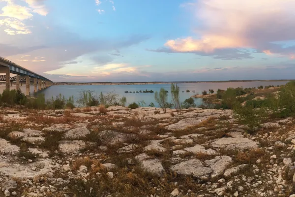
Amistad National Recreation Area
National Recreation Area
An oasis in the desert, Amistad National Recreation Area consists of the US portion of the International Amistad Reservoir. Amistad, a Spanish word meaning "friendship," is known for excellent water-b...
0 mi from route
~1 min detour
Free
near mile 47
Park Closure: Diablo East Marina Cove, Scuba Cove, and Walkway Access Are Closed
Caution: Help Prevent Aquatic Invasive Species (AIS) Infestation
Chamizal is more than just an urban park to recreate or enjoy a quiet afternoon. These grounds are a reminder of the harmonious settlement of a 100-year boundary dispute between the United States and...
Park data from the National Park Service API. Alerts update every 2 hours.
More Details
What kind of drive is this?
This route offers a mixed driving experience, with 39% of the journey utilizing highways. You'll encounter the La Entrada al Pacifico Corridor for a significant portion, including a longest uninterrupted stretch of 236.3 miles. While some sections might feel like a straightforward drive, the overall profile suggests a varied landscape and road type as you traverse the state. Expect to transition between different types of roads as you make your way west across Texas.
39% highway, the rest on surface roads — varied driving throughout.
25 navigation steps total — most of the decisions cluster near the start and finish.
Longest single stretch: 236.3 mi on La Entrada al Pacifico Corridor.
How Hard Is This Drive?
8/10
This route mixes highway mileage with some local-road sections near the start or finish. This route has several spots where lane changes, forks, or exits need your full attention. The trickiest moment comes early in the drive near RM 334 / South Ann Street.
Driving Effort8/10
Demanding - plan breaks and stay ahead of the key maneuvers
Balances navigation complexity with total wheel time.
This is a demanding drive. With 18 significant decision points across 454 miles, you will need to stay alert - especially through interchange areas and urban stretches. Consider splitting it into segments if you are not comfortable with fast highway navigation.
Where does it get tricky?
The main spots that need attention: near the start (RM 334 / South Ann Street): Navigation decision point; at 34.6 miles: Highway fork - watch signs carefully; at 216.4 miles (Interstate 10 West): Navigation decision point.
El Paso is the sixth largest city in Texas, with 679,000 residents (2020). It is on the United States-Mexico border. The city on the other side of the border is Ciudad Juarez, Chihuahua. El Paso is often called the Sun City. Collectively, the city of El Paso and other nearby cities, such as Juarez and Las Cruces, New Mexico are referred to as The Borderland.
Top landmarks
•El Paso Museum of Art — art museum in El Paso, Texas
•Union Depot — historic place in El Paso, El Paso County, Texas
•Plaza Theatre — building in El Paso, El Paso County, Texas
Doable as a same-day drive at 7h 58m. Total distance: 454 miles.
Family Friendly
Moderate complexity with 2 natural rest stops along the way.
Solo Traveler
7h 58m drive, plan rest stops for pacing.
Scenic Drive
Mixed highway & surface route profile with national parks nearby.
Frequently Asked Questions
The longest stretch is about 236.3 miles on La Entrada al Pacifico Corridor. The full list of main roads is in the Roads section above.
Yes — we found about 23 rest areas or service plazas within a short detour of the route (from OpenStreetMap). See the Rest Stops tab under Nearby Places for locations and mile markers. Plan to stretch, use the bathroom, and top off fluids every 2–3 hours on longer drives.
It helps. This route has a higher-than-average number of complex decision points, which get harder in the dark. If the last hour of the trip is on surface roads or mountain grades, aim to arrive at El Paso, TX before sunset when you can. Check the Trip Plan for departure windows that land you in daylight.
Only with planning. This is a long drive for kids — consider splitting it into two days rather than pushing through. Plan at least 2 meaningful breaks. There are 23 rest areas along the route for bathroom stops.
The main spots that need attention: near the start (RM 334 / South Ann Street): Navigation decision point; at 34.6 miles: Highway fork - watch signs carefully; at 216.4 miles (Interstate 10 West): Navigation decision point.
Yes — Amistad National Recreation Area and Chamizal National Memorial. See the National Parks section for detour distances and tips on detours.
Not recommended in a single day. At 8.0 hours each way, a round trip means 15.9 hours of driving — that is an unsafe level of fatigue for most drivers. Plan at least one night at El Paso, TX before the return drive.