Rest Area
0 mi from route
Compiled and reviewed by the US Trip Planner planning team at COD Solutions Oy · Last reviewed Jul 18, 2026 · Editorial standards
Drive Time
12h 18m
Distance
641.3 mi
1,032 km
Drive Score
6/10
Good drive
Same Day?
2-day trip
Fuel Cost
$100
one way
EV Charging
Unknown
Estimated drive times based on typical traffic patterns. Actual times may vary with weather, construction, and real-time conditions.

Baker, MT
Wikimedia Commons

Whitefish, MT
Wikimedia Commons
Baker, MT to Whitefish, MT is 641.3 miles and takes about 12 hours 18 minutes via MT 200 S, US 87, and US 2, with a fuel budget near $103 and likely requiring an overnight stay. This long-haul drive takes you across the breadth of Montana, moving from the Mountain West region to another part of the Mountain West. Given the 12-hour estimated driving time, it's best to plan for at least two days to comfortably complete this trip. You'll spend most of your time on major highways, making it a straightforward, albeit lengthy, transit across the state.
Trip Pace
Best split across 2 days
Treat the return leg as its own travel day rather than an afterthought.
Break Rhythm
3 planned breaks
Plan on a short reset every 3 to 4 hours to stay fresh behind the wheel.
Midpoint
320.7 miles from Baker, MT
A natural place for your longest stop of the day , about 6h 7m into the drive .
| Road | Distance | Duration |
|---|---|---|
| MT 200 S | 217.9 mi | 3h 58m |
| US 87 | 107.1 mi | 1h 57m |
| US 2 | 80.2 mi | 1h 32m |
| United States Highway 89 | 49.2 mi | 53m |
| Lake Street | 44.3 mi | 1h 5m |
| US 89 | 40.5 mi | 45m |
| I 94 | 29.8 mi | 27m |
| US Highway 87 | 14.7 mi | 15m |
Hour-of-day weekday pattern from 4 FHWA count stations on your route.
Peak
2 PM
~135 veh/hr typical · worst 212
Quietest
3 AM
~13 veh/hr
Peak-to-quiet ratio
10.4×
busier at peak than in the quiet hours
Averaged across 46 weeks of 2023 FHWA Travel Monitoring Analysis System data. Weekday hours only (Mon–Fri).
Step-by-step road directions between Baker, MT and Whitefish, MT.
Start on 6th Street West
Turn right onto US 12
Turn left onto MT 7
Continue on MT 7
Continue on MT 7
Turn left onto 2nd Avenue North
Continue on MT 261
Take the ramp
Merge onto I 94
Take the exit
Turn right onto MT 200 S
Continue on US 87; MT 200
Turn right onto 1st Avenue North
Continue on US 191
Continue on US 87; US 191; MT 200
Continue on US 87; MT 3; MT 200
Turn slight right
Enter roundabout
Continue
Continue on US 87; US 89; MT 3; MT 200
Turn right onto US 87 Bypass
Turn left onto 2nd Avenue North
At end of road, turn left onto I 15 Business
Turn right onto I 15 Business
Continue on I 15 Business
Continue on I 15 Business
Take the exit onto I 15 Business
Merge onto I 15; US 89; MT 200
Take the exit onto US 89; MT 200
Turn right onto US 89
Enter roundabout onto US 89
Continue on US 89
Turn slight right onto US 89
Continue on US 89
Continue on US 89
At end of road, turn left onto US 2; US 89
Enter roundabout onto US 2
Continue on US 2
Turn right
At end of road, turn left onto Old US 2
Turn right onto US 2
Continue on US 2
Continue on US 2
Continue on US 2
Continue on MT 40
Turn right onto US 93
Continue on US 93
Turn left onto US 93
Turn right
Arrive at destination
With a total drive time of over 12 hours, splitting this trip over two days is highly recommended. Aim to depart early in the morning on your first day to maximize your driving time. You'll make about 3 planned stops, so factor those into your schedule for fuel and rest. The longest stretch on MT 200 S is nearly 218 miles, so ensure you have sufficient fuel before starting that segment. Consider planning your overnight stop around the halfway point to break up the drive evenly.
Morning Departure
Start early — leave by 6-7 AM to arrive at a reasonable hour.
Evening Departure
This is a long drive — plan for a morning departure or consider splitting it into two days.
Consider an overnight stop or starting very early.
Departure
Before you leave
Start with fuel, water, and navigation already sorted so the first hour feels easy.
First stop
Around 141 miles or 2h 48m in
Use this first pause for coffee, a restroom break, and a quick traffic check ahead.
Halfway reset
Around 320.7 miles or 6h 7m in
This is the best place for your longest stop, a real meal, and a full fuel check.
Overnight split
Day 1 wrap after about 320.7 miles or 6h 7m
Stop before fatigue turns the last few hours into a grind. You want day two to start fresh, not just resumed.
Final approach
Final hour starts around 11h 1m
Traffic, exits, and arrival timing usually matter more near Whitefish, MT than in the middle of the route.
Open the route before leaving Baker, MT so your first major turns are already loaded.
Leave with enough water and a charging cable within reach, not packed away.
Check your fuel range against the first long segment, especially if you are starting outside city service areas.
Pick one backup stop option before the midpoint in case traffic changes your pacing.
Treat this as a 2-day road trip and book the overnight stop before the busiest arrival window.
Day 1
Settle into the route from Baker, MT
Aim for roughly 321 miles and 6.2 hours of wheel time on this day.
Day 2
Finish the approach into Whitefish, MT
Aim for roughly 321 miles and 6.2 hours of wheel time on this day.
Rest stops, refuel points, and overnight suggestions along this route.

First major stop
Coffee and fuel
212 mi into the route
Best for: Coffee, fuel, and an easy first stretch
This is a natural early stop once the first hours of the drive are behind you.

Second major stop
Overnight candidate
423 mi into the route
Best for: Hotel check-in, dinner, and a fresh start
This lines up well with a realistic day-end stop if you are breaking the drive into stages.
Find hotels in North Browning, MTNight 1
321 mi · about 6.2h in
A practical overnight split lands near Great Falls, MT after about 321 miles or 6.2 hours of driving.
Find hotelsA short stop after about 141 miles helps settle the day before fatigue starts building.
The midpoint is around 320.7 miles from Baker, MT, which is a good place for a longer meal and fuel stop.
Before the longest stretch
Fuel checkTop up before MT 200 S if your tank is already low. That segment runs about 217.9 miles.
Overnight split
Hotel stopFor a steadier pace, wrap day one after about 321 miles or 6.2 hours on the road.
These stop ideas are pacing suggestions — the exact town or exit can change with traffic, hotel plans, and fuel range.
Picked by where they fit in your drive — first break, midpoint reset, final stretch.
Place data sourced from public business listings. Hours and availability may vary.
5 decision points cluster between mile 399.4 and 620.6 — GPS handles the exact turns, but know they're coming. Your lane choice matters more than the turn itself.
Enter roundabout
Roundabout - know your exit number before entering
At end of road, turn left onto I 15 Business / Park Drive North
Navigation decision point
Enter roundabout onto US 89 / West Division Street
Roundabout - know your exit number before entering
At end of road, turn left onto US 2; US 89
Navigation decision point
At end of road, turn left onto Old US 2
Navigation decision point
Regular Gas
$99.96 one way
$199.91 round trip
| Fuel Type | $/gal | One Way | Round Trip |
|---|---|---|---|
| midgrade | $4.17 | $105.36 | $210.72 |
| premium | $4.47 | $112.96 | $225.92 |
| diesel | $4.80 | $121.09 | $242.18 |
No toll roads detected on this route.
Estimated Trip Cost (one way, 1 person)
Fuel
$100
Hotel (1n)
$80–$140
Meals
$50–$100
Total
$230–$340
Rough estimate based on US averages. Hotel $80–$140/night, meals $25–$50/day.
Estimated CO2 emission: 224.4 kg one way. Prices: EIA weekly data, 2026-07-13.
Driving Electric?
About $67 in charging · 2 stops · 67% less CO2
| Vehicle Type | kWh | Stops | DC Fast | Home Charge |
|---|---|---|---|---|
| Average EV | 192.4 | 2 | $67.34 | $30.78 |
| Efficient EV | 160.3 | 1 | $56.11 | $25.65 |
| EV Truck/SUV | 256.5 | 3 | $89.78 | $41.04 |
Gas CO2
224 kg
EV CO2
75 kg (67% less)
Plan for 2 charging stops, roughly every 270 miles. Allow 25-40 minutes per stop at a DC fast charger.
DC fast charging avg $0.35/kWh. Home charging avg $0.16/kWh. US grid CO2: 0.39 kg/kWh.
Current conditions at both ends of the drive.
Origin
Late night in Baker on Saturday
Local time
2:48 AM
MDT
Current temp
94°F
Sunny
Severe Thunderstorm Warning
Severe Thunderstorm Warning issued July 16 at 2:10PM MDT until July 16 at 2:45PM MDT by NWS Great Falls MT
Flash Flood Watch
Flash Flood Watch issued July 15 at 11:51AM MDT until July 17 at 12:00AM MDT by NWS Great Falls MT
Destination
Late night in Whitefish on Saturday
Local time
2:48 AM
MDT
Current temp
90°F
Slight Chance Showers And Thunderstorms
Severe Thunderstorm Warning
Severe Thunderstorm Warning issued July 16 at 2:10PM MDT until July 16 at 2:45PM MDT by NWS Great Falls MT
Flash Flood Watch
Flash Flood Watch issued July 15 at 11:51AM MDT until July 17 at 12:00AM MDT by NWS Great Falls MT
86°F
Lewistown, MT
212 mi in
Seasonal Notes
Summer travel usually means heavier construction, hotter rest stops, and busier weekend traffic around major cities.
Winter travel shortens daylight, so a route that looks manageable on paper can feel much longer after dark.
Holiday weekends tend to make both departure and arrival windows slower than the raw route time suggests.
For long drives, weather on day two can matter just as much as conditions at departure, so check the whole travel window rather than only the first day.
Time zone
Origin and destination are on the same clock, so arrival timing is easier to judge at a glance.
Temperature spread
A meaningful temperature swing is a good cue to rethink layers, water, and how soon you want to arrive.
Road read
This is long enough that the arrival forecast matters almost as much as departure conditions. Recheck both ends before you roll.
Weather data from the National Weather Service. Conditions may change; check closer to your travel date.
Worth a detour if your schedule allows.
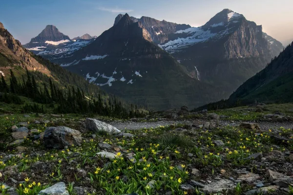
National Park
A showcase of melting glaciers, alpine meadows, carved valleys, and spectacular lakes. With over 700 miles of trails, Glacier is a paradise for adventurous visitors seeking a landscape steeped in huma...
Park data from the National Park Service API. Alerts update every 2 hours.
This route involves a significant amount of highway driving, with 86% of the total mileage on major roads like MT 200 S, US 87, and US 2. The longest continuous stretch without a major road change is 217.9 miles on MT 200 S. Expect long periods of rural cruising, especially on the extensive highway segments. The transition from highway to potentially more local roads will occur gradually as you approach your destination.
This is a straightforward highway drive that stays mostly on MT 200 S and US 87. You will hit about 25 points where you need to pay attention to lane position or signs. The trickiest moment comes around 399.4 miles in.
Moderate - straightforward overall, but long enough or busy enough to require pacing
Balances navigation complexity with total wheel time.
This drive requires moderate attention. Across 641.3 miles you will encounter 25 spots where lane choice or exit timing matters. Not difficult for experienced highway drivers, but worth previewing the tricky sections before you go.
Where does it get tricky?
The main spots that need attention: at 399.4 miles: Roundabout - know your exit number before entering; at 424 miles (I 15 Business / Park Drive North): Navigation decision point; at 476 miles (US 89 / West Division Street): Roundabout - know your exit number before entering.
Hilly terrain with moderate elevation changes
Total Climb
3,033 ft
Total Descent
2,918 ft
Highest Point
4,544 ft
~549.7 mi in
Elevation Range
1,976 ft
Notable High Points
Tagged by where each one fits in your drive — first break, midpoint, final stretch.
Cafe
Near the end, right off the route
Cuisine: breakfast
Hours: We-Su 09:00-16:00
Visit websiteCafe
Near the end, right off the route
Cuisine: coffee_shop;crepe
Hours: Mo-Su 08:00-16:00
Visit websiteCafe
Near the end, right off the route
Cuisine: coffee_shop
Cafe
Near the end, right off the route
Whitefish, MT
Cuisine: coffee_shop
Visit websiteCafe
Near the start, short detour
Cuisine: coffee_shop
Visit websiteCafe
Near the end, right off the route
Restaurant
Near the end, right off the route
Whitefish
Cuisine: american
Visit websiteRestaurant
Near the end, right off the route
Whitefish, MT
Cuisine: cajun
Visit websiteRestaurant
Near the end, right off the route
Whitefish, MT
Cuisine: regional
Hours: 07:00-15:00
Visit websiteRestaurant
Near the end, right off the route
Whitefish
Cuisine: pizza
Visit websiteRestaurant
Near the end, right off the route
Whitefish, MT
Restaurant
Near the end, right off the route
Park
Near the start, right off the route
Park
Near the start, right off the route
Attraction
Near the end, right off the route
Park
Near the start, right off the route
Park
Near the start, right off the route
Park
Near the end, right off the route
Museum
Near the end, right off the route
MT
Hours: Dec-Apr: Tu-Sa 11:00-15:00; May-Nov: Tu-...
Visit websiteMuseum
Near the start, right off the route
MT
Visit websiteMuseum
Later in the drive, short detour
MT
Memorial
Near the end, short detour
Artwork
Later in the drive, short detour
Artwork
Later in the drive, ~9 min detour
Dupuyer, MT
Motel
Near the end, right off the route
Motel
Later in the drive, short detour
Caravan_site
Near the start, short detour
Hotel
Later in the drive, short detour
Motel
Later in the drive, short detour
Points of interest from OpenStreetMap contributors. Listings may not reflect current hours or availability.
Top landmarks
Whitefish is a small town in Montana, near Glacier National Park. The population was about 8,300 in 2019.
Top landmarks
City content from Wikivoyage (CC BY-SA 4.0) and Wikidata (CC0).
Family Friendly
Moderate complexity with 3 natural rest stops along the way.
Solo Traveler
12h 18m drive, plan rest stops for pacing.
Compiled by the US Trip Planner planning team at COD Solutions Oy from open government datasets — OSRM over OpenStreetMap for geometry, EIA for fuel prices, USGS 3DEP for elevation, NPS for national parks, and FHWA TMAS for hourly traffic volumes. See our methodology for refresh cadence and limitations.
Was this helpful?
Thanks for your feedback!
Your tip has been submitted. Thanks!
/500
Recent Tips
·
Explore more options from Baker, MT or browse trips ending in Whitefish, MT.
Looking for more statewide routes? Browse MT road trips.